Items Similar to Antique Plan of the Siege of Grave by Guicciardini, c.1608


Want more images or videos?
Request additional images or videos from the seller
1 of 6
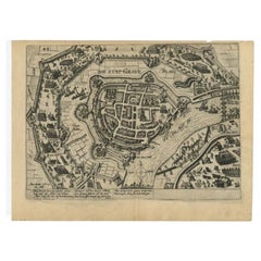
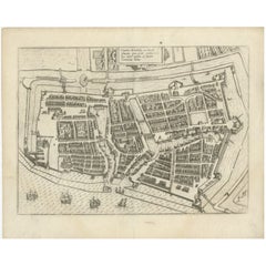
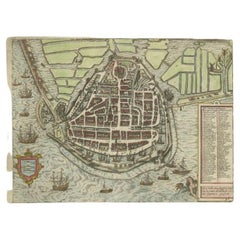
Antique Plan of the Siege of Grave by Guicciardini, c.1608
About the Item
Antique map titled 'Hic est situs oppidi Grauiae (..)'. Bird's eye view plan of Grave, The Netherlands, Holland. Showing the siege of Grave in the year 1602. Source unknown, to be determined.
Artists and Engravers: Lodovico Guicciardini (19 August 1521 – 22 March 1589) was an Italian writer and merchant from Florence who lived primarily in Antwerp from 1542 or earlier. He was the nephew of historian and diplomat Francesco Guicciardini.
Condition: Very good, given age. Some browning but only visible in the margins and on verso. Original middle fold as issued. General age-related toning and/or occasional minor defects from handling. Please study image carefully.
Date: c.1608
Overall size: 37.9 x 29.2 cm.
Image size: 33.8 x 24.4 cm.
We sell original antique maps to collectors, historians, educators and interior decorators all over the world. Our collection includes a wide range of authentic antique maps from the 16th to the 20th centuries. Buying and collecting antique maps is a tradition that goes back hundreds of years. Antique maps have proved a richly rewarding investment over the past decade, thanks to a growing appreciation of their unique historical appeal. Today the decorative qualities of antique maps are widely recognized by interior designers who appreciate their beauty and design flexibility. Depending on the individual map, presentation, and context, a rare or antique map can be modern, traditional, abstract, figurative, serious or whimsical. We offer a wide range of authentic antique maps for any budget.
- Dimensions:Height: 11.5 in (29.2 cm)Width: 14.93 in (37.9 cm)Depth: 0 in (0.01 mm)
- Materials and Techniques:
- Period:
- Date of Manufacture:circa 1608
- Condition:Condition: Very good, given age. Some browning but only visible in the margins and on verso. Original middle fold as issued. General age-related toning and/or occasional minor defects from handling. Please study image carefully.
- Seller Location:Langweer, NL
- Reference Number:
About the Seller
5.0
Platinum Seller
These expertly vetted sellers are 1stDibs' most experienced sellers and are rated highest by our customers.
Established in 2009
1stDibs seller since 2017
1,929 sales on 1stDibs
Typical response time: <1 hour
- ShippingRetrieving quote...Ships From: Langweer, Netherlands
- Return PolicyA return for this item may be initiated within 14 days of delivery.
More From This SellerView All
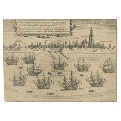
- Antique Plan of Grave, The Netherlands, Showing the Siege of Grave in 1602Located in Langweer, NLAntique map titled 'Die Stat Grave' Bird's eye view plan of Grave, The Netherlands, Holland. Showing the siege of Grave in the year 1602 by Prince Maurits of The Netherlands. Source ...Category
Antique 16th Century Maps
MaterialsPaper
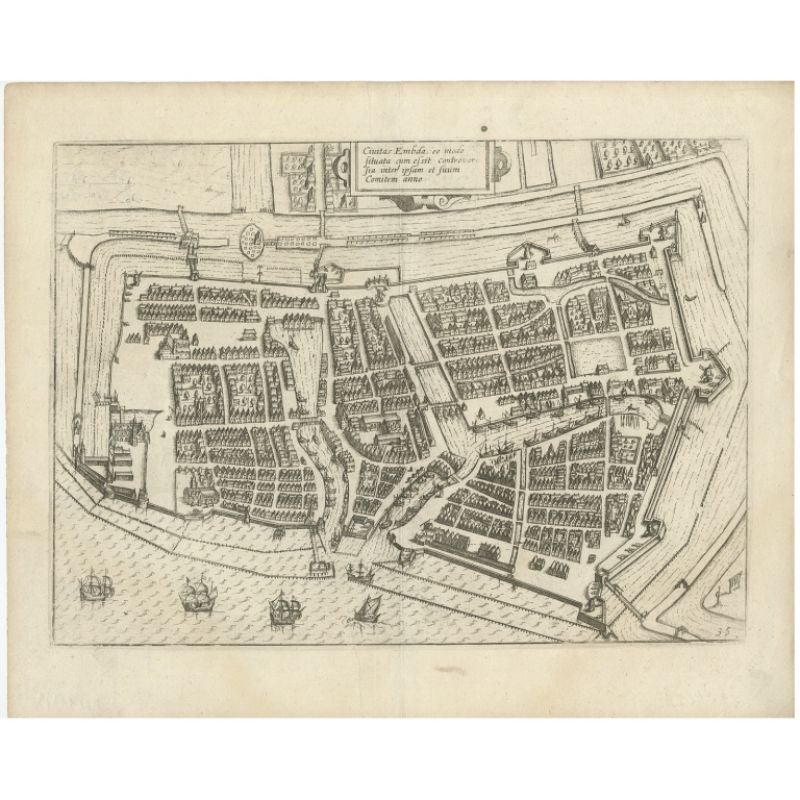
- Antique Plan of Emden in Germany by Guicciardini, 1612Located in Langweer, NLAntique map Emden titled 'Civitas Embda, eo modo situata cum essit controversia inter ipsam et suum Comitem anno'. Small plan of the city of Emden, Germany, Also depicted is part of ...Category
Antique 17th Century Maps
MaterialsPaper
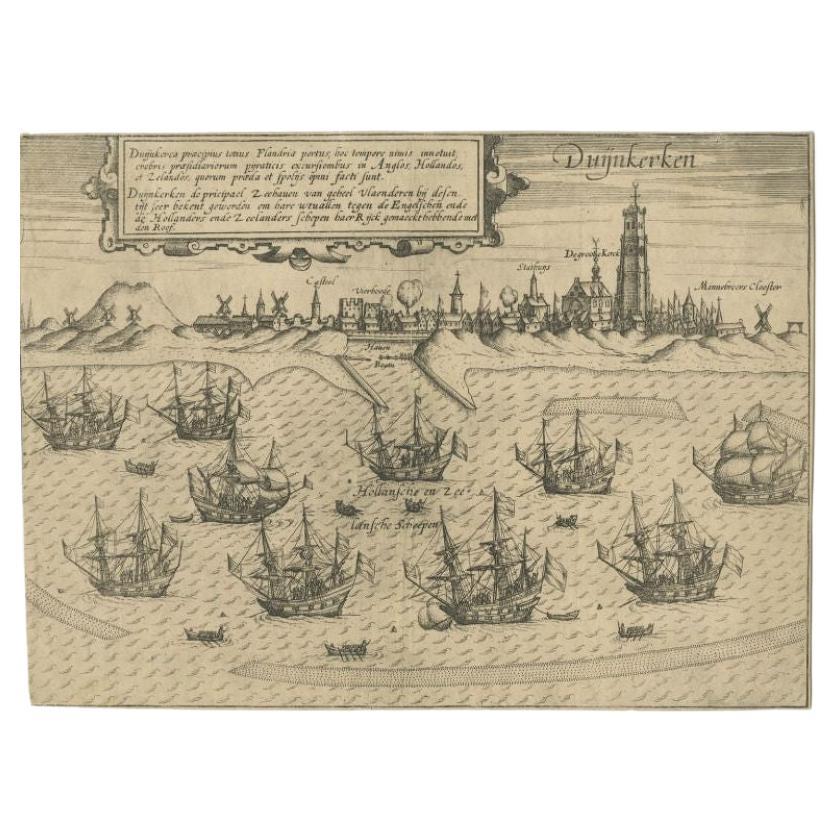
- Antique Plan of Duinkerke or Dunkirk in France by Guicciardini, 1612Located in Langweer, NLAntique map Duinkerke titled 'Duijnkerken'. Small plan of the city of Duinkerke/Dunkerque, France. Artists and Engravers: Lodovico Guicciardini (1521-1589): an Italian merchant fr...Category
Antique 17th Century Maps
MaterialsPaper
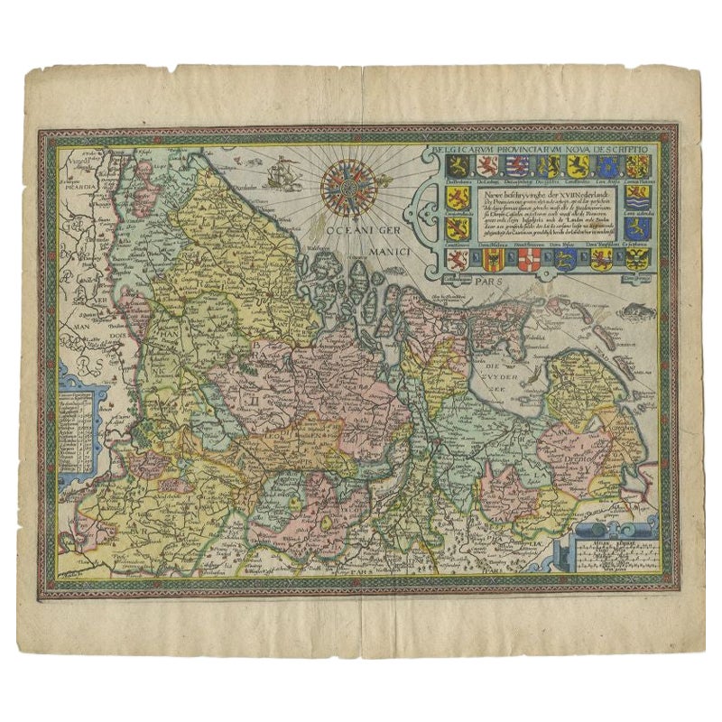
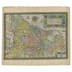
- Antique Map of the Netherlands by Guicciardini, 1612Located in Langweer, NLAntique map titled 'Belgicarum Provinciarum Nova Descriptio'. Beautiful old map of the Netherlands. With decorative cartouche including the coat...Category
Antique 17th Century Maps
MaterialsPaper
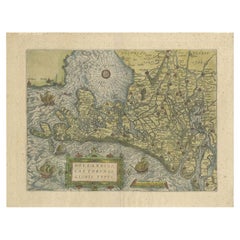
- Antique Map of the Netherlands by Guicciardini, 1582Located in Langweer, NLAntique map titled 'Hollandiae Cattorum Regionis Typus'. Early copper engraving of the Netherlands in the 2nd state, numbered 30 bottom right. This map originates from 'Description d...Category
Antique 16th Century Maps
MaterialsPaper
- Antique Map of the City of Enkhuizen by Guicciardini, 1625Located in Langweer, NLAntique map titled 'Die Stadt Enchuijsen, La ville denchuijsen'. Map of Enkhuizen, Noord-Holland, The Netherlands. Oiginates from the 1625 edition of 'Discrittione di tutti i Paesi B...Category
Antique 17th Century Maps
MaterialsPaper
You May Also Like
- Ordeal of the Hermitage, The Siege of Leningrad 1941-1944, First EditionBy Sergei Varshavsky, Boris RestLocated in valatie, NYThe Ordeal of the Hermitage, The Siege of Leningrad 1941-1944. Leningrad: Aurora Art Publishers, 1985. First edition hardcover with dust jacket. 302 pp. A beautifully photographed bo...Category
20th Century Russian Books
MaterialsPaper
- Plan of Paris, France, by A. Vuillemin, Antique Map, 1845Located in Colorado Springs, COThis large and detailed plan of Paris was published by Alexandre Vuillemin in 1845. The map conveys a wonderful amount of information and is decorated throughout with pictorial vigne...Category
Antique 1840s American Maps
MaterialsPaper
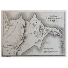
- Original Antique Plan of The Battle of Abukir, Napoleon Bonaparte. Circa 1850Located in St Annes, LancashireGreat battle plan of The Battle of Abukir Drawn by A.M Perrot Steel engraving by Tardieu with original hand colour Unframed. The size given is the paper sizeCategory
Antique 1850s French Maps
MaterialsPaper
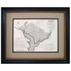
- Plan for the City of Washington by Andrew Ellicott, Antique Print, 19th CenturyLocated in Colorado Springs, COBy Andrew Ellicott (1754-1820) and Pierre Charles L'Enfant (1754-1825). Plan of the City of Washington. Published by Thackara & Vallance, Philadelphia, 1792. Later impression printed on 19th century wove paper. This is a fine 19th century printing of the "official" plan of Washington, D.C. First printed in 1792 by the original publishers, Thackara & Vallance in Philadelphia, this is a later 19th century printing of the fifth recorded engraving of the L’Enfant / Ellicott city plan. The first three issues of this city plan were in published in periodicals, making the fifth edition only the second separately-issued engraving of the plan. In full, the title reads, “Plan of the City of Washington in the Territory of Columbia, ceded by the States of Virginia and Maryland to the United States of America and by them established as the Seat of their Government after the year 1800.” The national capital city is laid out according to a plan originally proposed by Pierre Charles L'Enfant and modified by Andrew Ellicott. L'Enfant was born in Paris, where he trained to be an architect. He came to America in 1777, and served under George Washington as an engineer during the Revolutionary War. In 1791, Washington asked L'Enfant to design the new capital city in the District of Columbia. However, trouble arose between the city and L'Enfant. The City Commissioner needed a finished, printed copy of the plan in order to sell building lots but L'Enfant worked slowly and released only incomplete plans, and proved to be quite obstinate. On instruction from President Washington...Category
Antique Late 19th Century American Maps
MaterialsPaper
- Antique "New Plan of London" Map by John Bartholomew, 1900Located in Bridgeport, CTProduced for the W.H. Smith guide, folded in the original. The map here is unfolded and framed flat, with transportation routes shown and color details. sight 22 x 32" (original ful...Category
Antique Early 1900s English Victorian Maps
MaterialsPaper
- Gold Leaf Foil Pictorial Plan Map of the West Country of England Antique StyleLocated in GBWe are delighted to offer for sale this lovely Antique style pictorial plan map of the West Country of England etched in gold leaf foil This is a very interesting and decorative p...Category
20th Century English Adam Style Maps
MaterialsGold Leaf


Recently Viewed
View AllMore Ways To Browse
Antique Map Florence
Vintage Bartholomews Maps
Old Sicily Map
Antique Maps Of Lithuania
Antique Map Louisiana
Babylon Map
Antique Minnesota Map
Antique Ornamental Map
Jordan Antique Map
La Syrie Antique
Map Lebanon
Map Of Ural
Map Of Washington Dc
Maps Rochester
Queensland Maps
Republic Of Texas Map
Washington Dc Map
Washington Dc Maps