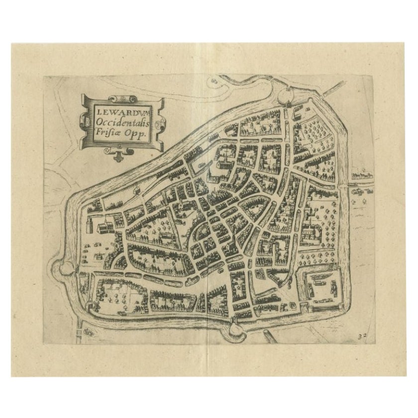
Items Similar to Antique Map of the City of Leeuwarden, The Netherlands, by Guicciardini, 1612


Want more images or videos?
Request additional images or videos from the seller
1 of 6
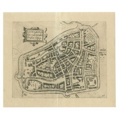
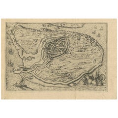
Antique Map of the City of Leeuwarden, The Netherlands, by Guicciardini, 1612
About the Item
Antique map titled 'Lewardum Occidentalis Frisia Opp'. Plan of the city of Leeuwarden, in the province of Friesland, the Netherlands. This map originates from 'Beschryvinghe van alle de Neder-landen, anderssins ghenoemt Neder-Duytslandt (..)'. Published in Amsterdam, 1612.
Artists and Engravers: Lodovico Guicciardini (1521-1589): Italian merchant from aristocratic descent. He was born in Florence, a son of Jacopo Guicciardini. His uncle was the famous author Francesco Guicciardini (1483-1540) who wrote 'La historia di Italia'. The Guicciardini family established a presence in Antwerp and in 1541 Lodovico arrived to work with his uncle. At the same time they functioned as informents for the Medici's back home. He stayed until his death. At one point he was accused with his brother Giovan Battista of killing Gaspare Ducci, who they held resposible for their bancruptcy in 1543. Lodovico apparently started writing in 1552 and in 1556 he published his first work 'Comentarii della......', about European history. In 1567 he got the 'Descrittione....' published. He wrote a few more works. In 1569 he landed in jail because he critisized Alva's policies. In 1582 he landed in jail again because he apparently knew Jean Jaureguy, who tried to kill William of Orange, but he was released soon. Although he had been prosperous at times he ended a poor man. Plates engraved by the very skilled Pieter van den Keere or Petrus Kaerius (1571-1646), a Flemish engraver, publisher and globe maker.
Condition: Very good. General age-related toning, mainly around the edges. Please study image carefully.
Date: 1612
Overall size: 38 x 30 cm.
Image size: 27.1 x 22 cm.
We sell original antique maps to collectors, historians, educators and interior decorators all over the world. Our collection includes a wide range of authentic antique maps from the 16th to the 20th centuries. Buying and collecting antique maps is a tradition that goes back hundreds of years. Antique maps have proved a richly rewarding investment over the past decade, thanks to a growing appreciation of their unique historical appeal. Today the decorative qualities of antique maps are widely recognized by interior designers who appreciate their beauty and design flexibility. Depending on the individual map, presentation, and context, a rare or antique map can be modern, traditional, abstract, figurative, serious or whimsical. We offer a wide range of authentic antique maps for any budget.
- Dimensions:Height: 11.82 in (30 cm)Width: 14.97 in (38 cm)Depth: 0 in (0.01 mm)
- Materials and Techniques:
- Period:
- Date of Manufacture:1612
- Condition:Condition: Very good. General age-related toning, mainly around the edges. Please study image carefully.
- Seller Location:Langweer, NL
- Reference Number:
About the Seller
5.0
Platinum Seller
These expertly vetted sellers are 1stDibs' most experienced sellers and are rated highest by our customers.
Established in 2009
1stDibs seller since 2017
1,916 sales on 1stDibs
Typical response time: <1 hour
- ShippingRetrieving quote...Ships From: Langweer, Netherlands
- Return PolicyA return for this item may be initiated within 14 days of delivery.
More From This SellerView All
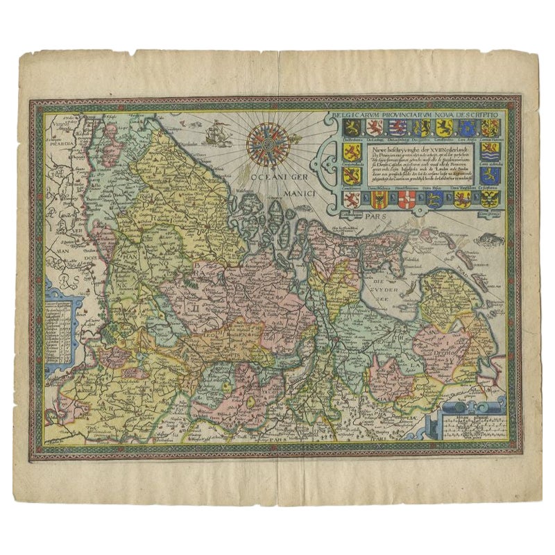
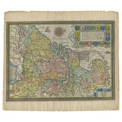
- Antique Map of the Netherlands by Guicciardini, 1612Located in Langweer, NLAntique map titled 'Belgicarum Provinciarum Nova Descriptio'. Beautiful old map of the Netherlands. With decorative cartouche including the coat...Category
Antique 17th Century Maps
MaterialsPaper
- Antique Map of the City of Leeuwarden by Guicciardini, 1613Located in Langweer, NLAntique map tited 'Lewardum'. Plan of the city of Leeuwarden, Friesland, the Netherlands. This map originates from the 1613 edition of 'Discrittione di tutti i Paesi Bassi', by L. Gu...Category
Antique 17th Century Maps
MaterialsPaper
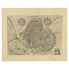
- Antique Map of the City of Zutphen by Guicciardini, 1612Located in Langweer, NLAntique map Zutphen titled 'Zutphen'. This map depicts the city of Zutphen, Gelderland, The Netherlands. Originates from 'Beschryvinghe van alle de Neder-landen anderssins ghenoemt N...Category
Antique 17th Century Maps
MaterialsPaper
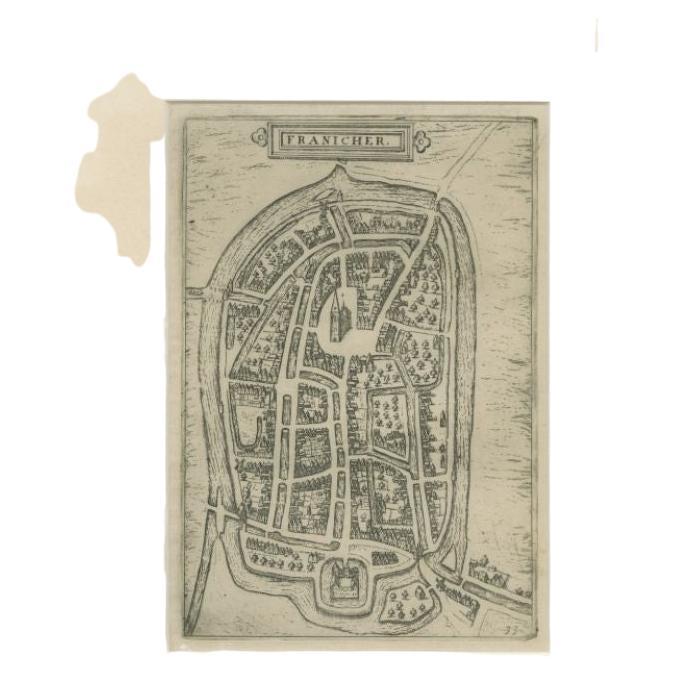
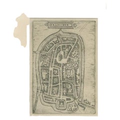
- Antique Map of the City of Franeker by Guicciardini, 1612Located in Langweer, NLAntique map titled 'Franicher'. Original antique map of the city of Franeker, Friesland, the Netherlands. This map originates from 'Beschryvinghe van alle de Neder-landen, anderssins...Category
Antique 17th Century Maps
MaterialsPaper
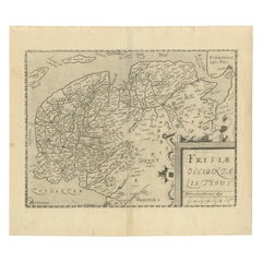
- Original Antique Map of Friesland by Guicciardini, 1612Located in Langweer, NLAntique map titled 'Frisiae Occidentalis Typus'. Original antique map of the province of Friesland, the Netherlands. This map originates from 'Beschryvinghe van alle de Neder-Landen'...Category
Antique 17th Century Maps
MaterialsPaper
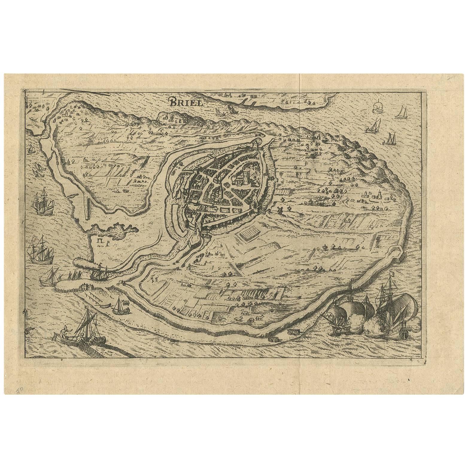
- Antique Map of the City of Brielle 'The Netherlands' by L. Guicciardini, 1625Located in Langweer, NLPlan of Brielle, Briel, Den Briel in the Province of Zuid-Holland, The Netherlands, Holland. This map originates from the 1625 edition of 'Discrittione di tutti i Paesi Bassi', by L....Category
Antique Early 17th Century Maps
MaterialsPaper
You May Also Like
- Original Antique Map of The Netherlands, Engraved by Barlow, Dated 1807Located in St Annes, LancashireGreat map of Netherlands Copper-plate engraving by Barlow Published by Brightly & Kinnersly, Bungay, Suffolk. Dated 1807 Unframed.Category
Antique Early 1800s English Maps
MaterialsPaper
- Original Antique Map of The Netherlands, Sherwood, Neely & Jones, Dated 1809Located in St Annes, LancashireGreat map of The Netherlands Copper-plate engraving by Cooper Published by Sherwood, Neely & Jones. Dated 1809 Unframed.Category
Antique Early 1800s English Maps
MaterialsPaper
- 1840 Map of the City of Washington Published by William M. MorrisonLocated in Colorado Springs, COThis map, printed in 1840, is a detailed representation of Washington, D.C. in the mid-19th century. The map shows block numbers, wards, and government buildings as well as details o...Category
Antique 1840s American Federal Maps
MaterialsPaper
- 1861 Topographical Map of the District of Columbia, by Boschke, Antique MapLocated in Colorado Springs, COPresented is an original map of Albert Boschke's extremely sought-after "Topographical Map of the District of Columbia Surveyed in the Years 1856 ...Category
Antique 1860s American Historical Memorabilia
MaterialsPaper
- Antique Map of American Cities, Vignette of New York City, circa 1920Located in St Annes, LancashireGreat maps of American Cities Unframed Original color By John Bartholomew and Co. Edinburgh Geographical Institute Published, circa 1920Category
Vintage 1920s British Maps
MaterialsPaper
- Original Antique Map / City Plan of Brussels by Tallis, circa 1850Located in St Annes, LancashireGreat map of Brussels. Steel engraving. Published by London Printing & Publishing Co. (Formerly Tallis), C.1850 Free shipping.Category
Antique 1850s English Maps
MaterialsPaper


Recently Viewed
View AllMore Ways To Browse
Antique Wrotic
Antique Globes Of The World
Medici Antique
Di Medici
Antique Map Globe
Antique Italia
Antique World Globe Map
17th Century Italian Map
17th Century Italy Map
Antique Jail
Antique Map Of Florence
Alva Design
Petrus Van
Antique Map Florence
Tree Bag
16th Century Scotland
Great Britain Maps
Used Furniture Depot