Antique Map Of The Moon
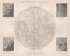
Ubersichtskarte Des Mondes (Overview Map of the Moon), antique astronomy print
Located in Melbourne, Victoria
'Ubersichtskarte Des Mondes'
(Overview Map of the Moon)
German chromolithograph, circa 1895
Category
Late 19th Century Naturalistic Antique Map Of The Moon
Materials
Lithograph
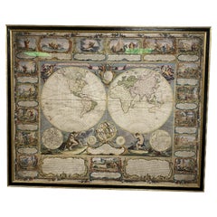
Antique Map of the World with Polar Projections by Keizer & de Lat, 1788
Located in Langweer, NL
phases of the moon and a Copernican solar system tucked between the hemispheres.
This map originates
Category
Late 18th Century Antique Map Of The Moon
Materials
Paper
H 8.08 in W 11.03 in D 0.02 in
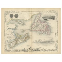
A Decorative Map of Nova Scotia and Newfoundland by John Tallis, 1851
Located in Langweer, NL
The map is part of the series created by John Tallis & Company, known for their mid-19th-century
Category
1850s Antique Map Of The Moon
Materials
Paper
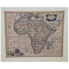
"Africae Accurata", a Hand-Colored 17th Century Map of Africa by Visscher
By Nicolaes Visscher II
Located in Alamo, CA
An 18th century hand-colored map of Africa entitled "Africae Accurata Tabula ex officina" by
Category
Late 17th Century Dutch Antique Map Of The Moon
Materials
Paper
H 23.75 in W 28.13 in D 0.13 in
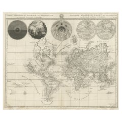
Antique Detailed World Map Drawn on Mercator's Projection, 1700
Located in Langweer, NL
Antique world map titled 'Carte generale du monde, ou description du monde terrestre & Aquatique
Category
17th Century Antique Map Of The Moon
Materials
Paper
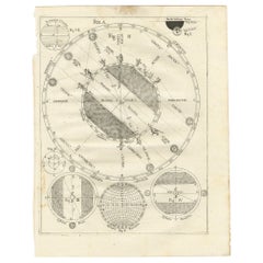
Antique Map Illustrating Solar Eclipses by Scherer, C.1703
Located in Langweer, NL
Antique map of an hemisphere and several figures illustrating the position of the earth, moon and
Category
18th Century Antique Map Of The Moon
Materials
Paper
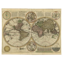
Antique Bible World Map by R. & J. Wetstein, 1743
Located in Langweer, NL
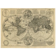
Antique world map titled 'De Werelt Caart'.
A scarce and richly detailed double hemisphere world
Category
Mid-18th Century Antique Map Of The Moon
Materials
Paper
Original Antique Engraving of the Creation of the World According to Mozes, 1725
Located in Langweer, NL
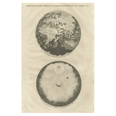
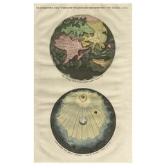
Antique map titled 'De Schepping der Wereldt volgens de Beschryving van Mozes' - This plate shows
Category
18th Century Antique Map Of The Moon
Materials
Paper
H 15.75 in W 9.57 in D 0 in
Beautiful Original Print of The Creation of the World According to Moses, 1725
Located in Langweer, NL
Antique map, titled: 'De Schepping der Wereldt volgens de Beschryving van Mozes.'
Two separate
Category
1720s Antique Map Of The Moon
Materials
Paper
H 15.75 in W 9.93 in D 0 in
Antique Double Hemisphere World Map with California as an Island, 1710
Located in Langweer, NL
Description: Antique map titled 'De Werelt Caart'. First state (out of three) antique double
Category
1710s Antique Map Of The Moon
Materials
Paper
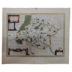
1630 Pierre Petit map "Description du Gouvernement de la Capelle" Ric0010
Located in Norton, MA
1630 Pierre Petit map entitled
"Description du Gouvernement de la Capelle,"
Ric0010
Pierre
Category
17th Century Dutch Antique Map Of The Moon
Materials
Paper
H 18.9 in W 22.45 in D 0.4 in
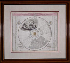
The Orbits of Venus and Mercury: An 18th C. Framed Celestial Map by Doppelmayr
By Johann Gabriel Doppelmayr 1
Located in Alamo, CA
This 18th century hand-colored copperplate celestial map by Johann Doppelmayr entitled "Phænomena
Category
Early 18th Century Antique Map Of The Moon
Materials
Engraving
H 31.13 in W 34.88 in D 1 in
Antique Puzzle of Colored Cardboard Depicting World Map, Europe and France
Located in Milan, IT
France. The world map in addition to the territorial map of the continents depicts the phases of the Moon
Category
1850s French Antique Map Of The Moon
Materials
Paper
H 0.99 in W 13.98 in D 10.36 in
Pair of Sevres Biscuit Porcelain Groups of the Continents
Located in New York, NY
European signifiers: books, maps, and a cannon. Behind her, a small putto plays with a globe behind the
Category
19th Century French Neoclassical Antique Map Of The Moon
Materials
Sèvres
Cosmgraphy and Astrology, 1686 by Richard Blome from the First Edition
By Richard Blome
Located in BUNGAY, SUFFOLK
Sansovino frame, carved with moons and suns
Frame Length 43 cm., 17 in., Height 58 cm., 23 in.
This
Category
1680s English Charles II Antique Map Of The Moon
Materials
Paper
H 16.34 in W 10.44 in D 0.04 in
Antique Print of an Orrery and Ancient Church, 1754
Located in Langweer, NL
. Edmund and an apparatus for drawing the Moons Path'. Print of i.a. an orrery and ancient wooden church
Category
18th Century Antique Map Of The Moon
Materials
Paper
Portrait of Lady in Mob Cap - British Old Master 18th century art oil painting
Located in London, GB
, daughter of a Charing Cross print and map seller, whom he had converted. They lived at No. 7 Mortimer
Category
18th Century Old Masters Antique Map Of The Moon
Materials
Oil
Nova Totius Terrarum Orbis Geographica Ac Hydrographica Tabula
Located in New York, NY
. Image size 15.75 x 21.19 inches (40 x 53.9 cm).
A classic example of a world map based on Mercator's
Category
17th Century Other Art Style Antique Map Of The Moon
Materials
Engraving
A beautiful Celestial Table Globe produced by Gerard & Leonard Valk
By Gerard and Leonard Valk
Located in ZWIJNDRECHT, NL
Gerard began his publishing firm producing maps and atlases in co-operation with Petrus Schenk about 1680
Category
Early 18th Century Dutch Dutch Colonial Antique Map Of The Moon
Materials
Other
Antique Brass Czech Orrery Astronomical Instruments Made by Jan Felkl in 1870
By Jan Felkl
Located in Milan, IT
the nineteenth century. Cast iron base, papier mâché´ globe, with detailed territorial map and oceanic
Category
1860s Czech Antique Map Of The Moon
Materials
Iron
H 18.9 in W 29.53 in D 11.03 in
People Also Browsed
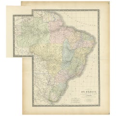
Antique Map of Brazil by Levasseur '1875'
Located in Langweer, NL
Antique map titled 'Carte du Brésil'. Large map of Brazil, with small fold out. This map originates from 'Atlas de Géographie Moderne Physique et Politique' by A. Levasseur. Publishe...
Category
Late 19th Century Antique Map Of The Moon
Materials
Paper
Colored wall map of the WORLD
By Chambon
Located in ZWIJNDRECHT, NL
“Mappe Monde, contenant les Parties Connues du Globe Terrestre”
CHAMBON, Gobert-Denis (France, 17.. - 1781)
Paris, Longchamps et Janvier, 1754
Size H. 115 x W. 145 cm.
Gobert-Denis...
Category
Mid-18th Century French French Provincial Antique Map Of The Moon
Materials
Wood, Paper
17th Century Hand-Colored Map of West Africa by Mercator/Hondius
Located in Alamo, CA
A 17th century hand-colored map entitled "Guineae Nova Descriptio" by Gerard Mercator and Jodocus Hondius, published in their 'Atlas Minor' in Amsterdam in 1635. It is focused on the...
Category
Mid-17th Century Dutch Antique Map Of The Moon
Materials
Paper
Regency Lane’s Pocket Globe, Dated 1818
By Lane's
Located in Lymington, Hampshire
A 3 ½ inch Regency Lane’s pocket globe, dated 1818, the terrestrial globe with the seas in light green and the land masses outlined in darker green, contained within a hinged black s...
Category
1810s English Regency Antique Map Of The Moon
Materials
Wood
Antique Map of Egypt, '1875'
Located in Langweer, NL
Antique map titled 'Carte des l'Égypte'. Large map of Egypt. This map originates from 'Atlas de Géographie Moderne Physique et Politique' by A. Levasseur. Published 1875.
Category
Late 19th Century Antique Map Of The Moon
Materials
Paper
Antique Print of the Fortress Cranganor near Kodungallur in India, 1757
Located in Langweer, NL
Antique print of the Fortress Cranganor, nowadays known by the name Kodungallor. French and Dutch title including scale and compass rose. This print originates from 'L'Histoire génér...
Category
Mid-18th Century Antique Map Of The Moon
Materials
Paper
Free Shipping
H 13.39 in W 16.54 in D 0 in
Early 20th Century American Library Globe
Located in Norwell, MA
Fine library globe with makers logo from Atlas School Supply Co., Chicago. Hardwood base with rich finish and nice detail. Celestial globe with equatorial ring. Showing zodiac markin...
Category
1920s North American Antique Map Of The Moon
Materials
Wood
Antique Map of Herefordshire 'England' by R. Morden, 1708
Located in Langweer, NL
This antique County map of Herefordshire by Robert Morden was first published in 1701 in a work entitled 'The New Description and State of England', however, a subsequent edition by ...
Category
Early 18th Century Antique Map Of The Moon
Materials
Paper
Map of the Holy Land "Carte de la Syrie et de l'Egypte" by Pierre M. Lapie
By Pierre M. Lapie
Located in Alamo, CA
An early 19th century map of ancient Syria and Egypt entitled "Carte de la Syrie et de l'Egypte anciennes/dressée par M. Lapie, Colonel d'Etat Major, et M. Lapie fils, Captaine au mé...
Category
Early 19th Century French Antique Map Of The Moon
Materials
Paper
H 27 in W 21.38 in D 0.75 in
Antique Map of Africa by Homann Heirs, '1804'
Located in Langweer, NL
Antique map titled 'Charte von Africa'. Large, original antique map of Africa by Franz Ludwig Güssefeld. Published by Homann Heirs, 1804.
Category
Early 19th Century Antique Map Of The Moon
Materials
Paper
Reproduction Giovanni Maria Cassini 1790 Terrestrial Globe And 1792 Celestial Gl
Located in Bridgeport, CT
Cassini terrestrial globe- Roma 1790. Observations of the voyages and new discoveries of Englishman Captain Cook.
Along with the 1792 Cassini celestial globe with charts of the heav...
Category
20th Century Renaissance Antique Map Of The Moon
Materials
Wood, Paper
H 18.5 in W 17.5 in D 17.5 in
18th Century Antique Georgian Satinwood Precision Barometer
Located in Devon, GB
A rare late 18th century George III period antique cross-banded satinwood wheel barometer. The nine inch circular silvered and engraved main scale has elaborate compass point central...
Category
18th Century English George III Antique Map Of The Moon
Materials
Satinwood
Art Deco Eggshell Lacquered Dinanderie Vase Alexander Lamont Pleiades Collection
By Alexander Lamont
Located in Khet Bang Sue, Krung Thep Maha Nakhon
"Helio Jar Large, Nebula Pattern. Working with lacquer and eggshell, Alexander explored ways to bring concepts of planets, constellations and celestial charts onto vessels. This is p...
Category
2010s Thai Art Deco Antique Map Of The Moon
Materials
Bronze
Georgian Terrestrial Pocket Globe by T. Harris and Son, London, 1813
Located in Oxfordshire, United Kingdom
A Rare George III pocket globe by T. Harris and Son, London, 1813. Housed in the original sharkskin case.
A fasinsting and rare item in wonderful condition.
The terrestrial gl...
Category
Early 19th Century English George III Antique Map Of The Moon
Materials
Plaster
18th Century Hand-Colored Homann Map of Germany, Including Frankfurt and Berlin
By Johann Baptist Homann
Located in Alamo, CA
An 18th century hand-colored map entitled "Tabula Marchionatus Brandenburgici et Ducatus Pomeraniae quae sunt Pars Septentrionalis Circuli Saxoniae Superioris" by Johann Baptist Homa...
Category
Early 18th Century German Antique Map Of The Moon
Materials
Paper
H 20.25 in W 23.5 in D 0.07 in
Antique Map of the Island of Java, Indonesia by P. Van Der Aa, 1713
Located in Langweer, NL
This rare map shows the Indonesian island of Java. With compass rose and scale. From: Nouvel Atlas, très exact et fort commode pour toutes sortes de personnes, Contenant Les Principa...
Category
Early 18th Century Antique Map Of The Moon
Materials
Paper
Recent Sales
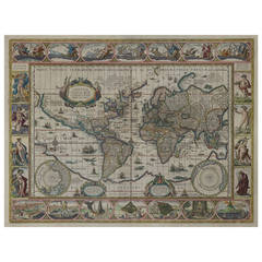
Nova Totius Terrarum Orbis Geographica Ac Hydrographica Tabula, 1638
By Willem Blaeu
Located in Houston, TX
New Geographical and Hydrographical Map of the World.
Beautifully hand-colored, this 1638
Category
Mid-17th Century Dutch Antique Map Of The Moon
Painted Tall Case Clock, Eight-Day Moon Dial Works
Located in Providence, RI
signed works, we take notice. Note the intricate map of the world and painted moon dial with boat, et al
Category
19th Century American Chippendale Antique Map Of The Moon
Mid-18th Century Eight Day Oak Longcase Clock by John Taylor of Manchester
Located in Worcester, Worcestershire
moon to the lunette with two brass hemisphere terrestial maps. Two winding holes, blued steel clock
Category
18th Century Antique Map Of The Moon
Materials
Mahogany
H 85.24 in W 21.46 in D 10.24 in
A Rare And Important Tall Case Clock By Jacob Hoster, Hanover Pa
By Jacob Hostetter
Located in Sharon, MA
tiger maple colonnettes and has oval side windows.
The dial features a painted moon phase disk in the
Category
19th Century American Antique Map Of The Moon
Typus Orbis Terrarum, Antique Map 1667
By Matthäus Merian the Younger
Located in Soquel, CA
Hand-colored twin hemisphere map of the world by Matthaus Merian. From Gottfried's "Historische
Category
17th Century Antique Map Of The Moon
Materials
Printer's Ink, Watercolor, Rag Paper
Map of Africa by Tanner
Located in Alamo, CA
An early to mid 19th century hand-colored map of Africa by Henry Schenk Tanner, published in
Category
Mid-19th Century Other Art Style Antique Map Of The Moon
Materials
Engraving
Set of World & Four Continents
By Joan (Johannes) Blaeu
Located in London, GB
World at the bottom and representations of the Classical Planets, moon and sun at the top. The maps of
Category
17th Century Antique Map Of The Moon
Materials
Watercolor, Engraving
Set of 22 Handpainted Tarot Tiles from France
Located in Dallas, TX
or as a map of mental and spiritual pathways. The trump cards, consists of 22 cards without suits
Category
19th Century French Antique Map Of The Moon
Original Vintage Poster By L.M. Gill - A Great Industry Where Our Tea Comes From
By "Leslie MacDonald ""Max"" Gill"
Located in London, GB
great illustrated maps of the countries and places in Asia where the tea comes from: India and Pakistan
Category
1920s British Antique Map Of The Moon
Materials
Paper
H 39.97 in W 25.01 in D 0.04 in
LATE 19THC COFFEE TABLE FROM A MISSION IN SANTA FE, NEW MEXICO
Located in Los Angeles, CA
TURQUOISE NUGGETS EMBEDDED IN THE TABLE AND A PAINTED DECORATED MAP OF THE SANTA FE, NEW MEXICO MISSION AREA
Category
19th Century American Antique Map Of The Moon
Materials
Pine
Hand-Colored Astronomical Engravings by Louis Charles Desnos, 1766
By Louis Charles Desnos
Located in Kinderhook, NY
Collection of three hand-colored astronomical map engravings illustrating celestial spheres in
Category
Mid-18th Century French Rococo Antique Map Of The Moon
Materials
Glass, Wood, Paper
American Revenue Cutter Service Ensign Belonging To Capt. W. H. Bagley
Located in York County, PA
believed to be Laura Barnes Bagley.
(3) A map with hand-drawn notations by Bagley, detailing routes he
Category
1870s American Antique Map Of The Moon
H 53.75 in W 81.25 in D 2.5 in
Original Antique Map of the Moon, Dated 1812
Located in St Annes, Lancashire
Great map of the moon.
Copper-plate engraving.
Dated 1812 in the watermark in the paper.
Some
Category
1810s English Antique Map Of The Moon
Materials
Paper
EARLY MAP OF THE MOON - Foundation map
By Johann Baptist Homann
Located in Santa Monica, CA
JOHN BAPTISTE HOMANN (1663 – 1724)
(J. G. Doppelmayr 1671 - 1750)
THE MOON c. 1704
Category
Early 1700s Old Masters Antique Map Of The Moon
Materials
Engraving
Original Antique Map of the Moon, 1833
Located in St Annes, Lancashire
Great image of the moon
Woodcut engraving
Text on verso
Published 1833.
Free
Category
1830s English Folk Art Antique Map Of The Moon
Materials
Paper
Original Antique Map of The Moon, 1833
Located in St Annes, Lancashire
Great image of the moon
Woodcut engraving
Text on verso
Published 1833.
Free
Category
1830s English Folk Art Antique Map Of The Moon
Materials
Paper
19th Century Hand-Colored Map of Africa by Henry Tanner
By Henry Schenck Tanner
Located in Alamo, CA
An early to mid-19th century hand-colored map of Africa by Henry Schenk Tanner, published in
Category
Mid-19th Century American Antique Map Of The Moon
Materials
Paper
Antique Double Hemisphere Celestial Chart by Lotter, 'circa 1770'
Located in Langweer, NL
Antique map titled 'Planisphaerium Coeleste'. A very decorative double hemisphere celestial chart
Category
Late 18th Century Antique Map Of The Moon
Materials
Paper
Portrait of Mary Bushby with Dog - British Old Master Regency art painting
By John Russell
Located in London, GB
February 1770, he married Hannah Faden, daughter of a Charing Cross print and map seller, whom he had
Category
18th Century Old Masters Antique Map Of The Moon
Materials
Pastel
Portrait of Girl with White Dog - British Old Master Regency art oil pastel
Located in London, GB
. On 5 February 1770, he married Hannah Faden, daughter of a Charing Cross print and map seller, whom
Category
18th Century Old Masters Antique Map Of The Moon
Materials
Oil Pastel
Original Vintage Poster By L.M. Gill - A Great Industry Where Our Tea Comes From
By "Leslie MacDonald ""Max"" Gill"
Located in London, GB
great illustrated maps of the countries and places in Asia where the tea comes from: India and Pakistan
Category
1920s Antique Map Of The Moon
Materials
Paper
Hand-Colored Copper Plates of Fish from “a Collection of Voyages and Travels"
By Johannes Kip
Located in Bedford, Bedfordshire
ancornet at scuttle fish Unknown fish A grondin at grumbler A kind of barbeue A cape verdo moon Unknown but
Category
1730s English George II Antique Map Of The Moon
Materials
Paper
H 15.5 in W 20.25 in D 0.19 in
Planiglobii Terrestris
Located in Florham Park, NJ
the routes of Magellan, Tasman, Dampier, et. al. Atop the map are decorative ideals of the sun, moon
Category
18th Century and Earlier Antique Map Of The Moon
Decorative Map of the Moon, circa 1916
Located in Vienna, Vienna
vy J. Klepesta, published in Prag c. 1916, chromolithgraphed print on
canvas, hanging wall chart. Size c. 80 x 57 cm.
Category
Early 20th Century Czech Antique Map Of The Moon
The Route of David Roberts, Esq. in the Holy Land, Petrea & Sarda, Ancient Sidon
By David Roberts
Located in New York, NY
Original lithograph map by David Roberts (1796 – 1864) published by F.G. Moon, 1845 depicting his
Category
1840s Realist Antique Map Of The Moon
Materials
Lithograph
Get Updated with New Arrivals
Save "Antique Map Of The Moon", and we’ll notify you when there are new listings in this category.
Antique Map Of The Moon For Sale on 1stDibs
Choose from an assortment of styles, material and more with respect to the antique map of the moon you’re looking for at 1stDibs. An antique map of the moon — often made from paper, ceramic and iron — can elevate any home. There are many kinds of the antique map of the moon you’re looking for, from those produced as long ago as the 18th Century to those made as recently as the 19th Century. When you’re browsing for the right antique map of the moon, those designed in neoclassical styles are of considerable interest. Many designers have produced at least one well-made antique map of the moon over the years, but those crafted by Jan Felkl, Nicolaes Visscher II and Richard Blome are often thought to be among the most beautiful.
How Much is a Antique Map Of The Moon?
The average selling price for an antique map of the moon at 1stDibs is $3,338, while they’re typically $406 on the low end and $36,609 for the highest priced.
