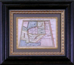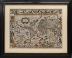
Set of World & Four Continents
View Similar Items


Want more images or videos?
Request additional images or videos from the seller
1 of 11
Joan (Johannes) BlaeuSet of World & Four Continents c. 1650
c. 1650
About the Item
- Creator:Joan (Johannes) Blaeu (1596 - 1673)
- Creation Year:c. 1650
- Dimensions:Height: 19.3 in (49 cm)Width: 23.63 in (60 cm)
- Medium:
- Period:
- Condition:Framed and glazed, overall size: 61 x 75 x 2 cm.
- Gallery Location:London, GB
- Reference Number:Seller: 1072521stDibs: LU1419211397192
About the Seller
5.0
Vetted Seller
These experienced sellers undergo a comprehensive evaluation by our team of in-house experts.
Established in 1979
1stDibs seller since 2020
11 sales on 1stDibs
Typical response time: 1 hour
More From This SellerView All
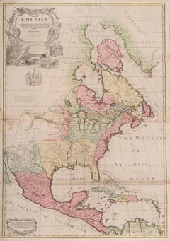
- one of the earliest large-scale English maps of North AmericaBy John SenexLocated in London, GBone of the earliest large-scale English maps of North America SENEX, John. North America Corrected from the Observations Communicated to the Royal Society at London, and the Royal Academy at Paris. By John Senex F.R.S. 1710. To the Honorable Anthony Hammond Esq. One of the Comissioners of Her Maj[es]ties Navy. This Map his humbly Dedicated and Presented by his Obliged Servants. John Senex F.R.S., 1710 [-1728]. A fine map of North and Central America, with the West Indies. One of the earliest large-scale English maps of North America. It represents a British attempt to consolidate new information about the region and borrows data from such recently published sources as Delisle’s landmark Carte du Mexique et de la Floride and Carte de la Canada. Senex improves upon De L'Isle's work with a fine depiction of the Great Lakes region and the most accurate definition of the lower Mississippi River and its delta by an English cartographer of the period. Several of the most important and controversial cartographic discoveries of the period are discussed at length, including Lahontan’s mythical Long River and the Salt Lake east of the Country of the Mozeemleck’s, both of which are also depicted in remarkable (albeit fanciful) detail. Sir William Phipps discovery of Spanish wrecks off the coast of the Caicos and Southern Bahamas is also noted. Senex also extended the map’s coverage to the Canadian Arctic and the Terra Incognita above Baffin’s Bay. Present-day Oklahoma and Texas are part of La Floride, considered at the time to be a possession of the French. The Red River and the Indian villages of East Texas are portrayed accurately, but Senex, following Delisle, incorrectly placed many Texas rivers...Category
1710s Naturalistic More Art
MaterialsWatercolor, Engraving
- South AmericaBy John SenexLocated in London, GBSouth America SENEX, John. South America Corrected from the Observations Communicated to the Royal Society’s of London & Paris. By John Senex. To Edmund Halley. LLD. Savilian Professor of Geometry in Oxford and Fellow of the Royal Society. This Map corrected from His own Discoveries In gratefull Acknowledgement of his Ready assistance to Encourage this Designe is Humbly Dedicated. John Senex, at the Globe against St Dunstans Church, Fleetstreet, London 1710 [-1728]. John Senex (1678-1740) was one of the foremost mapmakers in England in the early eighteenth century. He was also a surveyor, globemaker, and geographer. As a young man, he was apprenticed to Robert Clavell, a bookseller. He worked with several mapmakers over the course of his career, including Jeremiah Seller and Charles...Category
1710s Naturalistic More Art
MaterialsWatercolor, Engraving
 $3,820
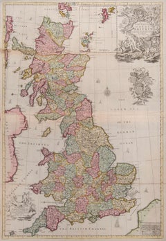
 - Great BritainBy John SenexLocated in London, GBGreat Britain SENEX, John. A New Map of Great Britain Corrected from the Observations communicated to the Royal Society at London. By John Senex F.R.S. To the Right Hono[ra]ble William Connelly ESQ. One of the Commissioners of His Maj[es]ties Revenue, Speakerof the Hono[a]ble House of Commons, and one of His Maj[es]ties most Hono[ra]ble Privy Council for Ye Kingdom of Ireland. This Map is dedicated by John Senex. John Senex F.R.S. 1710 [-1728]. John Senex (1678-1740) was one of the foremost mapmakers in England in the early eighteenth century. He was also a surveyor, globemaker, and geographer. As a young man, he was apprenticed to Robert Clavell, a bookseller. He worked with several mapmakers over the course of his career, including Jeremiah Seller and Charles Price...Category
1710s Naturalistic More Art
MaterialsWatercolor, Engraving
- NOZEMAN & SEPP. A Pair of DucksBy Cornelius Nozeman and Jan Christian SeppLocated in London, GBDutch Birds NOZEMAN, Cornelius & SEPP, Jan Christian. Pair of Ducks: ANAS FERINA Mas and ANAS FERINA Foemina, from Nederlandsche Vogelen. Jan Christian S...Category
1770s Naturalistic Animal Prints
MaterialsWatercolor, Engraving, Handmade Paper
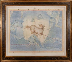
- eighteenth century sign of the zodiac - LibraLocated in London, GBeighteenth century sign of the zodiac FLAMSTEED, John Libra. London, C. Nourse, 1753. Hand coloured star chart heightened with gold and silver, engraved b...Category
1750s Naturalistic Prints and Multiples
MaterialsWatercolor, Engraving
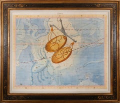
- eighteenth century sign of the zodiac - AriesLocated in London, GBeighteenth century sign of the zodiac FLAMSTEED, John. Aries. London, C. Nourse, 1753. Hand coloured star chart heightened with gold and silver, engraved ...Category
1750s Naturalistic Prints and Multiples
MaterialsWatercolor, Engraving

You May Also Like
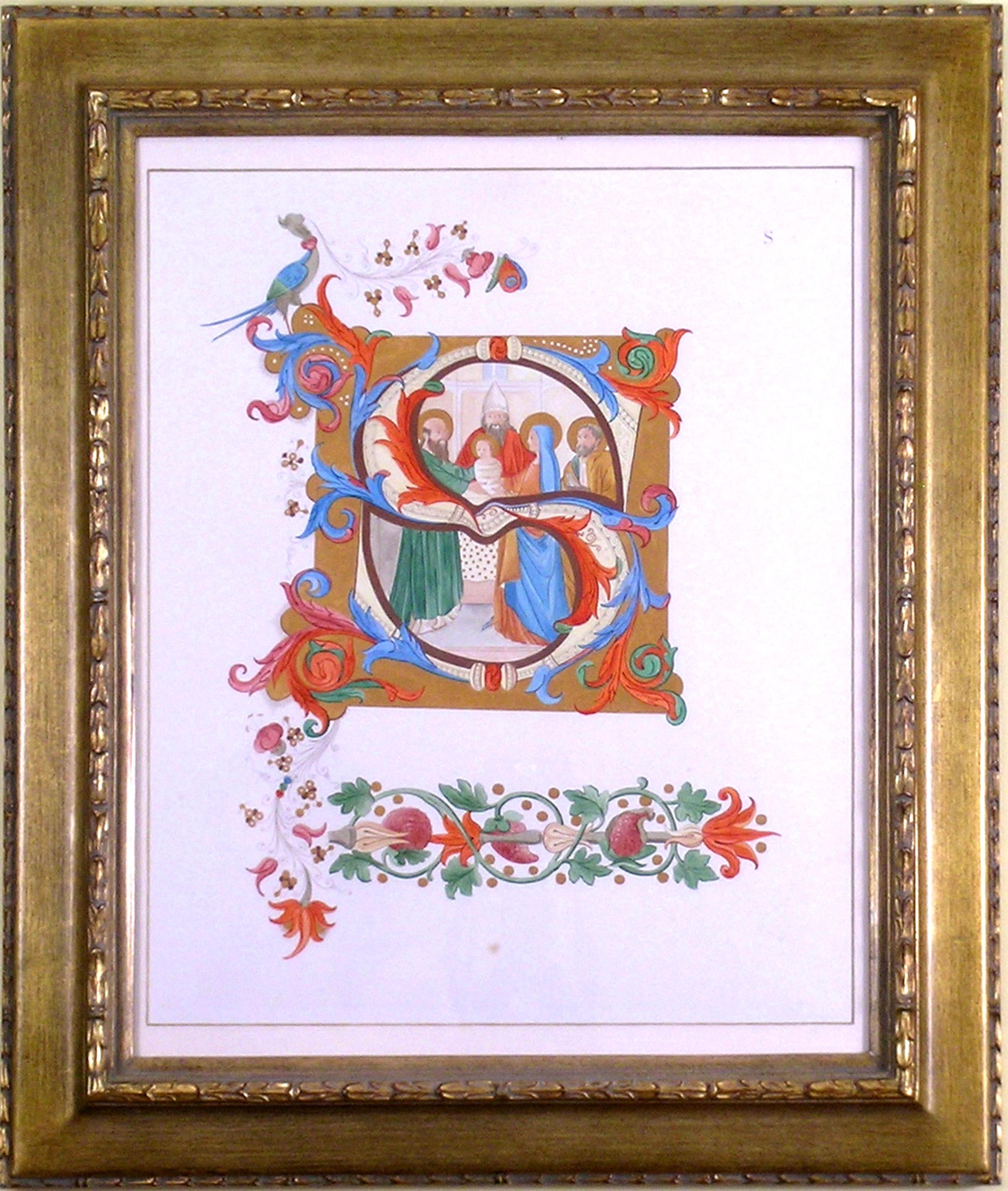
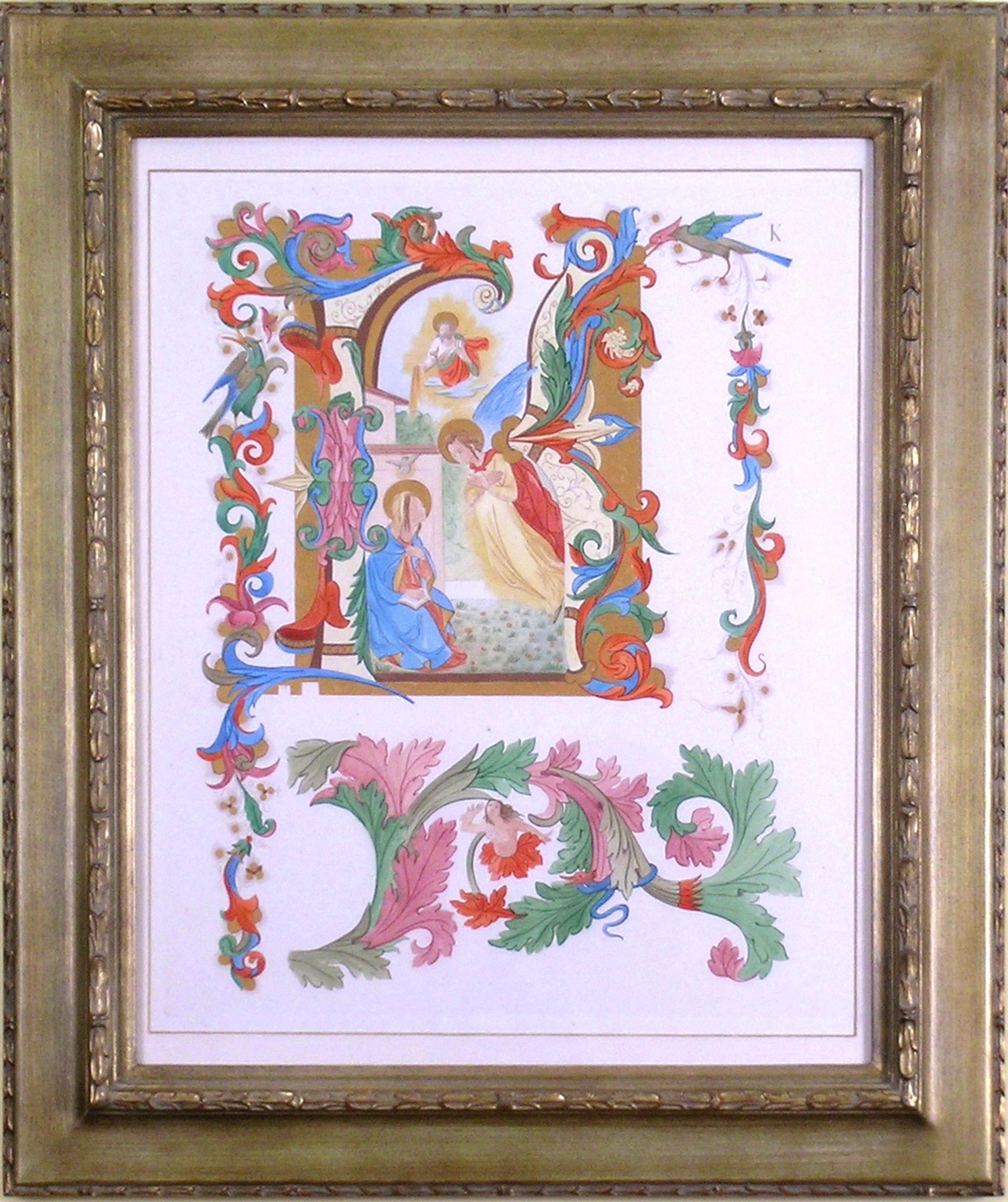
- Alphabet Letter "S", Saint, ReligiousLocated in Florham Park, NJAn Alphabet of Capital Letters: Selected from the Illuminations of Italian Chorale Books of the Fifteenth and Sixteenth Centuries. Arundel Society. London, 1862. Engraving. Printed...Category
1860s Academic More Prints
MaterialsGold
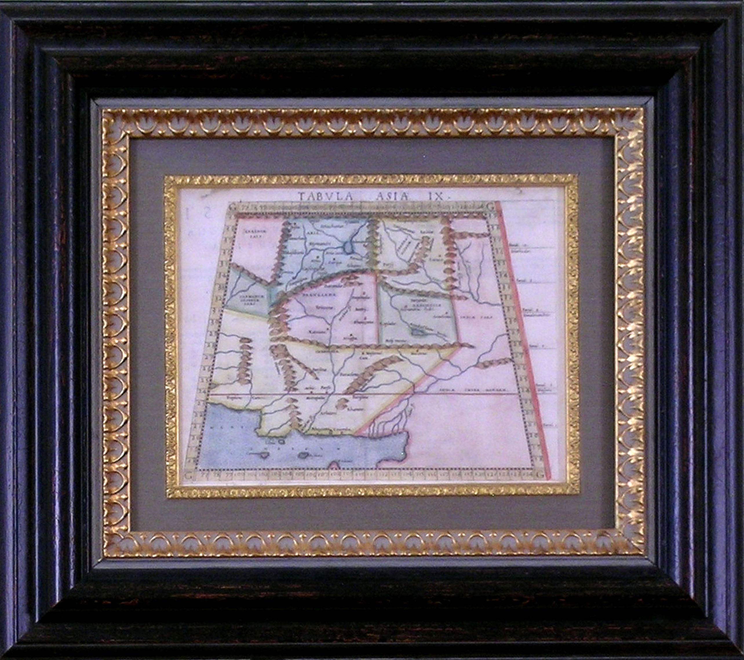
- Map Tabula Asiae IX Pakistan Afghanistan Iran Indian OceanLocated in Florham Park, NJ“Tabula Asiae IX Pakistan, Afghanistan, E. Iran” Girolamo Ruscelli (1504 – 1566) Venice, 1561 V. Valgrisi. publisher Copper Engraving with Later Hand-Color Born in Viterbo, Italy, Ruscelli was an Italian polymath, humanist, editor, and cartographer active in Venice during the early 16th century. He is well known for his exacting revision of Ptolemy's Geographia. He was influenced by the 1548 Gastaldi edition. The work was illustrated with 64 double page engraved maps. Twenty-seven were Ptolemaic and thirty-seven were considered “modern maps”. These showed early glimpses of North and South America...Category
16th Century Realist Prints and Multiples
MaterialsCopper
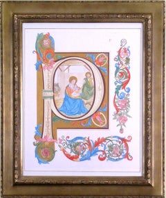
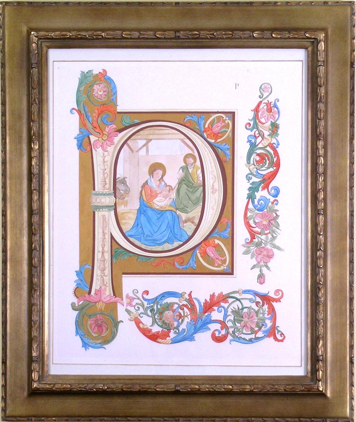
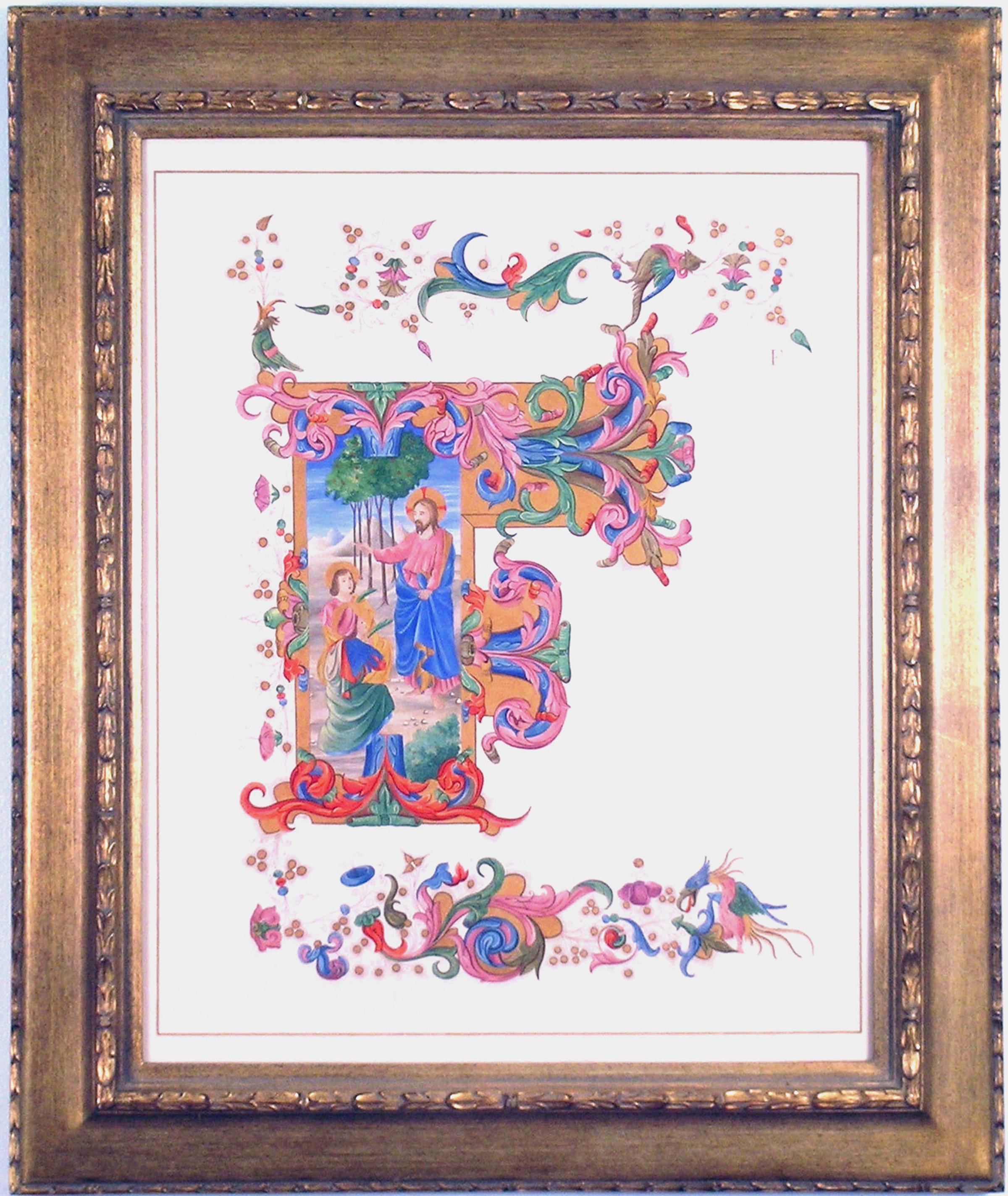
- Alphabet Letter "P"Located in Florham Park, NJAn Alphabet of Capital Letters: Selected from the Illuminations of Italian Chorale Books of the Fifteenth and Sixteenth Centuries. Arundel Society. London, 1862. Engraving. Printed in Colours. Hand-Painted Gold Highlights. To produce a study for an historic illumination of antiphonals, the Arundel Society selected each of the alphabet letters from chorale books created in the fifteenth and sixteenth centuries. Devotional pieces, the chorale music was greatly appreciated by Christians throughout the world. Often it was sung as responsive music where the choir would be divided into two parts thus creating a harmony which reinforced the Christian religious doctrine. As illustrious as the music, the key letters that headed each piece would take their own place in the art world. Many initials would be specifically devoted to prominent men and woman of both religious and cultural importance. For example, the “F” was devoted to Fra Angelico, an Italian painter of the Early Renaissance, described by Vasari in his Lives of the Artists...Category
1860s Academic More Prints
MaterialsGold
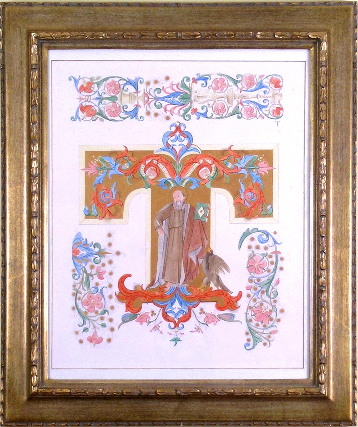
- Alphabet Letter "T"Located in Florham Park, NJAn Alphabet of Capital Letters: Selected from the Illuminations of Italian Chorale Books of the Fifteenth and Sixteenth Centuries. Arundel Society. London, 1862. Engraving. Printed...Category
1860s Academic More Prints
MaterialsGold
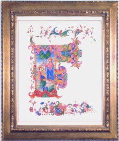
- Alphabet Letter "F"Located in Florham Park, NJAn Alphabet of Capital Letters: Selected from the Illuminations of Italian Chorale Books of the Fifteenth and Sixteenth Centuries. Arundel Society. London, 1862. Engraving. Printed...Category
1860s Academic More Prints
MaterialsGold
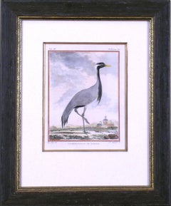
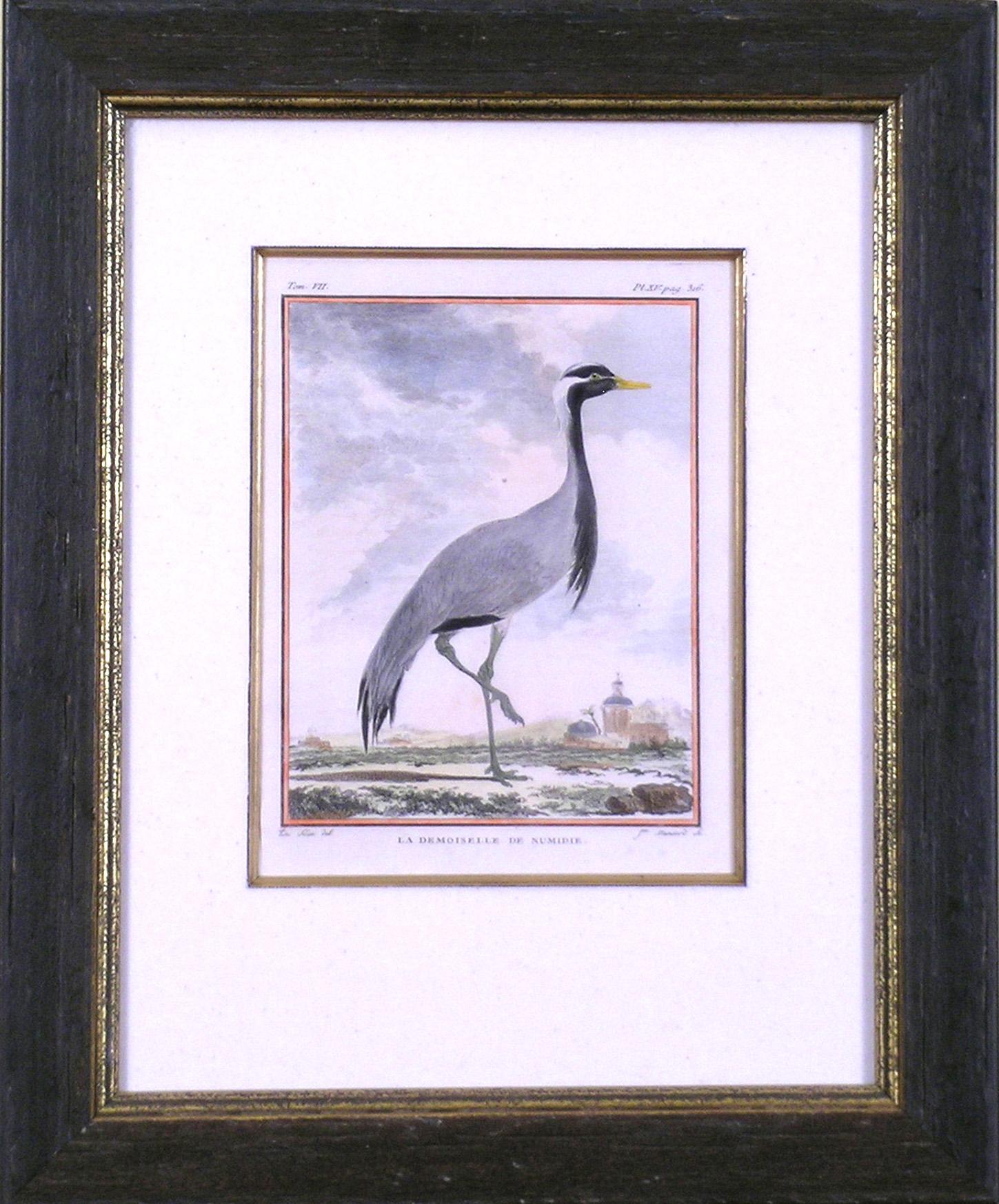
- La Demoiselle de Numidie (Crane)By Georges-Louis Leclerc, Comte de BuffonLocated in Florham Park, NJGeorge-Louis Leclerec, Comte de Buffon. HistoireNaturell, Generale et Particuliere avec la Description du Cabiner du Roi. Paris, 1749 Drawings by Jacques E. DeSeve. Engravings with l...Category
1740s Academic Prints and Multiples
MaterialsWatercolor, Engraving