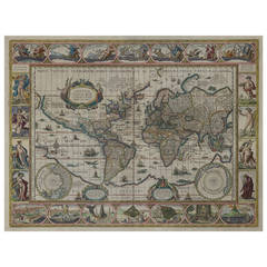
Antique Moon Map
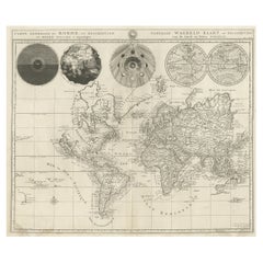
Antique Detailed World Map Drawn on Mercator's Projection, 1700
Located in Langweer, NL
Antique world map titled 'Carte generale du monde, ou description du monde terrestre & Aquatique
Category
17th Century Antique Moon Map
Materials
Paper
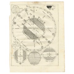
Antique Map Illustrating Solar Eclipses by Scherer, C.1703
Located in Langweer, NL
Antique map of an hemisphere and several figures illustrating the position of the earth, moon and
Category
18th Century Antique Moon Map
Materials
Paper
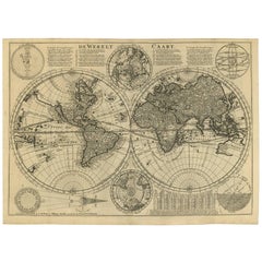
Antique Bible World Map by R. & J. Wetstein, 1743
Located in Langweer, NL
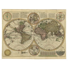
Antique world map titled 'De Werelt Caart'.
A scarce and richly detailed double hemisphere world
Category
Mid-18th Century Antique Moon Map
Materials
Paper
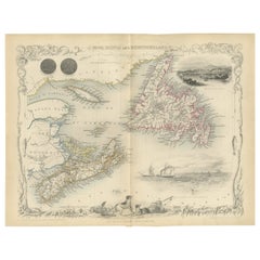
A Decorative Map of Nova Scotia and Newfoundland by John Tallis, 1851
Located in Langweer, NL
The map is part of the series created by John Tallis & Company, known for their mid-19th-century
Category
1850s Antique Moon Map
Materials
Paper
Antique Double Hemisphere World Map with California as an Island, 1710
Located in Langweer, NL
Description: Antique map titled 'De Werelt Caart'. First state (out of three) antique double
Category
1710s Antique Moon Map
Materials
Paper
1630 Pierre Petit map "Description du Gouvernement de la Capelle" Ric0010
Located in Norton, MA
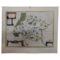
1630 Pierre Petit map entitled
"Description du Gouvernement de la Capelle,"
Ric0010
Pierre
Category
17th Century Dutch Antique Moon Map
Materials
Paper
H 18.9 in W 22.45 in D 0.4 in
"Africae Accurata", a Hand-Colored 17th Century Map of Africa by Visscher
By Nicolaes Visscher II
Located in Alamo, CA
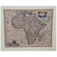
An 18th century hand-colored map of Africa entitled "Africae Accurata Tabula ex officina" by
Category
Late 17th Century Dutch Antique Moon Map
Materials
Paper
H 23.75 in W 28.13 in D 0.13 in
Antique Map of the World with Polar Projections by Keizer & de Lat, 1788
Located in Langweer, NL
phases of the moon and a Copernican solar system tucked between the hemispheres.
This map originates
Category
Late 18th Century Antique Moon Map
Materials
Paper
H 8.08 in W 11.03 in D 0.02 in
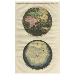
Original Antique Engraving of the Creation of the World According to Mozes, 1725
Located in Langweer, NL
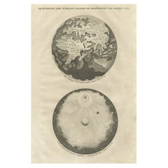
Antique map titled 'De Schepping der Wereldt volgens de Beschryving van Mozes' - This plate shows
Category
18th Century Antique Moon Map
Materials
Paper
H 15.75 in W 9.57 in D 0 in
Beautiful Original Print of The Creation of the World According to Moses, 1725
Located in Langweer, NL
Antique map, titled: 'De Schepping der Wereldt volgens de Beschryving van Mozes.'
Two separate
Category
1720s Antique Moon Map
Materials
Paper
H 15.75 in W 9.93 in D 0 in
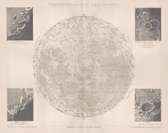
Ubersichtskarte Des Mondes (Overview Map of the Moon), antique astronomy print
Located in Melbourne, Victoria
'Ubersichtskarte Des Mondes'
(Overview Map of the Moon)
German chromolithograph, circa 1895
Category
Late 19th Century Naturalistic Antique Moon Map
Materials
Lithograph
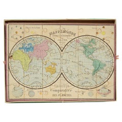
Antique Puzzle of Colored Cardboard Depicting World Map, Europe and France
Located in Milan, IT
France. The world map in addition to the territorial map of the continents depicts the phases of the Moon
Category
1850s French Antique Moon Map
Materials
Paper
H 0.99 in W 13.98 in D 10.36 in
The Orbits of Venus and Mercury: An 18th C. Framed Celestial Map by Doppelmayr
By Johann Gabriel Doppelmayr 1
Located in Alamo, CA
This 18th century hand-colored copperplate celestial map by Johann Doppelmayr entitled "Phænomena
Category
Early 18th Century Antique Moon Map
Materials
Engraving
H 31.13 in W 34.88 in D 1 in
Antique Print of an Orrery and Ancient Church, 1754
Located in Langweer, NL
. Edmund and an apparatus for drawing the Moons Path'. Print of i.a. an orrery and ancient wooden church
Category
18th Century Antique Moon Map
Materials
Paper
Nova Totius Terrarum Orbis Geographica Ac Hydrographica Tabula
Located in New York, NY
. Image size 15.75 x 21.19 inches (40 x 53.9 cm).
A classic example of a world map based on Mercator's
Category
17th Century Other Art Style Antique Moon Map
Materials
Engraving
Portrait of Lady in Mob Cap - British Old Master 18th century art oil painting
Located in London, GB
, daughter of a Charing Cross print and map seller, whom he had converted. They lived at No. 7 Mortimer
Category
18th Century Old Masters Antique Moon Map
Materials
Oil
Pair of Sevres Biscuit Porcelain Groups of the Continents
Located in New York, NY
European signifiers: books, maps, and a cannon. Behind her, a small putto plays with a globe behind the
Category
19th Century French Neoclassical Antique Moon Map
Materials
Sèvres
A beautiful Celestial Table Globe produced by Gerard & Leonard Valk
By Gerard and Leonard Valk
Located in ZWIJNDRECHT, NL
Gerard began his publishing firm producing maps and atlases in co-operation with Petrus Schenk about 1680
Category
Early 18th Century Dutch Dutch Colonial Antique Moon Map
Materials
Other
Antique Brass Czech Orrery Astronomical Instruments Made by Jan Felkl in 1870
By Jan Felkl
Located in Milan, IT
the nineteenth century. Cast iron base, papier mâché´ globe, with detailed territorial map and oceanic
Category
1860s Czech Antique Moon Map
Materials
Iron
H 18.9 in W 29.53 in D 11.03 in
Cosmgraphy and Astrology, 1686 by Richard Blome from the First Edition
By Richard Blome
Located in BUNGAY, SUFFOLK
Sansovino frame, carved with moons and suns
Frame Length 43 cm., 17 in., Height 58 cm., 23 in.
This
Category
1680s English Charles II Antique Moon Map
Materials
Paper
H 16.34 in W 10.44 in D 0.04 in
People Also Browsed
Nude Painting
By S. Moriniere
Located in Nashville, TN
Nude male painting. Signed S. Moriniere, 1896. Oil on stretched canvas.
Category
19th Century French Antique Moon Map
Materials
Canvas
Fine Presentation Sword Given to Lieutenant Charles Peake
Located in Lymington, Hampshire
A fine presentation sword given to Lieutenant Charles Peake as a token of gratitude by the Men of His Ship when recommissioned for Foreign Service in 1821, the citation reading, the ...
Category
1820s English Antique Moon Map
Materials
Metal
2nd World War Military Campaign Steamer Trunk Owner Major McGregor Medical Corps
Located in High Wycombe, GB
A Well Preserved British 2nd World War Military Campaign Steamer Trunk. Owner Major RM McGregor. Medical Corps
27 Bridge Street Hawick
At No 27 is the long-established Deans Chartere...
Category
Early 20th Century English Campaign Antique Moon Map
Materials
Brass
H 48.04 in W 21.66 in D 25.6 in
6 Miniature Cannons from the, 19th Century
Located in Brussels, Brussels
lovely collection of small cannons from the end of the 19th century.
All the canons have different dimensions
Category
Late 19th Century Antique Moon Map
Materials
Bronze
Historical American Civil War Era Wire Frame Magnifying Eye Glass Spectacles
Located in Philadelphia, PA
A delicate pair of handmade magnifying wire rim eye glasses from the American Civil War era, circa 1860.
A great looking historical conversation piece or decor item. Use this pair ...
Category
Mid-19th Century American American Classical Antique Moon Map
Materials
Metal
H 1.25 in W 5.5 in D 7 in
Antique World Map by P. Schenk '1706'
By Peter Schenk
Located in Langweer, NL
Antique map titled 'Diversa Orbis Terrae. Visu Incedente per Coluros Tropicorum, Ambos Ejus Polos, et Parciularis Sphaerae Zenith, in Planum Orthographica Projectio (..) Plat Ontwerp...
Category
Early 18th Century Antique Moon Map
Materials
Paper
Wonderful large antique Edwardian brass cannon
Located in Ipswich, GB
Wonderful large antique Edwardian brass cannon having a wonderful model of a brass cannon with lovely decoration, movable wheels and cannon.
Category
Early 20th Century Edwardian Antique Moon Map
Materials
Brass
Handmade Plank on Frame Ship Model, H.M.S. Pelican
Located in Woodbury, CT
A beautiful example of the craft of ship modeling, this sloop has all the details the original would have had and the model maker left the lower half of the hull exposed to reveal th...
Category
19th Century British Antique Moon Map
Materials
Tulipwood
Early 20th Century Bronze and Wood Mounted Cannon Model with Large Wheels
Located in Miami, FL
Early 20th Century Bronze and Wood Mounted Cannon Model
Offered is an early miniature bronze cannon on a wood carriage with large bronze wheel. This will be displayed nicely on a d...
Category
Early 20th Century Antique Moon Map
Materials
Bronze
A Late 19th Century Army Shell Case Possible Umbrella Or Stick Stand
Located in Brussels, Brussels
Former English army shell case from the end of the 19th century beginning of the 20th century
Large model which is unusual which can be used as an umbrella holder or stick stand or a...
Category
Late 19th Century British Edwardian Antique Moon Map
Materials
Leather
Meissen Genre Love Group With Drum Beater, by F.E. Meyer, Germany Circa 1850
By Meissen Porcelain
Located in Vienna, AT
Exceptional Meissen porcelain group:
On rock pedestal fixed with large rocailles in the foreground sitting musician with tricorn, frock coat over wide shirt, white pants and high boo...
Category
Mid-19th Century German Rococo Antique Moon Map
Materials
Porcelain
H 9.45 in W 7.49 in D 5.91 in
Bronze and Iron Desk Signal Cannon Model
Located in San Mateo, CA
This desk top signal cannon has a bronze barrel and iron carriage. This model will actually fire. The barrel has a nice patina. The base has been repainted in the past. One brass nut...
Category
Early 20th Century American Antique Moon Map
Materials
Iron, Bronze
Pair 19th Century Decorative Desktop Signalling Cannons
Located in Dublin 8, IE
Pair 19th Century decorative desktop cast iron signalling cannons set on carriages with working wheels.
Category
19th Century English Napoleon III Antique Moon Map
Materials
Iron
South American Presentation Sword
Located in New Orleans, LA
Believed to have originated from the collection of a South American diplomat, the exquisiteness of this presentation sword conveys its ownership by an individual of great importance....
Category
19th Century South American Other Antique Moon Map
Materials
Steel, Brass, Bronze
English Brass & Wood Desk Top Model of a Signal Cannon
Located in West Palm Beach, FL
English Brass & Wood Desk Top Model of a Signal Cannon
England, circa 1950s
An English brass & wood desk top model of a signal cannon, a mid 20th century example. This delightful...
Category
20th Century English Antique Moon Map
Materials
Brass
Ornate Desk Model Signal Cannon in Bronze and Iron
Located in San Mateo, CA
This large desk top cannon model will actually fire. The barrel is bronze and the carriage is iron. The carriage has been repainted in the past.
Category
Early 20th Century American Antique Moon Map
Materials
Bronze, Iron
Recent Sales
Nova Totius Terrarum Orbis Geographica Ac Hydrographica Tabula, 1638
By Willem Blaeu
Located in Houston, TX
New Geographical and Hydrographical Map of the World.
Beautifully hand-colored, this 1638
Category
Mid-17th Century Dutch Antique Moon Map
Painted Tall Case Clock, Eight-Day Moon Dial Works
Located in Providence, RI
signed works, we take notice. Note the intricate map of the world and painted moon dial with boat, et al
Category
19th Century American Chippendale Antique Moon Map
Mid-18th Century Eight Day Oak Longcase Clock by John Taylor of Manchester
Located in Worcester, Worcestershire
moon to the lunette with two brass hemisphere terrestial maps. Two winding holes, blued steel clock
Category
18th Century Antique Moon Map
Materials
Mahogany
H 85.24 in W 21.46 in D 10.24 in
A Rare And Important Tall Case Clock By Jacob Hoster, Hanover Pa
By Jacob Hostetter
Located in Sharon, MA
tiger maple colonnettes and has oval side windows.
The dial features a painted moon phase disk in the
Category
19th Century American Antique Moon Map
Map of Africa by Tanner
Located in Alamo, CA
An early to mid 19th century hand-colored map of Africa by Henry Schenk Tanner, published in
Category
Mid-19th Century Other Art Style Antique Moon Map
Materials
Engraving
Typus Orbis Terrarum, Antique Map 1667
By Matthäus Merian the Younger
Located in Soquel, CA
Hand-colored twin hemisphere map of the world by Matthaus Merian. From Gottfried's "Historische
Category
17th Century Antique Moon Map
Materials
Printer's Ink, Watercolor, Rag Paper
Set of World & Four Continents
By Joan (Johannes) Blaeu
Located in London, GB
World at the bottom and representations of the Classical Planets, moon and sun at the top. The maps of
Category
17th Century Antique Moon Map
Materials
Watercolor, Engraving
Original Vintage Poster By L.M. Gill - A Great Industry Where Our Tea Comes From
By "Leslie MacDonald ""Max"" Gill"
Located in London, GB
great illustrated maps of the countries and places in Asia where the tea comes from: India and Pakistan
Category
1920s British Antique Moon Map
Materials
Paper
H 39.97 in W 25.01 in D 0.04 in
Hand-Colored Astronomical Engravings by Louis Charles Desnos, 1766
By Louis Charles Desnos
Located in Kinderhook, NY
Collection of three hand-colored astronomical map engravings illustrating celestial spheres in
Category
Mid-18th Century French Rococo Antique Moon Map
Materials
Glass, Wood, Paper
LATE 19THC COFFEE TABLE FROM A MISSION IN SANTA FE, NEW MEXICO
Located in Los Angeles, CA
TURQUOISE NUGGETS EMBEDDED IN THE TABLE AND A PAINTED DECORATED MAP OF THE SANTA FE, NEW MEXICO MISSION AREA
Category
19th Century American Antique Moon Map
Materials
Pine
Set of 22 Handpainted Tarot Tiles from France
Located in Dallas, TX
or as a map of mental and spiritual pathways. The trump cards, consists of 22 cards without suits
Category
19th Century French Antique Moon Map
American Revenue Cutter Service Ensign Belonging To Capt. W. H. Bagley
Located in York County, PA
believed to be Laura Barnes Bagley.
(3) A map with hand-drawn notations by Bagley, detailing routes he
Category
1870s American Antique Moon Map
H 53.75 in W 81.25 in D 2.5 in
Original Antique Map of the Moon, Dated 1812
Located in St Annes, Lancashire
Great map of the moon.
Copper-plate engraving.
Dated 1812 in the watermark in the paper.
Some
Category
1810s English Antique Moon Map
Materials
Paper
19th Century Hand-Colored Map of Africa by Henry Tanner
By Henry Schenck Tanner
Located in Alamo, CA
An early to mid-19th century hand-colored map of Africa by Henry Schenk Tanner, published in
Category
Mid-19th Century American Antique Moon Map
Materials
Paper
Antique Double Hemisphere Celestial Chart by Lotter, 'circa 1770'
Located in Langweer, NL
Antique map titled 'Planisphaerium Coeleste'. A very decorative double hemisphere celestial chart
Category
Late 18th Century Antique Moon Map
Materials
Paper
EARLY MAP OF THE MOON - Foundation map
By Johann Baptist Homann
Located in Santa Monica, CA
JOHN BAPTISTE HOMANN (1663 – 1724)
(J. G. Doppelmayr 1671 - 1750)
THE MOON c. 1704
Category
Early 1700s Old Masters Antique Moon Map
Materials
Engraving
Original Antique Map of the Moon, 1833
Located in St Annes, Lancashire
Great image of the moon
Woodcut engraving
Text on verso
Published 1833.
Free
Category
1830s English Folk Art Antique Moon Map
Materials
Paper
Original Antique Map of The Moon, 1833
Located in St Annes, Lancashire
Great image of the moon
Woodcut engraving
Text on verso
Published 1833.
Free
Category
1830s English Folk Art Antique Moon Map
Materials
Paper
Portrait of Girl with White Dog - British Old Master Regency art oil pastel
Located in London, GB
. On 5 February 1770, he married Hannah Faden, daughter of a Charing Cross print and map seller, whom
Category
18th Century Old Masters Antique Moon Map
Materials
Oil Pastel
Portrait of Mary Bushby with Dog - British Old Master Regency art painting
By John Russell
Located in London, GB
February 1770, he married Hannah Faden, daughter of a Charing Cross print and map seller, whom he had
Category
18th Century Old Masters Antique Moon Map
Materials
Pastel
Original Vintage Poster By L.M. Gill - A Great Industry Where Our Tea Comes From
By "Leslie MacDonald ""Max"" Gill"
Located in London, GB
great illustrated maps of the countries and places in Asia where the tea comes from: India and Pakistan
Category
1920s Antique Moon Map
Materials
Paper
Planiglobii Terrestris
Located in Florham Park, NJ
the routes of Magellan, Tasman, Dampier, et. al. Atop the map are decorative ideals of the sun, moon
Category
18th Century and Earlier Antique Moon Map
Hand-Colored Copper Plates of Fish from “a Collection of Voyages and Travels"
By Johannes Kip
Located in Bedford, Bedfordshire
ancornet at scuttle fish Unknown fish A grondin at grumbler A kind of barbeue A cape verdo moon Unknown but
Category
1730s English George II Antique Moon Map
Materials
Paper
H 15.5 in W 20.25 in D 0.19 in
Decorative Map of the Moon, circa 1916
Located in Vienna, Vienna
vy J. Klepesta, published in Prag c. 1916, chromolithgraphed print on
canvas, hanging wall chart. Size c. 80 x 57 cm.
Category
Early 20th Century Czech Antique Moon Map
The Route of David Roberts, Esq. in the Holy Land, Petrea & Sarda, Ancient Sidon
By David Roberts
Located in New York, NY
Original lithograph map by David Roberts (1796 – 1864) published by F.G. Moon, 1845 depicting his
Category
1840s Realist Antique Moon Map
Materials
Lithograph
Get Updated with New Arrivals
Save "Antique Moon Map", and we’ll notify you when there are new listings in this category.
Antique Moon Map For Sale on 1stDibs
At 1stDibs, there are many versions of the ideal antique moon map for your home. An antique moon map — often made from paper, ceramic and iron — can elevate any home. You’ve searched high and low for the perfect antique moon map — we have versions that date back to the 18th Century alongside those produced as recently as the 19th Century are available. An antique moon map is a generally popular piece of furniture, but those created in neoclassical styles are sought with frequency. A well-made antique moon map has long been a part of the offerings for many furniture designers and manufacturers, but those produced by Jan Felkl, Nicolaes Visscher II and Richard Blome are consistently popular.
How Much is a Antique Moon Map?
Prices for an antique moon map can differ depending upon size, time period and other attributes — at 1stDibs, they begin at $406 and can go as high as $36,609, while the average can fetch as much as $3,338.
