Items Similar to Antique Map of the Island of Borneo by Janssonius, circa 1650


Want more images or videos?
Request additional images or videos from the seller
1 of 6
Antique Map of the Island of Borneo by Janssonius, circa 1650
About the Item
Antique map titled 'Insula Borneo et Occidentalis pars Celebis cum adjacentibus Insulis'. Rare sea chart of the island of Borneo. Published by J. Janssonius, circa 1650.
- Dimensions:Height: 18.31 in (46.5 cm)Width: 23.23 in (59 cm)Depth: 0.02 in (0.5 mm)
- Materials and Techniques:
- Period:Mid-17th Century
- Date of Manufacture:circa 1650
- Condition:Repaired: Professional repairs on folding line and a few tears. General age-related toning. Few professional repairs. Shows some wear and tears (slightly affecting image). Blank verso, please study images carefully.
- Seller Location:Langweer, NL
- Reference Number:
About the Seller
5.0
Platinum Seller
These expertly vetted sellers are 1stDibs' most experienced sellers and are rated highest by our customers.
Established in 2009
1stDibs seller since 2017
1,938 sales on 1stDibs
Typical response time: <1 hour
- ShippingRetrieving quote...Ships From: Langweer, Netherlands
- Return PolicyA return for this item may be initiated within 14 days of delivery.
More From This SellerView All
- Antique Map of Java by Janssonius, circa 1650Located in Langweer, NLAntique map titled 'Insulae Iavae cum parte insularum Borneo Sumatrae, et circumjacentium insularum novissima delineatio'. Beautiful map of Java and parts of Bali, Borneo, Sumatra an...Category
Antique Mid-17th Century Maps
MaterialsPaper
- Antique Map of the Vermandois Region by Janssonius, circa 1650By Johannes JanssoniusLocated in Langweer, NLAntique map titled 'Vermandois'. Old map of the Vermandois region, France. Vermandois was a French County that appeared in the Merovingian period. Its na...Category
Antique Mid-17th Century Maps
MaterialsPaper
- Antique Map of the Region of Touraine by Janssonius 'circa 1650'By Johannes JanssoniusLocated in Langweer, NLAntique map of France titled 'Touraine - Turonensis Ducatus'. Decorative map of the Touraine region, France. It shows the cities of Tours, Amboise and others. Published by J. Jansson...Category
Antique Mid-17th Century Maps
MaterialsPaper
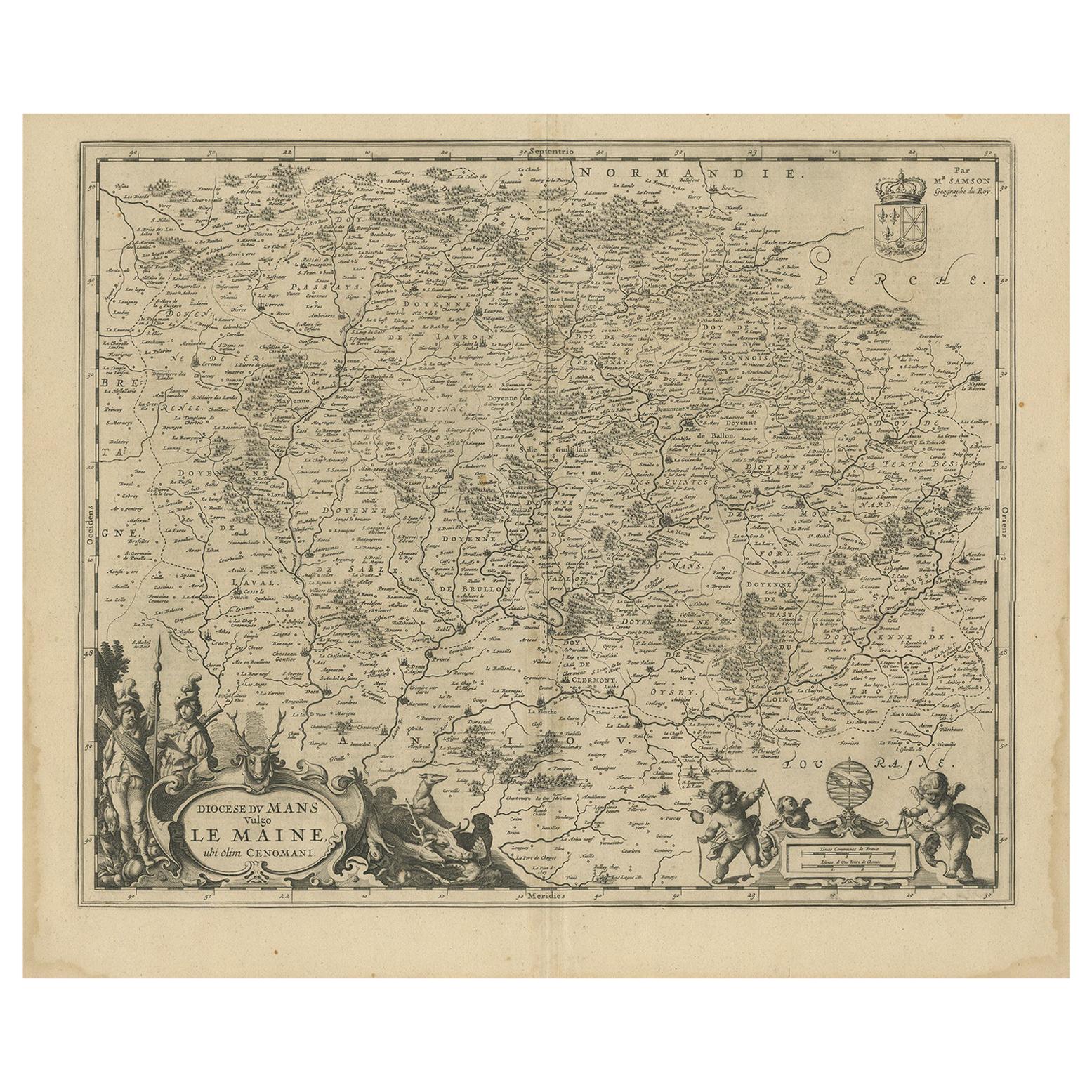
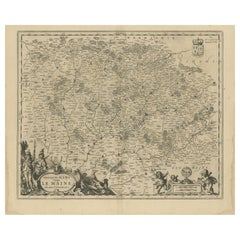
- Antique Map of the Region of Maine by Janssonius, circa 1650By Johannes JanssoniusLocated in Langweer, NLAntique map of France titled 'Diocese du Mans vulgo le Mains'. Decorative map of the region of Maine, France. Published by J. Janssonius.Category
Antique Mid-17th Century Maps
MaterialsPaper
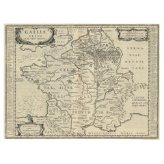
- Antique Map of France by Janssonius, c.1650Located in Langweer, NLAntique map titled 'Gallia Vetus'. Beautiful map of France based on Caesar's De Bello Gallico. In the columns to the left and right important tribes and people are described. Art...Category
Antique 17th Century Maps
MaterialsPaper
- Antique Map of France by Janssonius, c.1650Located in Langweer, NLAntique map titled 'Gallia Vetus'. Beautiful map of France based on Caesar's De Bello Gallico. In the columns to the left and right important tribes and people are described. Art...Category
Antique 17th Century Maps
MaterialsPaper


You May Also Like
- Large Original Antique Map of Java and Borneo, Fullarton, C.1870Located in St Annes, LancashireGreat map of Java and Borneo Wonderful figurative borders From the celebrated Royal Illustrated Atlas Lithograph. Original color. Published by Fullarton, Edinburgh. C.1870 Unfr...Category
Antique 1870s Scottish Maps
MaterialsPaper
- Large Original Antique Map of Rhode Island, USA, C.1900Located in St Annes, LancashireFabulous map of Rhode Island Original color Engraved and printed by the George F. Cram Company, Indianapolis. Published, C.1900 Unframed Free ...Category
Antique 1890s American Maps
MaterialsPaper
- Large Original Vintage Map of British Island Possessions, circa 1920Located in St Annes, LancashireGreat map of British Island Possessions Original color. Good condition Published by Alexander Gross Unframed.Category
Vintage 1920s English Maps
MaterialsPaper
- Original Antique Map of The United States of America, circa 1890Located in St Annes, LancashireGreat map of the USA By The Stanford's Geographical Establishment Original colour Unframed.Category
Antique 1890s English Victorian Maps
MaterialsPaper
- Large Original Antique Map of the World, Fullarton, circa 1870Located in St Annes, LancashireGreat map of the World. From the celebrated Royal Illustrated Atlas Lithograph. Original color. Published by Fullarton, Edinburgh, circa 1870. Unframed.Category
Antique 1870s Scottish Maps
MaterialsPaper
- Large Original Vintage Map of New Zealand, North Island, circa 1920Located in St Annes, LancashireGreat map of North Island, New Zealand Original color. Good condition / minor foxing to right edge Published by Alexander Gross Unframed.Category
Vintage 1920s English Edwardian Maps
MaterialsPaper


