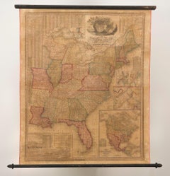
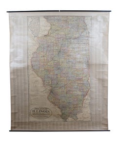
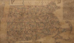
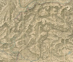
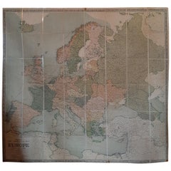
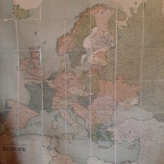
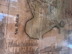
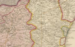
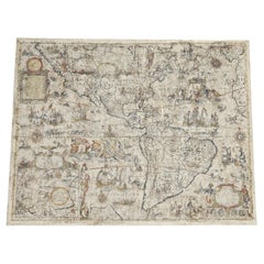
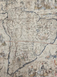
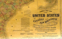
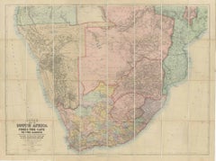
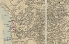
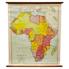
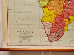
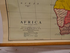
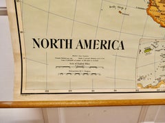
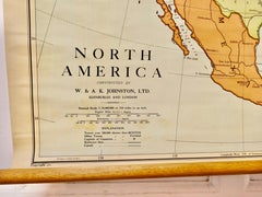
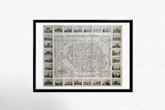
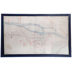
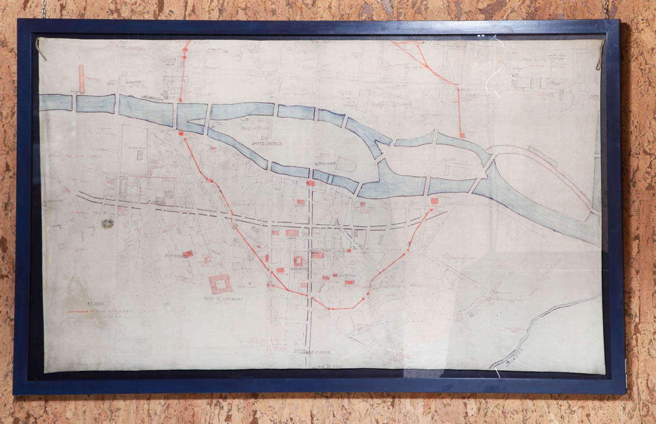
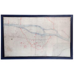
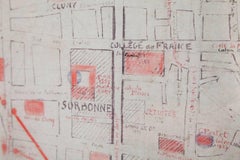
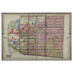
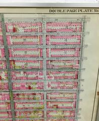
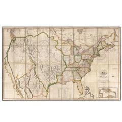
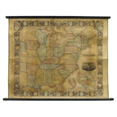
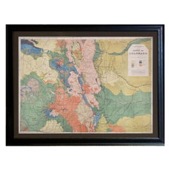
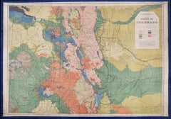
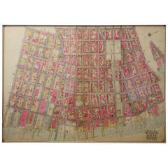
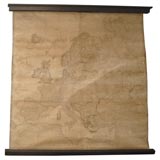
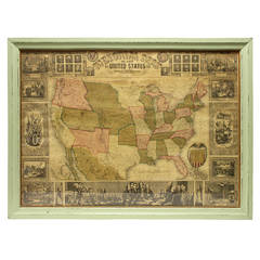
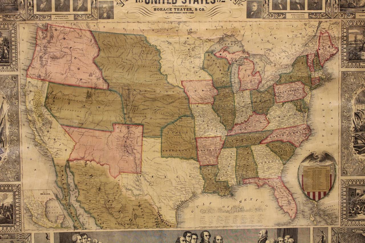
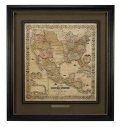
Antique Linen Map
2
to
12
115
83
97
81
81
45
26
23
22
20
13
12
12
8
8
8
7
5
5
4
3
3
3
3
3
2
1
1
1
1
1
1
5
2
2
2
1
Sort By
1842 Wall Map of the United States by J. H. Young, Published by S. A. Mitchell
Located in Colorado Springs, CO
since been stabilized and backed with new archival linen. Map measures 45" H x 38" W.
Category
1840s American Antique Linen Map
Materials
Paper
H 45 in W 38 in D 1 in
Large Folding Map of Paris, France, on Linen, 36 Segments, Published in 1836
Located in Langweer, NL
d'apres les travaux de la Nouvelle Carte De France'.
Folding map of Paris on linen, 36 segments
Category
1830s Antique Linen Map
Materials
Paper
H 27.96 in W 39.77 in D 0 in
University Chart “Black Map of North America
Located in Chillerton, Isle of Wight
Bacon,
This is a Black Physical map of North America, it is large lithograph set on Linen mounted on
Category
Early 20th Century Industrial Antique Linen Map
Materials
Linen
Antique Map of Scotland by Cary, '1811'
Located in Langweer, NL
Antique map titled 'A New Map of Scotland from the Latest Authorities':
**Title**: A New Map of
Category
Early 19th Century Antique Linen Map
Materials
Linen, Paper
Antique Chicago Illinois National Map Commercial Rollup Classroom Census Map 47"
Located in Dayton, OH
, IN. Paper map with linen trim, suspended from rolled metal poles at upper and lower edge.
Dimensions
Category
Early 20th Century North American Antique Linen Map
Materials
Paper
H 47 in W 41 in D 0.05 in
Antique Map of Italy by Andriveau-Goujon, 1843
By Andriveau-Goujon
Located in New York, NY
Antique Map of Italy by Andriveau-Goujon, 1843. Map of Italy in two parts by Andriveau-Goujon for
Category
1840s French Antique Linen Map
Materials
Linen, Paper
1854 Map of Massachusetts, Connecticut and Rhode Island, Antique Wall Map
Located in Colorado Springs, CO
mounted onto archival linen. Additionally, the map is attached to its original hanging hardware and is
Category
19th Century American Antique Linen Map
Materials
Paper
H 38.13 in W 45 in D 3.5 in
Antique Map of the North-West Frontier by Stanford, 1895
By E. Stanford
Located in Langweer, NL
Pamirs'. Linen backed folding map of the North-West Frontier of India from Peshawar to the Pamirs
Category
Late 19th Century Antique Linen Map
Materials
Linen, Paper
1864 Map of North America, Antique Hand-Colored Map, by Adolphe Hippolyte Dufour
Located in Colorado Springs, CO
Offered is a map of North America entitled Amerique du Nord from 1864. This rare, separately
Category
1860s French Antique Linen Map
Materials
Paper
H 44.5 in W 33 in D 1.5 in
Antique Folding London Map, English, Cartography, Historic, Georgian, Dated 1783
Located in Hele, Devon, GB
This is an antique folding London map. An English, paper on linen cartographical study of the
Category
Late 18th Century British Georgian Antique Linen Map
Materials
Linen, Paper
H 6.3 in W 6.11 in D 0.6 in
Vintage Swedish School Map of Vastergötland, Made in Sweden 1920
Located in Los Angeles, CA
Vintage Swedish School Map of Vastergötland, Made in Sweden 1920
Västergötland also known as
Category
1920s Swedish Antique Linen Map
Materials
Linen, Wood, Paper
Large Wall Map of Europe by George Philip & Son, circa 1920
Located in Langweer, NL
Antique map titled 'Philips' New Commercial Map of Europe'. Very large wall map of Europe including
Category
Early 20th Century Antique Linen Map
Materials
Linen, Paper
No Reserve
H 72.05 in W 66.15 in D 0.02 in
1900s Stielers Hand Atlas 100 Maps
Located in Seguin, TX
Stielers Hand Atlas, Gotha: Justus Perthes, Germany, circa 1905. Linen covered wood box containing
Category
Early 20th Century German Victorian Antique Linen Map
Materials
Paper
Framed Mid-19th Century Wall Map of Long Island, the Hamptons
Located in Sag Harbor, NY
A Framed museum quality find. This large wall map dates to the mid-1800s. Detailed inset maps of
Category
Mid-19th Century American Antique Linen Map
Materials
Linen, Paper
Vintage Swedish School Map of Europe, Large, Made in Sweden, 1905
Located in Los Angeles, CA
Vintage Swedish School Map of Europe - LARGE - Made in Sweden, 1905
This vintage Swedish school
Category
Early 1900s Swedish Antique Linen Map
Materials
Linen, Wood, Paper
Antique Map of the Region of Wakayama, Nara and Osaka 'Japan'
Located in Langweer, NL
Geological folding map of the area with Wakayama, Nara, Osaka, Mie, and Shiga in Japan, circa 1880
Category
Late 19th Century Antique Linen Map
Materials
Linen, Paper
Vintage Swedish Topographic School Map of European Alps, Made in Sweden 1922
Located in Los Angeles, CA
Vintage Swedish Topographic School map of European Alps, Made in Sweden 1922
This vintage
Category
1920s Swedish Antique Linen Map
Materials
Linen, Wood, Paper
Antique Map of West Asia, circa 1900
Located in Langweer, NL
Antique map titled 'Persia, Afghanistan and Beloochistan'. Folding map on linen.
Published
Category
Early 20th Century Antique Linen Map
Materials
Paper
Antique European War Folding Map, ‘circa 1915’
Located in Langweer, NL
Antique folding map of the European War (1914-1915) titled 'The Eastern Campaign '. From Petrograd
Category
Early 20th Century Antique Linen Map
Materials
Paper
1863 "Lloyd's New Map of the United States, the Canadas, and New Brunswick"
Located in Colorado Springs, CO
backed with linen. Presented on wooden rollers, as issued. Map is sold unframed, as-is. Unframed
Category
1860s American Antique Linen Map
Materials
Linen, Wood, Paper
H 37 in W 49.5 in D 1 in
Antique Map of Italy by Andriveau-Goujon, 1855
Located in Langweer, NL
Antique folding map of Italy titled 'Italie'. Detailed map of Italy. The map originates from 'Atlas
Category
Mid-19th Century Antique Linen Map
Materials
Paper
Antique Map of the Baltic States by Rücker, 1846
Located in Langweer, NL
map of the Baltic States, on linen. Artists and Engravers: Published by Franz Kluge, 1846.
Artist
Category
19th Century Antique Linen Map
Materials
Paper
Antique Map of the County of Devon by Overton, 1713
Located in Langweer, NL
Antique map titled 'Devoniae Descriptio - The Description of Devon Shire'. Map of the County of
Category
18th Century Antique Linen Map
Materials
Paper
Antique Map of the Netherlands and Belgium by Hérisson, 1829
Located in Langweer, NL
shortly before Belgium's independence in 1830.
The map is sectionalised and laid on linen, a common
Category
Mid-19th Century Antique Linen Map
Materials
Paper
Plan of Paris, France, by A. Vuillemin, Antique Map, 1845
Located in Colorado Springs, CO
toning to the paper. The map has been backed onto linen. It is displayed in a custom archival wood frame
Category
1840s American Antique Linen Map
Materials
Paper
1915 "San Francisco City and County" Hanging Map by W. Bashford Smith
Located in Colorado Springs, CO
outer margins.
Map has been artfully mounted, hanging, inside a custom wooden frame, with linen mats
Category
1910s American Art Deco Antique Linen Map
Materials
Wood, Paper
Map Silk Embroidered Western Eastern Hemisphere New Old World Asia America Afri
Located in BUNGAY, SUFFOLK
monogramming linens at the time.” (Norman B. Leventhal Map Center)
Related maps
Distressed map dated 1783
Category
18th Century British Georgian Antique Linen Map
Materials
Silk
H 0.4 in W 0.4 in D 0.4 in
1859 "Colton's New Map of the State of Texas..." by Johnson & Browning
Located in Colorado Springs, CO
Presented is "Colton's New Map of the State of Texas Compiled from De Cordova's Large Map
Category
1850s American Antique Linen Map
Materials
Paper
H 27.75 in W 38.5 in D 1.38 in
1859 "Map of the United States of America..." by J. H. Colton
By J.H. Colton
Located in Colorado Springs, CO
Presented is an 1859 “Map of the United States of America, the British Provinces, Mexico, the West
Category
1850s American Antique Linen Map
Materials
Paper
1847 Antique Map of Mexico, Texas and California by Samuel Augustus Mitchell
By Samuel Augustus Mitchell 1
Located in Colorado Springs, CO
example, the map has been professionally restored with new linen backing and edge ribbon on original
Category
1840s American Antique Linen Map
Materials
Paper
H 32 in W 23.63 in D 0.5 in
1873 "Map of the States of California and Nevada" by Chas. Drayton Gibbes
Located in Colorado Springs, CO
backed on linen. Repaired slight loss along some of the original fold lines.
Map has been framed in a
Category
1870s American Antique Linen Map
Materials
Paper
Map Hanging Wall County of Devon C&J Greenwood 1827 Exeter Cathedral Lundy Isle
Located in BUNGAY, SUFFOLK
C & J GREENWOOD MAP OF THE COUNTY OF DEVON, FROM AN ORIGINAL SURVEY, PUBLISHED 1827, WITH ENGRAVING
Category
1820s English Early Victorian Antique Linen Map
Materials
Paper
H 76.23 in W 74.26 in D 0.4 in
Original Antique Map of the Peninsula of India with Part of Ceylon by Wyld, 1844
Located in Langweer, NL
This extensive map of India, spanning two sheets, draws from Reynell’s original map and
Category
Mid-18th Century Antique Linen Map
Materials
Paper
No Reserve
H 33.47 in W 23.23 in D 0 in
Large University Chart “Africa Physical ” by Bacon
Located in Chillerton, Isle of Wight
W Bacon,
This is a Physical map of Africa, it is lithograph set on Linen mounted on wooden rods
Category
Early 20th Century Beaux Arts Antique Linen Map
Materials
Linen
1912 "Panoramic View of New York City and Vicinity" by Jacob Ruppert
Located in Colorado Springs, CO
This is an attractive and very scarce map of New York, published by the Yorkville brewer Jacob
Category
1910s American Antique Linen Map
Materials
Paper
1879 "United States of America, Western Part" by O. J. Stuart
Located in Colorado Springs, CO
dimensions: 12" H x 10" W.
Map is artfully framed with acid-free mats, an attractive linen top mat, UV
Category
1870s American Antique Linen Map
Materials
Paper
Original 1917 Railroad Map of Washington State railway map
Located in Spokane, WA
.
“Railroad Map of Washington, 1917, The Public Service Commission. Archival linen backed and ready to frame
Category
1910s Academic Antique Linen Map
Materials
Lithograph
1864 Original illustrated planisphere - World Map - Geography
Located in PARIS, FR
and wonder to your interior with this unique Historical Planisphere. 📜✨
Map - Geography
Edit
Category
1860s Antique Linen Map
Materials
Linen, Paper, Lithograph
Railway Map of India.
Located in London, GB
THUILLIER, Colonel Henry Ravenshaw.
Railway Map of India. Railways Brought up to October 1895
Category
1890s Other Art Style Antique Linen Map
Materials
Lithograph
Large University Chart “Physical Map of Ireland” by Bacon
Located in Chillerton, Isle of Wight
Maps By G W Bacon,
This is colorful Physical map of Ireland, it is large lithograph set on Linen
Category
Early 20th Century International Style Antique Linen Map
Materials
Linen
Large University Chart “Physical Map of Africa” by Bacon
Located in Chillerton, Isle of Wight
Large university chart “Physical Map of Africa” by Bacon
W&A K Johnston’s Charts of Physical
Category
Early 20th Century Folk Art Antique Linen Map
Materials
Linen
Large University Chart “Political Map of North America” by Bacon
Located in Chillerton, Isle of Wight
Large University chart “Political Map of North America” by Bacon
W&A K Johnston’s Charts of
Category
Early 20th Century American Empire Antique Linen Map
Materials
Linen
Large University Chart “Political Map of North America” by Bacon
Located in Chillerton, Isle of Wight
Large University Chart “Political Map of North America” by Bacon
W&A K Johnston’s Charts of
Category
Early 20th Century American Empire Antique Linen Map
Materials
Linen
Stanford's Portable Map of India
Located in London, GB
STANFORD, Edward
Stanford's Portable Map of India.
Shewing its Present Divisions and the Adjacent
Category
1870s Other Art Style Antique Linen Map
Materials
Watercolor, Engraving
1851 Original map by Maillard - Plan de Paris et ses Fortifications
Located in PARIS, FR
In the world of cartography, maps transcend mere geography; they are historical records and works
Category
1850s Antique Linen Map
Materials
Linen, Paper, Lithograph
H 30.71 in W 39.38 in
1848 Original map by Maillard - Plan de Paris et ses Fortifications
Located in PARIS, FR
In the realm of cartography, maps serve as both practical tools and artistic representations
Category
1840s Antique Linen Map
Materials
Paper, Lithograph, Linen
H 27.96 in W 40.56 in
W&A K Johnston’s Charts of Physical Maps by G W Bacon
Located in Chillerton, Isle of Wight
maps by G W Bacon,
This is a Physical Political map of Africa, it is lithograph set on Linen mounted
Category
Early 20th Century Rustic Antique Linen Map
Materials
Linen
Rare Set of 3 Map Samplers by A Charles. Italy, Spain & France
Located in Chelmsford, Essex
Set of 3 Map Samplers by A Charles. All depict countries, cities, seas and landmarks of the
Category
Early 19th Century English Antique Linen Map
Materials
Linen
Framed Early 19th Century Drawn and Engraved Map of China
By John Knighton Thomson
Located in San Francisco, CA
Hand drawn and tinted engraved map of China dated 1815
Created for Thomson's New General Atlas
Category
Early 19th Century European Antique Linen Map
Materials
Paper
Original Antique Poster French Infantry In Battle WWI Hindenburg Line Europe Map
Located in London, GB
bayonet rifle gun in front of a map of Europe showing the Hindenburg Line in red with the title text below
Category
1910s French Antique Linen Map
Materials
Paper
H 47.25 in W 31.5 in D 0.04 in
Original Antique World War One Humoros Wap Map Of The World WWI Japan Caricature
Located in London, GB
Original antique World War One satirical map of Europe and Asia portraying the outbreak of WWI
Category
1910s Japanese Antique Linen Map
Materials
Paper
H 18.51 in W 24.81 in D 0.04 in
1928 Original Poster - Coronation of The Emperor Hirohito - Politics - Japan
Located in PARIS, FR
exhibition Held in Conjunction with the Coronation is a stylized, Decorative Map of Kyoto, Displaying for
Category
1920s Art Deco Antique Linen Map
Materials
Linen, Paper, Lithograph
H 42.13 in W 26.78 in
White Grapes.
By Maria Sibylla Merian
Located in Florham Park, NJ
included various copper plates engraved with maps and natural history subjects. Merian’s prolific
Category
18th Century and Earlier Academic Antique Linen Map
Materials
Archival Paper, Archival Tape, Handmade Paper, Laid Paper, Plexiglass, R...
Art Nouveau Table Lamp with Owl Decor, Michael Andersen & Sons, Denmark, 1920s
By Michael Andersen & Son
Located in Odense, DK
underneath "MA&S" and model no. 621. Equipped with a new flax linen shade.
Michael Andersen & Sons was a
Category
1920s Danish Art Nouveau Antique Linen Map
Materials
Ceramic
H 24.02 in Dm 13.39 in
Original Antique Advertising Poster Lloyds France Maritime Transports Insurance
Located in London, GB
maritime insurance and immediate settlement of claims featuring a map of France showing the rivers and
Category
1920s French Antique Linen Map
Materials
Paper
H 46.86 in W 31.89 in D 0.04 in
Original Antique WWI Recruitment Poster Britishers You're Needed Come Across Now
By Lloyd Myers
Located in London, GB
- featuring an image on a globe map depicting a soldier holding a rifle in Europe (Great Britain / France
Category
1910s American Antique Linen Map
Materials
Paper
H 41.34 in W 28.35 in D 0.04 in
Original Antique Poster Le Tourisme Automobile Road Trip Travel Classic Car Art
Located in London, GB
her head with a scarf, reading a road sign with a driver looking at a map behind her, a man with a
Category
Early 1900s French Antique Linen Map
Materials
Paper
H 21.26 in W 27.56 in D 0.04 in
Original Antique Poster Midnight Sun Norway Travel Gronoy Bolgen Mountain View
Located in London, GB
State Railways logo between two route maps in the border below. Good condition, restored tears, backed
Category
Early 1900s Norwegian Antique Linen Map
Materials
Paper
H 38.98 in W 25.99 in D 0.04 in
Original Vintage Poster Colonial Troops Military Recruitment France War Ministry
Located in London, GB
military flags and banners with maps and landscape scenes of the military base locations above and below
Category
1920s French Antique Linen Map
Materials
Paper
H 39.77 in W 31.5 in D 0.04 in
Original Antique Montreux Oberland Bernois Railway Travel Poster MOB Switzerland
Located in London, GB
trees with a sailing boat on a lake below and a map of the railway route on the other side of the
Category
Early 1900s Swiss Antique Linen Map
Materials
Paper
H 46.26 in W 29.53 in D 0.04 in
- 1
Get Updated with New Arrivals
Save "Antique Linen Map", and we’ll notify you when there are new listings in this category.
Antique Linen Map For Sale on 1stDibs
Find many varieties of an authentic antique linen map available at 1stDibs. Frequently made of fabric, linen and paper, every antique linen map was constructed with great care. Your living room may not be complete without an antique linen map — find older editions for sale from the 18th Century and newer versions made as recently as the 20th Century. When you’re browsing for the right antique linen map, those designed in Folk Art, Industrial and Louis XVI styles are of considerable interest. Many designers have produced at least one well-made antique linen map over the years, but those crafted by Andriveau-Goujon and Horace Thayer Co. are often thought to be among the most beautiful.
How Much is a Antique Linen Map?
The average selling price for an antique linen map at 1stDibs is $1,206, while they’re typically $450 on the low end and $16,850 for the highest priced.
More Ways To Browse
Railroad Cart
World Map Relief
Map Of Prussia
Prussia Map
Antique Chart Table
Antique Colorado Map
Antique Maps Colorado
Map Chest Of Drawers Antique
Cuba Map
Antique Map Of Colorado
Railroad Crossing Sign
Georgian Campaign Chest
Antique Maps Of Russian Empire
Antique Map Fabric
Nashville Used Office Furniture
Antique Federalist Furniture
Map Iowa
Map Of Constantinople