Items Similar to Small Original Antique Map of Switzerland and Surroundings, 1807


Want more images or videos?
Request additional images or videos from the seller
1 of 5
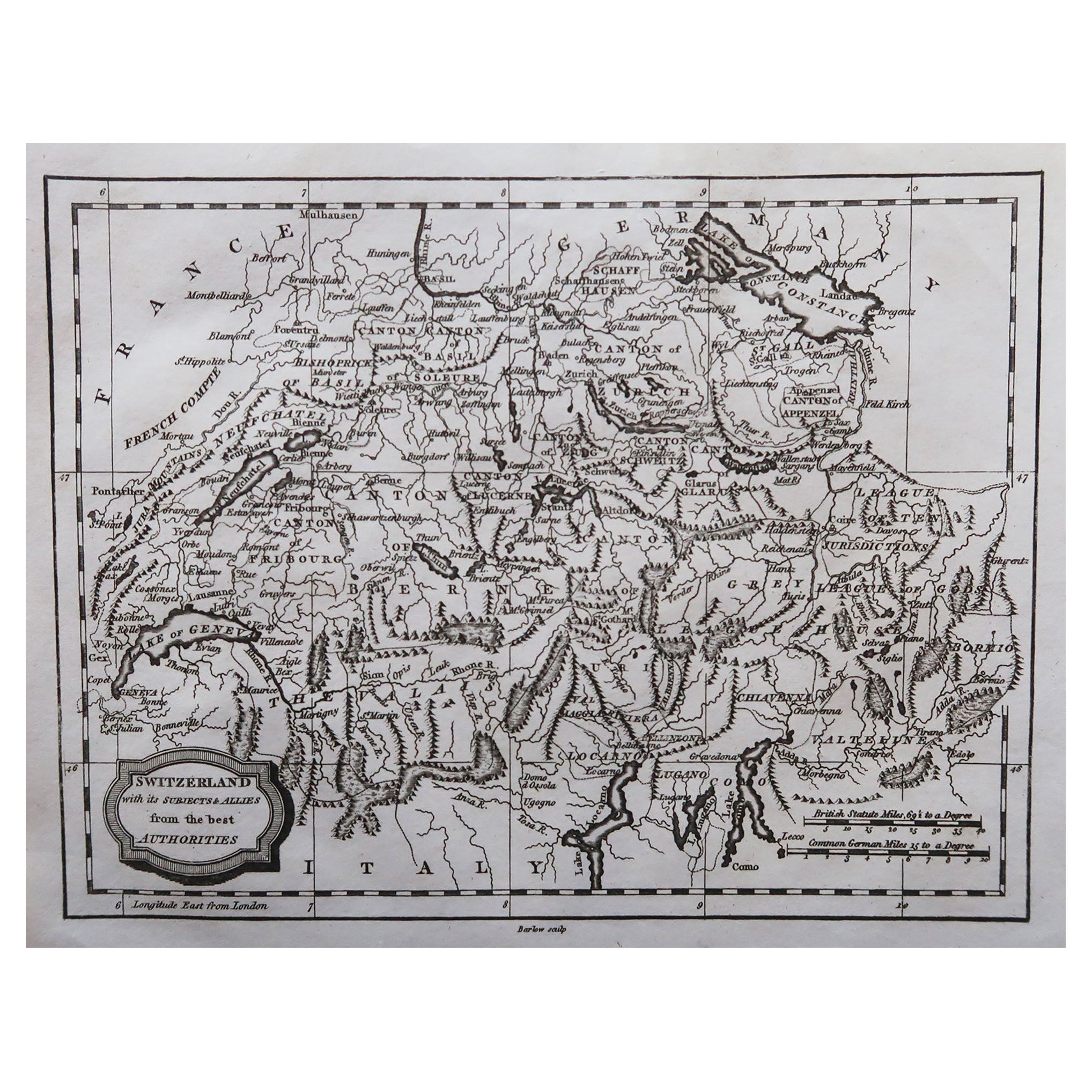
Small Original Antique Map of Switzerland and Surroundings, 1807
About the Item
Antique map titled 'Switzerland with its subjects & allies from the best authorities'.
Small map of Switzerland and surroundings. Originates from 'A general view of the world' by Blomfield.
Artists and engravers: Engraved by J. Barlow. Published by C. Brightly and E. Kinnersly.
- Dimensions:Height: 8.08 in (20.5 cm)Width: 10.24 in (26 cm)Depth: 0 in (0.02 mm)
- Materials and Techniques:
- Period:
- Date of Manufacture:1807
- Condition:Wear consistent with age and use. Condition: Very good, general age-related toning. Original, contemporary hand coloring. Please study image carefully.
- Seller Location:Langweer, NL
- Reference Number:
About the Seller
5.0
Platinum Seller
These expertly vetted sellers are 1stDibs' most experienced sellers and are rated highest by our customers.
Established in 2009
1stDibs seller since 2017
1,916 sales on 1stDibs
Typical response time: <1 hour
- ShippingRetrieving quote...Ships From: Langweer, Netherlands
- Return PolicyA return for this item may be initiated within 14 days of delivery.
More From This SellerView All
- Antique Map of Afghanistan and Surroundings, '1845'Located in Langweer, NLAntique map titled 'Map of Persia and Caubul'. Original antique map of Afghanistan and surroundings. This map originates from 'An Atlas of the World, Comprehending Separate Maps of...Category
Antique Mid-19th Century Maps
MaterialsPaper
- Antique Map of Belgium and Surroundings, 1692Located in Langweer, NLAntique map titled 'Provincie Meridionali de Paesi Bassi Intese sotto nome di Fiandra overo Li Paesi Bassi Cattolici con li confini di Francia di Allemagna et di Hollanda'. Uncommon map of Belgium...Category
Antique 17th Century Maps
MaterialsPaper
- Antique Map of Ambon and Surroundings by Valentijn '1726'By F. ValentijnLocated in Langweer, NLAntique map titled 'De landvoogdy van Amboina met de elf onderhoorige Eylanden'. Decorative map of the eastern tip of the islands of Ambon, Indonesia. This print originates from 'Oud...Category
Antique Early 18th Century Dutch Maps
MaterialsPaper
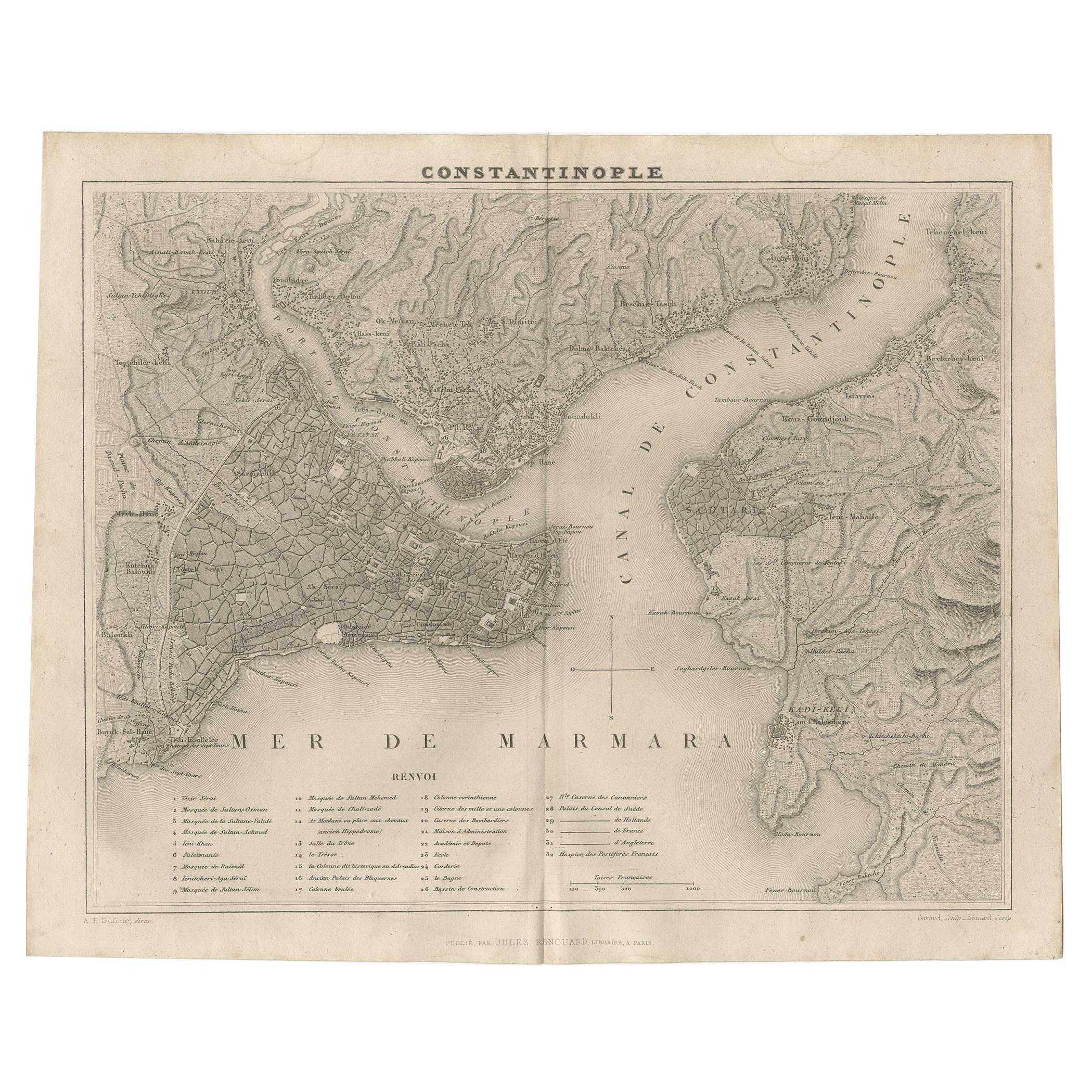
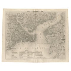
- Antique Map of Constantinople and Surroundings by Balbi '1847'Located in Langweer, NLAntique map titled 'Constantinople'. Original antique map of Constantinople and surroundings. This map originates from 'Abrégé de Géographie (..)...Category
Antique Mid-19th Century Maps
MaterialsPaper
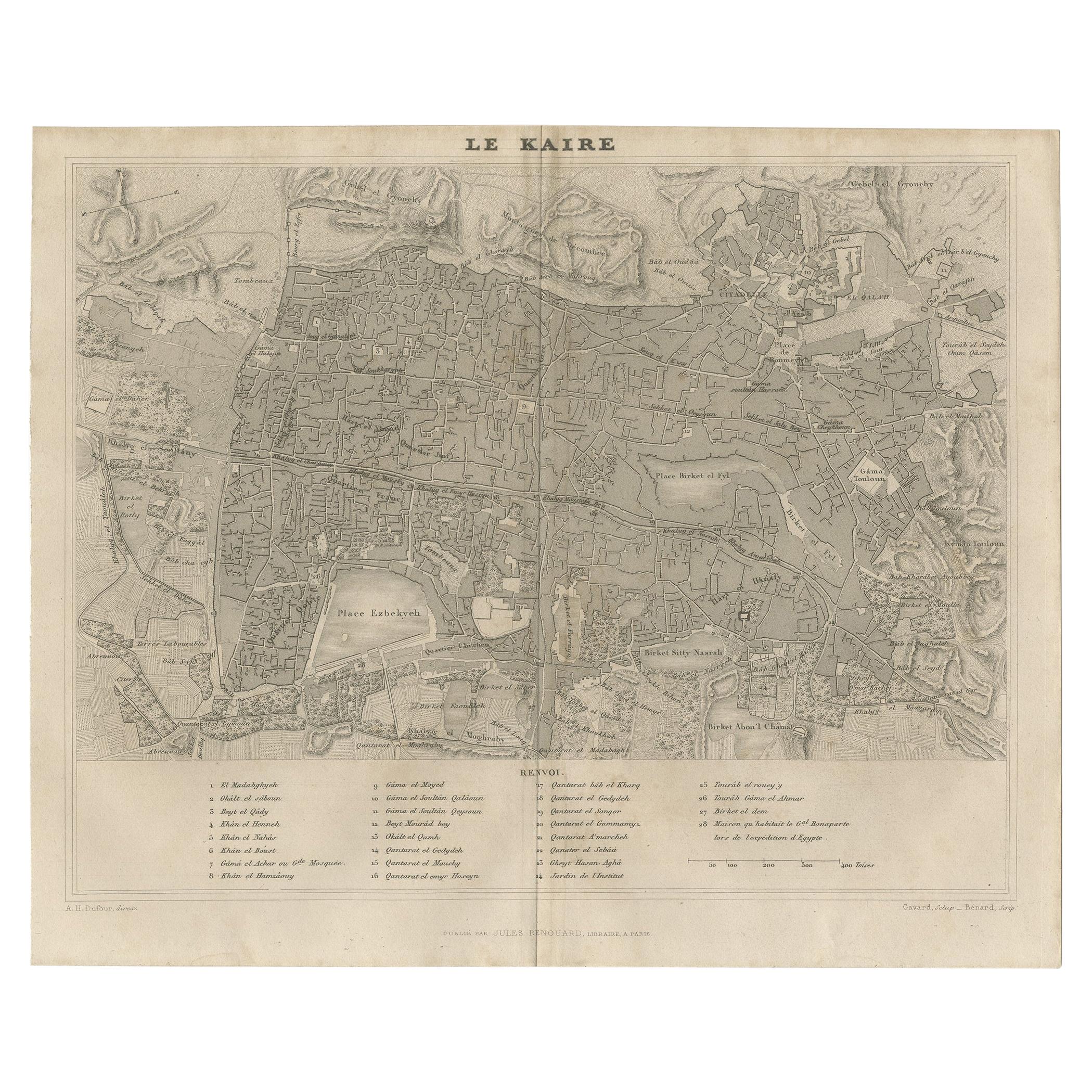
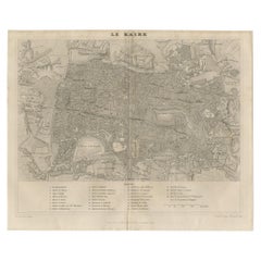
- Antique Map of Cairo and Surroundings by Balbi '1847'Located in Langweer, NLAntique map titled 'Le Kaire'. Original antique map of Cairo and surroundings, Egypt. This map originates from 'Abrégé de Géographie (..)' by Adrien Balbi. Published 1847.Category
Antique Mid-19th Century Maps
MaterialsPaper
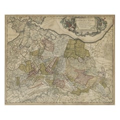
- Original Colored Antique Map of Utrecht & Surroundings, The Netherlands, c1690Located in Langweer, NLAntique map titled 'Tabula nova Provinciae Ultrajectinae quam jussu Nob: hujus Dominij Ordinum Emensus est Bernardus du Roy'. Map of the region of Utrecht, The Netherlands. This ...Category
Antique 1690s Maps
MaterialsPaper


You May Also Like
- Original Antique Map of Switzerland, Engraved By Barlow, Dated 1807Located in St Annes, LancashireGreat map of Switzerland Copper-plate engraving by Barlow Published by Brightly & Kinnersly, Bungay, Suffolk. Dated 1807 Unframed.Category
Antique Early 1800s English Maps
MaterialsPaper
- Original Antique Map of The Netherlands, Engraved by Barlow, Dated 1807Located in St Annes, LancashireGreat map of Netherlands Copper-plate engraving by Barlow Published by Brightly & Kinnersly, Bungay, Suffolk. Dated 1807 Unframed.Category
Antique Early 1800s English Maps
MaterialsPaper
- Original Antique Map of Italy. C.1780Located in St Annes, LancashireGreat map of Italy Copper-plate engraving Published C.1780 Unframed.Category
Antique Early 1800s English Georgian Maps
MaterialsPaper

- Original Antique Map of Asia. C.1780Located in St Annes, LancashireGreat map of Asia Copper-plate engraving Published C.1780 Two small worm holes to right side of map Unframed.Category
Antique Early 1800s English Georgian Maps
MaterialsPaper

- Original Antique Map of India. C.1780Located in St Annes, LancashireGreat map of India Copper-plate engraving Published C.1780 Three small worm holes to right side of map and one bottom left corner Unframed.Category
Antique Early 1800s English Georgian Maps
MaterialsPaper

- Original Antique Map of Spain and Portugal, circa 1790Located in St Annes, LancashireSuper map of Spain and Portugal Copper plate engraving by A. Bell Published, circa 1790. Unframed.Category
Antique 1790s English Other Maps
MaterialsPaper


Recently Viewed
View AllMore Ways To Browse
Swiss Antiques
Swiss Antiques And Collectables
Antique Map Switzerland
Antique Map Of Switzerland
Atlas Metal
Antique Railroad Furniture
Vintage Maps
Dutch Sellers
Ship Wood Carving
Antique Quadrant
Furniture From Bali
School Map
Russian Map
Map Russia
Wood Carvings Of Ships
Maps Of Russia
Map Of Russia
Compass Rose