Old Maps Of Italy
3
to
22
276
46
144
119
102
83
41
37
29
23
19
18
17
9
9
8
8
8
7
6
6
5
4
4
4
4
4
4
4
3
3
3
2
2
2
2
2
2
2
1
1
1
1
1
1
1
1
42
42
14
10
7
Sort By
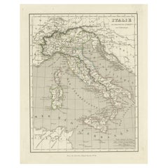
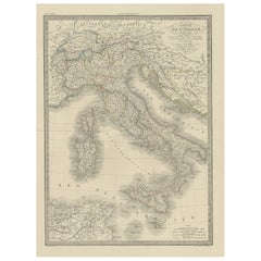
Antique Map of Italy and Other Regions Near the Adriatic Sea
Located in Langweer, NL
Antique map titled 'Italie et Provinces Autrichnes sur l'Adriatique'. Original old map of Italy and
Category
Antique Mid-19th Century Maps
Materials
Paper
Attractive Antique Map of Italy with Inset of Maps Showing The Regions, c.1870
Located in Langweer, NL
Antique map titled 'Italia'.
Old map of Italy, with a small inset map depicting the various
Category
Antique 19th Century Maps
Materials
Paper
H 13.78 in W 17.76 in D 0 in
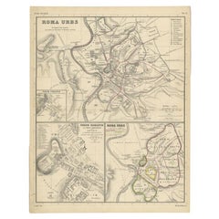
Detailed Original Antique Map of the Region of Rome in Italy, c.1870
By Heinrich Kiepert
Located in Langweer, NL
Antique map titled 'Roma Urbs'. Old map of Italy, it shows three inset maps of the region of Rome
Category
Antique 19th Century Maps
Materials
Paper
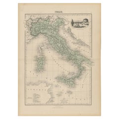
Antique Map of Italy with Vignette of Saint Angu Castle in Rome, 1880
Located in Langweer, NL
Antique map titled 'Italie Septentrionale'.
Old map of Italy with a decorative vignette of
Category
Antique 19th Century Maps
Materials
Paper
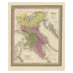
Old Antique Colourful Decorative Map of Northern Italy, 1846
Located in Langweer, NL
Description: Antique map titled 'Italy North Part'.
Old map of Northern Italy. This map
Category
Antique 1840s Maps
Materials
Paper
Antique Map of Italy from an Old French Atlas, 1842
Located in Langweer, NL
Antique map titled 'Carte de l'Italie'. Map of Italy.
This map originates from 'Atlas universel
Category
Antique 19th Century Maps
Materials
Paper
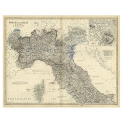
Old Coloure Map of North & Central Italy & Corsica with an Inset of Rome, c.1860
Located in Langweer, NL
Antique map titled 'North & Central Italy and the Island of Corsica'.
Old map of North and
Category
Antique 1860s Maps
Materials
Paper
H 19.38 in W 24.41 in D 0 in
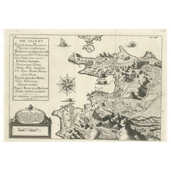
Old Original Map of Pozzuoli Near Naples in the Campania Region, Italy, ca.1740
Located in Langweer, NL
Antique map titled 'Hic Jacent Puteolorum Bajarum (..)'. Old map of the region of Pozzuoli showing
Category
Antique 1740s Maps
Materials
Paper
H 9.65 in W 13.19 in D 0 in
Antique Map of Italy and Corsica, c.1860
Located in Langweer, NL
Antique map titled 'North & Central Italy and the Island of Corsica'.
Old map of North and
Category
Antique 19th Century Maps
Materials
Paper
Antique Map of Northern Italy by Migeon, 1880
Located in Langweer, NL
Antique map titled 'Italie Septentrionale'. Old map of the northern part of Italy. This map
Category
Antique 19th Century Maps
Materials
Paper
Antique Map of Southern Italy by Migeon, 1880
Located in Langweer, NL
"Antique map titled 'Italie Méridionale'. Old map of southern Italy including Sicily/Sicilia. This
Category
Antique 19th Century Maps
Materials
Paper
Antique Map of Northwest Italy by Cluver, 1685
Located in Langweer, NL
Antique map titled 'Ligures, Taurini, etc.' Miniature map of northwest Italy. From the pocket atlas
Category
Antique 17th Century Maps
Materials
Paper
Antique Map of Northern Italy by Cluver, 1685
Located in Langweer, NL
Antique map titled 'Histri, Carni, Veneti item Rhaetiae Pars.' Charming miniature map of northern
Category
Antique 17th Century Maps
Materials
Paper
Very Old Antique Map of the Persian Empire by Magini, c.1597
Located in Langweer, NL
Antique map titled 'Persiae Regnum sive Sophorum Imperium'. Old map of the Persian Empire. This map
Category
Antique 16th Century Maps
Materials
Paper
Antique Map of Italy with an Inset of Rome, 1812
Located in Langweer, NL
Antique map titled 'Italie Ancienne'.
Old map of ancient Italy, with an inset map of the region
Category
Antique 19th Century Maps
Materials
Paper
Original Old Composite of Several Maps of the Ancient World on One Sheet, 1880
Located in Langweer, NL
This original antique map is from Karl Spruner von Merz's "Atlas Antiquus", later edited by
Category
Antique 1880s Maps
Materials
Paper
Free Shipping
H 15.56 in W 18.51 in D 0 in
Old Detailed Trade Route and Shipping Map from Italy to the Low Countries, c1671
Located in Langweer, NL
Antique map of Italy titled 'Carta Nova accurata del Passagio et strada dalli Peis Bassi per via de
Category
Antique 17th Century Maps
Materials
Paper
H 24.81 in W 20.08 in D 0 in
Antique Map of Southern Italy by Janssonius, C.1650
Located in Langweer, NL
primum de prica aerugine est abstersa (..)'. Beautiful map of Southern Italy, viewed from south to north
Category
Antique 17th Century Maps
Materials
Paper
Very Old Original Hand-Colored Map of the Basel Region, Switzerland, Ca.1578
Located in Langweer, NL
Antique print titled 'Basiliensis territorii descriptio nova'.
Old map of the Basel region
Category
Antique 16th Century Maps
Materials
Paper
H 39 in W 27.3 in D 0.002 in
Antique Map of the Region of Pavia, Lodi, Novara, Tortona & Alessandria, Italy
Located in Langweer, NL
Stato di Milano'. Original old map of the region of Pavia, Lodi, Novara, Tortona and Alessandria, Italy
Category
Antique Early 17th Century Maps
Materials
Paper
H 16.42 in W 21.54 in D 0.02 in
Antique Map of Italy and Corse in Ancient Times, 1848
Located in Langweer, NL
Antique map titled 'Italia Superior et Corsica'.
Old map of northern Italy and Corse
Category
Antique 19th Century Maps
Materials
Paper
Antique Map of Southern Italy and Sardinia by Johnston, 1882
Located in Langweer, NL
"Antique map titled 'South Italy and the Island of Sardinia'. Old map of Southern Italy and the
Category
Antique 19th Century Maps
Materials
Paper
Antique Map of Northern Italy by Homann Heirs, c.1730
Located in Langweer, NL
map of northern Italy by J. B. Homann. This map shows Venice and its adjacent states Parma, Modena
Category
Antique 18th Century Maps
Materials
Paper
Old Ptolemaic Map of the Region Between the Persian Gulf and Caspian Sea, 1598
Located in Langweer, NL
, and maps of the Old World were revised. Ptolemy's Geographia continued to be revised and published by
Category
Antique 16th Century Maps
Materials
Paper
H 7.09 in W 9.81 in D 0 in
Old Map of Ceylon 'Sri Lanka' with The North Oriented to The Left, 1731
Located in Langweer, NL
Description: Antique map Ceylon titled 'Nieuwe Kaart van t Eland Ceilon'.
Old map of present
Category
Antique 1730s Maps
Materials
Paper
Old Map of Ancient Times covering Egypt Towards Arabia and India to Java, c.1660
Located in Langweer, NL
daughter of Jodocus Hondius. He produced his first maps in 1616 of France and Italy. In 1623 Janssonius
Category
Antique 1660s Maps
Materials
Paper
H 19.49 in W 22.45 in D 0 in
Map of Southern Italy inlcluding Sardinia and Inset of the Bay of Naples, c.1860
Located in Langweer, NL
Antique map titled 'South Italy and the Island of Sardinia'.
Old map of Southern Italy and the
Category
Antique 1860s Maps
Materials
Paper
H 19.3 in W 24.41 in D 0 in
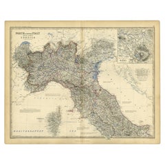
Antique Map of North and Central Italy and the Island of Corsica, c.1860
Located in Langweer, NL
Antique map titled 'North & Central Italy and the Island of Corsica'.
Old map of North and
Category
Antique 19th Century Maps
Materials
Paper
Antique Map of France by Zannoni, 1765
Located in Langweer, NL
Antique map titled 'La France divisée en ses LVIII Provinces (..)'. Beautiful old map of France
Category
Antique 18th Century Maps
Materials
Paper
Antique Map of Friesland by Guicciardini, 1613
Located in Langweer, NL
Antique map titled 'Frisia Occidenta.' (Map of the province of Friesland, the Netherlands.) This
Category
Antique 17th Century Maps
Materials
Paper
Old Copper Engraving of the Siege of Syracuse, Sicily, Italy, Published, ca.1740
Located in Langweer, NL
Antique print titled 'Syracuse, Assiégée par les Atheniens'.
Old print of the siege of Syracuse
Category
Antique 1740s Maps
Materials
Paper
H 9.85 in W 12.6 in D 0 in
Antique Map of ancient France by Zannoni, 1765
Located in Langweer, NL
Antique map France titled 'Galliae Veteris (..)'. Beautiful old map of France. This map originates
Category
Antique 18th Century Maps
Materials
Paper
Antique Map of the Netherlands by Zannoni, 1765
Located in Langweer, NL
Pays Bas (..)'. Beautiful old map of the Netherlands. This map originates from 'Atlas Historique de la
Category
Antique 18th Century Maps
Materials
Paper
Antique Map of the Netherlands by Guicciardini, 1612
Located in Langweer, NL
Antique map titled 'Belgicarum Provinciarum Nova Descriptio'. Beautiful old map of the Netherlands
Category
Antique 17th Century Maps
Materials
Paper
Antique Map of the Region of Dauphiné by Zatta, 1779
Located in Langweer, NL
d'Orange'. Old map of France showing the province of Dauphiné. This map originates from 'Atlante Novissimo
Category
Antique 18th Century Maps
Materials
Paper
Antique Map of the City of Arnhem by Guicciardini, 1613
Located in Langweer, NL
Antique map titled ?Arnhemium Gelriae in Ripa Rheni Opp?. Plan of Arnhem in the province of
Category
Antique 17th Century Maps
Materials
Paper
Antique Map of the City of Enkhuizen by Guicciardini, 1625
Located in Langweer, NL
Antique map titled 'Die Stadt Enchuijsen, La ville denchuijsen'. Map of Enkhuizen, Noord-Holland
Category
Antique 17th Century Maps
Materials
Paper
Antique Map of France under the Reign of Francois II, 1765
Located in Langweer, NL
Antique map France titled 'La Bretagne et le Cté de Penthièvre (..)'. Beautiful old map of France
Category
Antique 18th Century Maps
Materials
Paper
Antique Map of France under the Reign of Francois I, 1765
Located in Langweer, NL
Antique map France titled 'Etat des Possessions de la Couronne (..)'.
Beautiful old map of
Category
Antique 18th Century Maps
Materials
Paper
French Antique Map of France and Western Europe, 1765
By G. A. Rizzi-zannoni
Located in Langweer, NL
Antique map titled 'Carte de tous les Lieux, célébres dans l'Histoire (..)'. Beautiful old map of
Category
Antique 18th Century Maps
Materials
Paper
Antique Map of Gelderland and Overijssel by Guicciardini, 1613
Located in Langweer, NL
Antique map titled 'Geldria et Transisulania.' (Map of the provinces of Gelderland and Overijssel
Category
Antique 17th Century Maps
Materials
Paper
Antique Map of North Africa by Ortelius, c.1600
Located in Langweer, NL
Antique map titled 'Barbariae et Biledulgerid nova descriptio'.
Old map of coastal North Africa
Category
Antique 17th Century Maps
Materials
Paper
Antique Map of the City of Leuven, Belgium, with Original Coloring, 1609
Located in Langweer, NL
in old hand-colouring. The map is notable for its circular layout of the city, detailed illustration
Category
Antique Early 17th Century Maps
Materials
Paper
H 11.74 in W 13.94 in D 0.02 in
Antique Map of the Establishment of the French Monarchy by Zannoni, 1765
Located in Langweer, NL
Antique map France titled 'Carte de l'Etablissement de la Monarchie Francoise (..)'. Beautiful old
Category
Antique 18th Century Maps
Materials
Paper
H 11.03 in W 15.75 in D 0 in
Antique Map of France After the Peace of Ryswick by Zannoni, 1765
By G. A. Rizzi-zannoni
Located in Langweer, NL
Antique map France titled 'Etat du Domaine apès le Traité de Ryswick (..)'. Beautiful old map of
Category
Antique 18th Century Maps
Materials
Paper
Antique Map of the Region of Brie and Champagne by Zatta, 1779
Located in Langweer, NL
Antique map titled 'Li Governi di Sciampagna e Brie'. Old map of France showing the provinces of
Category
Antique 18th Century Maps
Materials
Paper
Antique Map of the Region of Poitou and Saintonge by Zatta (1779)
Located in Langweer, NL
'. Old map of France showing the provinces of Poitou and Saintonge with their adjacent regions. This map
Category
Antique 18th Century Maps
Materials
Paper
Antique Map of France at the End of the Ministry of Cardinal Richelieu, 1765
By G. A. Rizzi-zannoni
Located in Langweer, NL
(..)'. Beautiful old map of France. This map originates from 'Atlas Historique de la France Ancienne et Moderne' by
Category
Antique 18th Century Maps
Materials
Paper
H 11.03 in W 15.75 in D 0 in
Antique Map of Northern England and Wales by Zatta, 1784
Located in Langweer, NL
Italian map publisher of the late 18th and early 19th century. His firm, based in Venice, produced maps
Category
Antique 18th Century Maps
Materials
Paper
Antique Map of Southern England and Wales by Zatta, 1784
Located in Langweer, NL
. Zatta. Artists and Engravers: Antonio Zatta (active 1757-1797) was the most prominent Italian map
Category
Antique 18th Century Maps
Materials
Paper
Antique Map of France under the Reign of Philip III by Zannoni, 1765
Located in Langweer, NL
Antique map France titled 'Tableau du Domaine Royal (..)'. Beautiful old map of France. This map
Category
Antique 18th Century Maps
Materials
Paper
Antique Map of France under the Reign of Louis XI by Zannoni, 1765
Located in Langweer, NL
Antique map France titled 'La Provence et la Bourgogne (..)'. Beautiful old map of France. This map
Category
Antique 18th Century Maps
Materials
Paper
Antique Map of France under the reign of Charles VII by Zannoni, 1765
Located in Langweer, NL
Antique map France titled 'Après la Bataille de Formigni (..)'. Beautiful old map of France. This
Category
Antique 18th Century Maps
Materials
Paper
Antique Map of France under the Reign of Louis XI by Zannoni, 1765
Located in Langweer, NL
Antique map France titled 'Carte de l'Etat de la Monarchie Francoise (..)'. Beautiful old map of
Category
Antique 18th Century Maps
Materials
Paper
Antique Map of France under the Reign of Henry IV by Zannoni, 1765
Located in Langweer, NL
Antique map France titled 'Carte de la réunion de la Basse Navarre (..)'. Beautiful old map of
Category
Antique 18th Century Maps
Materials
Paper
Antique Map of France under the reign of Henry III by Zannoni, 1765
Located in Langweer, NL
old map of France. This map originates from 'Atlas Historique de la France Ancienne et Moderne' by M
Category
Antique 18th Century Maps
Materials
Paper
Antique Map of France under the Reign of Philip II by Zannoni, 1765
Located in Langweer, NL
(..)'. Beautiful old map of France. This map originates from 'Atlas Historique de la France Ancienne et Moderne' by
Category
Antique 18th Century Maps
Materials
Paper
Antique Map of France under the Reign of Henry III by Zannoni, 1765
Located in Langweer, NL
Antique map France titled 'Etat de la France pendant le Règne d'Henri III (..)'. Beautiful old map
Category
Antique 18th Century Maps
Materials
Paper
Antique Map of France under the Reign of Louis XV by Zannoni, 1765
Located in Langweer, NL
(..)'. Beautiful old map of France. This map originates from 'Atlas Historique de la France Ancienne et Moderne' by
Category
Antique 18th Century Maps
Materials
Paper
Antique Map of France under the Reign of Charles VII by Zannoni, 1765
Located in Langweer, NL
Antique map France titled 'La France sous le Règne de Charles VII (..)'.
Beautiful old map of
Category
Antique 18th Century Maps
Materials
Paper
- 1
Get Updated with New Arrivals
Save "Old Maps Of Italy", and we’ll notify you when there are new listings in this category.
More Ways To Browse
Small Map
Libya King
Map Prussia Germany
World Map Globe Light
English County Maps By Blaeu
Ferry Large
Small World Map
Gallia Dior
Ruscelli Map
Old Cypriot Maps
Paprika Dress
Antique Map Copenhagen
Antique Map Singapore
Mushroom Scientific Model
Antique Maps Singapore
Old Sicily Map
Coach Coat Womens
Coach Coats Women
