Items Similar to Antique Map of Italy and Corsica, c.1860
Want more images or videos?
Request additional images or videos from the seller
1 of 5
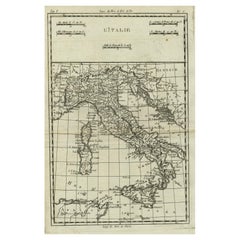
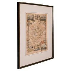
Antique Map of Italy and Corsica, c.1860
About the Item
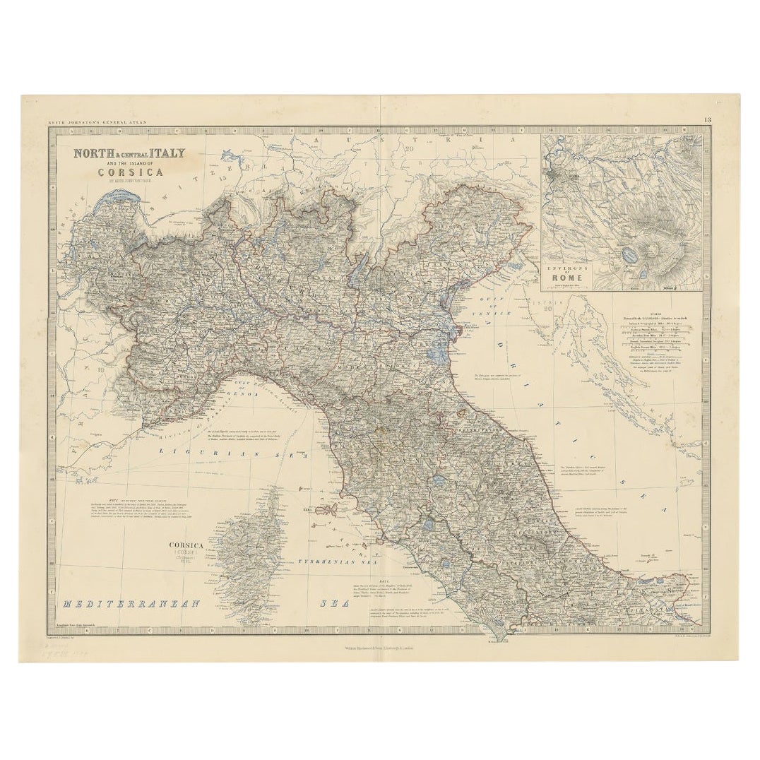
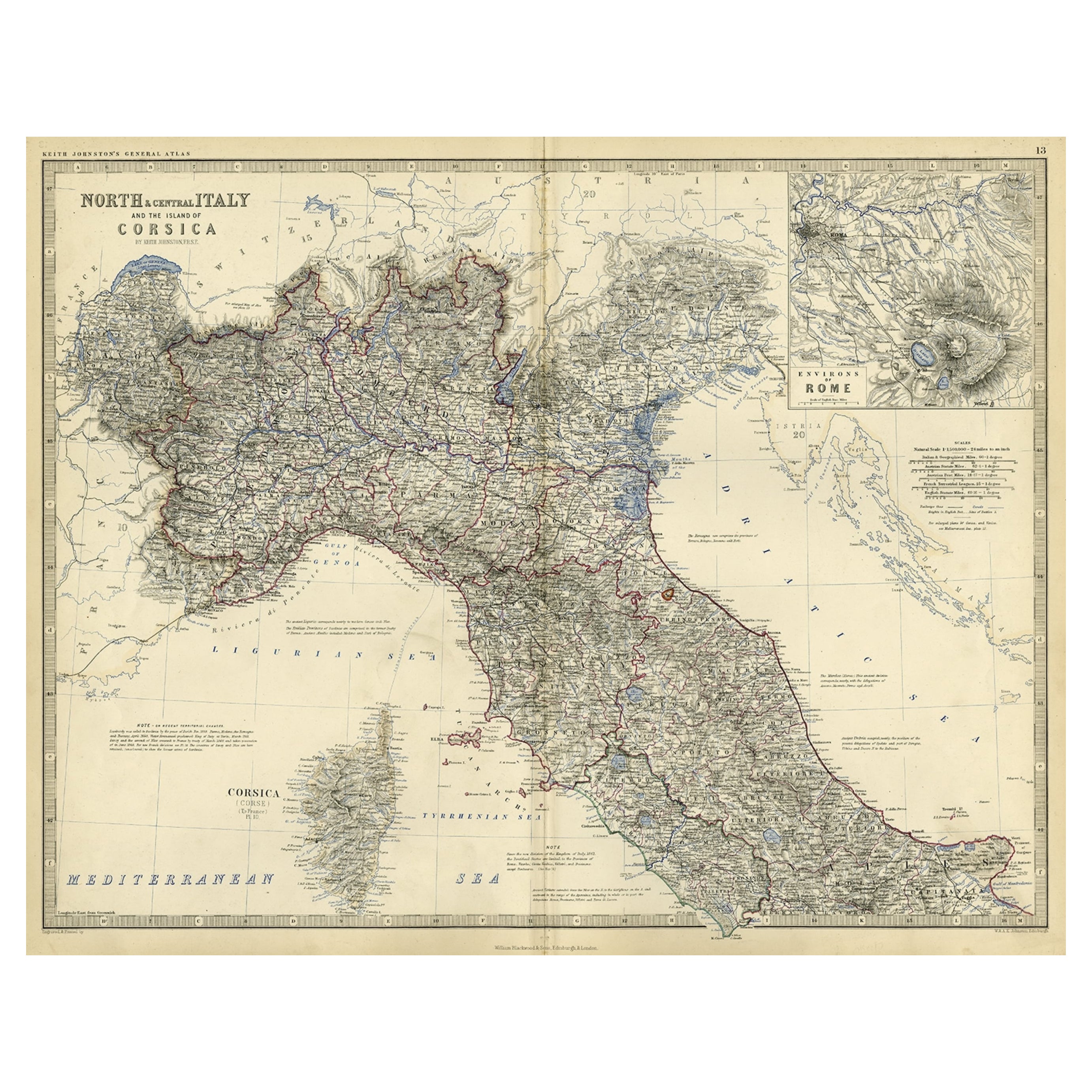
Antique map titled 'North & Central Italy and the Island of Corsica'.
Old map of North and Central Italy, and the island of Corsica. With an inset map of the region of Rome. Originates from 'The Royal Atlas Of Modern Geography Exhibiting, In A Series Of Entirely Original And Authentic Maps, The Present Condition Of Geographical Discovery And Research In The Several Countries, Empires, And States Of The World By Alexander Keith Johnston'.
Alexander Keith Johnston LLD (1804-1871) was a Scottish geographer. He was a pupil of the Edinburgh engraver and mapmaker, James Kirkwood. In 1826, he joined his brother William (who would become Sir William Johnston, Lord Provost of Edinburgh) in a printing and engraving business, forming the well-known cartographical firm of W. and A. K. Johnston.
Condition: Very good, given age. Original middle fold, as issued. Minimal paper separation in lower and top middle fold margin, backed. Small tear in bottom paper edge, not effecting image. Contemporary hand coloring. General age-related toning and/or occasional minor defects from handling. Please study scan carefully.
We sell original antique maps to collectors, historians, educators and interior decorators all over the world. Our collection includes a wide range of authentic antique maps from the 16th to the 20th centuries. Buying and collecting antique maps is a tradition that goes back hundreds of years. Antique maps have proved a richly rewarding investment over the past decade, thanks to a growing appreciation of their unique historical appeal. Today the decorative qualities of antique maps are widely recognized by interior designers who appreciate their beauty and design flexibility. Depending on the individual map, presentation, and context, a rare or antique map can be modern, traditional, abstract, figurative, serious or whimsical. We offer a wide range of authentic antique maps for any budget.
- Dimensions:Height: 24.41 in (62 cm)Width: 19.38 in (49.2 cm)Depth: 0 in (0.01 mm)
- Materials and Techniques:
- Period:
- Date of Manufacture:circa 1860
- Condition:
- Seller Location:Langweer, NL
- Reference Number:
About the Seller
5.0
Platinum Seller
These expertly vetted sellers are 1stDibs' most experienced sellers and are rated highest by our customers.
Established in 2009
1stDibs seller since 2017
1,916 sales on 1stDibs
Typical response time: <1 hour
- ShippingRetrieving quote...Ships From: Langweer, Netherlands
- Return PolicyA return for this item may be initiated within 14 days of delivery.
More From This SellerView All
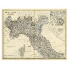
- Antique Map of North and Central Italy and the Island of Corsica, c.1860Located in Langweer, NLAntique map titled 'North & Central Italy and the Island of Corsica'. Old map of North and Central Italy, and the island of Corsica. With an inset map of the region of Rome. Orig...Category
Antique 19th Century Maps
MaterialsPaper
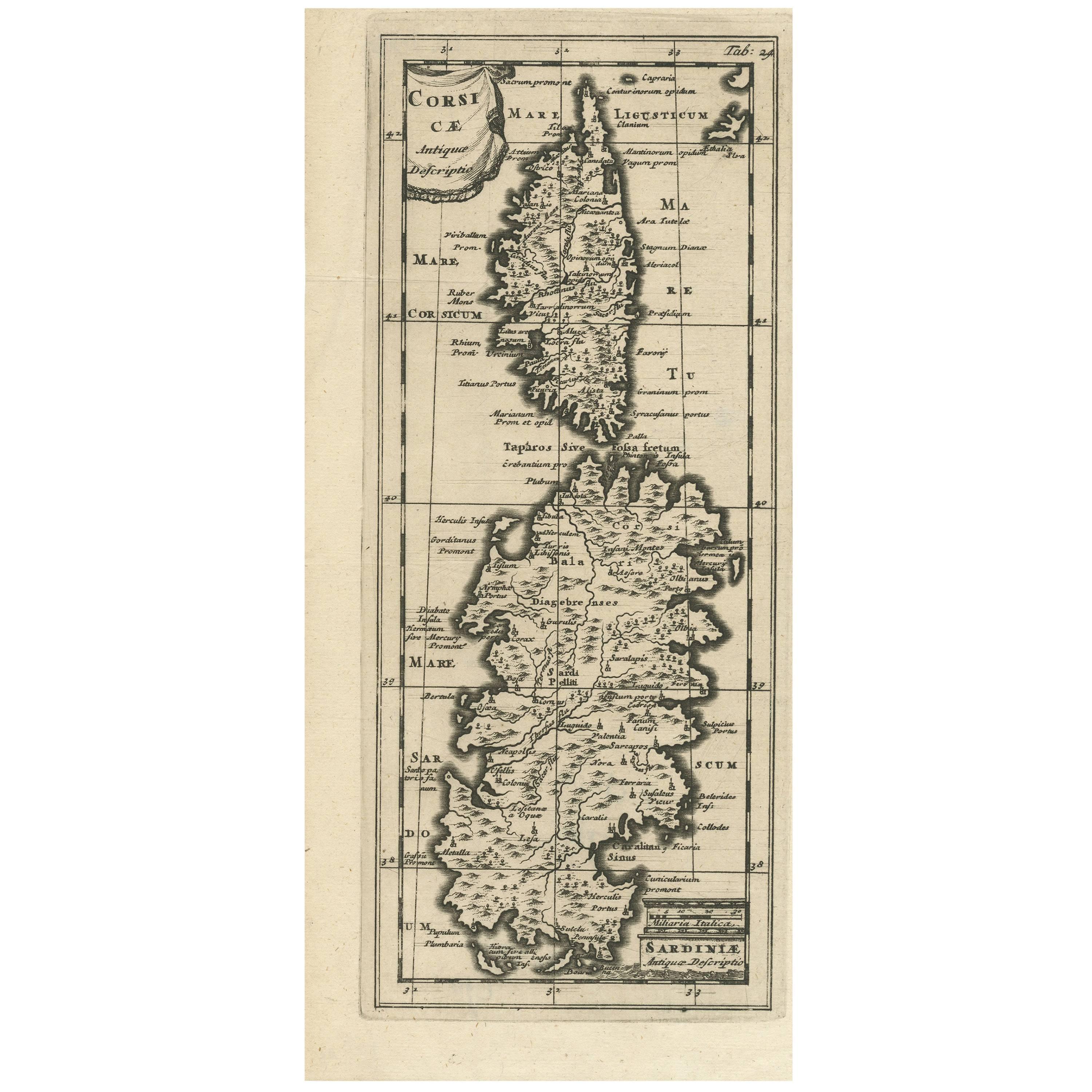
- Antique Map of Corsica and Sardini, 1729Located in Langweer, NLDetailed map of the Islands of Corsica and Sardinia, showing towns, rivers, lakes, mountains, bays, and other features. Cluver's Geography was one of the most enduring works of the ...Category
Antique Early 18th Century Maps
MaterialsPaper
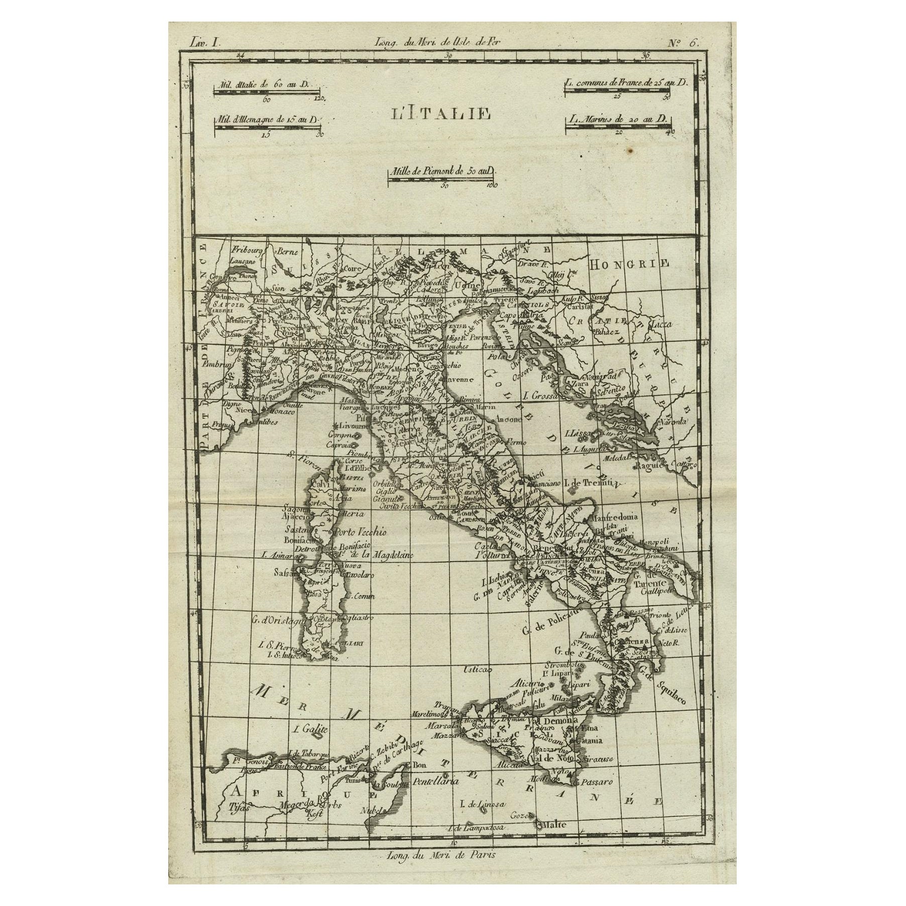
- Antique Map of Italy, Corsica, Sardinia and Sicily, ca.1780Located in Langweer, NLDescription: Antique map titled 'L'Italie.' Map of Italy, Corsica, Sardinia and Sicily. Highly detailed, showing towns, rivers, some topographical features and political boundari...Category
Antique 1780s Maps
MaterialsPaper
- Old Coloure Map of North & Central Italy & Corsica with an Inset of Rome, c.1860Located in Langweer, NLAntique map titled 'North & Central Italy and the Island of Corsica'. Old map of North and Central Italy, and the island of Corsica. With an inset map of the region of Rome. Orig...Category
Antique 1860s Maps
MaterialsPaper
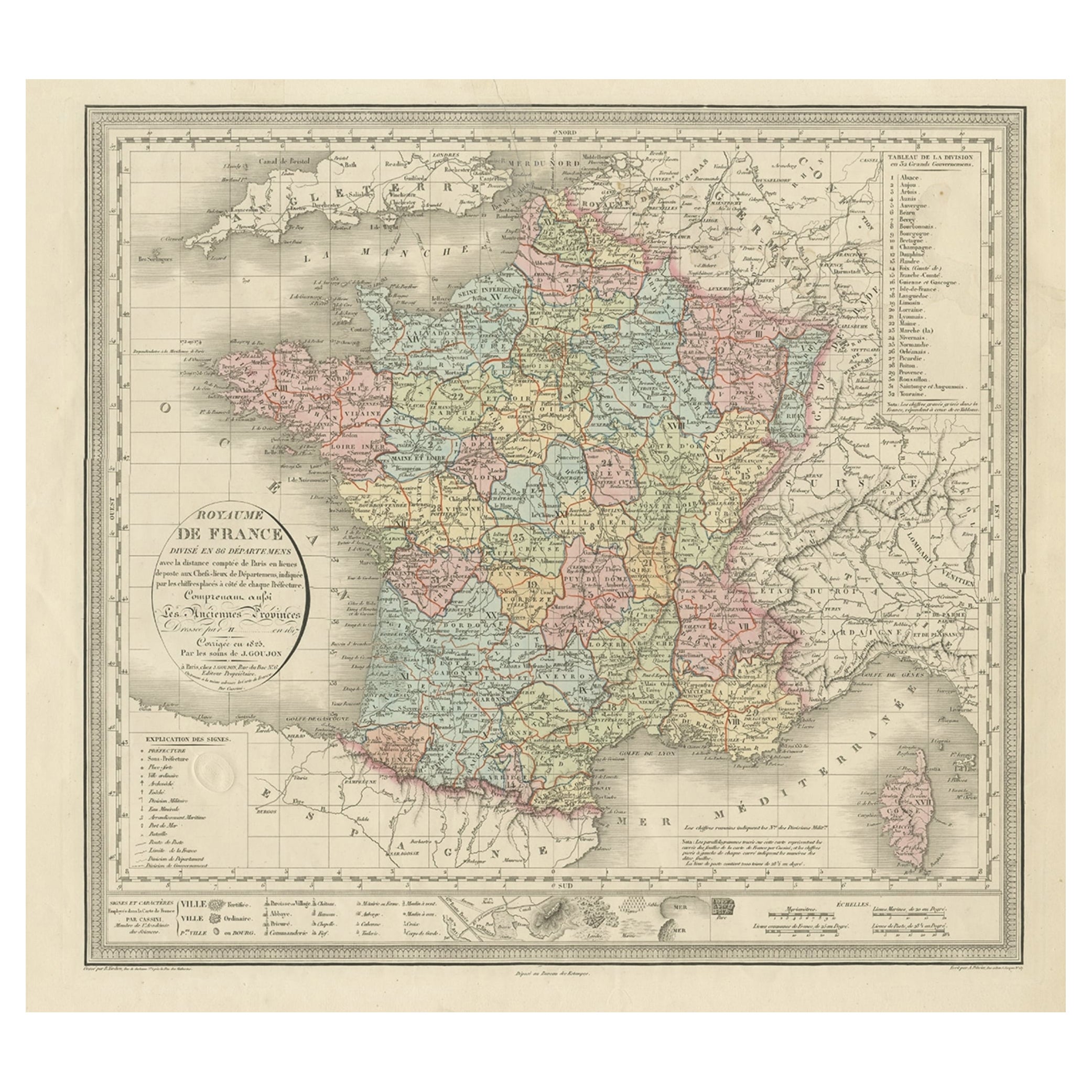
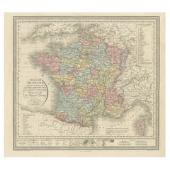
- Antique Map of France and the Island of Corsica, c.1825Located in Langweer, NLAntique map titled 'Royaume de France divisé en 86 Départemens'. Old map of France, revised in 1825. Also shows the Island of Corsica. Source unknown, to be determined. Artists and E...Category
Antique 19th Century Maps
MaterialsPaper
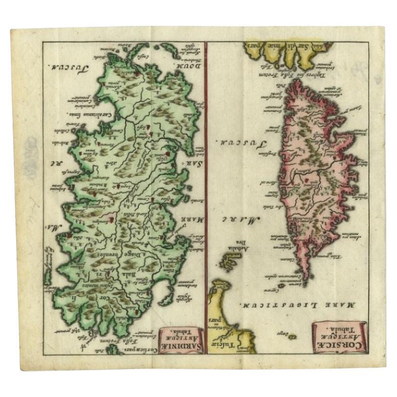
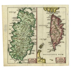
- Antique Map of the Islands of Corsica and Sardinia, 1685Located in Langweer, NLAntique map titled 'Corsicae Antiquae Tabula - Sardiniae Antiquae Tabula.' Two charming miniature maps on one sheet, showing the islands Corsica and Sardinia from the pocket atlas 'I...Category
Antique 17th Century Maps
MaterialsPaper
You May Also Like
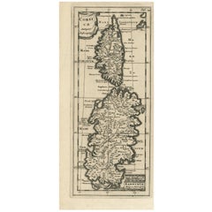
- Old Nautical Map of CorsicaLocated in Alessandria, PiemonteST/556/1 - Old map of Corsica isle, surveyed by Captain Hell, of the French Royal Navy in 1824, engraved and published on 1874, with additions and corre...Category
Antique Early 19th Century English Other Prints
MaterialsPaper
- Italy, Sicily, Sardinia, Corsica and Dalmatian Coast: A 17th Century Dutch MapBy Theodorus DanckertsLocated in Alamo, CAThis hand colored 17th century Dutch map entitled "Novissima et Accuratissima totius Italiae Corsicae et Sardiniae Descriptio" by Theodore Danckerts depicts the Italian Peninsula in ...Category
Antique Late 17th Century Dutch Maps
MaterialsPaper
- Original Antique Map of Italy. C.1780Located in St Annes, LancashireGreat map of Italy Copper-plate engraving Published C.1780 Unframed.Category
Antique Early 1800s English Georgian Maps
MaterialsPaper

- Antique Lithography Map, Northamptonshire, English, Framed Cartography, C.1860Located in Hele, Devon, GBThis is an antique lithography map of Northamptonshire. An English, framed atlas engraving of cartographic interest, dating to the mid 19th century...Category
Antique Mid-19th Century British Victorian Maps
MaterialsWood
- Original Antique Map of Italy. Arrowsmith. 1820Located in St Annes, LancashireGreat map of Italy Drawn under the direction of Arrowsmith Copper-plate engraving Published by Longman, Hurst, Rees, Orme and Brown, 1820 Unframed.Category
Antique 1820s English Maps
MaterialsPaper
- Antique County Map, Rutlandshire, English, Framed, Cartography, Victorian, 1860Located in Hele, Devon, GBThis is an antique lithography map of Rutlandshire. An English, framed atlas engraving of cartographic interest, dating to the mid 19th century and later. Superb lithography of Rutl...Category
Antique Mid-19th Century British Victorian Maps
MaterialsWood


Recently Viewed
View AllMore Ways To Browse
Antique Italian Engraving
Antique Old World Map
Old World Antique Map
Old Antique World Map
Old World Antique Maps
Antique Maps Of States
Edinburgh Antiques
19th C Country Antiques
16th C Italian
Alexander James
Antique Italian Map
Antique Italy Map
Italy Antique Map
Italy Map Antique
Antique Maps Italy
Antique Map Italy
Antique Italian Maps
Antique Italy Maps