Large Antique Maps North America
5
to
12
70
39
61
41
33
18
17
16
15
15
13
8
7
7
7
6
6
5
4
4
3
3
3
3
2
2
2
2
2
2
1
1
1
1
1
1
1
1
1
1
1
7
2
2
2
1
Sort By
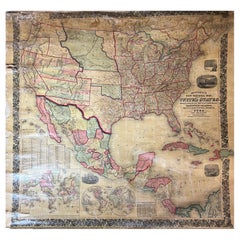
Large Antique 1859 Map of North America
Located in Sag Harbor, NY
population of 1850 North America is included as well as details of all of North and Central America. The size
Category
Mid-19th Century American Large Antique Maps North America
Materials
Canvas, Paper
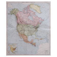
Large Original Vintage Map of North America, circa 1920
Located in St Annes, Lancashire
Great map of North America
Original color. Good condition
Published by Alexander Gross
Category
1920s English Edwardian Large Antique Maps North America
Materials
Paper
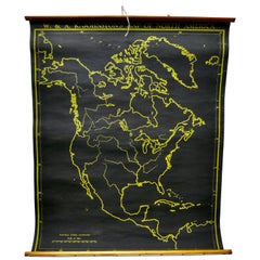
University Chart “Black Map of North America
Located in Chillerton, Isle of Wight
Bacon,
This is a Black Physical map of North America, it is large lithograph set on Linen mounted on
Category
Early 20th Century Industrial Large Antique Maps North America
Materials
Linen
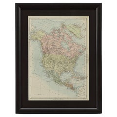
1875 "North America" Map by J. Bartholomew
Located in Colorado Springs, CO
Presented is an original 1875 map of “North America.” The map was issued in Volume 1 of the Ninth
Category
1870s Scottish Large Antique Maps North America
Materials
Paper
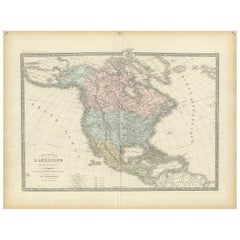
Antique Map of North America by Levasseur '1875'
Located in Langweer, NL
Antique map titled 'Carte générale de l'Amérique Septentrionale'. Large map of North America. This
Category
Late 19th Century Large Antique Maps North America
Materials
Paper
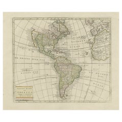
Original Antique Map of North and South America in Attractive Old Coloring
By Isaak Tirion
Located in Langweer, NL
Antique map titled 'Nieuwe Kaart van America'. Beautiful map of America. The fabled Quivira is used
Category
Mid-18th Century Large Antique Maps North America
Materials
Paper
H 16.15 in W 19.69 in D 0.02 in
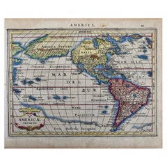
North & South America: A 17th Century Hand-colored Map by Jansson & Goos
By Johannes Janssonius
Located in Alamo, CA
A 17th century hand-colored map of North & South America entitled "Americae Descriptio" by the
Category
1620s Dutch Large Antique Maps North America
Materials
Paper
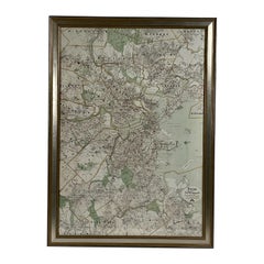
Map of Boston and Surrounding Towns
Located in Norwell, MA
Later copy of a nineteenth century map of Boston and surrounding towns. Showing parts of Quincy
Category
19th Century North American Large Antique Maps North America
Materials
Paper
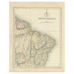
Antique Map of Part of South America by Archer, C.1860
Located in Langweer, NL
Antique map titled 'South America'. This antique map depicts the north-east of South America
Category
19th Century Large Antique Maps North America
Materials
Paper
1859 "Map of the United States of America..." by J. H. Colton
By J.H. Colton
Located in Colorado Springs, CO
across the Caribbean and South America. A large inset map on the lower left shows the Atlantic Ocean and
Category
1850s American Large Antique Maps North America
Materials
Paper
Africa: A Large 17th Century Hand-Colored Map by Sanson and Jaillot
By Nicolas Sanson
Located in Alamo, CA
This large original hand-colored copperplate engraved map of Africa entitled "L'Afrique divisee
Category
1690s French Large Antique Maps North America
Materials
Paper
Antique Map of Southeast Asia by Ortelius '1587'
By Abraham Ortelius
Located in Langweer, NL
to the north and south. The map also shows parts of the American northwest, including the cities of
Category
16th Century Large Antique Maps North America
Materials
Paper
1866 Ensign & Bridgman's Rail Road Map of the United States
Located in Colorado Springs, CO
ornamental border.
The map captures the burgeoning American railway infrastructure and documents the
Category
1860s American Late Victorian Large Antique Maps North America
Materials
Paper
Interesting Map of the Atlantic Showing Nelson's and Trade Routes, 1817
By John Thomson
Located in Langweer, NL
, North America, &cc'. Large map of the Atlantic, showing the tracks of the ships trading in North America
Category
19th Century Large Antique Maps North America
Materials
Paper
Free Shipping
H 21.26 in W 27.76 in D 0 in
Very Attractive Antique Map of the World as Planisphere, Shows Cook's Voyages
Located in Langweer, NL
Northwest Coast of America and North East coast of Asia, along with Greenland. A new large lake also appears
Category
Late 18th Century Large Antique Maps North America
Materials
Paper
No Reserve
H 16.15 in W 20.08 in D 0.02 in
Antique Map of the World in Hemispheres by Keizer & de Lat, 1788
Located in Langweer, NL
double hemisphere world map on polar projections. In North America, there is a large Island of California
Category
Late 18th Century Large Antique Maps North America
Materials
Paper
California, Alaska and Mexico: 18th Century Hand-Colored Map by de Vaugondy
By Didier Robert de Vaugondy
Located in Alamo, CA
This an 18th century hand-colored map of the western portions of North America entitled "Carte de
Category
1770s French Large Antique Maps North America
Materials
Paper
H 13.75 in W 16.63 in D 0.13 in
Antique Map with Details of Berings' Expedition into Russians' Far East, 1737
Located in Langweer, NL
the western side of the Bering Strait, dividing Asia from North America. As shown on the map, a series
Category
1730s Large Antique Maps North America
Materials
Paper
H 12.96 in W 22.64 in D 0 in
1847 Antique Map of Mexico, Texas and California by Samuel Augustus Mitchell
By Samuel Augustus Mitchell 1
Located in Colorado Springs, CO
& Upper California, an important map showing the progress of the Mexican-American War. Published in 1847
Category
1840s American Large Antique Maps North America
Materials
Paper
H 32 in W 23.63 in D 0.5 in
Antique Map of the World with Polar Projections by Keizer & de Lat, 1788
Located in Langweer, NL
polar projections. In North America, there is a large Island of California. Australia and New Zealand
Category
Late 18th Century Large Antique Maps North America
Materials
Paper
H 8.08 in W 11.03 in D 0.02 in
Captain Cook's Exploration of Tahiti 18th C. Hand-Colored Map by Bellin
By Jacques-Nicolas Bellin
Located in Alamo, CA
and of the Royal Society of London. Over a 50 year career, he produced a large number of maps of
Category
Mid-18th Century French Large Antique Maps North America
Materials
Paper
H 11.38 in W 17.5 in D 0.13 in
1842 Wall Map of the United States by J. H. Young, Published by S. A. Mitchell
Located in Colorado Springs, CO
earliest counties present.
Elaborately detailed, the hanging wall map includes a large inset "Map of
Category
1840s American Large Antique Maps North America
Materials
Paper
H 45 in W 38 in D 1 in
Large University Chart “Political Map of North America” by Bacon
Located in Chillerton, Isle of Wight
Large University chart “Political Map of North America” by Bacon
W&A K Johnston’s Charts of
Category
Early 20th Century American Empire Large Antique Maps North America
Materials
Linen
Large University Chart “Political Map of North America” by Bacon
Located in Chillerton, Isle of Wight
Large University Chart “Political Map of North America” by Bacon
W&A K Johnston’s Charts of
Category
Early 20th Century American Empire Large Antique Maps North America
Materials
Linen
one of the earliest large-scale English maps of North America
By John Senex
Located in London, GB
one of the earliest large-scale English maps of North America
SENEX, John.
North America Corrected
Category
1710s Naturalistic Large Antique Maps North America
Materials
Watercolor, Engraving
North & South America: A 17th Century Hand-colored Map by Jansson & Goos
By Johannes Jansson
Located in Alamo, CA
A 17th century hand-colored map of North & South America entitled "Americae Descriptio" by the
Category
1620s Large Antique Maps North America
Materials
Engraving
North and South America: An 18th Century Hand-colored Map by Johann Homann
By Johann Baptist Homann
Located in Alamo, CA
This early 18th century hand-colored copperplate map of North and South America entitled "Totius
Category
Early 18th Century Old Masters Large Antique Maps North America
Materials
Engraving
Large University Chart “Physical Map of Africa” by Bacon
Located in Chillerton, Isle of Wight
Maps By G W Bacon,
This is colorful Physical map of North America, it is large lithograph set on
Category
Early 20th Century Folk Art Large Antique Maps North America
Materials
Linen
Original Antique Print of a North American Chippewa Mother with Child, 1836
Located in Langweer, NL
the largest tribal populations among Native American peoples. In Canada, they are the second-largest
Category
1830s Large Antique Maps North America
Materials
Paper
H 7.49 in W 6.3 in D 0 in
First Edition of Historical Work on ". Indians of North America" by Paul Kane
Located in Middletown, NY
Kane, Paul (1810-1871)
Wanderings of an Artist Among the Indians of North America; From Canada to
Category
Mid-19th Century English Large Antique Maps North America
Materials
Leather, Paper
H 8.5 in W 5.25 in D 1.5 in
Africa: A Large 17th Century Hand-colored Map By Sanson and Jaillot
By Nicholas Sanson d'Abbeville
Located in Alamo, CA
This large original hand-colored copperplate engraved map of Africa entitled "L'Afrique divisee
Category
1690s Large Antique Maps North America
Materials
Engraving
Important Confederate Field Map of Richmond VA 1864 with Provenance
Located in Dallas, TX
is a very large map, measuring 40.2 in (W) x 36.75 in (H) fully unfolded, but when folded, is a neat
Category
Mid-19th Century American American Classical Large Antique Maps North America
Materials
Canvas, Paper
California: 18th Century Hand-colored Map by de Vaugondy
By Didier Robert de Vaugondy
Located in Alamo, CA
This is an 18th century hand-colored map of the western portions of North America entitled "Carte
Category
1770s Large Antique Maps North America
Materials
Engraving
Bermuda: An Early 17th Century Hand-colored Map by Henricus Hondius
By Henricus Hondius
Located in Alamo, CA
significant map that depicts the islands of Bermuda. The map is oriented with north to the right, which was a
Category
Early 17th Century Old Masters Large Antique Maps North America
Materials
Engraving
Captain Cook's Exploration of Tahiti: 18th C. Hand-colored Map by Bellin
By Jacques-Nicolas Bellin
Located in Alamo, CA
and of the Royal Society of London. Over a 50 year career, he produced a large number of maps of
Category
Late 18th Century Large Antique Maps North America
Materials
Engraving
Asia Declineatio: A 17th Century Hand-colored Map of Asia by Justus Danckerts
Located in Alamo, CA
"Atlas Coelestis". He created maps of Europe, Asia, Africa, and the Americas, as well as city plans of
Category
Late 17th Century Old Masters Large Antique Maps North America
Materials
Engraving
Seminal guide to the East and West Indies, with 42 coloured maps and plates
By Jan Huygen van Linschoten
Located in ZWIJNDRECHT, NL
cartouche with 4 inset views, 42 engraved plates including 6 maps (31 double-page & 11 larger folding). All
Category
Early 17th Century Dutch Dutch Colonial Large Antique Maps North America
Materials
Paper
Free Shipping
H 12.6 in W 8.27 in D 1.58 in
HOMANN, Johann Baptist (1663-1724) Nova Anglia. Septentrionali Americæ implantat
Located in Bristol, CT
Cartography of North America, 116, Goss, The Mapping of North America, 50; Sellers & Van Ee, Maps & Charts of
Category
1740s Large Antique Maps North America
Materials
Paper
Hell Gate / Oyster Bay and Huntington / Huntington Bay
Located in New York, NY
HELL GATE / OYSTER BAY AND HUNTINGTON / HUNTINGTON BAY. This aquatint and line engraved map was
Category
18th Century Naturalistic Large Antique Maps North America
Materials
Engraving, Aquatint
Pocket Globe, Nicholas Lane, London, post 1779
By Nicholas Lane
Located in Milano, IT
after 1858) are not marked. North America only bears the names of some British colonies. California is
Category
1780s English Other Large Antique Maps North America
Materials
Leather, Wood, Paper
A truly delightful miniature terrestrial pocket globe
By Nathaniel Mills
Located in ZWIJNDRECHT, NL
). There is some slight loss to a portion of North America, and there is a crack to the northern portion of
Category
Mid-18th Century British Dutch Colonial Large Antique Maps North America
Materials
Other
A huge pair of 21 inches Cruchley Library Globes
By G.F. Cruchley
Located in ZWIJNDRECHT, NL
selfserving colonies, ruled directly from England.
In North America, both Los Angeles and San Francisco are
Category
1850s British Victorian Large Antique Maps North America
Materials
Other
An exceptional pair of BLAEU table globes
By Willem Blaeu
Located in ZWIJNDRECHT, NL
changes.
- The west coast of North America is drawn differently and the river system of Brazil is altered
Category
17th Century European Dutch Colonial Large Antique Maps North America
Materials
Other
Ecce Homo Plate X
By Werner Drewes
Located in Fairlawn, OH
Europe, North America and Asia. After returning to Germany in 1927, he went back to the Bauhaus, this
Category
1920s Bauhaus Large Antique Maps North America
Materials
Woodcut
Ecce Homo VII
By Werner Drewes
Located in Fairlawn, OH
through Europe, North America and Asia. After returning to Germany in 1927, he went back to the Bauhaus
Category
1920s Expressionist Large Antique Maps North America
Materials
Woodcut
Portrait of William Pitt, Earl of Chatham: Rare Framed Mezzotint after Brompton
By Edward Fisher
Located in Alamo, CA
subsisting between Great Britain and North America". This engraving is held by the British Museum and the
Category
Late 18th Century Old Masters Large Antique Maps North America
Materials
Mezzotint
H 31.63 in W 26.63 in D 0.75 in
Captain James Cook: 18th C. Portrait by William Hodges After Cook's 2nd Voyage
By William Hodges
Located in Alamo, CA
occupied the South Pole. He also explored the northwest coast of North America, including present day
Category
1770s Large Antique Maps North America
Materials
Engraving
Art Deco Fortune Magazine Cover October 1938
Located in Dallas, TX
Mexican cultural diffusion to the north, particularly to the Mississippian Native American Indian cultures
Category
Early 20th Century American Art Deco Large Antique Maps North America
Materials
Paper
The 1564 Medici Danti Map of California
By Fra Egnazio Danti
Located in New York, NY
were to be placed large hand-painted maps specially commissioned to document and illustrate the current
Category
17th Century Old Masters Large Antique Maps North America
Materials
Canvas, Paper, Ink, Watercolor, Gouache, Pen
A Rare Large Scale Eighteenth Century Wall Map of North America
By Gerard van Keulen
Located in New York, NY
Gerard Van Keulen
Carte de la Nouvelle France (A Rare Large Scale Eighteenth Century Land Map of
Category
18th Century and Earlier Belgian Large Antique Maps North America
Large 1804 Hand-Colored Map of America After the Louisiana Purchase
By Aaron Arrowsmith
Located in La Jolla, CA
Fine example of Arrowsmith's map of America, in four sheets.
An excellent map of America on the
Category
Early 1800s English Federal Large Antique Maps North America
Materials
Paper
1730 Hand-Colored Antique Map of the Americas
Located in La Jolla, CA
map was not published in any of the de Leths' atlases, which accounts for its rarity. As a large
Category
1730s Dutch Baroque Large Antique Maps North America
Materials
Paper
1764 Map "Carte Reduite Du Globe Terrestre"
By Jacques-Nicolas Bellin
Located in New York, NY
de la Marine. He is noted for his maps of Canada and of French territories in North America (New
Category
1760s Large Antique Maps North America
Materials
Engraving
Rare 1790s Russian Map of the World
Located in La Jolla, CA
, Vancouver’s discoveries on the Northwest coast of North America are not articulated, suggesting the map was
Category
1790s Russian Large Antique Maps North America
Materials
Paper
Highly Decorative Italian Wall Map of the World
By Paolo Petrini
Located in La Jolla, CA
depiction of the Americas is in good part based on Vincenzo Maria Coronelli’s maps of North and South
Category
Early 1700s Italian Baroque Large Antique Maps North America
Materials
Paper
Extremely Rare 1695 Hand-Colored Map on Vellum
By Willem Blaeu
Located in La Jolla, CA
, being the first sea chart relating to North America to use Gerard Mercator’s projection”. Blaeu's chart
Category
1690s Dutch Northern Renaissance Large Antique Maps North America
Materials
Paper
1774 Map of Lower Hudson Bay by Nicolas Bellin
By Jacques-Nicolas Bellin
Located in New York, NY
Marine. He is noted for his maps of Canada and of French territories in North America (New France, Acadia
Category
1740s Realist Large Antique Maps North America
Materials
Engraving
World map on Mercator's projection by Bonne - Engraving - 18th Century
Located in Zeeland, Noord-Brabant
Terre (…).' - World map on Mercator's projection. Greenland and the Arctic are attached to North America
Category
1780s Contemporary Large Antique Maps North America
Materials
Engraving
H 11.03 in W 16.26 in
Highly decorative sea chart of the Pacific Ocean - Engraving - 18th century
By Jacques-Nicolas Bellin
Located in Zeeland, Noord-Brabant
map / maritime map of the Pacific Ocean with large parts of North and South America, Asia and
Category
1750s Old Masters Large Antique Maps North America
Materials
Engraving
1854 Map of Partial North America, Antique Wall Map by Jacob Monk
Located in Colorado Springs, CO
"New Map of that Portion of North America, exhibiting the United States and Territories, The
Category
1850s American Large Antique Maps North America
Materials
Paper
- 1
Get Updated with New Arrivals
Save "Large Antique Maps North America", and we’ll notify you when there are new listings in this category.
Large Antique Maps North America For Sale on 1stDibs
On 1stDibs, you can find the most appropriate large antique maps north america for your needs in our varied inventory. In our selection of items, you can find modern examples as well as a contemporary version. If you’re looking for a large antique maps north america from a specific time period, our collection is diverse and broad-ranging, and you’ll find at least one that dates back to the 18th Century while another version may have been produced as recently as the 21st Century. When looking for the right large antique maps north america for your space, you can search on 1stDibs by color — popular works were created in bold and neutral palettes with elements of gray, blue, white and beige. Creating a large antique maps north america has been a part of the legacy of many artists, but those crafted by (after) Henri Matisse, Henri Matisse, Don Pollack, Nicholas Sanson d'Abbeville and William Aiken Walker are consistently popular. Artworks like these of any era or style can make for thoughtful decor in any space, but a selection from our variety of those made in lithograph, oil paint and paint can add an especially memorable touch.
How Much is a Large Antique Maps North America?
The price for an artwork of this kind can differ depending upon size, time period and other attributes — a large antique maps north america in our inventory may begin at $75 and can go as high as $24,500, while the average can fetch as much as $1,642.
More Ways To Browse
Georgetown Map
Mark Beale
Antique Map Louisiana
Antique Poncho
Mid20th Century Abstract
Map Of South Dakota
18 Th Century Bird Prints
Antique Maps Of Tennessee
East Coast Australia Charts
U Of Missouri Antique
Native American Tribes Map
New Delisle
Map Of Native American Tribes
Azores Map
20 Th Century Paris Paintings
Antique Map Kentucky
Charleston Map
John Levee
