Map Southern Africa
to
16
132
20
101
88
36
27
23
19
14
14
9
9
8
6
6
4
4
4
3
3
3
3
3
2
2
2
2
2
2
2
1
1
1
1
1
1
1
1
1
42
42
4
2
2
Sort By
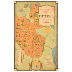
Original Vintage Travel Poster Rhodesia Pictorial Map Southern Africa Zimbabwe
Located in London, GB
Original vintage travel poster - A Pictorial Map of Rhodesia (Southern & Northern) - featuring a
Category
Vintage 1930s British Posters
Materials
Paper
H 39.38 in W 24.41 in D 0.04 in
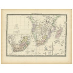
Antique Map of Southern Africa by Levasseur, 1875
Located in Langweer, NL
Antique map titled 'Afrique Méridionale'. Large map of Southern Africa. This map originates from
Category
Antique Late 19th Century Maps
Materials
Paper
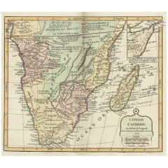
Decorative Antique Map of the Southern Part of Africa, 1806
Located in Langweer, NL
Antique map titled 'Congo, Cafrerie.'
Decorative map of the southern part of Africa by Robert
Category
Antique Early 1800s Maps
Materials
Paper
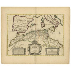
Antique Map of the Northern Coast of Africa and Southern Europe, circa 1745
By Covens & Mortier
Located in Langweer, NL
-colored map of the northern coast of Africa, Spain, Italy and the Mediterranean with the islands of
Category
Antique Mid-18th Century Maps
Materials
Paper
H 21.07 in W 25.4 in D 0.02 in
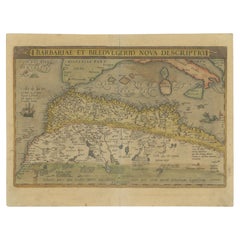
Antique Map of North Africa by Ortelius, c.1580
Located in Langweer, NL
Africa. The map covers the regions of Barbaria and Biledulgerid, essentially the territories north and
Category
Antique 16th Century Maps
Materials
Paper
Original Antique Map of Northern Africa by Van Dùren (1749)
Located in Langweer, NL
Libya, and including the southern tip of Spain and Sicily. This map originates from 'Neue Sammlung der
Category
Antique Mid-18th Century Maps
Materials
Paper
"Africa Vetus": a 17th Century Hand-Colored Map by Sanson
By Nicolas Sanson
Located in Alamo, CA
This original hand-colored copperplate engraved map of Africa entitled "Africa Vetus, Nicolai
Category
Antique Late 17th Century French Maps
Materials
Paper
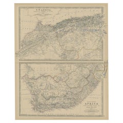
Antique Map of North and South Africa by Johnston, 1882
Located in Langweer, NL
Two antique maps on one sheet titled 'N.W. Africa, Marocco, Algeria & Tunis' and 'Southern Africa
Category
Antique 19th Century Maps
Materials
Paper
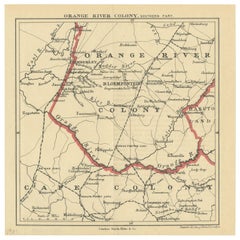
Antique Map of the Southern Part of the Orange River Colony by Stanford, 1901
Located in Langweer, NL
Antique map titled 'Orange River Colony, southernpart'. Lithograph of the southern part of the
Category
Early 20th Century Maps
Materials
Paper
H 7.88 in W 7.88 in D 0.02 in
Detailed Original Old Map of the Southern Region of the Kingdom of Algiers 1773
Located in Langweer, NL
Antique map titled 'Kaart van het Zuidelyk Gedeelte van het Ryk Algiers'.
Old map of the
Category
Antique 18th Century Maps
Materials
Paper
H 16.34 in W 10.24 in D 0 in
Set of Three Antique Maps of Africa by Colton (circa 1855)
Located in Langweer, NL
'Southern Africa'. All three maps are surrounded by Colton's typical spiral motif border. Colton names
Category
Antique Mid-19th Century Maps
Materials
Paper
Antique Map of Southern Asia with India, the Maldives, Ceylon and Arabia, c.1700
Located in Langweer, NL
Stunning Old Map of Asia.
Description: Two-sheet map of Asia, joined. The left part of this
Category
Antique Early 18th Century Maps
Materials
Paper
H 24.81 in W 37.01 in D 0 in
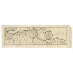
Antique Map of Western and Eastern Barbary in Africa, c.1744
Located in Langweer, NL
of the Eastern Parts of Barbary'. Decorative maps of North Africa and the Southern Mediterranean
Category
Antique 18th Century Maps
Materials
Paper
"Nova Barbariae Descriptio", a 17th Century Hand-Colored Map of North Africa
By Johannes Janssonius
Located in Alamo, CA
This original attractive 17th century hand-colored map of North Africa entitled "Nova Barbariae
Category
Antique Mid-17th Century Dutch Maps
Materials
Paper
H 22.38 in W 29 in D 0.13 in
Africa: A Large 17th Century Hand-Colored Map by Sanson and Jaillot
By Nicolas Sanson
Located in Alamo, CA
This large original hand-colored copperplate engraved map of Africa entitled "L'Afrique divisee
Category
Antique 1690s French Maps
Materials
Paper
"Africae Accurata", a Hand-Colored 17th Century Map of Africa by Visscher
By Nicolaes Visscher II
Located in Alamo, CA
An 18th century hand-colored map of Africa entitled "Africae Accurata Tabula ex officina" by
Category
Antique Late 17th Century Dutch Maps
Materials
Paper
H 23.75 in W 28.13 in D 0.13 in
Antique Map of North-Western and South Africa by A.K. Johnston, 1865
Located in Langweer, NL
Two maps on one sheet titled 'North-Western Africa' and 'Southern Africa'. Depicting Morocco
Category
Antique Mid-19th Century Maps
Materials
Paper
Antique Map of South American, The West Indies & Most of Africa, Ca.1775
Located in Langweer, NL
, but includes most of Africa, the southern part of North America and the West Indies. Arrows in the
Category
Antique 1770s Maps
Materials
Paper
H 15.04 in W 19.77 in D 0 in
Antique Map of the Turkish Empire by Tirion 'c.1760'
Located in Langweer, NL
Antique map titled 'Nieuwe Kaart van het Turksche Ryk gelegen in Europa, Asia en Africa'. Original
Category
Antique Mid-18th Century Maps
Materials
Paper
Rare and Interesting Small Antique Woodcut Map of the Mediterranean
Located in Langweer, NL
Paul. It shows the Mediterranean with Greece, Asia Minor (Turkey), Northern Africa, Southern Italy and
Category
Antique 16th Century Maps
Materials
Paper
Mediterranean Tapestry: A 19th Century Map of the Mediterranean Shores, 1882
Located in Langweer, NL
Europe down to the northern coastlines of Africa.
The map is a vivid document of the time, with each
Category
Antique 1880s Maps
Materials
Paper
H 11.03 in W 14.97 in D 0 in
Antique Map of the Straits of Gibraltar by J. Gascoyne, circa 1716
Located in Langweer, NL
through the Straits of Gibraltar, between southern Spain and northern Africa. Tide tables appear at top
Category
Antique Early 18th Century Maps
Materials
Paper
Map Silk Embroidered Western Eastern Hemisphere New Old World Asia America Afri
Located in BUNGAY, SUFFOLK
indicated within the southern polar region, the interior portions of western North America, Africa, and
Category
Antique 18th Century British Georgian Maps
Materials
Silk
H 0.4 in W 0.4 in D 0.4 in
Antique Map of Anjouan or Ndzuani Island, Part of The Comoros, 1749
Located in Langweer, NL
Antique map titled ‘Carte de L’Isle D’Anjouan - Kaart van 't Eiland Anjouan’. Original antique map
Category
Antique 18th Century Maps
Materials
Paper
Original Old Composite of Several Maps of the Ancient World on One Sheet, 1880
Located in Langweer, NL
Europe, North Africa, and parts of Asia, reflecting the Roman Empire at its extent.
The map includes
Category
Antique 1880s Maps
Materials
Paper
Free Shipping
H 15.56 in W 18.51 in D 0 in
Antique Map of Central Asia Wiht Nova Zembla as an Island, C.1700
Located in Langweer, NL
Antique map titled 'Asiae Pars Potissima.' Attractive map focusing on the central part of Asia but
Category
Antique 18th Century Maps
Materials
Paper
Antique Map of the Harbour of Praia, Santiago Island, Cape Verde, c.1750
Located in Langweer, NL
Antique map titled 'A Draught of ye Harbour of Praya in the Island St. Jago (..)'. Uncommon map
Category
Antique 18th Century Maps
Materials
Paper
Decorative Ancient World Map with Large Parts of the World Still Unknown, c 1731
Located in Langweer, NL
Interesting ancient map of the world, based upon Strabo. The Southern tip of Africa is undiscovered
Category
Antique 1730s Maps
Materials
Paper
H 9.45 in W 14.57 in D 0 in
Africa. Southern Part. Century Atlas antique vintage map
Located in Melbourne, Victoria
'The Century Atlas. Africa. Southern Part'
Original antique map, 1903.
Inset maps of 'Cape Town
Category
Early 20th Century Victorian More Prints
Materials
Lithograph
Antique Map of the Southern Oceans, South America and Africa
Located in Larchmont, NY
Antique Map of the South Atlantic, c. 1800s
Engraving
20 x 28 in.
Framed: 25 3/4 x 33 3/4 in.
Category
19th Century Realist Figurative Prints
Materials
Engraving
H 25.75 in W 33.75 in D 0.75 in
Vintage Mural Map of North Africa Countrycore African Wall Chart Decoration
Located in Berghuelen, DE
The wall map shows North Africa. It was published by Westermann-Schulwandkarten. Used as teaching
Category
Late 20th Century German Country Prints
Materials
Canvas, Wood, Paper
H 61.42 in W 100.01 in D 0.79 in
Africa. North-West Part. Century Atlas antique vintage map
Located in Melbourne, Victoria
'The Century Atlas. Africa. Southern Part'
Original antique map, 1903.
Central fold as issued
Category
Early 20th Century Victorian More Prints
Materials
Lithograph
"Africa Vetus": A 17th Century Hand-colored Map By Sanson
By Nicholas Sanson d'Abbeville
Located in Alamo, CA
This original hand-colored copperplate engraved map of Africa entitled "Africa Vetus, Nicolai
Category
1690s Landscape Prints
Materials
Engraving
Countrycore Mural Vintage Map Wall Chart Rollable Poster Central South Africa
Located in Berghuelen, DE
The cottagecore pull-down mural map depicts Middle and South Africa. Published by Westermann
Category
Vintage 1970s German Country Posters
Materials
Canvas, Wood, Paper
H 68.51 in W 83.86 in D 0.79 in
Africa: A Large 17th Century Hand-colored Map By Sanson and Jaillot
By Nicholas Sanson d'Abbeville
Located in Alamo, CA
This large original hand-colored copperplate engraved map of Africa entitled "L'Afrique divisee
Category
1690s Landscape Prints
Materials
Engraving
Travelers Mind Map
Located in New Orleans, LA
Africa for his next series Transit Urban, which included twelve paintings using local traditional fabrics
Category
2010s Contemporary Paintings
Materials
Fabric, Oil, Acrylic
Antique Chart of the Southern Pole, Showing Three Routes of Captain Cook, 1803
Located in Langweer, NL
the southern pole. It shows southern parts of South America, South Africa and Madagascar as well as
Category
Antique 19th Century Prints
Materials
Paper
H 24.02 in W 28.94 in D 0 in
Original poster made by Monique Cras - Map - New Caledonia
Located in PARIS, FR
(mountainous massif in southern Algeria).
In 1938, thanks to another grant, she discovered French West Africa
Category
Mid-20th Century Prints and Multiples
Materials
Linen, Paper, Lithograph
H 16.54 in W 24.41 in
"Pierces North Hemisphere" wall sculpture - world map - ceramic - James Turrell
By Gregor Turk
Located in Atlanta, GA
A ceramic wall sculpture featuring a map of the Southern Hemisphere. Black and white with a touch
Category
2010s Contemporary Sculptures
Materials
Ceramic
"Pierces North Hemisphere" wall sculpture - world map - ceramic - James Turrell
By Gregor Turk
Located in Atlanta, GA
A ceramic wall sculpture featuring a map of the Northern Hemisphere. Black and white with a touch
Category
2010s Contemporary Sculptures
Materials
Ceramic
Europa Regnorum Provinciarum: 18th Century Hand-colored Map of Europe by Lotter
By Tobias Conrad Lotter
Located in Alamo, CA
This is an 18th century hand-colored copperplate engraved map entitled "Europa Regnorum
Category
Mid-18th Century Landscape Prints
Materials
Engraving
Persia, Armenia & Adjacent Regions: A Hand-colored 17th Century Map by De Wit
By Frederick de Wit
Located in Alamo, CA
This colorful and detailed 17th century copperplate map by Frederick De Wit was published in
Category
Late 17th Century Old Masters More Prints
Materials
Engraving
Frederick de WitPersia, Armenia & Adjacent Regions: A Hand-colored 17th Century Map by De Wit , 1680
H 23.5 in W 27 in D 1.325 in
Circa 1940 Original Political poster - To defend the imperial heritage - Colony
Located in PARIS, FR
.
It shows a sailor standing at attention, protecting a maritime map of southern Europe and Africa
Category
1940s Prints and Multiples
Materials
Paper, Lithograph
Antique Mycology Print of the Beefsteak Fungus by Fries, c.1860
By Elias Magnus Fries
Located in Langweer, NL
Britain, but can be found in North America, Australia, North Africa, Southern Africa and the rest of
Category
Antique 19th Century Prints
Materials
Paper
Antique Mycology Print of the Suillus Luteus, C.1860
By Elias Magnus Fries
Located in Langweer, NL
, southern Africa, Australia and New Zealand. Commonly referred to as slippery jack or sticky bun in English
Category
Antique 19th Century Prints
Materials
Paper
Pocket Globe, Nicholas Lane, London, post 1779
By Nicholas Lane
Located in Milano, IT
cartouche, there is:
1776 Prockter fc.
On the terrestrial globe, a large part of southern and central
Category
Antique 1780s English Other Models and Miniatures
Materials
Leather, Wood, Paper
Wonderful and extremely rare Dutch pocketglobe
By Dementz Family DEUR Art Company
Located in ZWIJNDRECHT, NL
-mapped. The continent of Africa is much the same as South America, with a mixture of old regions and more
Category
Antique Early 18th Century Dutch Dutch Colonial Globes
Materials
Hardwood, Paper
English Pocket Globe, London, Circa 1775-1798
By Herman Moll
Located in Milano, IT
region in his 1727 map. (Encyclopaedia Britannica, ed. 1902, under "States of Central Africa"); Tartary
Category
Antique Late 18th Century English George III Globes
Materials
Shagreen, Paper
Pocket Globe by Nathaniel Hill, London 1754
Located in Milano, IT
globe much of central and southern Africa is empty. North America bears only the name of some British
Category
Antique 1750s English George II Globes
Materials
Shagreen, Paper
A truly delightful miniature terrestrial pocket globe
By Nathaniel Mills
Located in ZWIJNDRECHT, NL
large lakes engraved in Africa that may longer exist.
The Celestial Gores.
The celestial gores, housed
Category
Antique Mid-18th Century British Dutch Colonial Globes
Materials
Other
Abstract Expressionist Paris Landscape Painting
By Jacques Yankel
Located in Surfside, FL
was forced to flee to Southern France with his family to escape the Nazis.
During the Second World War
Category
Mid-20th Century Abstract Expressionist Abstract Drawings and Watercolors
Materials
Paper, Oil Pastel
Giant Egg of the Extinct 'Elephant Bird'
Located in London, GB
from the northern to southern tip of the island of Madagascar. The precise date of its extinction is
Category
Antique 15th Century and Earlier Malagasy Natural Specimens
Materials
Eggshell
Rare Judaica Jewish Folk Art Sukkot Papercut Jerusalem Mizrach Archie Granot
By Archie Granot
Located in Surfside, FL
North Africa and the Middle East for centuries and has seen a revival in modern times in Israel and
Category
1980s Folk Art Mixed Media
Materials
Mixed Media
Lithograph - Flowers
By (after) Henri Matisse
Located in Collonge Bellerive, Geneve, CH
ways unchanged since Roman times. The coming of the railway had put Bohain on the industrial map, but
Category
1940s Modern Still-life Prints
Materials
Lithograph
Henri Matisse (After) - Lithograph - Pumpkin and Flowers
By (after) Henri Matisse
Located in Collonge Bellerive, Geneve, CH
ways unchanged since Roman times. The coming of the railway had put Bohain on the industrial map, but
Category
1940s Modern Still-life Prints
Materials
Lithograph
H 9.45 in W 12.6 in D 0.04 in
Henri Matisse (After) - Lithograph - Flowers
By (after) Henri Matisse
Located in Collonge Bellerive, Geneve, CH
ways unchanged since Roman times. The coming of the railway had put Bohain on the industrial map, but
Category
1940s Modern Still-life Prints
Materials
Lithograph
H 9.45 in W 12.6 in D 0.04 in
Henri Matisse (After) - Lithograph - Pumpkin and Flowers
By (after) Henri Matisse
Located in Collonge Bellerive, Geneve, CH
ways unchanged since Roman times. The coming of the railway had put Bohain on the industrial map, but
Category
1940s Modern Figurative Prints
Materials
Lithograph
H 12.6 in W 9.45 in D 0.04 in
Henri Matisse (After) - Lithograph - Flowers
By (after) Henri Matisse
Located in Collonge Bellerive, Geneve, CH
railway had put Bohain on the industrial map, but people still traveled everywhere on foot or horseback
Category
1940s Modern Figurative Prints
Materials
Lithograph
H 12.6 in W 9.45 in D 0.04 in
Henri Matisse (After) - Lithograph - Woman with Flowers in Her Hair
By (after) Henri Matisse
Located in Collonge Bellerive, Geneve, CH
railway had put Bohain on the industrial map, but people still traveled everywhere on foot or horseback
Category
1940s Modern Portrait Prints
Materials
Lithograph
H 12.6 in W 9.45 in D 0.04 in
Original Vintage Travel Poster Rhodesia Pictorial Map Southern Africa Zimbabwe
Located in London, GB
Original vintage travel poster - A Pictorial Map of Rhodesia (Southern & Northern) - featuring a
Category
1930s More Prints
Materials
Paper
H 39.38 in W 23.63 in
- 1
Get Updated with New Arrivals
Save "Map Southern Africa", and we’ll notify you when there are new listings in this category.
Map Southern Africa For Sale on 1stDibs
At 1stDibs, there are many versions of the ideal map southern Africa for your home. A map southern Africa — often made from paper, animal skin and shagreen — can elevate any home. You’ve searched high and low for the perfect map southern Africa — we have versions that date back to the 18th Century alongside those produced as recently as the 20th Century are available. When you’re browsing for the right map southern Africa, those designed in Georgian styles are of considerable interest. Many designers have produced at least one well-made map southern Africa over the years, but those crafted by Nicolas Sanson, Covens & Mortier and Herman Moll are often thought to be among the most beautiful.
How Much is a Map Southern Africa?
A map southern Africa can differ in price owing to various characteristics — the average selling price 1stDibs is $1,275, while the lowest priced sells for $85 and the highest can go for as much as $155,000.
More Ways To Browse
Sierra Leone Antique Map
Elephant Bird Egg
Antique Yemen
Mark Beale
Congo Antique Map
Saudi Arabia Antique Map
Afrique Du Nord
Vintage Geological Maps
Stonewall Jackson
Giant Antique Map
Giant Antique Maps
Herman Mile
Old Sicily Map
Green Oran
Old Israel Map
Antique Maps Of Tennessee
Civil War Piano
Tunisia Antique Map
