Items Similar to Roman Italy and Provinces: A Cartographic Snapshot, 1880


Want more images or videos?
Request additional images or videos from the seller
1 of 7
Roman Italy and Provinces: A Cartographic Snapshot, 1880
About the Item
The map titled "ITALIA, Gallia Cisalpina, Sicilia, Sardinia, Corsica" focuses on Italy and its surrounding regions during Roman times. It offers a detailed depiction of the Italian peninsula, the Po Valley (Gallia Cisalpina), and the islands of Sicily, Sardinia, and Corsica.
Produced as part of the "Spruner-Menke Atlas Antiquus" by Karl Spruner von Merz and edited by Theodorus Menke, this map reflects the 19th-century European scholarship on ancient geography and history.
The period represented is likely during the Roman Republic or early Roman Empire, suggested by the level of detail in regions like Latium and Campania, which were central to Roman culture and power. This era was marked by Roman expansion and consolidation of the Italian peninsula, as well as the Punic Wars, which led to Roman dominance over the Mediterranean.
What makes this map interesting is its:
1. **Rich Detail**: The map delineates the intricate network of Roman roads, cities, and colonies, showing the infrastructure that facilitated Roman administration and control.
2. **Strategic Locations**: It identifies strategic locations like harbors and passes, crucial for trade and military campaigns.
3. **Geographic Accuracy**: It reflects the geographical knowledge of the time, with an accurate representation of the topography that shaped the development of these regions.
4. **Cultural and Historical Sites**: Insets of important sites like Syracuse offer a closer look at places of historical significance.
5. **Educational Purpose**: The map was designed to aid in the study of Roman history, providing a visual tool for understanding the ancient world.
Maps like this were essential for education in the 19th century, offering a window into the ancient world and helping scholars and students visualize the vast scope of Roman influence and the geography of the Mediterranean basin.
- Dimensions:Height: 15.56 in (39.5 cm)Width: 18.51 in (47 cm)Depth: 0 in (0.02 mm)
- Materials and Techniques:
- Period:
- Date of Manufacture:1880
- Condition:Good, given age. General age-related toning, especially around the edges. The vertical folding line as issued. Please study scan carefully.
- Seller Location:Langweer, NL
- Reference Number:
About the Seller
5.0
Platinum Seller
These expertly vetted sellers are 1stDibs' most experienced sellers and are rated highest by our customers.
Established in 2009
1stDibs seller since 2017
1,916 sales on 1stDibs
Typical response time: <1 hour
- ShippingRetrieving quote...Ships From: Langweer, Netherlands
- Return PolicyA return for this item may be initiated within 14 days of delivery.
More From This SellerView All
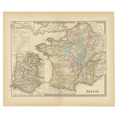
- Ancient Gaul: A Cartographic Overview of Gallic Tribes and Roman Provinces, 1880Located in Langweer, NLThe print titled "GALLIA," is a historical map of ancient Gaul, which corresponds to modern-day France and parts of its surrounding countries. Here are the features and details noted...Category
Antique 1880s Maps
MaterialsPaper
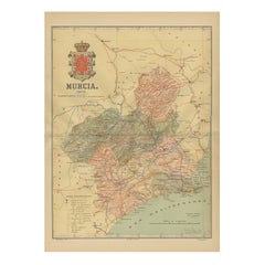
- 1902 Murcia: A Cartographic Snapshot of Spain's Southeastern ProvinceLocated in Langweer, NLThe map represents the province of Murcia, Spain, as it was in 1902. Here's an overview of its characteristics: - **Geography**: It displays the varied terrain of Murcia, from the c...Category
Antique Early 1900s Maps
MaterialsPaper
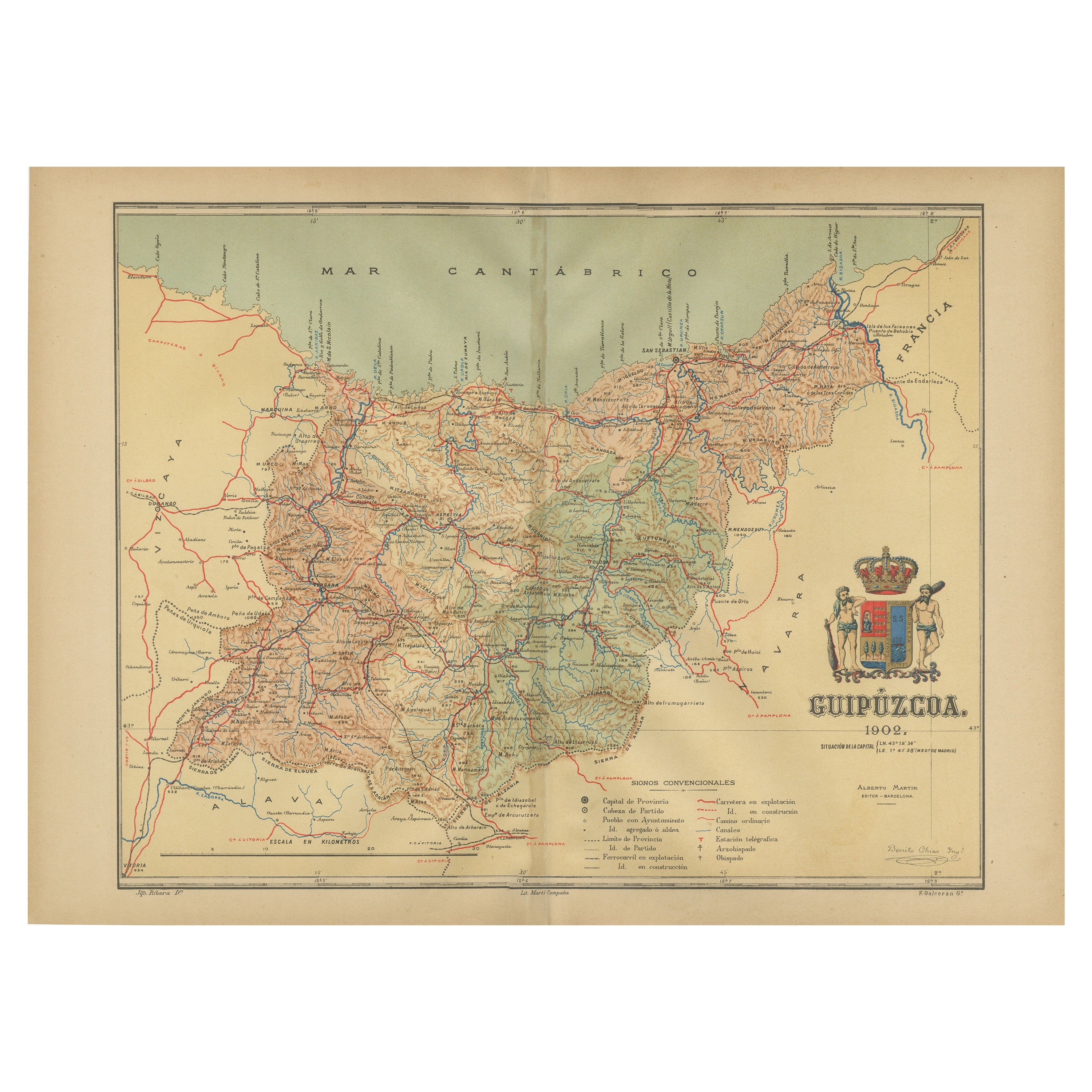
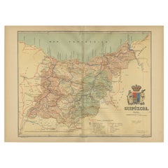
- Gipuzkoa 1902: A Cartographic Snapshot of the Basque Coastline and HighlandsLocated in Langweer, NLThe map showcases the province of Gipuzkoa (also known as Guipúzcoa in Spanish), which is part of the autonomous community of the Basque Country in northern Spain, as of the year 190...Category
Antique Early 1900s Maps
MaterialsPaper
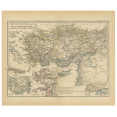
- Asia Minor and Provinces: A Roman Empire Map from Spruner-Menke Atlas, 1880Located in Langweer, NLThis authentic map of the 19th century, titled "PONTUS ET BITHYNIA, ASIA, LYCIA ET PAMPHYLIA, GALATIA, CAPPADOCIA, SYRIA, CRET, CYPRVS," details the regions of Asia Minor and surroun...Category
Antique 1880s Maps
MaterialsPaper
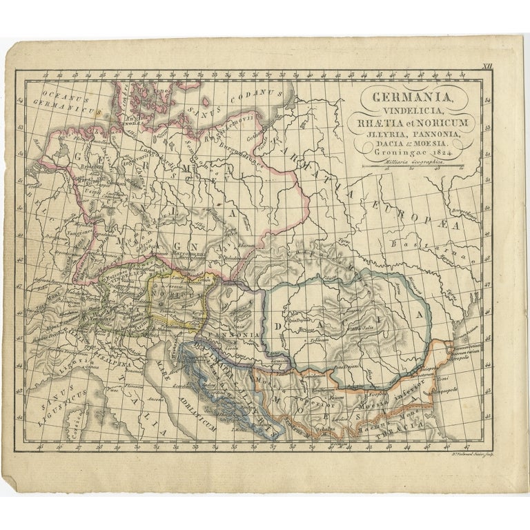
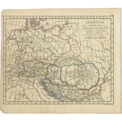
- Antique Map of Germany in Roman Times, Showing Roman Provinces, 1825Located in Langweer, NLAntique map titled 'Germania, Vindelicia, Rhaetia et Noricum Jllyria, Pannonia, Dacie & Moesia'. Old map of Germany and surroundings originating from 'Atlas der Oude Wereld'. Artists...Category
Antique 19th Century Maps
MaterialsPaper
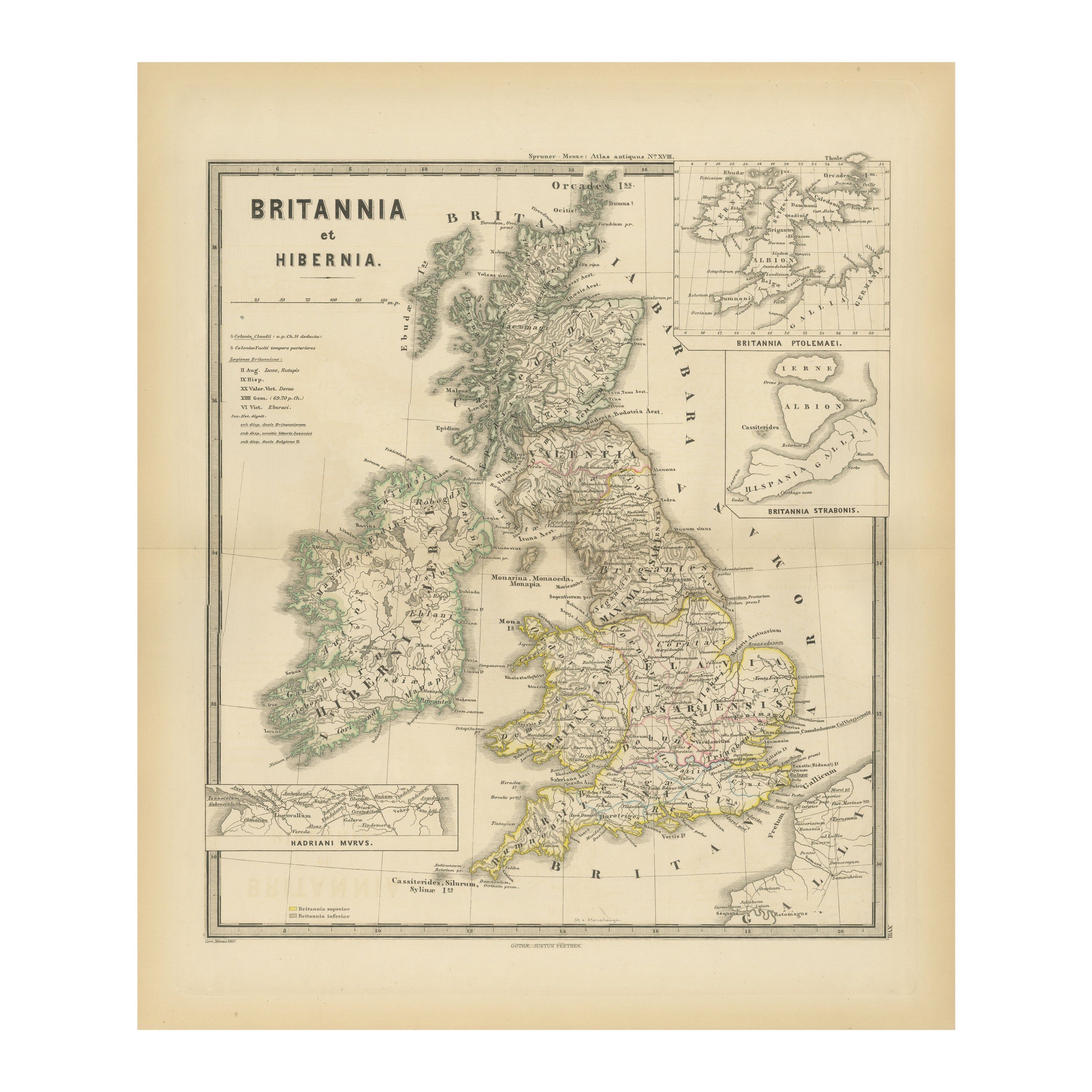
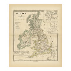
- Ancient Cartography of Britannia and Hibernia, Published in 1880Located in Langweer, NLThis map depicts the geographical area of Great Britain and Ireland, labeled "BRITANNIA et HIBERNIA." It is a historical map, as indicated by the Latin titles and the classical names of regions and tribes. In the main section of the map, Great Britain is depicted in fine detail, with topographical features such as mountains and rivers. The map is color-coded, to differentiate political or tribal boundaries. Various Roman place names are indicated, such as "Londinium" for London. To the left of Great Britain is Ireland, referred to as "Hibernia," similarly detailed with its own topographical features and ancient...Category
Antique 1880s Maps
MaterialsPaper
You May Also Like
- Sun and Moon a Story of Astronomy, Photography and CartographyLocated in New York City, NYA unique pictorial history of astronomical exploration from the earliest Prehistoric observatories to the latest satellite images with 280 spectacular images and an inspiring story i...Category
21st Century and Contemporary European Books
MaterialsPaper
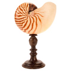
- Nautilus Pompilius, Italy, 1880Located in Milan, ITA natural Wunderkammer Specimen: a Nautilus Pompilius. The Specimen is mounted over a wooden painted base. Italy 1880 ca. (SHIP TO EU ONLY)Category
Antique Early 19th Century Italian Natural Specimens
MaterialsShell, Wood
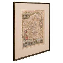
- Antique Lithography Map, Lincolnshire, English, Framed, Engraving, CartographyLocated in Hele, Devon, GBThis is an antique lithography map of Lincolnshire. An English, framed atlas engraving of cartographic interest, dating to the mid 19th century and...Category
Antique Mid-19th Century British Victorian Maps
MaterialsWood
- Antique Lithography Map, Northumberland, English, Framed, Engraving, CartographyLocated in Hele, Devon, GBThis is an antique lithography map of Northumberland. An English, framed atlas engraving of cartographic interest, dating to the mid 19th century a...Category
Antique Mid-19th Century British Victorian Maps
MaterialsWood
- Antique Lithography Map, Worcestershire, English, Framed Engraving, CartographyLocated in Hele, Devon, GBThis is an antique lithography map of Worcestershire. An English, framed atlas engraving of cartographic interest, dating to the early 19th centur...Category
Antique Early 19th Century British Regency Maps
MaterialsWood
- Antique Lithography Map, Northamptonshire, English, Framed Cartography, C.1860Located in Hele, Devon, GBThis is an antique lithography map of Northamptonshire. An English, framed atlas engraving of cartographic interest, dating to the mid 19th century...Category
Antique Mid-19th Century British Victorian Maps
MaterialsWood