Map Of South Pole
4
to
8
122
11
108
95
26
20
17
16
14
9
9
9
7
4
4
3
3
2
2
2
2
2
1
1
1
1
1
1
1
1
1
1
1
1
1
42
42
3
1
1
Sort By
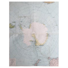
Large Original Vintage Map of The South Pole, circa 1920
Located in St Annes, Lancashire
Great map of The South Pole
Original color.
Published by Alexander Gross
Unframed.
Repairs to
Category
Vintage 1920s English Maps
Materials
Paper
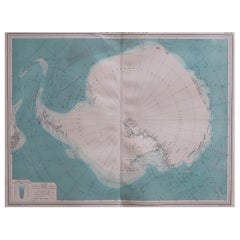
Large Original Vintage Map of the South Pole, circa 1920
Located in St Annes, Lancashire
Great map of the South pole.
Unframed.
Original color.
By John Bartholomew and Co
Category
Vintage 1920s British Maps
Materials
Paper
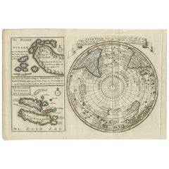
Antique Map of the South Pole by Keizer & de Lat, 1788
Located in Langweer, NL
antique map of the South Pole including two small inset maps of Cape Circoncision (a peninsula on the
Category
Antique Late 18th Century Maps
Materials
Paper
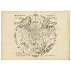
18th Century Antique Engraving of the Southern Hemisphere by G. de L'Isle
By Guillaume De L'Isle
Located in Langweer, NL
'. Hemispherical map of the southern hemisphere centered on the South Pole showing tracks of explorers, up to and
Category
Antique Late 18th Century Maps
Materials
Paper
H 21.58 in W 29.93 in D 0.02 in
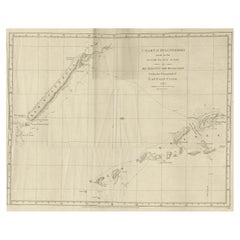
Rare Engraving of New Caledonia & New Hebrides from Capt. Cook's Travels, 1777
Located in Langweer, NL
Antique map titled 'Chart of Discoveries made in the South Pacific Ocean'.
Rare engraving from
Category
Antique 1770s Maps
Materials
Paper
H 16.34 in W 22.45 in D 0 in
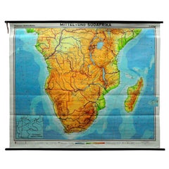
Countrycore Mural Vintage Map Wall Chart Rollable Poster Central South Africa
Located in Berghuelen, DE
The cottagecore pull-down mural map depicts Middle and South Africa. Published by Westermann
Category
Vintage 1970s German Country Posters
Materials
Canvas, Wood, Paper
H 68.51 in W 83.86 in D 0.79 in
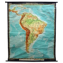
Old Vintage Look Pull Down Map Wall Chart Poster South America
Located in Berghuelen, DE
The wall map shows South America in a combination of physical and political map with the emphasis
Category
Mid-20th Century German Country Prints
Materials
Canvas, Wood, Paper
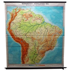
Vintage Rollable Map Wall Chart South America Brasilia and Neighbour States
Located in Berghuelen, DE
A classical pull-down school map showing South America with Brasilia and its neighbor states
Category
Mid-20th Century German Country Prints
Materials
Canvas, Wood, Paper
H 84.65 in W 77.56 in D 0.79 in
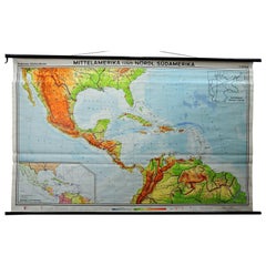
Large Rollable Map Central America Northern South America Wall Chart Poster
Located in Berghuelen, DE
A fantastic pull-down wall chart depicting a map of Central America and Northern South America
Category
Mid-20th Century German Country Prints
Materials
Canvas, Wood, Paper
H 60.24 in W 96.86 in D 0.79 in
Vintage Mural Pull Down Map South America American Continent Wall Chart
Located in Berghuelen, DE
The wall map shows South America. It was published by Haack Paincke, Justus Perthes Darmstadt. Used
Category
Late 20th Century German Country Prints
Materials
Canvas, Wood, Paper
H 78.75 in W 63 in D 0.79 in
Vintage Mural Rollable Map Wall Chart France Benelux Countries South England
Located in Berghuelen, DE
A cottagecore pull-down wall chart map illustrating France and the Benelux countries (the
Category
Mid-20th Century German Country Prints
Materials
Canvas, Wood, Paper
H 75.99 in W 61.03 in D 0.79 in
Antique Chart of the Southern Pole, Showing Three Routes of Captain Cook, 1803
Located in Langweer, NL
the southern pole. It shows southern parts of South America, South Africa and Madagascar as well as
Category
Antique 19th Century Prints
Materials
Paper
H 24.02 in W 28.94 in D 0 in
Framed World Map print showing double hemisphere dating to 1642 originally, New
Located in Lincoln, Lincolnshire
celestial hemispheres, North and South Poles, sailing ships and sea monsters. Full of fascinating detail, it
Category
2010s British Charles II Prints
Materials
Glass, Wood, Paper
H 19.69 in W 27.56 in D 1.58 in
Vintage Table Globe, English, World Map, 13.5 Inch Diameter, Cartography, C.1960
Located in Hele, Devon, GB
This is a vintage table globe. An English, paper finished world map with chrome meridian, dating to
Category
Vintage 1960s British Mid-Century Modern Globes
Materials
Chrome
H 16.34 in W 13.39 in D 13.39 in
Pair of Philip & Son Globes, circa 1946
By George Philip & Son
Located in London, GB
point at the North and South Poles.
Over the years, Philip acquired the production lines of other
Category
Vintage 1940s British Globes
Materials
Brass
A huge pair of 21 inches Cruchley Library Globes
By G.F. Cruchley
Located in ZWIJNDRECHT, NL
authorities. Exhibiting the discoveries in equatorial Africa, north pole. And the new settlements and
Category
Antique 1850s British Victorian Globes
Materials
Other
Philips' Celestial Globe, circa 1935
By George Philip & Son
Located in London, GB
, thin elliptical strips of paper that narrow to a point at the North and South Poles.
Over the years
Category
Vintage 1930s British Globes
Materials
Brass
Little America by Richard E. Byrd, First Edition, 1930
Located in Colorado Springs, CO
Byrd, Richard E., Little America: Aerial Exploration in the Antarctic, The Flight to the South Pole
Category
Vintage 1930s American Books
Materials
Leather, Paper
Philips 14 Inch Globe, circa 1940
By Philips
Located in London, GB
the North and South Poles.
Over the years, Philip acquired the production lines of other British globe
Category
Vintage 1940s British Globes
Materials
Gesso, Wood, Paper
A truly delightful miniature terrestrial pocket globe
By Nathaniel Mills
Located in ZWIJNDRECHT, NL
north and a south pole, an equator, and lines of latitude and longitude.
The Terrestrial Globe.
The
Category
Antique Mid-18th Century British Dutch Colonial Globes
Materials
Other
Pocket Globe, Nicholas Lane, London, post 1779
By Nicholas Lane
Located in Milano, IT
aligned and glued to the sphere. On the Poles, two pins had been inserted, but these are now missing.
In
Category
Antique 1780s English Other Models and Miniatures
Materials
Leather, Wood, Paper
Captain James Cook: 18th C. Portrait by William Hodges After Cook's 2nd Voyage
By William Hodges
Located in Alamo, CA
Cook's 2nd voyage of discovery, "A voyage towards the South Pole, and round the World. Performed in His
Category
1770s Portrait Prints
Materials
Engraving
Lithograph - Flowers
By (after) Henri Matisse
Located in Collonge Bellerive, Geneve, CH
ways unchanged since Roman times. The coming of the railway had put Bohain on the industrial map, but
Category
1940s Modern Still-life Prints
Materials
Lithograph
Henri Matisse (After) - Lithograph - Pumpkin and Flowers
By (after) Henri Matisse
Located in Collonge Bellerive, Geneve, CH
ways unchanged since Roman times. The coming of the railway had put Bohain on the industrial map, but
Category
1940s Modern Still-life Prints
Materials
Lithograph
H 9.45 in W 12.6 in D 0.04 in
Henri Matisse (After) - Lithograph - Flowers
By (after) Henri Matisse
Located in Collonge Bellerive, Geneve, CH
ways unchanged since Roman times. The coming of the railway had put Bohain on the industrial map, but
Category
1940s Modern Still-life Prints
Materials
Lithograph
H 9.45 in W 12.6 in D 0.04 in
Henri Matisse (After) - Lithograph - Pumpkin and Flowers
By (after) Henri Matisse
Located in Collonge Bellerive, Geneve, CH
ways unchanged since Roman times. The coming of the railway had put Bohain on the industrial map, but
Category
1940s Modern Figurative Prints
Materials
Lithograph
H 12.6 in W 9.45 in D 0.04 in
Henri Matisse (After) - Lithograph - Flowers
By (after) Henri Matisse
Located in Collonge Bellerive, Geneve, CH
railway had put Bohain on the industrial map, but people still traveled everywhere on foot or horseback
Category
1940s Modern Figurative Prints
Materials
Lithograph
H 12.6 in W 9.45 in D 0.04 in
Henri Matisse (After) - Lithograph - Woman with Flowers in Her Hair
By (after) Henri Matisse
Located in Collonge Bellerive, Geneve, CH
railway had put Bohain on the industrial map, but people still traveled everywhere on foot or horseback
Category
1940s Modern Portrait Prints
Materials
Lithograph
H 12.6 in W 9.45 in D 0.04 in
Original Lithograph - Henri Matisse - Apollinaire
By Henri Matisse
Located in Collonge Bellerive, Geneve, CH
Roman times. The coming of the railway had put Bohain on the industrial map, but people still traveled
Category
1930s Modern Portrait Prints
Materials
Linocut
Guillaume Apollinaire
By Henri Matisse
Located in Collonge Bellerive, Geneve, CH
Roman times. The coming of the railway had put Bohain on the industrial map, but people still traveled
Category
1930s Modern Portrait Prints
Materials
Lithograph
Original Lithograph - Henri Matisse - Apollinaire
By Henri Matisse
Located in Collonge Bellerive, Geneve, CH
Roman times. The coming of the railway had put Bohain on the industrial map, but people still traveled
Category
1930s Modern Portrait Prints
Materials
Linocut
Original Lithograph - Henri Matisse - Apollinaire
By Henri Matisse
Located in Collonge Bellerive, Geneve, CH
Roman times. The coming of the railway had put Bohain on the industrial map, but people still traveled
Category
1930s Modern Portrait Prints
Materials
Linocut
Creole Dancer
By (after) Henri Matisse
Located in Collonge Bellerive, Geneve, CH
railway had put Bohain on the industrial map, but people still traveled everywhere on foot or horseback
Category
Mid-20th Century Modern Still-life Prints
Materials
Lithograph
Map of the Southern Hemisphere by Bonne - Engraving - 18th Century
Located in Zeeland, Noord-Brabant
.' - Map of the Southern Hemisphere centered on the South Pole, from the South Pole up to the Equator. Some
Category
1780s Contemporary More Prints
Materials
Engraving
Planiglobii Terrestris.
By Johann Baptist Homann
Located in Zeeland, Noord-Brabant
inset maps show the North and South poles in Nuremberg projection. Two small insets show sun solstices
Category
1740s More Prints
Materials
Engraving, Etching
Map Plan of the City of Washington in the Territory of Columbia
Located in Colorado Springs, CO
Plan (Map) of the City of Washington in the Territory of Columbia Published 1796, in the American
Category
Antique Late 18th Century American Maps
17th Century Hand-Colored Map of Bordeaux Region of France by Mercator/Hondius
Located in Alamo, CA
A 17th century hand-colored map entitled "Bourdelois Pais de Medoc et la Prevoste de Born" by
Category
Antique Mid-17th Century Dutch Maps
Materials
Paper
H 10.75 in W 13.5 in D 0.13 in
Decorative Antique World Map with two Hemispheres
Located in Langweer, NL
hemisphere (South Pole) Australia showing- Northern hemisphere (Perpendicular from North Pole) - Northern
Category
Antique Mid-18th Century Maps
Materials
Paper
Vintage Map North Pole South Pole Polar Region Rollable Wall Chart
Located in Berghuelen, DE
A classical pull-down wall chart map illustrating the North and South polar region, published by
Category
Mid-20th Century German Country Prints
Materials
Canvas, Wood, Paper
Antique Coastal Chart of the North Sea between England and the Netherlands, 1730
Located in Langweer, NL
ofte Zee Atlas, contained 27 charts from the North Pole to North and South America. The charts all
Category
Antique 1730s Maps
Materials
Paper
H 20.63 in W 24.53 in D 0 in
English Pocket Globe by Lane, London, between 1817 and 1833
By Lane's
Located in Milano, IT
inserted on the poles.
In the North Pacific Ocean, above the Tropic of Cancer, the globe bears a cartouche
Category
Antique 1820s English George IV Maps
Materials
Shagreen, Paper
Globe of the Earth, Weimar, 1843
Located in Greding, DE
.”. Small imperfections on the map, especially at the south pole.
Category
Antique 1840s German Globes
Materials
Brass
Antique Print of the New Zealand Parson Bird or Green Collar Bird by Cook, 1803
By James Cook
Located in Langweer, NL
Dutch translation of Cook's travelogue, published in 1778 as Journey to the South Pole. Jan David
Category
Antique 19th Century Prints
Materials
Paper
H 8.86 in W 5.12 in D 0 in
Discovery: The Story of the Second Byrd Antarctic Expedition, Signed by Byrd
Located in Colorado Springs, CO
coastline were mapped and his scientists discovered tree fossils in mountains only 210 miles from the South
Category
Vintage 1930s American Books
Materials
Paper
H 10 in W 6.88 in D 2.25 in
Philips' Terrestrial Globe, circa 1925
By George Philip & Son
Located in London, GB
point at the North and South Poles.
Over the years, Philip acquired the production lines of other
Category
Vintage 1920s British Globes
Materials
Gesso, Wood, Paper
Abstract, Drawing, Pen & Ink on Paper by Modern Indian Artist "In Stock"
By Ram Kumar
Located in Kolkata, West Bengal
asceticism. Motivated by one pole of his sensibility, Ram Kumar has often acted as an ‘inquisitor of
Category
1960s Modern Abstract Paintings
Materials
Paper, Ink, Pen
H 19.5 in W 16 in D 1 in
after Henri Matisse - Fern - Lithograph
By (after) Henri Matisse
Located in Collonge Bellerive, Geneve, CH
coming of the railway had put Bohain on the industrial map, but people still traveled everywhere on foot
Category
1950s Modern Still-life Prints
Materials
Lithograph
Lithograph - Woman
By (after) Henri Matisse
Located in Collonge Bellerive, Geneve, CH
ways unchanged since Roman times. The coming of the railway had put Bohain on the industrial map, but
Category
1940s Modern Figurative Prints
Materials
Lithograph
Large Original Vintage Map of The South Pole, circa 1920
Located in St Annes, Lancashire
Great maps of The South Pole
Unframed
Original color
By John Bartholomew and Co. Edinburgh
Category
Vintage 1920s British Maps
Materials
Paper
Large Original Vintage Map of The South Pole, circa 1920
Located in St Annes, Lancashire
Great map of The South Pole
Unframed
Original color
By John Bartholomew and Co. Edinburgh
Category
Vintage 1920s British Maps
Materials
Paper
Large Original Vintage Map of the South Pole, circa 1920
Located in St Annes, Lancashire
Great map of the South pole.
Unframed.
Original color.
By John Bartholomew and Co
Category
Vintage 1920s British Maps
Materials
Paper
"Orbis Terrarum Typus" Cluver 17th C Hand-colored World Map, CA as an Island
By Philipp Clüver
Located in Alamo, CA
years to occupy the South Pole. Its existence was believed to exist for over an additional 100 years
Category
Antique 17th Century German Maps
Materials
Paper
H 7.5 in W 11 in D 0.07 in
Antique Double Hemisphere Celestial Chart by Lotter, 'circa 1770'
Located in Langweer, NL
, centered on the North and South Poles, with smaller circular diagrams illustrating the theories of Tycho
Category
Antique Late 18th Century Maps
Materials
Paper
Vintage Pull Down Map South America American Continent
Located in Berghuelen, DE
The wall map shows South America. It was published by Westermann-Schulwandkarten. Used as teaching
Category
Mid-20th Century German Country Prints
Materials
Canvas, Wood, Paper
Scott and Amundsen at the South Pole, Painting, Oil on Paper
By Federico Cortese
Located in Yardley, PA
imaginary maps. I like to play with the codes of representation and the symbols that are usually used in the
Category
21st Century and Contemporary Abstract Abstract Paintings
Materials
Oil
Vintage Rollable Map Middle and South Africa Wall Chart
Located in Berghuelen, DE
a countrycore vintage pull-down map illustrating Middle and South Africa, published by Westermann
Category
Late 20th Century German Country Prints
Materials
Canvas, Wood, Paper
Bordeaux Region of France: A 17th Century Hand-Colored Map by Mercator/Hondius
By Gerard Mercator
Located in Alamo, CA
This is a 17th century hand-colored map entitled "Bourdelois Pais de Medoc et la Prevoste de Born
Category
1630s Landscape Prints
Materials
Engraving
Handsigned Portfolio of Lithographs by Henri Matisse - Poems
By Henri Matisse
Located in Collonge Bellerive, Geneve, CH
on the industrial map, but people still traveled everywhere on foot or horseback.
Matisse’s father
Category
1950s Modern Figurative Prints
Materials
Lithograph
H 15.75 in W 17.72 in D 0.04 in
Discovery the Story of the Second Byrd Antarctic Expedition Signed 1st Edition
Located in Colorado Springs, CO
mapped and his scientists discovered tree fossils in mountains only 210 miles from the South Pole
Category
Vintage 1930s American Books
Materials
Paper
H 9 in W 6.25 in D 2 in
Fine Antique French Celestial Table Globe by Charles Dien, 19th Century
By Emile Bertaux
Located in Shippensburg, PA
at equator around 290 degrees, some losses around celestial south pole, chip along equator at around
Category
Antique Late 19th Century French Globes
Materials
Brass
- 1
Get Updated with New Arrivals
Save "Map Of South Pole", and we’ll notify you when there are new listings in this category.
Map Of South Pole For Sale on 1stDibs
Choose from an assortment of styles, material and more with respect to the map of south pole you’re looking for at 1stDibs. Frequently made of paper, wood and canvas, every map of south pole was constructed with great care. There are many kinds of the map of south pole you’re looking for, from those produced as long ago as the 18th Century to those made as recently as the 20th Century. G.F. Cruchley's and Guillaume De L'Isle each produced at least one beautiful map of south pole that is worth considering.
How Much is a Map Of South Pole?
Prices for a map of south pole start at $50 and top out at $238,935 with the average selling for $1,375.
More Ways To Browse
Georgetown Map
Copper Globe Finials
Kona Hawaii
Antique Armillary Globe
Antique Map Kentucky
Saint Mark Ink Master
Ford Indigo
Repose End Table
Antique Surveying Compass
Frederick Gore
Antique Survey Compass
John Inglis
Vintage Tea Van
Atlas School Supply
Wc Rings
Antique Maps Washington Dc
E J Ferguson
G Plan Table Antique Furniture
