Nautical Vintage Maps
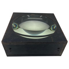
Large European 1930's Nautical Map Reader Magnifying Glass
Located in Haddonfield, NJ
This European set of two nautical magnifying glass map-readers are quite unusual and rarely found
Category
1930s German Industrial Nautical Vintage Maps
Materials
Metal
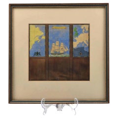
Watercolour Drawing by Kenneth Stevens MacIntire of a Nautical Map
By Kenneth Stevens MacIntire
Located in Norwich, GB
A watercolour drawing of a three-fold screen design, depicting a nautical map of the Atlantic
Category
20th Century American American Classical Nautical Vintage Maps
Materials
Paper
Map Nautical Glass Flush Mount
Located in Douglas Manor, NY
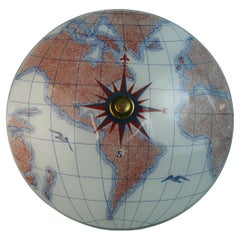
1428 Nautical glass 3 light flushmount
light red and blue color
Category
1970s Nautical Vintage Maps
Materials
Brass
Map Nautical Glass Flush Mount
Located in Douglas Manor, NY
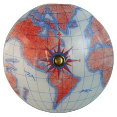
1429 Nautical flush mount with 3 light cluster
Red and blue colors
Category
1970s Nautical Vintage Maps
Materials
Art Glass
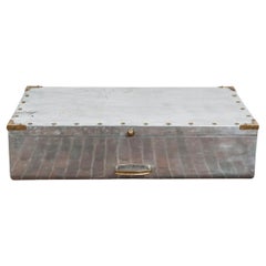
Metal Nautical Captains Trunk Aluminium & Brass Campaign Style
Located in BUSSUM, NH
. This piece was used to store maps and nautical equipment.
Beautiful patina and brass fittings
Category
1950s Nautical Vintage Maps
Materials
Aluminum, Brass
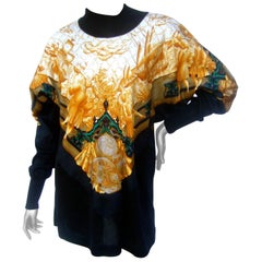
Hermes Paris Silk 18th Century Style Nautical Exploration Blouse cira 1990s
By Hermès
Located in University City, MO
. Concealed within the golden silk
graphics are nautical instruments with longitude and latitude
chart maps
Category
Late 20th Century French Nautical Vintage Maps
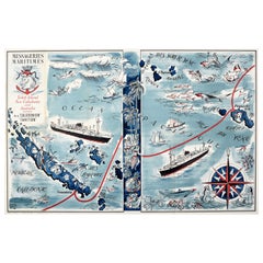
Original Vintage Advertising Poster Tahiti New Caledonia Illustrated Route Map
By Hervé Baille
Located in London, GB
Caledonia and Australia service m.s. Caledonien Tahitien. Fantastic illustrated map design by Herve Baille
Category
1950s French Nautical Vintage Maps
Materials
Paper
H 22.84 in W 35.04 in D 0.04 in
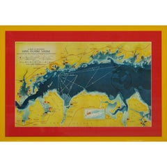
A Map Of Western Long Island Sound Showing Yacht Clubs, Aids To Navigation...
Located in Bristol, CT
Classic color map/ nautical chart (by Nolf Klep '39) of the North Shore of Long Island Sound
for
Category
1930s Nautical Vintage Maps
Materials
Paper
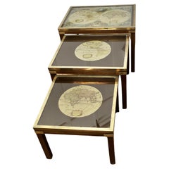
Mid-century Maison Jansen Campaign Style Large Nest of 3 Tables
Located in Chillerton, Isle of Wight
have brass trim with brass banding to the Legs and early world maps on glass
These are Classic English
Category
Mid-20th Century Campaign Nautical Vintage Maps
Materials
Glass
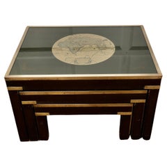
Mid-century Maison Jansen Campaign Style Nest of 3 Tables
Located in Chillerton, Isle of Wight
brass trim with brass inlay to the Legs and early world maps on black glass
These are Classic English
Category
Mid-20th Century Campaign Nautical Vintage Maps
Materials
Glass
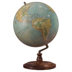
Philips 14 Inch Globe, circa 1940
By Philips
Located in London, GB
indicates all the principal shipping routes with distances in nautical miles and the principal railways. A
Category
1940s British Nautical Vintage Maps
Materials
Gesso, Wood, Paper
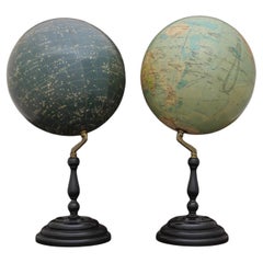
Pair of Philip & Son Globes, circa 1946
By George Philip & Son
Located in London, GB
and also indicates all the principal steamship routes with distances in nautical miles. The globe also
Category
1940s British Nautical Vintage Maps
Materials
Brass
“Circumventing the Sun” Contemporary Abstract Metallic Gold Gestural Painting
Located in Houston, TX
with carbon, watercolor, or oil. He incorporated found letters, antique maps, and nautical charts to
Category
1990s Abstract Nautical Vintage Maps
Materials
Acrylic, Pigment
H 88.5 in W 66 in D 1.63 in
Original Vintage French Riviera Sport Poster, 3rd Powerboat Festival Cote d'Azur
By Jean-Adrien Mercier
Located in London, GB
-1995) depicting a map of the Cote d'Azur marking the host towns of Cannes and Monte Carlo in France
Category
1930s French Nautical Vintage Maps
Materials
Paper
H 31.3 in W 22.64 in D 0.04 in
Original Vintage Advertising Poster Tahiti New Caledonia Illustrated Route Map
By Hervé Baille
Located in London, GB
Caledonia and Australia service m.s. Caledonien Tahitien. Fantastic illustrated map design by Herve Baille
Category
1950s Nautical Vintage Maps
Materials
Paper
Original Vintage French Riviera Sport Poster 3rd Powerboat Festival Cote d'Azur
Located in London, GB
-1995) depicting a map of the Cote d'Azur marking the host towns of Cannes and Monte Carlo in France
Category
1930s Nautical Vintage Maps
Materials
Paper
People Also Browsed
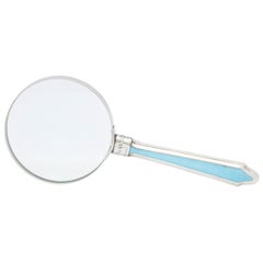
Edwardian Sterling Silver and Blue Guilloche Enamel-Mounted Magnifying Glass
By George Hope
Located in New York, NY
Large, Edwardian, sterling silver and blue guilloche enamel-mounted magnifying glass, Birmingham, England, 1906, Geo. Hope - maker. Measures almost 9 inches long x 3 3/4 inches diame...
Category
Early 1900s English Edwardian Nautical Vintage Maps
Materials
Metal, Sterling Silver, Enamel
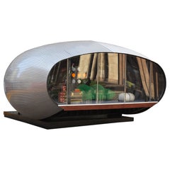
1972, Prefab Nova House by Studio Rochel
By Societé anonyme francaise
Located in Perpignan, FR
Designed in 1972 by architects Michel Hudrisier and M. Roma for Studio Rochel, the Nova House came to fulfill the fantasy of those dreaming of living in space. While that type of arc...
Category
1970s French Space Age Nautical Vintage Maps
Materials
Metal, Aluminum
Early 20th Century Georgian Mahogany Tripod Pedestal Plant Stand Brass Paw Feet
Located in Germantown, MD
An Early 20th Century Georgian Mahogany Tripod Pedestal Plant Stand with Brass Paw Feet in good condition.
Measures 14.5" in diameter and stands 41" tall.
Category
Early 20th Century American Georgian Nautical Vintage Maps
Materials
Brass
H 41 in W 14.5 in D 14.5 in
Handsome Letter Opener, Magnifying Glass with Alligator Handles, Sterling Mounts
Located in Buchanan, MI
Handsome letter opener, magnifying glass with alligator handles, sterling mounts.
Category
Early 20th Century European Nautical Vintage Maps
Materials
Silver, Stainless Steel
H 10 in W 4 in D 0.5 in
Hand painted Tichelaar Makkum Dutch plates, Set of 4. Various sizes
By Royal Tichelaar Makkum
Located in AMSTERDAM, NH
A collection of two scalloped plates, one bowl and one small saucer with polychrome painted tulips and flowers in tones of red; yellow; green and blue. The plate with a bird on larg...
Category
Late 20th Century Dutch Other Nautical Vintage Maps
Materials
Ceramic
Azucena 1960 Nautical Italian Mid Century Flush Ceiling Light
By Azucena
Located in New York, NY
A 1960s Italian nautical style ceiling light in polished brass with a white glass shade. Rewired. Made by Azucena.
Category
1960s Italian Mid-Century Modern Nautical Vintage Maps
Materials
Brass
Christo and Jeanne-Claude and Christo Signed in Christo in Crayon Lithograph
By Christo and Jeanne-Claude
Located in Chicago, IL
Christo and Jeanne-Claude and Christo Signed in Christo in Crayon Lithograph: This work shows conceptual project; over the river is a two-week temporary work of art by the artists Ch...
Category
1990s North American Organic Modern Nautical Vintage Maps
Materials
Paper
H 42.5 in W 34 in D 1.25 in
18th Century mahogany and brass telescope by Nairne & Blunt of London
Located in Martlesham, GB
18th Century mahogany and brass telescope by Nairne & Blunt of London, having a mahogany barrel with a thumb wheel to the side of the main barrel, supported on a solid brass tripod s...
Category
1780s British Georgian Nautical Vintage Maps
Materials
Mahogany
Original Vintage Travel Poster Oxford University British Railways Fred Taylor
By Fred Taylor
Located in London, GB
Original vintage railway poster published by British Railways - Oxford Travel by Train - featuring artwork by Fred Taylor (1875-1963) depicting an aerial map view of the city of Oxfo...
Category
1950s British Nautical Vintage Maps
Materials
Paper
H 40.16 in W 50.01 in D 0.04 in
Vintage Map of Paris "Plan De Paris A Vol. D'Oiseau" by Blondel la Rougery, 1959
Located in Philadelphia, PA
Vintage Map Of Paris
"Plan De Paris A Vol. D'Oiseau"
Blondel la Rougery
1959
Map Size: 26 1/4" tall x 37 3/4" wide
Overall Size: 29" tall x 40" wide
edges are distressed / some wa...
Category
1950s French Mid-Century Modern Nautical Vintage Maps
Materials
Linen, Paper
H 29 in W 40 in D 0.07 in
1955 "Quaternary: Ice-Age Landscape" Woolly Mammoth Vintage Wall Hanging
Located in Colorado Springs, CO
Presented is an original, hanging wall chart from the 1955 “History of Life on Earth” series by Austrian paleontologist Erich Thenius and illustrator Fritz Zerritsch. The series cons...
Category
1950s Austrian Mid-Century Modern Nautical Vintage Maps
Materials
Metal
Large French Paris Metro Map 1960s
Located in North Hollywood, CA
Large French Paris Metro Map 1960s.
A large Vintage French framed map of the Parisian Metro from the mid-20th century.
Featuring a Paris metro map from the midcentury period showing ...
Category
Mid-20th Century French Industrial Nautical Vintage Maps
Materials
Wood, Paper
Rare 19th Century Nautical Desk Set with Historic Monogram
Located in London, GB
A rare nautical desk set
The lockable oak felt-lined case, embossed with the initials 'AL' of the original owner, houses twelve writing implements and accessories, constructed in ...
Category
Late 19th Century English Nautical Vintage Maps
Materials
Silver Plate, Metal
Red Ceramic Wall Light Flush Mount, Denmark, 1970
By OTHR
Located in Rijssen, NL
Spectacular circular ceramic wall light, with beautiful red accents. Manufactured in Denmark in the 1970s.
Labelled by Løvemose, in excellent condition. Løvemose was a pottery in t...
Category
1970s Danish Space Age Nautical Vintage Maps
Materials
Ceramic
Antique American Mother-of-Pearl and Silver Overlay Magnifying Glass
Located in New York, NY
Antique magnifying glass, circa 1900. Tapering mother-of-pearl handle overlaid with silver scrollwork. Circular lens in metal frame. Handle marked "sterling".
Category
Early 20th Century American Victorian Nautical Vintage Maps
Materials
Silver
1990 Triple Perspective Planet Earth Map Framed Poster
Located in New York, NY
This decorative poster features a map of the Earth with a unique triple perspective view. It is enclosed in a black plastic frame, and the glass covering the poster is still intact. ...
Category
1990s American Nautical Vintage Maps
Materials
Glass, Plastic, Paper
Recent Sales
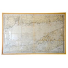
Framed Vintage Nautical Map of Long Island Sound
Located in Houston, TX
Great framed vintage nautical map of Long Island Sound, would look great in a Hamptons Home
Category
20th Century American Nautical Vintage Maps
Materials
Wood
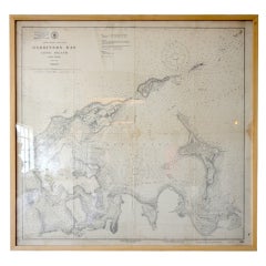
Framed Vintage Nautical Map of Gardiners Bay Long Island
Located in Houston, TX
Great framed vintage nautical map of Gardiners Bay Long Island, would look great in a Hamptons Home
Category
20th Century American Nautical Vintage Maps
1960s Set of Six Long Island Tidal Current Charts or Maps
Located in Culver City, CA
This set of six charts are aesthetically great and intriguing for their geographic, nautical and
Category
1960s American Mid-Century Modern Nautical Vintage Maps
Materials
Linen, Paper, Plexiglass, Wood
Swedish Nautical Charts of the Stockholm from 1970s
Located in Singapore, SG
Original vintage nautical charts. Aesthetically great and intriguing for their geographic, nautical
Category
Mid-20th Century Swedish Scandinavian Modern Nautical Vintage Maps
Maritime Still Life with Maps, Charts and a Telescope
By Charles Cerny
Located in New York, NY
Original nautical still life etching pencil-signed by the artist Charles Cerny. Cerny was a Czech
Category
1950s Realist Nautical Vintage Maps
Materials
Lithograph
Framed Nautical Chart of Provincetown Harbor, 1935
Located in New York, NY
This nautical chart of Provincetown Harbor was created circa 1935 and depicts the coasts of Cape
Category
1930s American Nautical Vintage Maps
Materials
Paper
SAILBOATS
By Kerry Hallam
Located in Aventura, FL
Original acrylic painting on nautical map. Hand signed by the artist. Frame size approx 24 x 44
Category
Late 20th Century Impressionist Nautical Vintage Maps
Materials
Acrylic, Paper
Whimsical Decorative Map of Nantucket by Jack Atherton, 1937
Located in Nantucket, MA
A wonderful vintage pictorial map of Nantucket Island, by Jack Atherton, 1937, simple and whimsical
Category
1930s American Modern Nautical Vintage Maps
Materials
Paper
American Neptune Chart of Nantucket
Located in Norwell, MA
Framed map showing Nantucket Island with major ponts noted. Printed mileage legend on bottom. Also
Category
20th Century Nautical Vintage Maps
Map Flushmount
Located in Douglas Manor, NY
1-2562a Map flushmount
3 internal 60 watt edison base bulbs
keyword search sconces lighting
Category
1960s Nautical Vintage Maps
Materials
Glass
Compass Map Flushmount
Located in Douglas Manor, NY
1-2367 Compass map flushmount 3 internal lites
Good for nautical decor
Category
1950s Nautical Vintage Maps
Materials
Glass
Compass Map Flushmount
Located in Douglas Manor, NY
1-2365b Compass flushmpunt
Great for nautical decor
Category
1950s Nautical Vintage Maps
Materials
Glass
World map flushmount(others available)
Located in Douglas Manor, NY
#1-2422 Compass world map flushmount
suitable for nautical decor
Others available
Category
1950s Nautical Vintage Maps
Materials
Glass
Glass map flushmount(others available)
Located in Douglas Manor, NY
1-2524 Glass flushmount of world
Ideal for nautical motiffe
Others available
3
Category
1950s Nautical Vintage Maps
Materials
Brass
World map flushmount(other designs available)
Located in Douglas Manor, NY
#1-2264 World map with compass directions.
Great for nautical decor
Category
1950s Nautical Vintage Maps
Materials
Glass
Compass Map Flush Mount Two available
Located in Douglas Manor, NY
#1-2031ab compass flushmount
Great for nautical decor
Priced individually
Category
1950s Nautical Vintage Maps
Materials
Glass
Map Glass Flush Mount(other colors available)
Located in Douglas Manor, NY
#1-2534 A satin glass map nautical flush mount.
3 60 watt candelabra base bulbs
Category
1950s Nautical Vintage Maps
Materials
Brass
Geographia 10 Inch Globe, circa 1955
By Geographia, Ltd.
Located in London, GB
steamship routes, with distances in nautical miles. A cartouche is present that includes the title and
Category
1950s British Nautical Vintage Maps
Materials
Chrome
Vintage Cushions, British Bespoke Made Silk Pillow ‘Tartaria', Made in UK
Located in London, GB
vintage silks
Front side is an original rare silk featuring superb graphic images of the map of northern
Category
1970s British Organic Modern Nautical Vintage Maps
Materials
Silk
H 22.84 in W 22.84 in D 9.85 in
1934 "12 Inch Library Globe" by Replogle, Inc.
By Replogle Globes
Located in Colorado Springs, CO
lines, caravan routes, submarine cables, steamship routes (with small boats), and distances in nautical
Category
1930s American Modern Nautical Vintage Maps
Materials
Bronze
Mario Ceroli La Rosa dei Venti Table in Pinewood with Inlays by Poltronova 1970s
By Poltronova, Mario Ceroli
Located in Montecatini Terme, IT
can be found on a compass, map, nautical chart, or also a monument used to display the orientation of
Category
1970s Italian Mid-Century Modern Nautical Vintage Maps
Materials
Pine
H 28.75 in Dm 64.57 in
Rare Vintage Gucci Nautical ' Maps + Compass ' Silk Pant Set Jumpsuit
By Gucci
Located in San Diego, CA
Important, and extremely rare late 1970s, early 1980s Gucci nautical pant set! Features silk
Category
1980s Italian Nautical Vintage Maps
1998 Hermès Au-dela des cinq Mers Silk Scarf by Laurence Bourthoumieux
By Hermès
Located in Portland, OR
mermaid and nautical maps. This scarf is one of many we acquired when we purchased an estate of high end
Category
1990s French Nautical Vintage Maps
Mid Century World Map Nautical Flushmount
Located in Douglas Manor, NY
1-3042a Map flushmount
Takes 3 75 watt max Edison bulbs.
See 1-3020 map flushmount with blue colors
Category
1960s Nautical Vintage Maps
Compass Nautical Flush Mount
Located in Douglas Manor, NY
1372 Nautical compass world map flush mount
Takes 3 Edison based 60 watt bulbs
Rewired
Category
1960s Nautical Vintage Maps
Materials
Glass
Compass Nautical Flush Mount #1
Located in Douglas Manor, NY
1-3018 nautical compass world map flush mount.
Take 3 Edison based 60 watt bulbs.
Other colors
Category
1960s Nautical Vintage Maps
Compass Nautical Flush Mount #2(2 available)
Located in Douglas Manor, NY
1-3019, compass nautical world map flush mount.
Takes three 60 watt Edison bade bulbs
See last
Category
1960s Nautical Vintage Maps
Cees Braakman Style Copper Map Coffee Table
By Cees Braakman
Located in Los Angeles, CA
Mid-Century black enamel framed large coffee table with Copper Etched Top of Detailed Nautical
Category
1960s Dutch Mid-Century Modern Nautical Vintage Maps
Materials
Metal, Copper
Vintage Nautical Map of the Mediterranean
Located in West Hollywood, CA
Vintage hand drawn nautical map chart tracing the routes and stops of the USS John W. Weeks while
Category
20th Century Unknown Nautical Vintage Maps
Materials
Wood
Folk Art Sailfish
Located in West Palm Beach, FL
Fantastic folk art sailfish decoupaged in old maps, with aluminum fin.
Category
1970s American Folk Art Nautical Vintage Maps
large framed world map
Located in Los Angeles, CA
vintage framed philips new commerical map of the world, nautical cylindrical map projection, 1958
Category
20th Century American Nautical Vintage Maps
Materials
Wood
Map Chest of Drawers
Located in Hudson, NY
accented with blue.Hand-made rope handles complete the nautical motif.Maps are perfectly matched on each.
Category
1950s American Nautical Vintage Maps
Materials
Mahogany
Bielecky Bros Rattan Chaise Lounge
By Bielecky Brothers
Located in New York City, NY
are newly upholstered in a nautical map print.
Category
1970s Mid-Century Modern Nautical Vintage Maps
Materials
Rattan
Rare Adjustable Brass Sconce from a Yacht, Germany, 1950s
Located in Berlin, DE
This brass sconce was made for reading maps on a yacht. It reminds of the nautical equipment of
Category
Mid-20th Century German Arts and Crafts Nautical Vintage Maps
Materials
Aluminum, Brass
Get Updated with New Arrivals
Save "Nautical Vintage Maps", and we’ll notify you when there are new listings in this category.
Nautical Vintage Maps For Sale on 1stDibs
At 1stDibs, there are several options of nautical vintage maps available for sale. Frequently made of paper, metal and wood, all nautical vintage maps available were constructed with great care. Nautical vintage maps have been produced for many years, with earlier versions available from the 20th Century and newer variations made as recently as the 20th Century. Nautical vintage maps made by industrial designers — as well as those associated with neoclassical — are very popular at 1stDibs. Herve Baille, Geographia, Ltd. and Jean-Adrien Mercier each produced beautiful nautical vintage maps that are worth considering.
How Much are Nautical Vintage Maps?
Nautical vintage maps can differ in price owing to various characteristics — the average selling price at 1stDibs is $1,541, while the lowest priced sells for $396 and the highest can go for as much as $6,650.
More Ways To Browse
Gucci Jumpsuits
Hermes Sailing
Cape Cod Vintage Map
Antique Map Of Massachusetts
Wall Sconces Movable Arm
Boat Primitive
Vintage Water Ski
Antique Map Stars
Colla Wood
Antique Boat Compass
Vintage Map Holder
Linen Map Italy
Vintage Bartholomew Maps
Vintage Pocket Compass
Vintage Bartholomews Maps
Map Of Cape Cod
Vintage Aberdeenshire
Cape Cod Map
