Captain Greenvile Collins
to
1
5
1
6
6
5
5
5
5
6
6
6
6
8,701
3,917
2,534
2,229
Creator: Captain Greenvile Collins
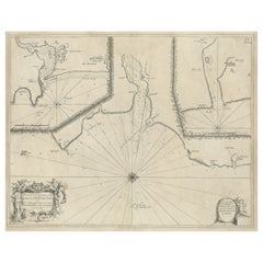
Antique Chart of Dundee, Aberdeen and Montrose in Scotland, C.1774
By Captain Greenvile Collins
Located in Langweer, NL
Antique map titled 'To the Honble the Magistrates of the Citty of Aberdeene'. Sea chart of Tay Estuary depictinging Dundee, with two further inset charts of Aberdeen and Montrose, wi...
Category
18th Century Antique Captain Greenvile Collins
Materials
Paper
$259 Sale Price
20% Off
Flanders, Holland & Norfolk: Hand-Colored 17th Century Sea Chart by Collins
By Captain Greenvile Collins
Located in Alamo, CA
This hand-colored chart of the seas about Flanders, Holland, Frisia, and Norfolk is from "Great Britain's Coasting Pilot. Being a New and Exact Survey of the Sea-Coast of England" by...
Category
Late 17th Century English Antique Captain Greenvile Collins
Materials
Paper
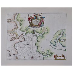
Plymouth, England: A Hand-Colored 17th Century Sea Chart by Captain Collins
By Captain Greenvile Collins
Located in Alamo, CA
This hand-colored sea chart of the area around Plymouth, England from "Great Britain's Coasting Pilot. Being a New and Exact Survey of the Sea-Coast of England", first published in 1...
Category
Late 17th Century English Antique Captain Greenvile Collins
Materials
Paper
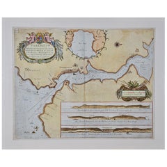
Dartmouth, England: A Hand-Colored 17th Century Sea Chart by Captain Collins
By Captain Greenvile Collins
Located in Alamo, CA
This hand-colored sea chart of the area around Dartmouth, England is from "Great Britain's Coasting Pilot. Being a New and Exact Survey of the Sea-Coast of England", first published ...
Category
Late 17th Century English Antique Captain Greenvile Collins
Materials
Paper
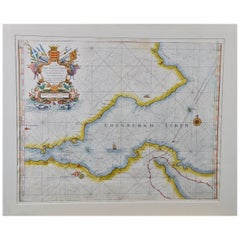
Edinburgh, Scotland Coast: A 17th Century Hand-Colored Sea Chart by Collins
By Captain Greenvile Collins
Located in Alamo, CA
This hand-colored sea chart is entitled "Edinburgh Firth" from "Great Britain's Coasting Pilot. Being a New and Exact Survey of the Sea-Coast of England" by Captain Greenville Collin...
Category
Late 17th Century English Antique Captain Greenvile Collins
Materials
Paper
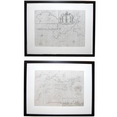
Handsome Pair of Framed Sea Charts by Captain Greenvile Collins
By Captain Greenvile Collins
Located in San Francisco, CA
A handsome pair of framed sea charts of the coasts of Great Britain by Captain Greenvile Collins; with later mattes and ebonized wooden frames.
Category
Late 18th Century English Antique Captain Greenvile Collins
Related Items
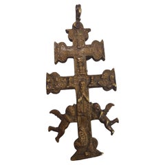
Cross of Caravaca 17th Century
Located in Madrid, ES
Cross of caravaca XVII century.
Very beautiful cross of caravaca made in bronze. 17th Century. Measurements: 14X6 cm.
Good condition.
Category
17th Century Italian Gothic Antique Captain Greenvile Collins
Materials
Bronze
Antique Map of Principality of Monaco
By Antonio Vallardi Editore
Located in Alessandria, Piemonte
ST/619 - "Old Geographical Atlas of Italy - Topographic map of ex-Principality of Monaco" -
ediz Vallardi - Milano -
A somewhat special edition ---
Category
Late 19th Century Italian Other Antique Captain Greenvile Collins
Materials
Paper
Cross of Caravaca 17th Century
Located in Madrid, ES
Cross of caravaca xvii century
Very beautiful cross of Caravaca made in bronze. 17th century. Measurements: 12 x 6cm
Good condition.
Category
17th Century Italian Gothic Antique Captain Greenvile Collins
Materials
Bronze
17th Century Brass Alms Plate
Located in San Francisco, CA
A 17th century or earlier brass alms dish or alms plate.
Category
17th Century European Antique Captain Greenvile Collins
Materials
Brass
CROSS OF CARAVACA 17th CENTURY
Located in Madrid, ES
CROSS OF CARAVACA XVII CENTURY
BEAUTIFUL CARAVACA CROSS FROM THE 17TH CENTURY IN BRONZE. MEASURES: 12.5X5.5 CM. IN GOOD CONDITION
good condition
Category
17th Century Italian Gothic Antique Captain Greenvile Collins
Materials
Bronze
Original Antique Map of Ancient Greece, Achaia, Corinth, 1786
Located in St Annes, Lancashire
Great map of Ancient Greece. Showing the region of Thessaly, including Mount Olympus
Drawn by J.D. Barbie Du Bocage
Copper plate engraving by P.F Tardieu
Original hand color...
Category
1780s French Other Antique Captain Greenvile Collins
Materials
Paper
Original Antique Print of A Colour Chart . C.1900
Located in St Annes, Lancashire
Great image of a colour chart
Unframed.
Chromo-lithograph
Published, C.1900
The measurement is the paper size of the print
Free shipping.
Category
Early 1900s English Folk Art Antique Captain Greenvile Collins
Materials
Paper
Antique Golf Portrait, Charlie Hunter of Prestwick, Photogravure
By Robert Cree Crawford
Located in Oxfordshire, GB
Charlie Hunter, golf club maker, Prestwick. Robert Cree Crawford,
A fine photogravure by Annan & Sons, after the painting by R.C. Crawford, of the famo...
Category
Early 1900s English Sporting Art Antique Captain Greenvile Collins
Materials
Paper
$1,163
H 28.55 in W 20.67 in D 1.19 in
Early 17th Century Sculpture
Located in Copenhagen, K
Amazing Baroque sculpture of a woman wearing a crown in original paint. Her hands are missing. Colors are untouched, recently cleaned off from a thick dark coating, I have images fro...
Category
Early 17th Century French Baroque Antique Captain Greenvile Collins
Materials
Oak
17th Century Sterling Silver Reliquary
Located in Madrid, ES
A refined and devotional 17th-century sterling silver reliquary featuring a delicate reverse glass painting of the Virgin Mary. This exqui...
Category
17th Century Baroque Antique Captain Greenvile Collins
Materials
Silver
Original Antique Print of Relics of Bonnie Prince Charlie. C.1880
Located in St Annes, Lancashire
Great image of relics belonging to Charles Edward Stuart, Bonnie Prince Charlie
Fine steel engraving by Charles Lawrie
Published by Blackie, Ed...
Category
1880s English Antique Captain Greenvile Collins
Materials
Paper
Buffon Natural History Pair of Framed Original 18thC Hand Colored Monkey Prints
Located in Fort Washington, MD
Fantastic pair of Ca. late 18thC. Hand Colored Monkey Prints Framed matted and sealed under glass.
They have information on the back but I don’t read French
Category
Late 18th Century French Chinoiserie Antique Captain Greenvile Collins
Materials
Paper
$712 Sale Price / set
25% Off
H 26 in W 1 in D 18.75 in
Captain Greenvile Collins furniture for sale on 1stDibs.
Captain Greenvile Collins furniture are available for sale on 1stDibs. These distinctive items are frequently made of paper and are designed with extraordinary care. There are many options to choose from in our collection of Captain Greenvile Collins furniture, although gray editions of this piece are particularly popular. If you’re looking for additional options, many customers also consider furniture by John Speed, Eleazar Albin, and Arnoldus Montanus. Prices for Captain Greenvile Collins furniture can differ depending upon size, time period and other attributes — on 1stDibs, these items begin at $291 and can go as high as $3,875, while a piece like these, on average, fetch $2,775.
