Captain Greenvile Collins Maps
5
to
4
1
5
5
5
5
5
4
4
4
6
106
63
28
26
Creator: Captain Greenvile Collins
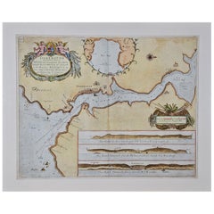
Dartmouth, England: A Hand-Colored 17th Century Sea Chart by Captain Collins
By Captain Greenvile Collins
Located in Alamo, CA
This hand-colored sea chart of the area around Dartmouth, England is from "Great Britain's Coasting Pilot. Being a New and Exact Survey of the Sea-Coast of England", first published ...
Category
Late 17th Century English Antique Captain Greenvile Collins Maps
Materials
Paper
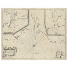
Antique Chart of Dundee, Aberdeen and Montrose in Scotland, C.1774
By Captain Greenvile Collins
Located in Langweer, NL
Antique map titled 'To the Honble the Magistrates of the Citty of Aberdeene'. Sea chart of Tay Estuary depictinging Dundee, with two further inset charts of Aberdeen and Montrose, wi...
Category
18th Century Antique Captain Greenvile Collins Maps
Materials
Paper
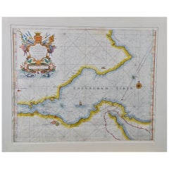
Edinburgh, Scotland Coast: A 17th Century Hand-Colored Sea Chart by Collins
By Captain Greenvile Collins
Located in Alamo, CA
This hand-colored sea chart is entitled "Edinburgh Firth" from "Great Britain's Coasting Pilot. Being a New and Exact Survey of the Sea-Coast of England" by Captain Greenville Collin...
Category
Late 17th Century English Antique Captain Greenvile Collins Maps
Materials
Paper
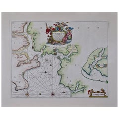
Plymouth, England: A Hand-Colored 17th Century Sea Chart by Captain Collins
By Captain Greenvile Collins
Located in Alamo, CA
This hand-colored sea chart of the area around Plymouth, England from "Great Britain's Coasting Pilot. Being a New and Exact Survey of the Sea-Coast of England", first published in 1...
Category
Late 17th Century English Antique Captain Greenvile Collins Maps
Materials
Paper
Flanders, Holland & Norfolk: Hand-Colored 17th Century Sea Chart by Collins
By Captain Greenvile Collins
Located in Alamo, CA
This hand-colored chart of the seas about Flanders, Holland, Frisia, and Norfolk is from "Great Britain's Coasting Pilot. Being a New and Exact Survey of the Sea-Coast of England" by...
Category
Late 17th Century English Antique Captain Greenvile Collins Maps
Materials
Paper
Related Items
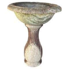
French 17th Century Baptismal Font
Located in Atlanta, GA
A very beautiful 17th century Baptismal Font from the South of France beautifully carved from marble. Minimalist lines give this piece a calming feel. Wil...
Category
17th Century French Antique Captain Greenvile Collins Maps
Materials
Marble
Cross of Caravaca 17th Century
By Europa Antiques
Located in Madrid, ES
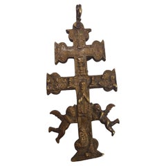
Cross of caravaca XVII century.
Very beautiful cross of caravaca made in bronze. 17th Century. Measurements: 14X6 cm.
Good condition.
Category
17th Century Italian Gothic Antique Captain Greenvile Collins Maps
Materials
Bronze
17th Century Embroidered King David With Harp Silk Tread Green Velvet Flanders
Located in Antwerpen, BE
Step into the rich tapestry of the 17th century with our exquisite embroidered picture featuring King David With Harp. Meticulously crafted with silk thread, mounted on luscious gree...
Category
17th Century Belgian Gothic Antique Captain Greenvile Collins Maps
Materials
Silk, Velvet
H 23.82 in W 11.42 in D 0.79 in
Cross of Caravaca 17th Century
By Europa Antiques
Located in Madrid, ES
Cross of caravaca xvii century
Very beautiful cross of Caravaca made in bronze. 17th century. Measurements: 12 x 6cm
Good condition.
Category
17th Century Italian Gothic Antique Captain Greenvile Collins Maps
Materials
Bronze
Original Antique Map of India. C.1780
Located in St Annes, Lancashire
Great map of India
Copper-plate engraving
Published C.1780
Three small worm holes to right side of map and one bottom left corner
Unframed.
Category
Early 1800s English Georgian Antique Captain Greenvile Collins Maps
Materials
Paper
17th-18th Century Italian Hand carved Wooden Reliquary Bust of a Saint
Located in Buisson, FR
Spectacular and very decorative piece. Large carved wooden reliquary bust of a Saint. Beautiful weathered paint and gilding. Small losses / old repairs and without the relics. Italy ...
Category
18th Century Italian Baroque Antique Captain Greenvile Collins Maps
Materials
Wood
H 18.51 in W 11.42 in D 6.3 in
Original Antique Map of Italy. C.1780
Located in St Annes, Lancashire
Great map of Italy
Copper-plate engraving
Published C.1780
Unframed.
Category
Early 1800s English Georgian Antique Captain Greenvile Collins Maps
Materials
Paper
Original Antique Map of Asia. C.1780
Located in St Annes, Lancashire
Great map of Asia
Copper-plate engraving
Published C.1780
Two small worm holes to right side of map
Unframed.
Category
Early 1800s English Georgian Antique Captain Greenvile Collins Maps
Materials
Paper
Cross of Caravaca 17th Century
By Europa Antiques
Located in Madrid, ES
Cross of caravaca XVII century.
Very beautiful cross of caravaca made in bronze. 17th Century. Measurements: 15x6 cm.
Good condition.
Category
17th Century Italian Gothic Antique Captain Greenvile Collins Maps
Materials
Bronze
17th-18th Century Italian Hand Carved Wooden Reliquary Bust
Located in Buisson, FR
Spectacular and very decorative piece. Carved wooden reliquary bust representing a Saint figure. Beautiful traces of its original silver and gilding. Weathered, small losses and with...
Category
17th Century Italian Baroque Antique Captain Greenvile Collins Maps
Materials
Wood
Original Antique Map of Spain and Portugal, circa 1790
Located in St Annes, Lancashire
Super map of Spain and Portugal
Copper plate engraving by A. Bell
Published, circa 1790.
Unframed.
Category
1790s English Other Antique Captain Greenvile Collins Maps
Materials
Paper
Antique Anatomical Wall Chart Depicting the Human Skeleton
Located in Berghuelen, DE
A rare 19th century anatomical wall chart depicting the human skeleton. On the sides On the sides are detailed description in German language. The wall...
Category
Early 20th Century German Victorian Captain Greenvile Collins Maps
Materials
Paper
Captain Greenvile Collins maps for sale on 1stDibs.
Captain Greenvile Collins maps are available for sale on 1stDibs. These distinctive items are frequently made of paper and are designed with extraordinary care. There are many options to choose from in our collection of Captain Greenvile Collins maps, although gray editions of this piece are particularly popular. If you’re looking for additional options, many customers also consider maps by John Speed, John Ogilby, and John Cary. Prices for Captain Greenvile Collins maps can differ depending upon size, time period and other attributes — on 1stDibs, these items begin at $291 and can go as high as $2,775, while a piece like these, on average, fetch $2,775.
