John Cary Maps
British, 1755-1835
John Cary was an English cartographer. He was born in February of 1755 and died in August of 1835. His career started with his apprenticeship in London, and he opened up his own shop in the Strand in 1783. His atlas New and Correct English Atlas became the standard reference work in England. He was commissioned in 1794 by the Postmaster General to survey England's roads. Out of this commission, he published Cary's New Itinerary in 1798. He later produced Ordnance Survey maps before 1805. His business was eventually taken over by G.F. Cruchley.
9
to
2
9
9
9
9
2
1
1
8
8
1
1
1
5
5
3
6
107
63
29
26
Creator: John Cary
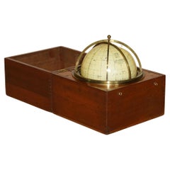
John Cary Travel Celestial Globe in Box Marked Cary & Co London, No. 21540
By John Cary
Located in GB
We are delighted to offer for sale this lovely John Cary Travel Celestial Globe in Box marked Cary & Co London, No. 21540
This globe I believe is classed as a 14 inch which is the...
Category
19th Century English Victorian Antique John Cary Maps
Materials
Brass
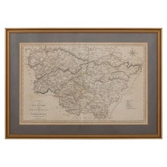
19th Century John Cary Map of South Part of West Riding of Yorkshire, circa 1805
By John Cary
Located in Royal Tunbridge Wells, Kent
Antique 19th century British original John Cary sr (1755-1835) map of South part of the West Riding of Yorkshire, From the beft Authorities. Engraved J Car...
Category
19th Century British Antique John Cary Maps
Materials
Paper
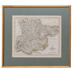
Essex John Cary 1787 Cary's New & Correct English Atlas 40cm 16" long gilt frame
By John Cary
Located in BUNGAY, SUFFOLK
Map of Essex by John Cary Engraver
London published as the act directs Sept 1st 1787 by J Cary Engraver Map & Printseller no 188 the corner of Arundel Str...
Category
18th Century English Georgian Antique John Cary Maps
Materials
Paper
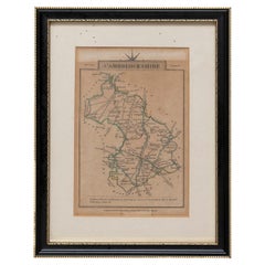
Cambridgeshire J Cary
By John Cary
Located in BUNGAY, SUFFOLK
Cambridgeshire published may 1 1814 engraver no 181 strand
Maker John Cary c. 1754 – 1835.
Category
19th Century English Georgian Antique John Cary Maps
Materials
Paper
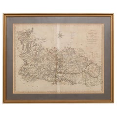
19th Century John Cary Map of North Part of West Riding of Yorkshire, C.1805
By John Cary
Located in Royal Tunbridge Wells, Kent
Antique 19th century British original John Cary sr (1755-1835) map of North part of the West Riding of Yorkshire, From the beft Authorities. Engraved J Car...
Category
19th Century British Antique John Cary Maps
Materials
Paper
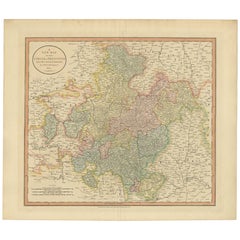
Antique Map of Franconia, a region of Germany, '1811'
By John Cary
Located in Langweer, NL
Antique map titled 'A New Map of the Circle of Franconia'. Detailed map of Franconia in Northwestern Germany. Covers from Upper Saxony south to Swabia, west to the Lower Rhine and we...
Category
Early 19th Century Antique John Cary Maps
Materials
Paper
Antique Map of the Swabia Region of Germany by Cary, '1811'
By John Cary
Located in Langweer, NL
Antique map titled 'A New Map of the Circle of Swabia'. Antique map of Swabia in Southwestern Germany. Covers from the Upper Rhine region south as far as Switzerland, Lake Constance ...
Category
Early 19th Century Antique John Cary Maps
Materials
Paper
Antique Map of Bavaria and Salzburg by Cary, 1811
By John Cary
Located in Langweer, NL
Antique map titled 'A New Map of the Circle of Bavaria'. Antique map of Bavaria and Salzburg, Germany. Covers the Duchy of Bavaria and the mountainous A...
Category
Early 19th Century Antique John Cary Maps
Materials
Paper
Antique Map of the Upper and Lower Rhine by Cary '1811'
By John Cary
Located in Langweer, NL
Antique map titled 'A New Map of the Circles of the Upper and Lower Rhine'. Antique map covering an area from Westphalia and Lower Saxony in the north to France and Swabia in the south.
Category
Early 19th Century Antique John Cary Maps
Materials
Paper
Related Items
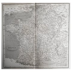
Original Antique Map of France, Arrowsmith, 1820
Located in St Annes, Lancashire
Great map of France
Drawn under the direction of Arrowsmith.
Copper-plate engraving.
Published by Longman, Hurst, Rees, Orme and Brown, 1820
Unframed.
Category
1820s English Antique John Cary Maps
Materials
Paper
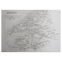
Original Antique Map of Ireland- Kerry. C.1840
Located in St Annes, Lancashire
Great map of Kerry
Steel engraving
Drawn under the direction of A.Adlard
Published by How and Parsons, C.1840
Unframed.
Category
1840s English Antique John Cary Maps
Materials
Paper
Original Antique Map of Russia By Arrowsmith. 1820
Located in St Annes, Lancashire
Great map of Russia
Drawn under the direction of Arrowsmith
Copper-plate engraving
Published by Longman, Hurst, Rees, Orme and Brown, 1820
Unframed.
Category
1820s English Antique John Cary Maps
Materials
Paper
Original Antique Map of Italy. Arrowsmith. 1820
Located in St Annes, Lancashire
Great map of Italy
Drawn under the direction of Arrowsmith
Copper-plate engraving
Published by Longman, Hurst, Rees, Orme and Brown, 1820
Unframed.
Category
1820s English Antique John Cary Maps
Materials
Paper
Original Antique Map of Canada, Arrowsmith, 1820
Located in St Annes, Lancashire
Great map of Canada.
Drawn under the direction of Arrowsmith.
Copper-plate engraving.
Published by Longman, Hurst, Rees, Orme and Brown, 1820
...
Category
1820s English Antique John Cary Maps
Materials
Paper
Antique Print of Horseheath Hall in Cambridgeshire, England, 1725
Located in Langweer, NL
Antique print titled 'General front of Horse heath Hall in Cambridgeshire (..)'.
Old engraving of Horseheath Hall, Cambridgeshire.
The original Hall was the home of the Alington family and was visited by Queen Elizabeth 1...
Category
18th Century Antique John Cary Maps
Materials
Paper
Original Antique Map of South Africa, Arrowsmith, 1820
Located in St Annes, Lancashire
Great map of South Africa.
Drawn under the direction of Arrowsmith.
Copper-plate engraving.
Published by Longman, Hurst, Rees, Orme and Br...
Category
1820s English Antique John Cary Maps
Materials
Paper
Original Antique Map of China, Arrowsmith, 1820
Located in St Annes, Lancashire
Great map of China
Drawn under the direction of Arrowsmith
Copper-plate engraving
Published by Longman, Hurst, Rees, Orme and Brown, 1820
Unfr...
Category
1820s English Antique John Cary Maps
Materials
Paper
Original Antique Map of South East Asia, Arrowsmith, 1820
Located in St Annes, Lancashire
Great map of South East Asia
Drawn under the direction of Arrowsmith
Copper-plate engraving
Published by Longman, Hurst, Rees, Orme and Brown, 1820
Unframed.
Category
1820s English Antique John Cary Maps
Materials
Paper
Antique Map of North and West Africa by J.B. Elwe, 1792
Located in Langweer, NL
Beautiful richly engraved map of North and West Africa, based upon the earlier maps of De L'Isle. Richly annotated throughout and with excellent regional detail. Too much detail to d...
Category
Late 19th Century Antique John Cary Maps
Materials
Paper
Fine Pair of Floor Globes by J & G Cary, Dated 1820 and 1833
By George & John Cary
Located in Lymington, Hampshire
A fine pair of 15 inch floor globes by J & G Cary, dated 1820 and 1833, each set into a mahogany stand with a vase shaped support and three legs centred on a compass, one with a labe...
Category
Early 19th Century English Regency Antique John Cary Maps
Materials
Mahogany
Original Antique Map of India. C.1780
Located in St Annes, Lancashire
Great map of India
Copper-plate engraving
Published C.1780
Three small worm holes to right side of map and one bottom left corner
Unframed.
Category
Early 1800s English Georgian Antique John Cary Maps
Materials
Paper
Previously Available Items
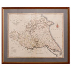
19th Century John Cary Map of the East Riding of Yorkshire, C.1800
By John Cary
Located in Royal Tunbridge Wells, Kent
Antique 19th century British original John Cary sr (1755-1835) map of the East Riding of Yorkshire, with ainsty liberty, From the beft Authorities. Engraved J Cary, mounted in solid ...
Category
19th Century British Antique John Cary Maps
Materials
Paper
Free Shipping
H 21.26 in W 25.99 in D 0.79 in
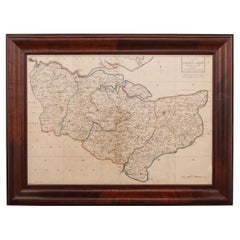
18th Century John Cary Map of Kent, c.1769
By John Cary
Located in Royal Tunbridge Wells, Kent
Antique 18th century British very rare and original John Cary sr (1755-1835) map of Kent, publication 1769, A Map of the County of Kent taken from an actua...
Category
18th Century British Antique John Cary Maps
Materials
Paper
John Cary maps for sale on 1stDibs.
John Cary maps are available for sale on 1stDibs. These distinctive items are frequently made of paper and are designed with extraordinary care. There are many options to choose from in our collection of John Cary maps, although beige editions of this piece are particularly popular. Many of the original maps by John Cary were created in the Georgian style in united kingdom during the 19th century. Prices for John Cary maps can differ depending upon size, time period and other attributes — on 1stDibs, these items begin at $176 and can go as high as $2,526, while a piece like these, on average, fetch $376.
