Items Similar to Cambridgeshire J Cary


Want more images or videos?
Request additional images or videos from the seller
1 of 6
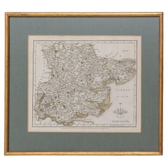
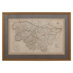
Cambridgeshire J Cary
About the Item
Cambridgeshire published may 1 1814 engraver no 181 strand
Maker John Cary c. 1754 – 1835.
- Creator:John Cary (Artist)
- Dimensions:Height: 8.67 in (22 cm)Width: 6.7 in (17 cm)Depth: 0.6 in (1.5 cm)
- Style:Georgian (Of the Period)
- Materials and Techniques:
- Place of Origin:
- Period:
- Date of Manufacture:1814
- Condition:Wear consistent with age and use.
- Seller Location:BUNGAY, GB
- Reference Number:1stDibs: LU3867332633732
About the Seller
5.0
Vetted Seller
These experienced sellers undergo a comprehensive evaluation by our team of in-house experts.
Established in 1985
1stDibs seller since 2018
84 sales on 1stDibs
Typical response time: 9 hours
- ShippingRetrieving quote...Ships From: BUNGAY, United Kingdom
- Return PolicyA return for this item may be initiated within 7 days of delivery.
More From This SellerView All
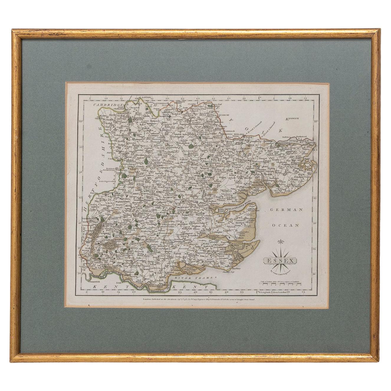
- Essex John Cary 1787 Cary's New & Correct English Atlas 40cm 16" long gilt frameBy John CaryLocated in BUNGAY, SUFFOLKMap of Essex by John Cary Engraver London published as the act directs Sept 1st 1787 by J Cary Engraver Map & Printseller no 188 the corner of Arundel Str...Category
Antique 18th Century English Georgian Maps
MaterialsPaper
- Map Lancashire 1793 John Cary engraver 37cm 14 1/2" highLocated in BUNGAY, SUFFOLKMap of Lancashire by John Cary engraver published 1st Jan 1793 by J Cary Engraver & Mapseller Strand in original black and gold classic map frameCategory
Antique 18th Century English Georgian Maps
MaterialsPaper
- Map Kyle Carrick Aireshire Thomas Kitchen 1749By Thomas KitchinLocated in BUNGAY, SUFFOLKA Map of Kyle & Carrick Aireshire Thomas Kitchen 1749 In original black and gold frame Just purchased more information to follow MAKER Thomas Kitchin (1718-1784) English engrave...Category
Antique 18th Century English Georgian Maps
MaterialsPaper
- Map Southern Scotland Thomas Conder Alex Hogg 1795Located in BUNGAY, SUFFOLKA new map of the southern part of Scotland containing the counties of Stirling, Lanerk, Renfrew, Linlithgow, Edinburgh, Peebles, Haddingtoun, Berwick, Selkirk, Roxburgh, Dumfries, Wigtoun, Kirkudbright & Air Published by Alex Hogg at the Kings Arms...Category
Antique 18th Century English Georgian Maps
MaterialsPaper
- Map Bedfordshire General FramedLocated in BUNGAY, SUFFOLKA general map of Bedfordshire with its hundreds A scale of 5 miles in the original green mount and traditional black and gold frame. Measures: 36cm 14" high.Category
Antique 18th Century English Georgian Maps
MaterialsPaper
- Map Bedfordshire No 3 General FramedLocated in BUNGAY, SUFFOLKA general map of Bedfordshire with its hundreds. Measure: 37cm 14 1/2" high A scale of 5 miles. in the original green mount and traditional black and gold frame. charming map with...Category
Antique 18th Century English Georgian Maps
MaterialsPaper


You May Also Like
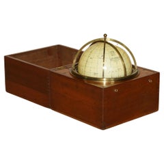
- John Cary Travel Celestial Globe in Box Marked Cary & Co London, No. 21540By John CaryLocated in GBWe are delighted to offer for sale this lovely John Cary Travel Celestial Globe in Box marked Cary & Co London, No. 21540 This globe I believe is classed as a 14 inch which is the...Category
Antique 19th Century English Victorian Scientific Instruments
MaterialsBrass
- Antique Map of Bavaria and Salzburg by Cary, 1811By John CaryLocated in Langweer, NLAntique map titled 'A New Map of the Circle of Bavaria'. Antique map of Bavaria and Salzburg, Germany. Covers the Duchy of Bavaria and the mountainous A...Category
Antique Early 19th Century Maps
MaterialsPaper
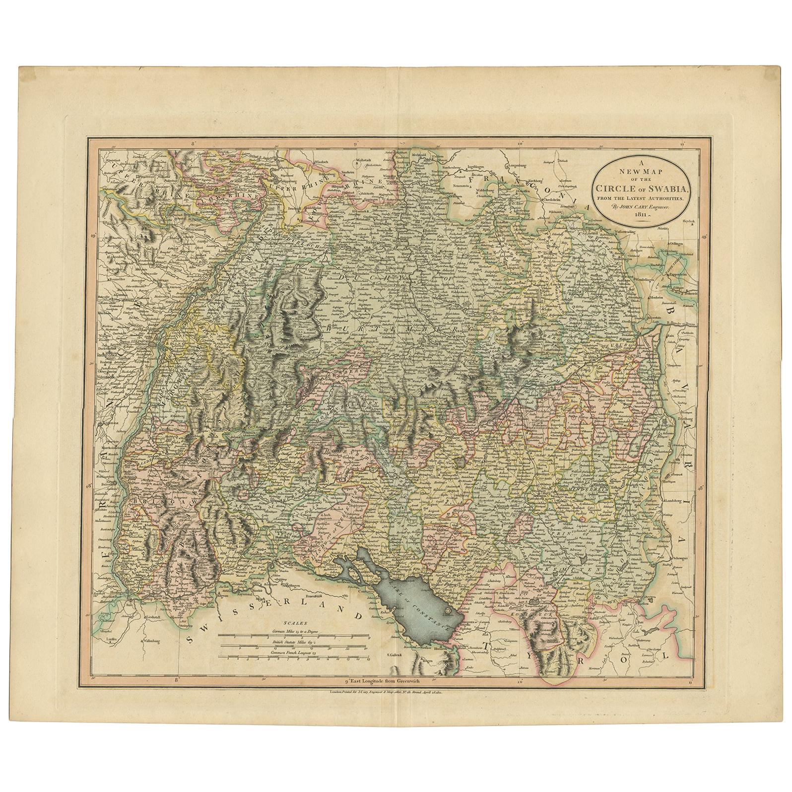
- Antique Map of the Swabia Region of Germany by Cary, '1811'By John CaryLocated in Langweer, NLAntique map titled 'A New Map of the Circle of Swabia'. Antique map of Swabia in Southwestern Germany. Covers from the Upper Rhine region south as far as Switzerland, Lake Constance ...Category
Antique Early 19th Century Maps
MaterialsPaper
- Antique Map of the Upper and Lower Rhine by Cary '1811'By John CaryLocated in Langweer, NLAntique map titled 'A New Map of the Circles of the Upper and Lower Rhine'. Antique map covering an area from Westphalia and Lower Saxony in the north to France and Swabia in the south.Category
Antique Early 19th Century Maps
MaterialsPaper
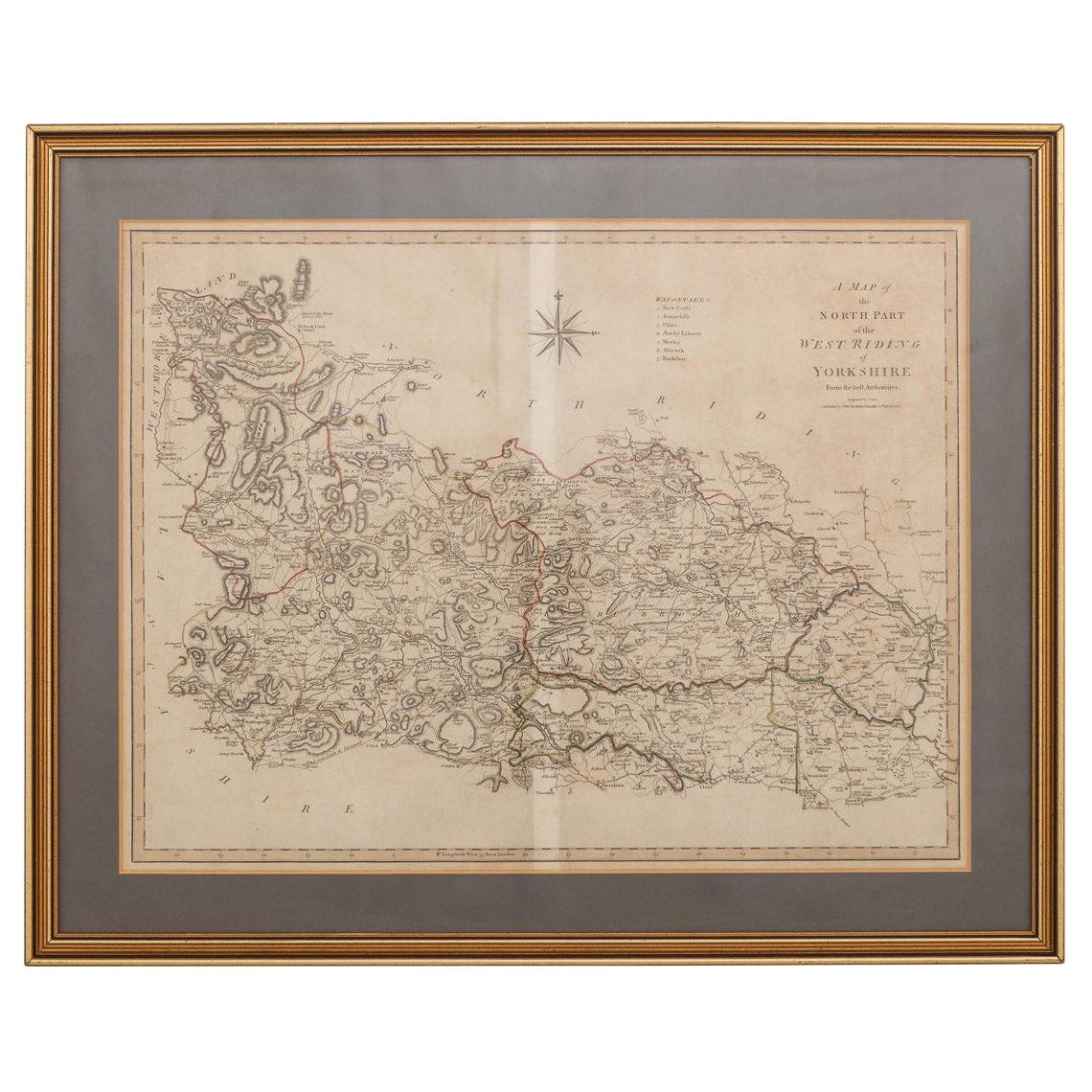
- 19th Century John Cary Map of North Part of West Riding of Yorkshire, C.1805By John CaryLocated in Royal Tunbridge Wells, KentAntique 19th century British original John Cary sr (1755-1835) map of North part of the West Riding of Yorkshire, From the beft Authorities. Engraved J Car...Category
Antique 19th Century British Maps
MaterialsPaper
- 19th Century John Cary Map of South Part of West Riding of Yorkshire, circa 1805By John CaryLocated in Royal Tunbridge Wells, KentAntique 19th century British original John Cary sr (1755-1835) map of South part of the West Riding of Yorkshire, From the beft Authorities. Engraved J Car...Category
Antique 19th Century British Maps
MaterialsPaper


Recently Viewed
View AllMore Ways To Browse
Antique Furniture Strand
Antique Georgia Maps
Georgia Map
Antique Georgia Map
Antique Cambridgeshire
Antique Furniture Cambridgeshire
Boston Map
Map Of Boston
Johnston James
Caribbean Antique Furniture
James Johnston
Large Map Of London
18th Century Antique Mexican
Caribbean Antiques
Victorian Compass
Hebrew Antique
Framed Atlas Map
Antique Collectors Australia