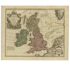
Antique Maps Of British Isles

3
to
15
60
2
41
32
17
15
9
7
6
4
4
4
4
3
3
3
2
2
2
2
2
2
1
1
1
1
1
1
1
1
1
2
1
1
1
Sort By
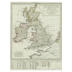
Antique Map of British Isles with Outline Hand Coloring
Located in Langweer, NL
Antique map titled 'Carte des Isles Britanniques et des Côtes qui les Avoisinent (..)'. Original
Category

Antique Early 19th Century Maps

Materials

Paper

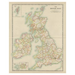
Antique Map of the British Isles by Johnston '1909'
Located in Langweer, NL
Antique map titled 'The British Isles'. Original antique map of the British Isles. With inset maps
Category

Early 20th Century Maps

Materials

Paper

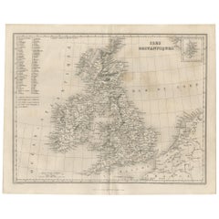
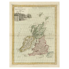
Antique Map of the British Isles by Balbi '1847'
Located in Langweer, NL
Antique map titled 'Iles Britanniques'. Original antique map of the British Isles. This map
Category

Antique Mid-19th Century Maps

Materials

Paper

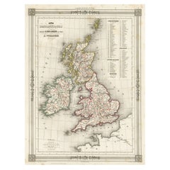
Antique Map of the British Isles with Outline Coloring
Located in Langweer, NL
Antique map titled 'Iles Britanniques'. Attractive map of the British Isles. Details England
Category

Antique Mid-19th Century Maps

Materials

Paper

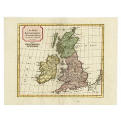
Antique Map of the British Isles by Delamarche, 1806
Located in Langweer, NL
Antique map titled 'Les Isles Britanniques.' Decorative map of the British Isles by Robert de
Category

Antique 19th Century Maps

Materials

Paper

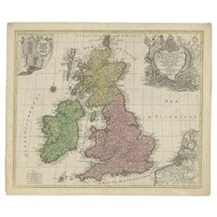
Antique Map of the British Isles by Lotter, 1764
Located in Langweer, NL
Antique map titled 'Le Grand Bretagne ou les Royaumes d'Angleterre et d'Ecosse'. Old engraved map
Category

Antique 18th Century Maps

Materials

Paper

Antique Map of the British Isles with Contemporary Hand Coloring
Located in Langweer, NL
Antique map titled 'Les Isles Britanniques'. Original antique map of the British Isles, with
Category

Antique Late 18th Century Maps

Materials

Paper

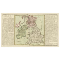
Original Antique Map of the British Isles Surrounded by Text
Located in Langweer, NL
Antique map titled 'Des Isles Britanniques'. Original antique map of the British isles. This map is
Category

Antique Late 18th Century Maps

Materials

Paper

Antique Map of the British Isles by Covens & Mortier, 1730
By Covens & Mortier
Located in Langweer, NL
Covens and Mortier's attractive double-page engraved map of the British Isles, based on the 1702 De
Category

Antique Mid-18th Century Maps

Materials

Paper

Antique Map of the British Isles by H. Chatelain, 1719
By Henri-Abraham Chatelain
Located in Langweer, NL
Beautiful hand colored large format map of the British Isles, with large insets of the Eastern and
Category

Antique Early 18th Century Maps

Materials

Paper

Antique Map of the Palaeontology of the British Isles by Johnston '1850'
Located in Langweer, NL
Antique map titled 'Palaeontological Map of the British Islands'. Original antique map showing the
Category

Antique Mid-19th Century Maps

Materials

Paper

Antique Map of the Ancient British Isles by Janssonius 'circa 1640'
Located in Langweer, NL
Antique map titled 'Insularum Britannicarum Acurata Delineatio'. Original antique map of the
Category

Antique Mid-17th Century Maps

Materials

Paper

Antique Map of the British Isles and Part of the Coast of France
Located in Langweer, NL
Antique map titled 'Carte Particuliere l'Angleterre (..)'. Original antique map of the British
Category

Antique Mid-19th Century Maps

Materials

Paper

Map of the British Isles with Historical Kings, 1719
Located in Langweer, NL
This antique map, titled "Les Royaumes d'Angleterre d'Escosse et d'Irlande," offers a detailed view
Category

Antique Early 18th Century Maps

Materials

Paper

Antique Map 'Colored Cartouches' of the British Isles by Covens & Mortier ‘1761’
By Covens & Mortier
Located in Langweer, NL
Covens and Mortier's attractive double-page engraved map of the British Isles, based on the 1702 De
Category

Antique Late 18th Century Maps

Materials

Paper

Antique Map of the British Isles, Insets of the Shetland Islands and Hebrides
Located in Langweer, NL
Antique map titled 'Great Britain and Ireland with ye Judges Circuits'. A scarce map of the British
Category

Antique Late 18th Century Maps

Materials

Paper

Antique Map of the British Isles with Walls, Settlements and Other Features
Located in Langweer, NL
Antique map titled 'Insulae Britannicae'. Interesting map of Britain, Scotland, and Ireland. It
Category

Antique Late 18th Century Maps

Materials

Paper

Attractive Small Map of the British Isles with Decorative Cartouche
Located in Langweer, NL
Antique map titled 'Isles Britaniques ou sont les Royaumes d'Angleterre, D'Escosse et d'Irlande
Category

Antique Early 18th Century Maps

Materials

Paper

Interesting Small Map of the British Isles with Hand Coloring
Located in Langweer, NL
Antique map titled 'Insularum Britannicarum Tabula'. Interesting small map of the British Isles by
Category

Antique Early 18th Century Maps

Materials

Paper

Large Antique Map of the British Isles, with inset of the Orkneys and Shetlands
Located in Langweer, NL
Antique map titled 'A Map of Great Britain and Ireland (..)'. Large antique map of the British
Category

Antique Late 18th Century Maps

Materials

Paper

Antique Map of the British Isles According to the Geography of the Roman Empire
Located in Langweer, NL
Antique map titled 'Insulae Britannicae'. Interesting map of Britain, Scotland, and Ireland. It
Category

Antique Late 18th Century Maps

Materials

Paper

Antique Map of the British Isles and Part of Europe by Chatelain, c.1720
Located in Langweer, NL
Antique map titled 'Carte pour l'Intelligence de l'Histoire d'Angleterre (..)'. Decorative map
Category

Antique 18th Century Maps

Materials

Paper

Attractive Map of the British Isles with an Inset of the Shetland Islands, c1770
Located in Langweer, NL
Antique map titled 'Les Isles Britanniques Comprenant les Royaumes D'Angleterre D'Ecosse et
Category

Antique 1770s Maps

Materials

Paper

Old Map of the British Isles with the Faroes and Shetlands, Showing Cock Fights
Located in Langweer, NL
Antique map titled 'Les Isles Britaniques ou sont les Royaumes d'Angleterre (..)'. Original old map
Category

Antique Early 18th Century Maps

Materials

Paper

Large Antique County Map of Cornwall and the Isles of Scilly, England
Located in Langweer, NL
Antique map titled 'A Map of Cornwall from the best Authorities'. Original old county map of
Category

Antique Early 19th Century Maps

Materials

Paper

Antique Map of the British Islands by J. Thomson, 1817
Located in Langweer, NL
Group of 5 maps of the Channel Islands, Scilly, Jersey, the Isle of Mann and the Isle of Wight
Category

Antique Early 19th Century Maps

Materials

Paper

Antique Map of the South Part of Great Britain by Tirion, c.1750
By Isaak Tirion
Located in Langweer, NL
Antique map titled 'Nieuwe Kaart van 'T Zuider Gedeelte van Groot Britannie behelzende Het
Category

Antique 18th Century Maps

Materials

Paper

Colorful Detailed Antique Map of The British Islands and `The North Sea, 1882
Located in Langweer, NL
Islands! This captivating original antique map offers a detailed view of the British Isles and the North
Category

Antique 1880s Maps

Materials

Paper

Antique Map of Great Britain and Ireland by Brion de la Tour, 1766
Located in Langweer, NL
Antique map titled 'Les Isles Britanniques (..).' Attractive map of Great Britain surrounded by
Category

Antique 18th Century Maps

Materials

Paper

Old Map of Indonesian Islands Borneo, Celebes, New Guinea & New Britain, 1792
Located in Langweer, NL
Antique map titled 'Partie de la Nouvelle Grande Carte des Indes Orientales, contenant les Isles de
Category

Antique 1790s Maps

Materials

Paper

Antique Map of New Ireland with 7 Coastal Profiles
Located in Langweer, NL
Antique print titled 'l'Isle St. Jean (..) - Cap St. George (..)'. Antique map of New Ireland, an
Category

Antique Late 18th Century Maps

Materials

Paper

Antique Map of the Queen Charlotte Islands, Haida Gwaii
Located in Langweer, NL
Antique map titled 'Isles de la Reine Charlotte (..)'. Original old map of the Queen Charlotte
Category

Antique Late 18th Century Maps

Materials

Paper

Antique Map Made After a Roman Papyrus Travel Map, Known as Peutinger Map, 1773
Located in Langweer, NL
Old Dutch engraving with title: 'Romeinsche Reis Kaart van K. Peutinger'. Rare antique map based
Category

Antique 18th Century Maps

Materials

Paper

Antique Map of Coiba Island, Panama, South America, C.1740
Located in Langweer, NL
Antique map titled 'Plan de la partie orientale de l'Isle de Quibo'. Map of the eastside of Coiba
Category

Antique 18th Century Maps

Materials

Paper

Excellent Antique Map of America with Unusual Northwest Coast of America, c.1754
Located in Langweer, NL
Description: Antique map titled 'Nieuwe Kaart Van het Westelykste Deel Der Weereld, dienende tot
Category

Antique 1750s Maps

Materials

Paper

Antique Decorative Map of the Low Countries, '17 Provinces, Netherlands', c.1680
Located in Langweer, NL
the British Isles, but his first atlas consisted of maps printed from plates bought from van den Keere
Category

Antique 1680s Maps

Materials

Paper

Original Antique Detailed Map of the Rhine and Moselle River Regions, ca.1680
Located in Langweer, NL
been. From about 1620 he designed a number of individual maps, including one of the British Isles, but
Category

Antique 1680s Maps

Materials

Paper

Antique Map of the Rhine and Moselle River Region in Germany and France, c.1680
Located in Langweer, NL
been. From about 1620 he designed a number of individual maps, including one of the British Isles, but
Category

Antique 17th Century Maps

Materials

Paper

Large Sea Chart of the British Islands, 1918
Located in Langweer, NL
Antique map titled 'The British Islands'. Large sea chart of the British Islands. It shows
Category

Vintage 1910s Maps

Materials

Paper

Engraving of Allegorical Celebrations of the British Victories in America, 1880
Located in Langweer, NL
Antique print, untitled. Wonderful allegorical antique hand colored engraving depicting the
Category

Antique 1880s Maps

Materials

Paper

1859 Vintage Maps of England and Wales: Blackie's Imperial Geographic Detail
Located in Langweer, NL
The "Antique Map of England & Wales" from 'The Imperial Atlas of Modern Geography', published by W
Category

Antique Mid-19th Century Maps

Materials

Paper

Detailed Map of the Holy Land, Showing the Travels of Christ & Apostles, ca.1650
Located in Langweer, NL
one of the British Isles, but his first atlas consisted of maps printed from plates bought from van
Category

Antique 1650s Maps

Materials

Paper

Imperium Romanum: A Detailed Map of the Roman Empire in its Zenith, 1880
Located in Langweer, NL
This original antique map, titled "IMPERIVM ROMANVM", is a detailed depiction of the Roman Empire
Category

Antique 1880s Maps

Materials

Paper

Old Map of the East Indonesian Islands Borneo, Celebes, New Guinea, Bali, 1792
Located in Langweer, NL
Antique map titled 'Partie de la Nouvelle Grande Carte des Indes Orientales, contenant les Isles de
Category

Antique 1790s Maps

Materials

Paper

Spectacular Large Map of Upper and Lower Austria between Passau and Wien, c.1700
Located in Langweer, NL
1620 he designed a number of individual maps, including one of the British Isles, but his first atlas
Category

Antique Early 1700s Maps

Materials

Paper

Views of Saunders, Osnaburg, Boscawens, Admiral Keppel's & Wallis Island, c.1774
Located in Langweer, NL
Antique print titled 'Isles de Sir Charles Saunder Latitude (..)'. Coastal views of Sir Charles
Category

Antique 1770s Maps

Materials

Paper

The Roman Empire from the Time of Constantine the Great, Published in 1880
Located in Langweer, NL
Antique map titled: "IMPERIUM ROMANORUM inde a Constantini Magni tempore," which translates to "The
Category

Antique 1880s Maps

Materials

Paper

Taera Bretland - Blaeu British Isles
By Kristjana Williams
Located in New York, NY
Kristjana S Williams Taera Bretland - Blaeu British Isles, 2021 Giclée on Matt Smooth Fine Art
Category

2010s Contemporary Figurative Prints

Materials

Giclée

Antique Paterson's Guide to Britain, English, Maps, Georgian, Published 1811
Located in Hele, Devon, GB
titling in gilt to the ribbed spine Opens to a superb fold-out map of the British Isles, with table of
Category

Antique Early 19th Century British Georgian Books

Materials

Paper

Cambridge map 17th century engraving after John Speed
By John Speed
Located in London, GB
Engraving 8 x 12 cm A beautifully coloured map of Cambridgeshire, with an antique description of the county
Category

1620s Landscape Prints

Materials

Engraving

Antique Mycology Print of the Suillus Luteus, C.1860
By Elias Magnus Fries
Located in Langweer, NL
the British Isles to Korea, it has been introduced widely elsewhere, including North and South America
Category

Antique 19th Century Prints

Materials

Paper

Map of ancient Great Britain, Scotland, Ireland by Mercator - Engraving - 17th c
By Gerard Mercator
Located in Zeeland, Noord-Brabant
map of the British Isles shows an early view of the cartographer's developing shape of the island
Category

1690s Old Masters More Prints

Materials

Engraving

Antique Map of the British Isles by Homann Heirs, c.1749
Located in Langweer, NL
Antique map titled 'Regnorum Magnae Britanniae et Hiberniae / A General Map of Great Britain and
Category

Antique 18th Century Maps

Materials

Paper

Antique Engraving of the Cemetery of Tongatapu, Friendly Islands, 1785
Located in Langweer, NL
Antique print titled ‘Fiatooka ou cimetiére de l'isle de Tongataboo'. View of the cemetery of
Category

Antique 1780s Prints

Materials

Paper

Original 1914 World War One Propaganda Poster "Britons! Your Country Needs You"
Located in London, GB
featuring text in big red letters over a map of the British Isles in grey in the background with a grey
Category

Vintage 1910s British Posters

Materials

Paper

Antique Map of the British Isles by Lowry '1852'
Located in Langweer, NL
Antique map titled 'The British Isles'. Original map of the British Isles. This map originates from
Category

Antique Mid-19th Century Maps

Materials

Paper

Antique Map of the British Isles by Cluver, 1685
Located in Langweer, NL
Antique map titled 'Britannicarum Insularum Typus.' Charming miniature map of the British Islands
Category

Antique 17th Century Maps

Materials

Paper

Attractive Original Antique Map of Great Britain and Ireland, c.1750
Located in Langweer, NL
Antique map titled 'Nieuwe Kaart van de Eilanden van Groot Brittannien Behelzende de Koningryken
Category

Antique 18th Century Maps

Materials

Paper

Antique Map of England, Scotland and Ireland with Original Hand Coloring, 1677
Located in Langweer, NL
The antique map titled 'L'Isole Britanniche ouèro l'Inghilterra' is a stunning depiction of England
Category

Antique Late 17th Century Maps

Materials

Paper

Map of British Isles
Located in Houston, TX
Over 150 year old engraved map of British Isles, titled "Die Brittischen Inseln" from
Category

1830s More Prints

Materials

Ink, Watercolor, Handmade Paper

Map of British Isles
H 18 in W 24 in D 0.1 in
  • 1
Get Updated with New Arrivals
Save "Antique Maps Of British Isles", and we’ll notify you when there are new listings in this category.

Antique Maps Of British Isles For Sale on 1stDibs

At 1stDibs, there are several options of antique maps of British isles available for sale. The range of distinct antique maps of British isles — often made from paper — can elevate any home. Antique maps of British isles have been made for many years, and versions that date back to the 18th Century alongside those produced as recently as the 20th Century. Antique maps of British isles bearing Georgian hallmark is very popular at 1stDibs. Covens & Mortier, Henri-Abraham Chatelain and Isaak Tirion each produced beautiful antique maps of British isles that are worth considering.

Finding the Right collectibles-curiosities for You

Antique and vintage collectibles and curiosities can bring whimsy and wonder to any interior. 

Decorating with old scientific instruments, historical memorabilia and vintage musical instruments, as well as other authentic collectibles and curiosities that can be found on 1stDibs, presents an opportunity to create a unique, natural history museum-like atmosphere in your home that can provoke conversation as often as it pays tribute to how far we’ve come in understanding our world. 

And bringing collectibles and curiosities into your space is actually on trend — Wunderkammern, or curiosity cabinets, were all the rage in Europe during the 1500s and continued to have adherents there and in the U.S. in the following centuries. Today, however, they’re experiencing a real surge in popularity and influencing how many interior designers are furnishing and decorating homes — combining contemporary with antique, scientific with tribal, earthly with extraterrestrial, Les Lalanne tables with Flemish tapestries.

The original Wunderkammern were entire rooms filled with objects demonstrating their owners’ worldly knowledge: A proper one included artificiala or preciosa (objets d’art); naturalia (such as skeletons, shells, minerals); exotica (taxidermy or dried plants); and scientifica (scientific instruments), frequently alongside religious relics and ancient artifacts.

Pay tribute to a history of rich and diverse musical traditions that have taken shape all over the world by decorating your home with a collection of antique and vintage musical instruments — with a little help from strong hanging wire or some wall hooks, vintage brass instruments such as a gong, French horn or trumpet can help elevate a home office or complement the efforts you’ve made to ensure a welcoming vibe in your home’s entryway. Bells or antique wind instruments can add provocative metallic contrasts to dark woods as tabletop decorative objects.  

Create an intriguing focal point with Georgian scientific instruments, such as stick barometers with mahogany cases or lacquered brass telescopes. These items stem from an era named for the monarchies of the four King Georges, who ruled England in succession starting in 1714 (plus King William’s reign, which lasted until 1837). Just as there was beautiful jewelry produced during the period that today is coveted by collectors, there is much to be found in the collectibles and curiosities realm too.

Wanderlust, nostalgia and a shared love of good design are contributing factors to certain trends in decorating — just as vintage trunks and luggage have reappeared as furniture or home accents in a bedroom or foyer, decorating with globes, maps or nautical objects is similarly rooted in the allure of travel and a penchant for the stylish finishing touch that collectibles bring to our homes.

Find a wide range of antique and vintage collectibles and curiosities on 1stDibs.

Read More

Pamela Shamshiri Shares the Secrets behind Her First-Ever Book and Its Effortlessly Cool Interiors

The sought-after designer worked with the team at Hoffman Creative to produce a monograph that beautifully showcases some of Studio Shamshiri's most inspiring projects.

Moroccan Artworks and Objects Take Center Stage in an Extraordinary Villa in Tangier

Italian writer and collector Umberto Pasti opens the doors to his remarkable cave of wonders in North Africa.

Montecito Has Drawn Royalty and Celebrities, and These Homes Are Proof of Its Allure

Hollywood A-listers, ex-pat aristocrats and art collectors and style setters of all stripes appreciate the allure of the coastal California hamlet — much on our minds after recent winter floods.

Whaam! Blam! Pow! — a New Book on Pop Art Packs a Punch

Publishing house Assouline and writer Julie Belcove have teamed up to trace the history of the genre, from Roy Lichtenstein, Andy Warhol and Yayoi Kusama to Mickalene Thomas and Jeff Koons.

The Sparkling Legacy of Tiffany & Co. Explained, One Jewel at a Time

A gorgeous new book celebrates — and memorializes — the iconic jeweler’s rich heritage.

What Makes a Gem-Encrusted Chess Set Worth $4 Million?

The world’s most opulent chess set, weighing in at 513 carats, is literally fit for a king and queen.

Tauba Auerbach’s Geometric Pop-Up Book Is Mighty Rare, Thanks to a Hurricane

This sculptural art book has an epic backstory of its own.

Step inside the Storied Mansions of Palm Beach’s Most Effervescent Architect

From Spanish-style courtyards to fanciful fountains, these acclaimed structures abound in surprising and elegant details.