Items Similar to Antique Map of British Isles with Outline Hand Coloring


Want more images or videos?
Request additional images or videos from the seller
1 of 6
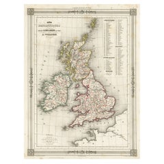
Antique Map of British Isles with Outline Hand Coloring
About the Item
Antique map titled 'Carte des Isles Britanniques et des Côtes qui les Avoisinent (..)'. Original old map of the British Isles with outline hand coloring. Published by P.G. Chanlaire and engraved by P.P. Bartholomé, published circa 1804.
- Dimensions:Height: 22.56 in (57.3 cm)Width: 17.25 in (43.8 cm)Depth: 0.02 in (0.5 mm)
- Materials and Techniques:
- Period:
- Date of Manufacture:circa 1804
- Condition:General age-related toning. Original folding line, narrow margins. Small tear in bottom margin, sl. affecting legend. Please study image carefully.
- Seller Location:Langweer, NL
- Reference Number:
About the Seller
5.0
Platinum Seller
These expertly vetted sellers are 1stDibs' most experienced sellers and are rated highest by our customers.
Established in 2009
1stDibs seller since 2017
1,933 sales on 1stDibs
Typical response time: <1 hour
- ShippingRetrieving quote...Ships From: Langweer, Netherlands
- Return PolicyA return for this item may be initiated within 14 days of delivery.
More From This SellerView All
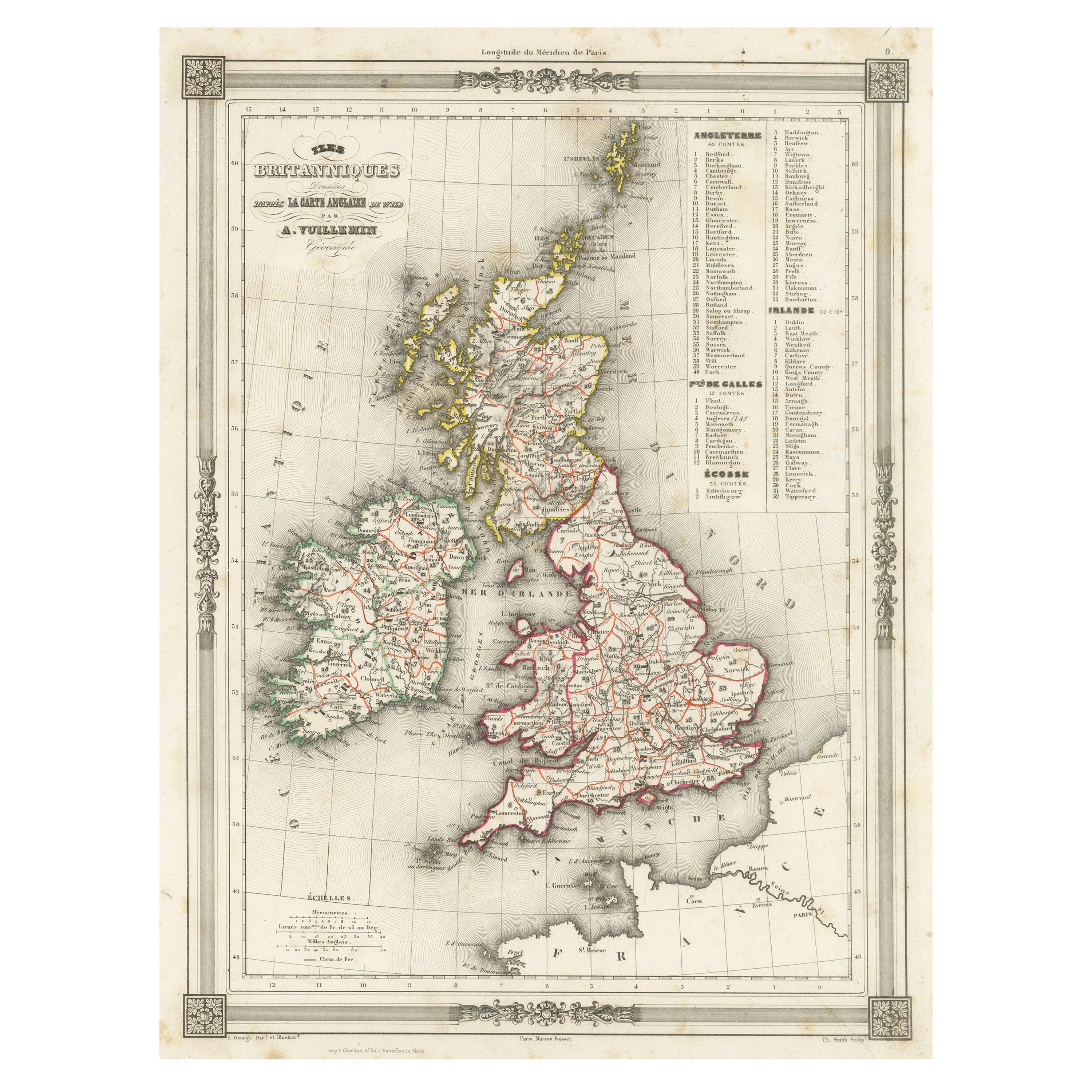
- Antique Map of the British Isles with Outline ColoringLocated in Langweer, NLAntique map titled 'Iles Britanniques'. Attractive map of the British Isles. Details England, Scotland and Ireland as well as parts of neighboring France. Upper right corner features...Category
Antique Mid-19th Century Maps
MaterialsPaper
- Antique Map of the British Isles with Contemporary Hand ColoringLocated in Langweer, NLAntique map titled 'Les Isles Britanniques'. Original antique map of the British Isles, with original/contemporary hand coloring. Published by Crepe, circa 1767.Category
Antique Late 18th Century Maps
MaterialsPaper
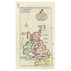
- Interesting Small Map of the British Isles with Hand ColoringLocated in Langweer, NLAntique map titled 'Insularum Britannicarum Tabula'. Interesting small map of the British Isles by Wells. This map originates from 'Oikumenes Periegesis, sive, Dionysii Geographia em...Category
Antique Early 18th Century Maps
MaterialsPaper
- Original Antique Map of England with Outline ColoringLocated in Langweer, NLAntique map titled 'Angleterre'. Original old map of England with outline coloring. Source unknown, to be determined. Published circa 1830.Category
Antique Mid-19th Century Maps
MaterialsPaper
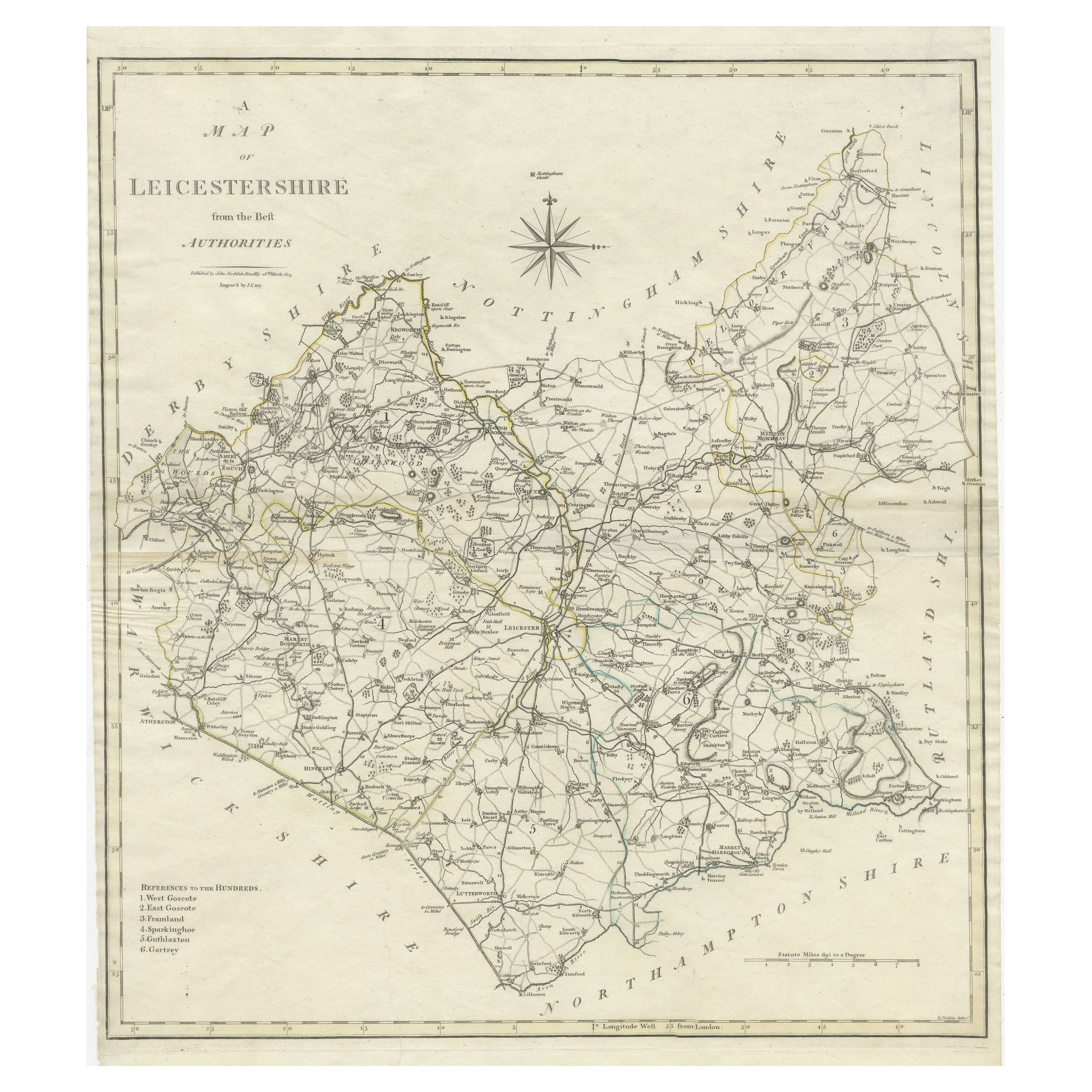
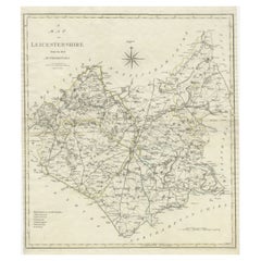
- Large Antique County Map of Leicestershire, England, with Outline ColoringLocated in Langweer, NLAntique map titled 'A Map of Leicestershire from the best Authorities'. Original old county map of Leicestershire, England. Engraved by John Cary. Originates from 'New British Atlas'...Category
Antique Early 19th Century Maps
MaterialsPaper
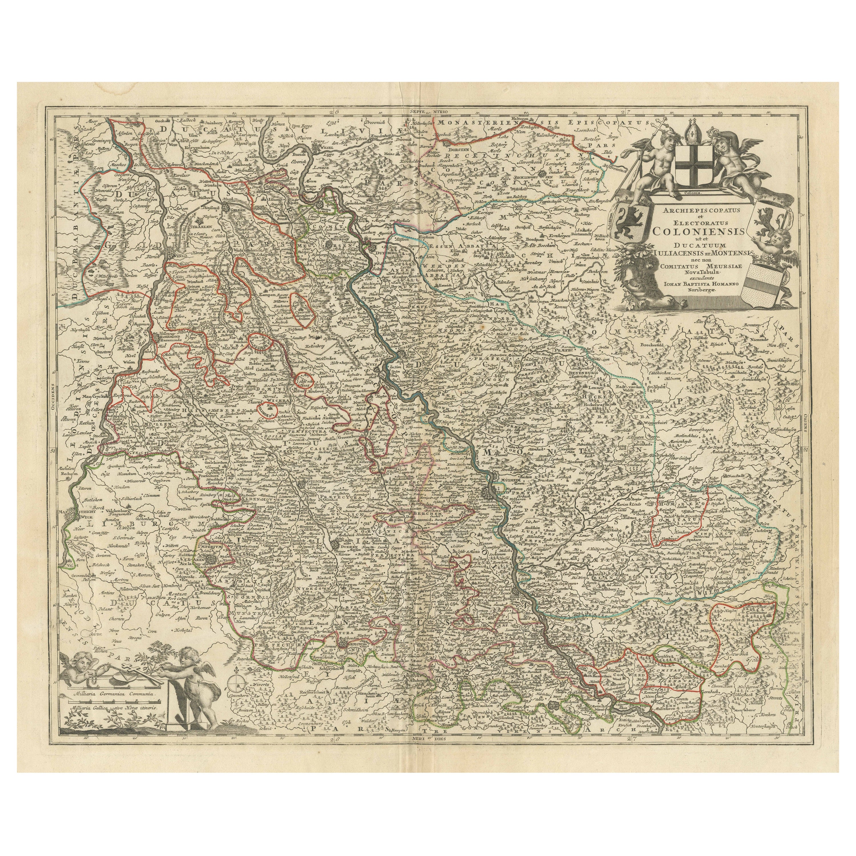
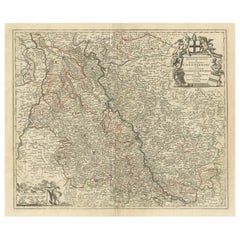
- Antique Map of the Rhine centered on Cologne, Germany, with outline coloringLocated in Langweer, NLAntique map titled 'Archiepsiscopatus et Electoratus Coloniensis (..)'. Original antique map of the Rhine river, centered on Cologne, Germany. The Rhine River cuts across this map fr...Category
Antique Early 18th Century Maps
MaterialsPaper


You May Also Like
- Large 17th Century Hand Colored Map of England and the British Isles by de WitBy Frederick de WitLocated in Alamo, CAA large hand colored 17th century map of England and the British Isles by Frederick de Wit entitled "Accuratissima Angliæ Regni et Walliæ Principatus", published in Amsterdam in 1680. It is a highly detailed map of England, Scotland, the Scottish Isles...Category
Antique Late 17th Century Dutch Maps
MaterialsPaper
- Antique Lithography Map, Isle of Wight, English, Framed, Engraving, CartographyLocated in Hele, Devon, GBThis is an antique lithography map of the Isle of Wight. An English, framed atlas engraving of cartographic interest, dating to the early 19th century and later. Superb lithography ...Category
Antique Early 19th Century British Regency Maps
MaterialsWood
- Antique Lithography Map, Isle of Thanet, Kent, English, Cartography, VictorianLocated in Hele, Devon, GBThis is an antique lithography map of The Isle of Thanet in Kent. An English, framed atlas engraving of cartographic interest, dating to the mid 19th century and later. Superb litho...Category
Antique Mid-19th Century British Victorian Maps
MaterialsWood
- Northwest Coast and Isle of Man MapLocated in Cheshire, GBGreenville Collins Northwest Coast and Isle of Man. hand coloured chart, encased in an ebonised frame. Dimensions Height 26.5 Inches Width 30 Inches Depth 1 InchesCategory
Early 20th Century British Maps
MaterialsPaper
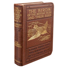
- Antique Book, Birds Of The British Isles, English, Ornithology Reference, C.1920Located in Hele, Devon, GBThis is an antique illustrated book of The Birds of the British Isles. An English, bound ornithology reference title, dating to the early 20th century, published 1920. Full Title - ...Category
Early 20th Century European Mid-Century Modern Books
MaterialsLeather, Paper
- Antique Hand Colored Framed Map of EuropeLocated in West Palm Beach, FLAntique reproduction copied from an edition dated 1595 by Ortelius.Category
Antique Late 19th Century Maps


Recently Viewed
View AllMore Ways To Browse
Pakistan Antique Map
Armenia Map
Armenian Map
Antique Maps Uk
Antique Uk Map
Antique Uk Maps
Northumberland Map
Uk Antique Map
Ancient Map Of Jerusalem
Antique Jamaica Map
Antique Map Brooklyn
Antique Map Of Brooklyn
Antique Map Of Jamaica
Corse Antique
Map Of The Bahamas
Old Sicily Map
Saudi Arabia Antique Map
Tunisia Antique Map