Items Similar to Antique Map of the Circle of Franconia, 1757
Want more images or videos?
Request additional images or videos from the seller
1 of 6
Antique Map of the Circle of Franconia, 1757
About the Item
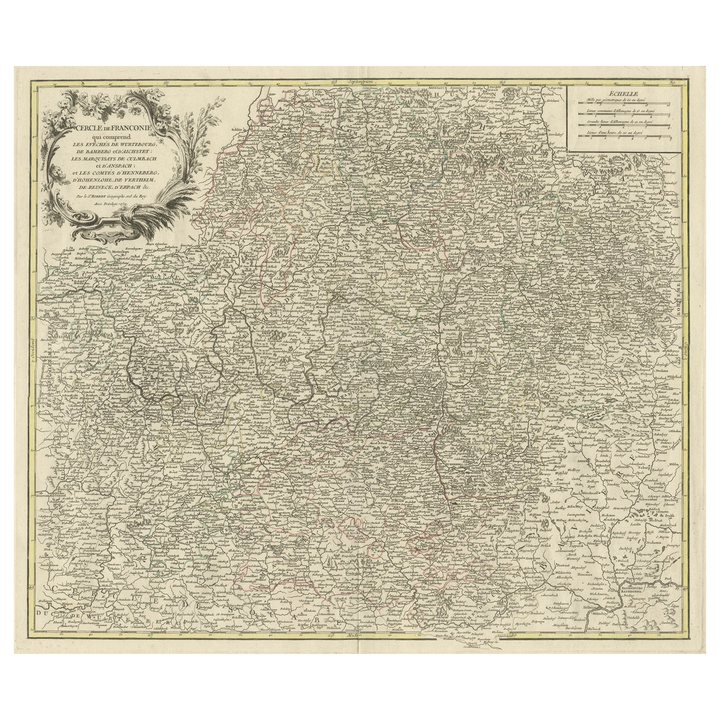
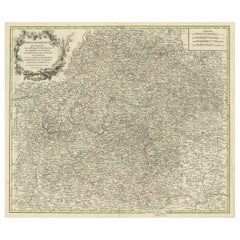
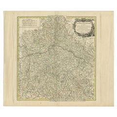
Antique map titled 'Cercle de Franconie (..)'. Map of the Circle of Franconia, Germany. Centered on Bamberg, Wurtzburg and Nuremberg. This map originates from 'Atlas Universel (..)'.
Artists and Engravers: Gilles Robert de Vaugondy (1688 - 1766), also known as Le Sieur or Monsieur Robert, and his son, Didier Robert de Vaugondy (c.1723 - 1786), were leading mapmakers in France during the 18th century. In 1757, they published The Atlas Universel, one of the most important atlases of the 18th century. To produce the atlas, the Vaugondys integrated older sources with more modern surveyed maps. They verified and corrected the latitude and longitude of many regional maps in the atlas with astronomical observations. The older material was revised with the addition of many new place names. In 1760, Didier Robert de Vaugondy was appointed geographer to Louis XV.
Condition: Fair/good, general age-related tonign. Original folding line, with repair. Minor wear and small defects, blank verso. Please study image carefully.
Date: 1757
Overall size: 69 x 56 cm.
Image size: 56 x 48 cm.
We sell original antique maps to collectors, historians, educators and interior decorators all over the world. Our collection includes a wide range of authentic antique maps from the 16th to the 20th centuries. Buying and collecting antique maps is a tradition that goes back hundreds of years. Antique maps have proved a richly rewarding investment over the past decade, thanks to a growing appreciation of their unique historical appeal. Today the decorative qualities of antique maps are widely recognized by interior designers who appreciate their beauty and design flexibility. Depending on the individual map, presentation, and context, a rare or antique map can be modern, traditional, abstract, figurative, serious or whimsical. We offer a wide range of authentic antique maps for any budget.
- Dimensions:Height: 22.05 in (56 cm)Width: 27.17 in (69 cm)Depth: 0 in (0.01 mm)
- Materials and Techniques:
- Period:
- Date of Manufacture:1757
- Condition:Repaired: Original folding line, with repair. Condition: Fair/good, general age-related tonign. Original folding line, with repair. Minor wear and small defects, blank verso. Please study image carefully.
- Seller Location:Langweer, NL
- Reference Number:
About the Seller
5.0
Platinum Seller
These expertly vetted sellers are 1stDibs' most experienced sellers and are rated highest by our customers.
Established in 2009
1stDibs seller since 2017
1,932 sales on 1stDibs
Typical response time: <1 hour
- ShippingRetrieving quote...Ships From: Langweer, Netherlands
- Return PolicyA return for this item may be initiated within 14 days of delivery.
More From This SellerView All
- Map of the Circle of Franconia, Germany Bamberg, Wurtzburg and Nuremberg, 1757Located in Langweer, NLAntique map titled 'Cercle de Franconie (..)'. Map of the Circle of Franconia, Germany. Centered on Bamberg, Wurtzburg and Nuremberg. This map originates from 'Atlas Universel (..)'. Artists and Engravers: Gilles Robert de Vaugondy (1688 - 1766), also known as Le Sieur or Monsieur Robert, and his son, Didier Robert de Vaugondy (c.1723 - 1786), were leading mapmakers in France during the 18th century. In 1757, they published The Atlas Universel, one of the most important atlases of the 18th century. To produce the atlas, the Vaugondys integrated older sources with more modern surveyed maps...Category
Antique 1750s Maps
MaterialsPaper
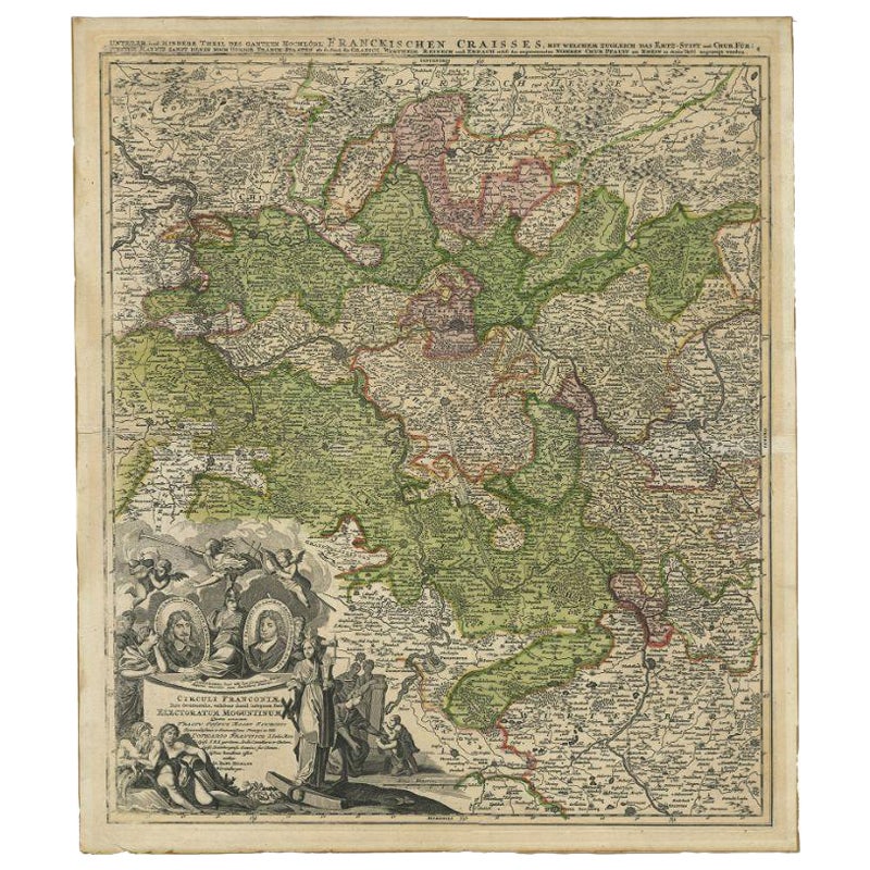
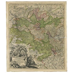
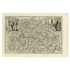
- Antique Map of the Circle of Franconia by Homann, c.1703Located in Langweer, NLAntique map titled 'Circuli Franconiae pars Occidentalis, exhibes simul integrum fere Electoratum Moguntinum (..)'. Antique map centered on Nuremberg and Bamberg. Extends from the Do...Category
Antique 18th Century Maps
MaterialsPaper
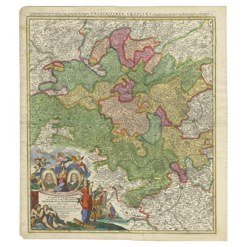
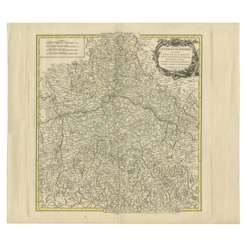
- Antique Map of the Circle of Bavaria by Vaugondy, 1757Located in Langweer, NLAntique map titled 'Le Cercle de Baviere (..)'. Map of the Circle of Bavaria, Germany. Extends from Bamberg to Innsbruck. This map originates from 'Atlas Universel (..)'. Artists and Engravers: Gilles Robert de Vaugondy (1688 - 1766), also known as Le Sieur or Monsieur Robert, and his son, Didier Robert de Vaugondy (c.1723 - 1786), were leading mapmakers in France during the 18th century. In 1757, they published The Atlas Universel, one of the most important atlases of the 18th century. To produce the atlas, the Vaugondys integrated older sources with more modern surveyed maps...Category
Antique 18th Century Maps
MaterialsPaper
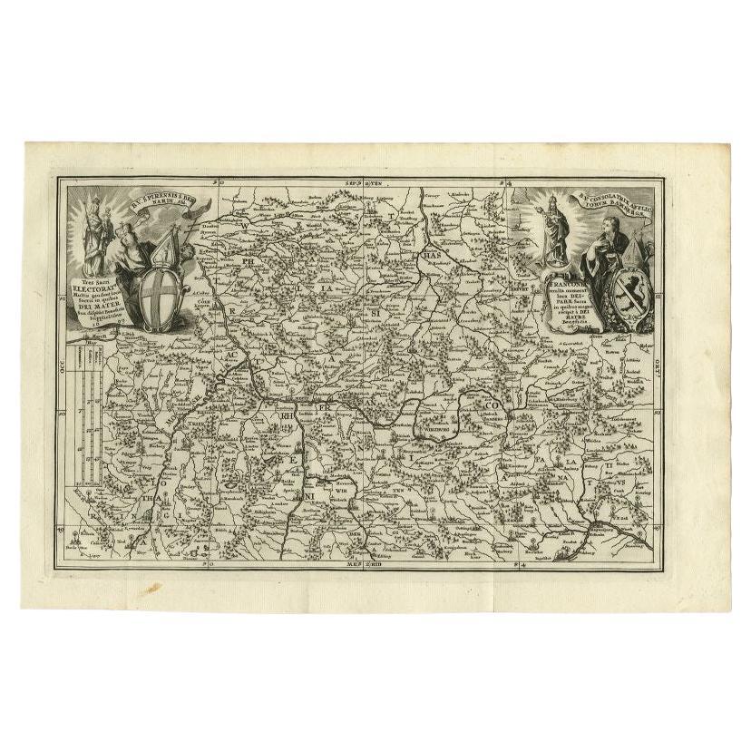
- Antique Map of the Franconia Region by Scherer, 1699Located in Langweer, NLAntique map titled 'Franconia multa numerat loca deiparae sacra in quibus magna recipit à dei matre beneficia.' Detailed uncommon map of the Franconia region in Germany. Source unkno...Category
Antique 17th Century Maps
MaterialsPaper
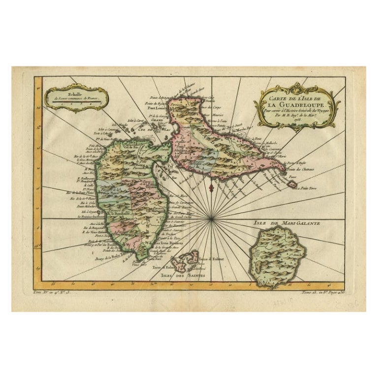
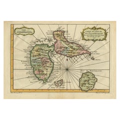
- Antique Map of Guadeloupe, Island in the Caribbean, c.1757Located in Langweer, NLAntique map titled 'Carte de L'Isle de la Guadeloupe'. A very decorative map of Guadeloupe in the Caribbean, adorned with rhumb lines, fleur-de-lys, and two decorative rococo-style...Category
Antique 18th Century Maps
MaterialsPaper

You May Also Like
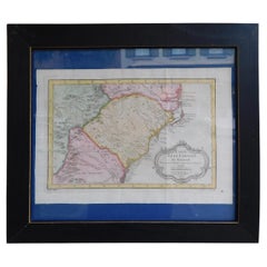
- French Framed Copper Engraved Hand Colored Map of Carolina & Georgia, Circa 1757Located in Hollywood, SCFrench copper engraved hand colored map of Carolina & Georgia matted under glass with a painted frame, mid-18th centuryCategory
Antique 1750s French Louis XV Maps
MaterialsGlass, Wood, Paint, Paper
- 1861 Topographical Map of the District of Columbia, by Boschke, Antique MapLocated in Colorado Springs, COPresented is an original map of Albert Boschke's extremely sought-after "Topographical Map of the District of Columbia Surveyed in the Years 1856 ...Category
Antique 1860s American Historical Memorabilia
MaterialsPaper
- Original Antique Map of the American State of Nevada, 1889Located in St Annes, LancashireGreat map of Nevada Drawn and Engraved by W. & A.K. Johnston Published By A & C Black, Edinburgh. Original colour Unframed.Category
Antique 1880s Scottish Victorian Maps
MaterialsPaper
- Original Antique Map of the American State of Oregon, 1889Located in St Annes, LancashireGreat map of Oregon Drawn and Engraved by W. & A.K. Johnston Published By A & C Black, Edinburgh. Original colour Unframed.Category
Antique 1880s Scottish Victorian Maps
MaterialsPaper
- Original Antique Map of the American State of Pennsylvania, 1889Located in St Annes, LancashireGreat map of Pennsylvania Drawn and Engraved by W. & A.K. Johnston Published By A & C Black, Edinburgh. Original colour Unframed. Repair to a minor tear on bottom edge.Category
Antique 1880s Scottish Victorian Maps
MaterialsPaper
- Large Original Antique Map of The World, Fullarton, C.1870Located in St Annes, LancashireGreat map of the World. Showing both hemispheres From the celebrated Royal Illustrated Atlas Lithograph. Original color. Published by Fullarton, Edinburgh, C.1870 Unframed. Rep...Category
Antique 1870s Scottish Maps
MaterialsPaper


Recently Viewed
View AllMore Ways To Browse
Leicestershire Antique Map
Alabama Antique Map
Antique Alabama Map
Berkshire Antique Map
Ontario Map
Warwickshire Antique Map
Antique Map Of Alabama
Heinrich Kiepert On Sale
Hertfordshire Antique Map
Poired Metal
Ruscelli Map
Antique Map Kentucky
Antique Map Tennessee
Antique Maps Of Tennessee
Huntingdonshire Antique Map
Mappemonde Antique
Tennessee Map
Antique Bermuda Maps