Items Similar to Map of the Circle of Franconia, Germany Bamberg, Wurtzburg and Nuremberg, 1757


Want more images or videos?
Request additional images or videos from the seller
1 of 5
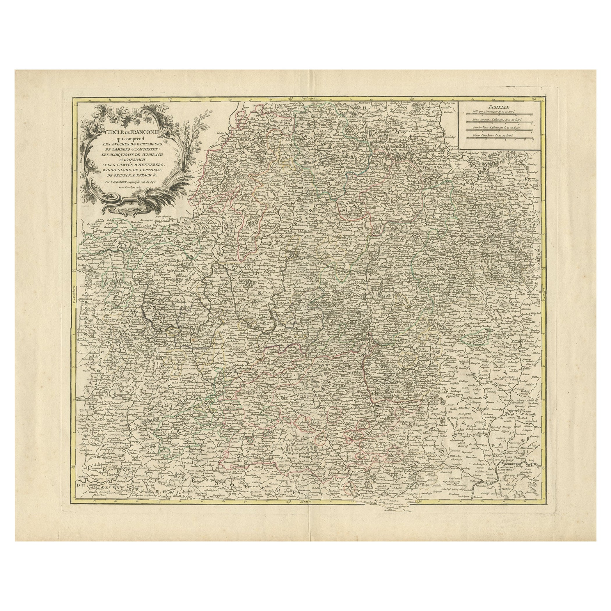
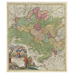
Map of the Circle of Franconia, Germany Bamberg, Wurtzburg and Nuremberg, 1757
About the Item
Antique map titled 'Cercle de Franconie (..)'.
Map of the Circle of Franconia, Germany. Centered on Bamberg, Wurtzburg and Nuremberg. This map originates from 'Atlas Universel (..)'.
Artists and Engravers: Gilles Robert de Vaugondy (1688 - 1766), also known as Le Sieur or Monsieur Robert, and his son, Didier Robert de Vaugondy (c.1723 - 1786), were leading mapmakers in France during the 18th century. In 1757, they published The Atlas Universel, one of the most important atlases of the 18th century. To produce the atlas, the Vaugondys integrated older sources with more modern surveyed maps. They verified and corrected the latitude and longitude of many regional maps in the atlas with astronomical observations. The older material was revised with the addition of many new place names. In 1760, Didier Robert de Vaugondy was appointed geographer to Louis XV.
Condition: Fair/good, general age-related tonign. Original folding line, with repair. Minor wear and small defects, blank verso. Please study image carefully.
- Dimensions:Height: 22.05 in (56 cm)Width: 27.17 in (69 cm)Depth: 0 in (0.02 mm)
- Materials and Techniques:
- Period:1750-1759
- Date of Manufacture:1757
- Condition:Repaired: Original folding line with repair. Wear consistent with age and use. Condition: Fair/good, general age-related tonign. Original folding line, with repair. Minor wear and small defects, blank verso. Please study image carefully.
- Seller Location:Langweer, NL
- Reference Number:
About the Seller
5.0
Platinum Seller
These expertly vetted sellers are 1stDibs' most experienced sellers and are rated highest by our customers.
Established in 2009
1stDibs seller since 2017
1,932 sales on 1stDibs
Typical response time: <1 hour
- ShippingRetrieving quote...Ships From: Langweer, Netherlands
- Return PolicyA return for this item may be initiated within 14 days of delivery.
More From This SellerView All
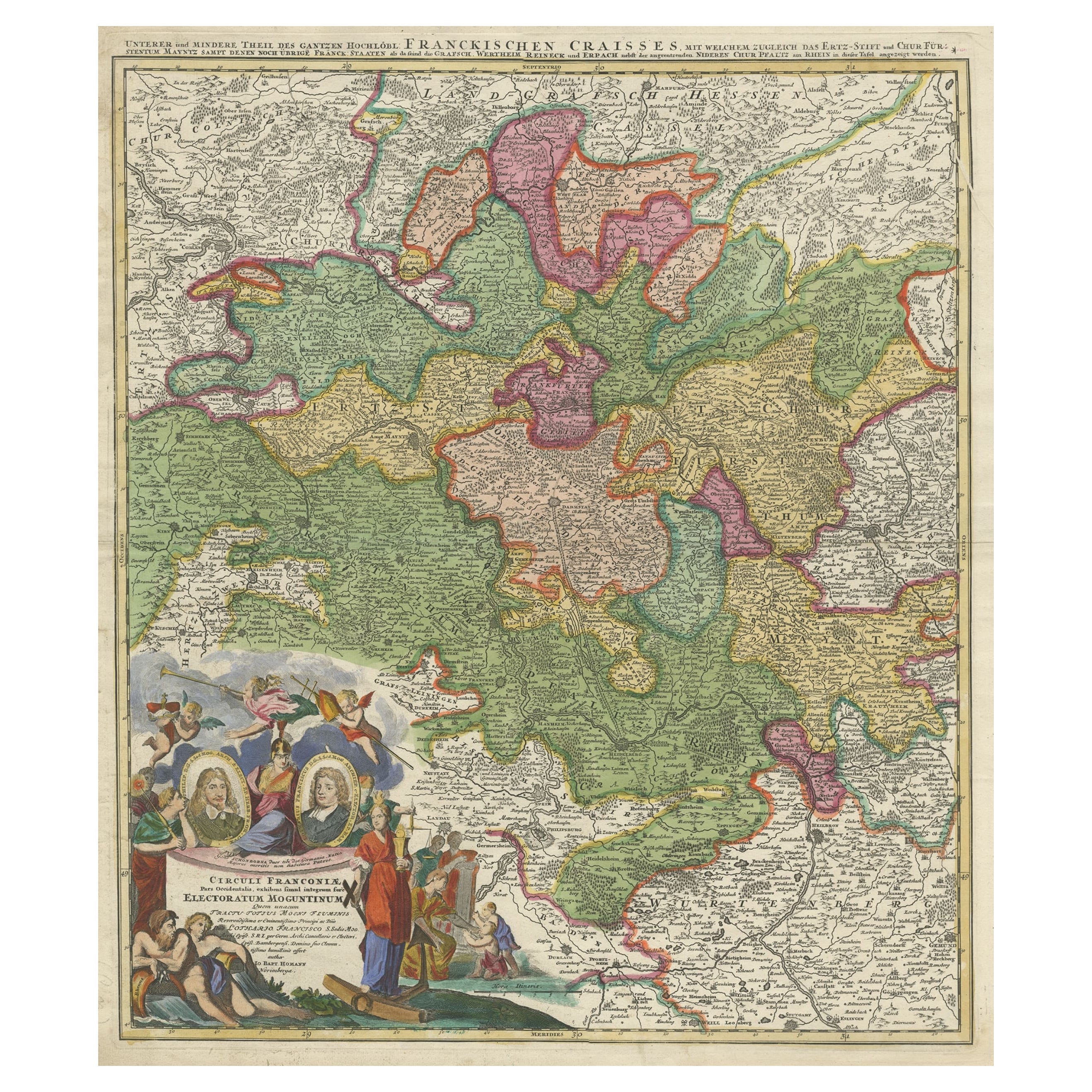
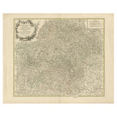
- Colourful Antique Map Centered on Nuremberg and Bamberg in Germany, ca.1703Located in Langweer, NLAntique map titled 'Circuli Franconiae pars Occidentalis, exhibes simul integrum fere Electoratum Moguntinum (..)'. Antique map centered on Nuremberg and Bamberg. Extends from th...Category
Antique Early 1700s Maps
MaterialsPaper
- Antique Map of the Circle of Franconia, 1757Located in Langweer, NLAntique map titled 'Cercle de Franconie (..)'. Map of the Circle of Franconia, Germany. Centered on Bamberg, Wurtzburg and Nuremberg. This map originates from 'Atlas Universel (..)'....Category
Antique 18th Century Maps
MaterialsPaper
- Antique Map of Franconia, a region of Germany, '1811'By John CaryLocated in Langweer, NLAntique map titled 'A New Map of the Circle of Franconia'. Detailed map of Franconia in Northwestern Germany. Covers from Upper Saxony south to Swabia, west to the Lower Rhine and we...Category
Antique Early 19th Century Maps
MaterialsPaper
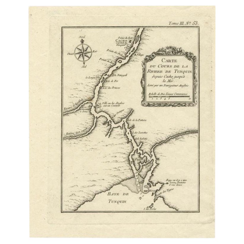
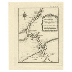
- Antique Map of the Tunquin River and Bay, Siam, 1757Located in Langweer, NLAntique map titled ‘Carte du Cours de la Riviere de Tunquin Depuis Cacho jusqu'à la Mer’. Detailed map of the Tunquin River and Bay, extending north to Cacho, the capital city. Made ...Category
Antique 18th Century Maps
MaterialsPaper
- Antique Map of Menorca / Minorca by Homann Heirs '1757'Located in Langweer, NLAntique map titled 'Carte Topographique de l'Isle Minorque'. Scarce decorative map of Menorca (or Minorca), with two gorgeous views of Mahon and Fort St. Phillipe at the bottom. Publ...Category
Antique Mid-18th Century Maps
MaterialsPaper
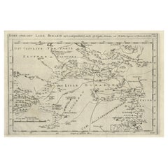
- Old Map of Turkmenistan, Uzbekistan, Afghanistan, Tajikistan, Kyrgyzstan, 1757Located in Langweer, NLAntique map titled 'Kort over det Lille Bukarie og de naest graensende Lande. af Engelske Skribentere ved N. Bellin Ingenieur ved Marinen efter Söe Etaten'. Map of present-day Turkmenistan, Uzbekistan, Afghanistan, Tajikistan, Kyrgyzstan including part of China. Originates from 'Almindelig histoirie over reiser til lands og bands (..)'. This 17 volume set is a translation of Collection of voyages and travels edited by Awnsham and John Churchill and Thomas Osborne...Category
Antique 1750s Maps
MaterialsPaper


You May Also Like
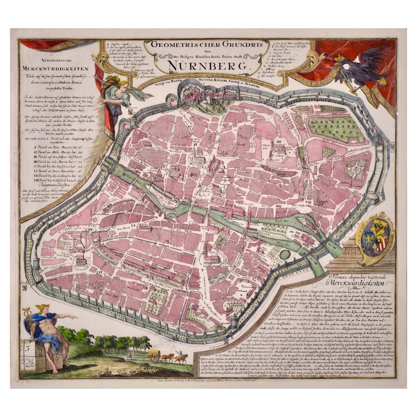
- City View of Nuremberg, Germany: An 18th Century Hand-Colored Map by M. SeutterBy Matthew SeutterLocated in Alamo, CAAn 18th century hand-colored city view of Nuremburg, Germany entitled "Geometrischer Grundris der des Heiligen Römischen Reichs Freyen Stadt Nürnberg" by Matthaus Seutter from his "A...Category
Antique Mid-18th Century German Maps
MaterialsPaper
- Map of the Republic of GenoaLocated in New York, NYFramed antique hand-coloured map of the Republic of Genoa including the duchies of Mantua, Modena, and Parma. Europe, late 18th century. Dimension: 25...Category
Antique Late 18th Century European Maps
- Map "Estuary- Mouth of the Thames"Located in Alessandria, PiemonteST/426 - Antique French Map of the estuary of the Thames, map dated 1769 - "Mape of the entrance of the Thames. Designed by filing of Navy cards fo...Category
Antique Mid-18th Century French Other Prints
MaterialsPaper
- Germany West of the Rhine: A Hand-colored 18th Century Map by de WitBy Frederick de WitLocated in Alamo, CAThis original 18th century hand-colored map of the county of Moers, Germany entitled "Illustrissimo Celsissmo Principi GUILIELMO HENRICO D.G. Arausionum Principi Domino suo Clementis...Category
Antique Early 18th Century Dutch Maps
MaterialsPaper
- 18th Century Hand-Colored Homann Map of Germany, Including Frankfurt and BerlinBy Johann Baptist HomannLocated in Alamo, CAAn 18th century hand-colored map entitled "Tabula Marchionatus Brandenburgici et Ducatus Pomeraniae quae sunt Pars Septentrionalis Circuli Saxoniae Superioris" by Johann Baptist Homa...Category
Antique Early 18th Century German Maps
MaterialsPaper
- Vintage "View of the Center of Paris Taken from the Air" Lithograph MapLocated in San Diego, CAA very stylish "View of the Center of Paris Taken from the Air" lithograph map published by the Paris Ministry of Tourism, circa early 1950s. The piece measures 27" x 43" and shows...Category
20th Century French Mid-Century Modern Prints
MaterialsPaper


Recently Viewed
View AllMore Ways To Browse
Folded Circle
Survey Map
Antique Astronomical
Louis Atlas
Gillers Antiques
Important Astronomical
Map 1786
Antique Furniture East London
Antique Eastern European Furniture
Antique House Plans
Antique Metal Window
Antique Metal Windows
Antique Furniture Rollers
Antiques Compasses
India Map
Antique Maps Book
Antique Map Book
Antique Italian Map