Items Similar to Colourful Antique Map Centered on Nuremberg and Bamberg in Germany, ca.1703
Want more images or videos?
Request additional images or videos from the seller
1 of 5
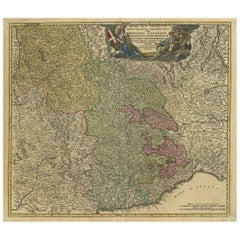
Colourful Antique Map Centered on Nuremberg and Bamberg in Germany, ca.1703
About the Item
Antique map titled 'Circuli Franconiae pars Occidentalis, exhibes simul integrum fere Electoratum Moguntinum (..)'.
Antique map centered on Nuremberg and Bamberg. Extends from the Donau in the South (showing Regensberg, Ingolstatt and Nordlingen) to Eger, Hoff and Amberg in the East and Wurtzberg in the west.
Artists and Engravers: Johann Baptist Homann (1663-1724) was a mapmaker who founded the famous Homann Heirs publishing company. He lived his entire life in Bavaria, particularly in Nuremberg. Initially, Johann trained to become a priest before converting to Protestantism and working as a notary.
- Dimensions:Height: 23.23 in (59 cm)Width: 20.87 in (53 cm)Depth: 0 in (0.02 mm)
- Materials and Techniques:
- Period:1700-1709
- Date of Manufacture:circa 1703
- Condition:Wear consistent with age and use. Condition: Good, general age-related toning. Later hand coloring, Minor wear and a few small defects, blank verso. Please study image carefully.
- Seller Location:Langweer, NL
- Reference Number:
About the Seller
5.0
Platinum Seller
These expertly vetted sellers are 1stDibs' most experienced sellers and are rated highest by our customers.
Established in 2009
1stDibs seller since 2017
1,928 sales on 1stDibs
Typical response time: <1 hour
- ShippingRetrieving quote...Ships From: Langweer, Netherlands
- Return PolicyA return for this item may be initiated within 14 days of delivery.
More From This SellerView All
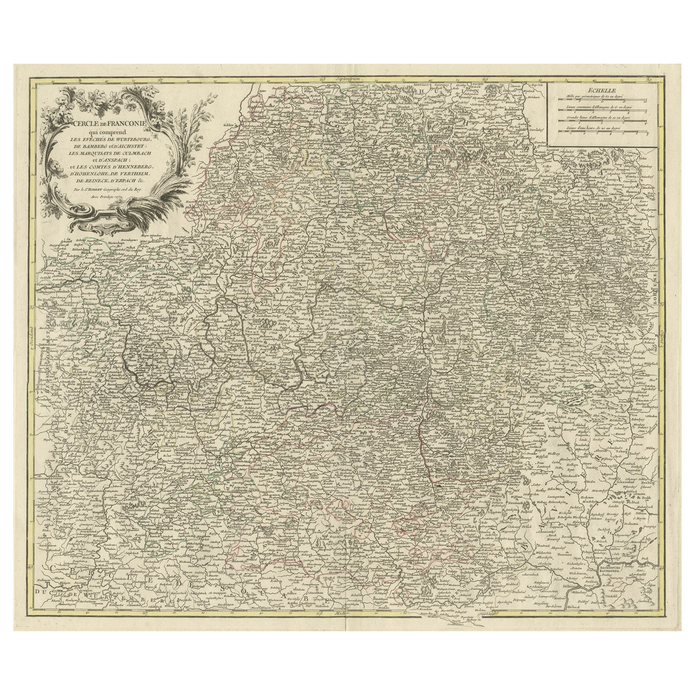
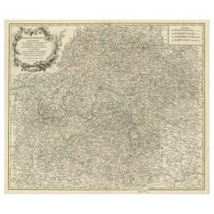
- Map of the Circle of Franconia, Germany Bamberg, Wurtzburg and Nuremberg, 1757Located in Langweer, NLAntique map titled 'Cercle de Franconie (..)'. Map of the Circle of Franconia, Germany. Centered on Bamberg, Wurtzburg and Nuremberg. This map originates from 'Atlas Universel (..)'. Artists and Engravers: Gilles Robert de Vaugondy (1688 - 1766), also known as Le Sieur or Monsieur Robert, and his son, Didier Robert de Vaugondy (c.1723 - 1786), were leading mapmakers in France during the 18th century. In 1757, they published The Atlas Universel, one of the most important atlases of the 18th century. To produce the atlas, the Vaugondys integrated older sources with more modern surveyed maps...Category
Antique 1750s Maps
MaterialsPaper
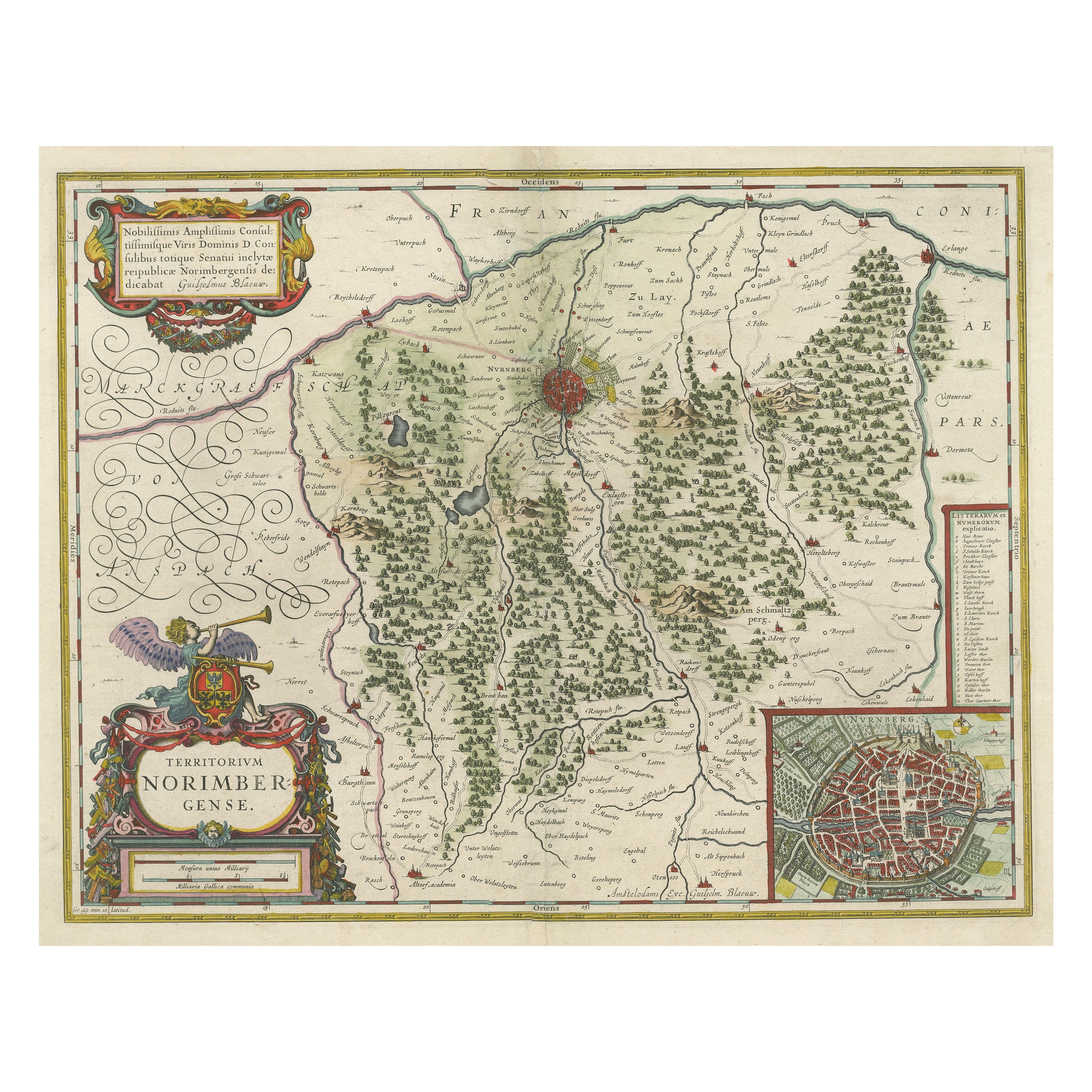
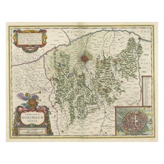
- Antique Map centered on Nuremberg, GermanyLocated in Langweer, NLAntique map titled 'Territorium Norimbergense'. Beautiful map centered on Nuremberg, Germany. With decorative title cartouche and inset plan of the city. Published by W. Blaeu, circa...Category
Antique Mid-17th Century Maps
MaterialsPaper
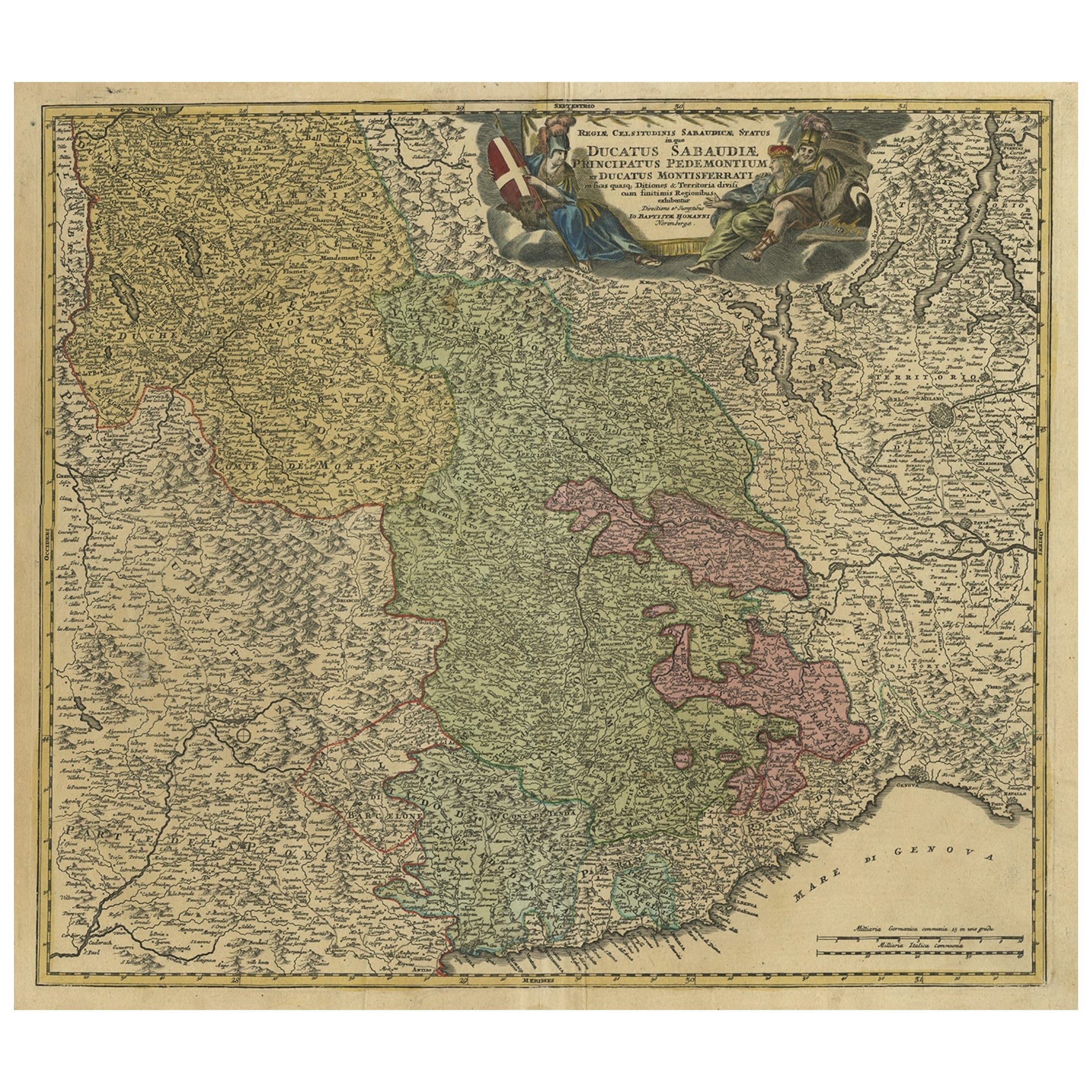
- Antique Map of the Savoy and Piedmont Regions, Centered on Torino, ca.1735Located in Langweer, NLAntique map titled 'Ducatus Sabaudiae, Principatus Pedemontium et ducatis Montisferrati (..).' Map of the Savoy and Piedmont regions, centered on Torino. The map coverage extends...Category
Antique 1730s Maps
MaterialsPaper
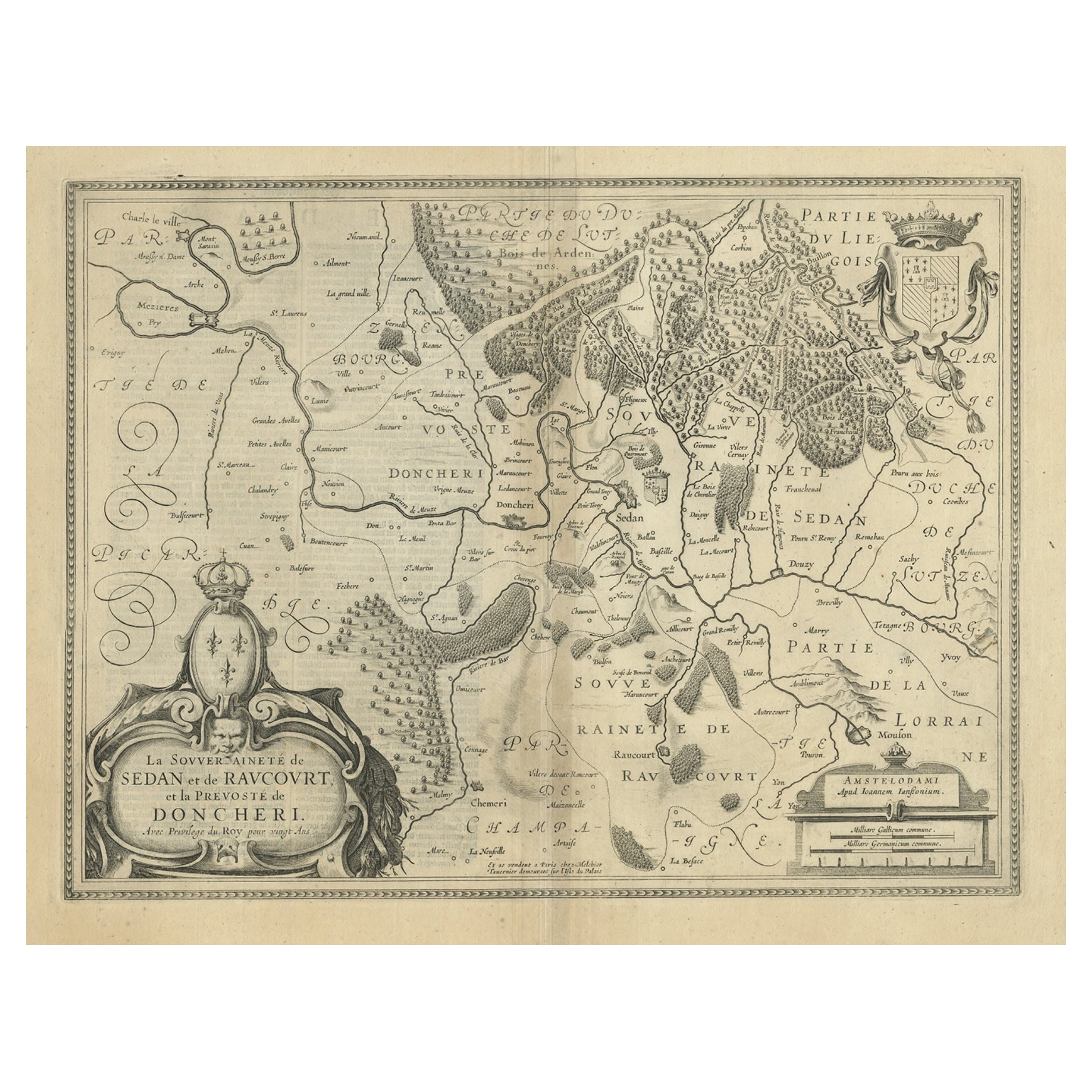
- Lovely Antique Map Centered on Sedan and Doncheri and the Meuze River, ca.1650Located in Langweer, NLOriginal antique map with title: 'La Souveraineté de Sedan et de Raucourt, et la prevosté de Doncheri', is an antique map centered on Sedan and Doncheri, along with the Meuze River ...Category
Antique 1650s Maps
MaterialsPaper
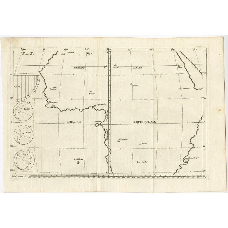
- Remarkable Antique Map of Central Africa by Scherer, c.1703Located in Langweer, NLUntitled map of Central Africa depicting Tarodant, Lempta, Guber, Borno, Chaxumo, Tombut, Melegvete, Benin, S. Salvator, Zaire, Gondar, S. Helena and Mozambique. Printed for Scherer'...Category
Antique 18th Century Maps
MaterialsPaper
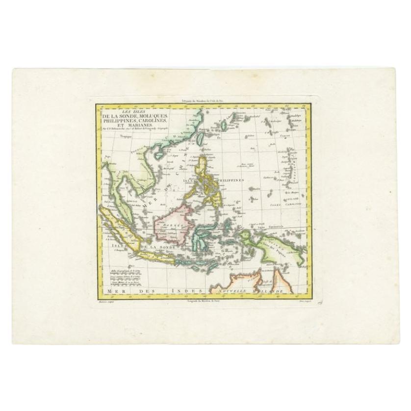
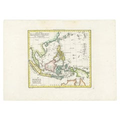
- Antique Colourful Map of the Dutch East Indies 'Indonesia', ca.1806Located in Langweer, NLAntique map titled 'Les Isles de la Sonde Moluques Philippines, Carolines et Marianes'. Old map of the East Indies, also showing a part of Australia. Artists and Engravers: Publi...Category
Antique 19th Century Maps
MaterialsPaper
You May Also Like
- City View of Nuremberg, Germany: An 18th Century Hand-Colored Map by M. SeutterBy Matthew SeutterLocated in Alamo, CAAn 18th century hand-colored city view of Nuremburg, Germany entitled "Geometrischer Grundris der des Heiligen Römischen Reichs Freyen Stadt Nürnberg" by Matthaus Seutter from his "A...Category
Antique Mid-18th Century German Maps
MaterialsPaper
- 17th Century Hand-Colored Map of a Region in West Germany by JanssoniusBy Johannes JanssoniusLocated in Alamo, CAThis attractive highly detailed 17th century original hand-colored map is entitled "Archiepiscopatus Maghdeburgensis et Anhaltinus Ducatus cum terris adjacentibus". It was published ...Category
Antique Mid-17th Century Dutch Maps
MaterialsPaper
- Original Antique Map of Spain and Portugal, circa 1790Located in St Annes, LancashireSuper map of Spain and Portugal Copper plate engraving by A. Bell Published, circa 1790. Unframed.Category
Antique 1790s English Other Maps
MaterialsPaper
- Original Antique Map of Ireland- Tipperary and Waterford. C.1840Located in St Annes, LancashireGreat map of Tipperary and Waterford Steel engraving Drawn under the direction of A.Adlard Published by How and Parsons, C.1840 Unframed.Category
Antique 1840s English Maps
MaterialsPaper
- Original Antique Map of Sweden and Norway, Grattan and Gilbert, 1843Located in St Annes, LancashireGreat map of Sweden and Norway Drawn and engraved by Archer Published by Grattan and Gilbert Original color Unframed.Category
Antique 1840s English Other Maps
MaterialsPaper
- 18th Century Hand-Colored Homann Map of Germany, Including Frankfurt and BerlinBy Johann Baptist HomannLocated in Alamo, CAAn 18th century hand-colored map entitled "Tabula Marchionatus Brandenburgici et Ducatus Pomeraniae quae sunt Pars Septentrionalis Circuli Saxoniae Superioris" by Johann Baptist Homa...Category
Antique Early 18th Century German Maps
MaterialsPaper


