Items Similar to Antique Map of Flanders and Zeeland by Merian, 1659


Want more images or videos?
Request additional images or videos from the seller
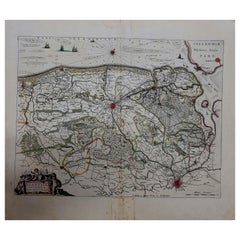
Antique Map of Flanders and Zeeland by Merian, 1659
About the Item
Antique map titled 'Flandria et Zeelandia Comitatus'. Original antique map of Flanders, Belgium, and part of Zeeland, the Netherlands. This map originates from 'Topographia Germaniae Inferioris' by C. Merian.
Artists and Engravers: Caspar Merian (1627-1686) was one of the most important German topographical engravers and publishers in the Baroque period.
Condition: Fair/good, age-related toning. Tape on verso. Minor wear and creasing. Blank verso. Please study image carefully.
Date: 1659
Overall size: 39.5 x 31 cm.
Image size: 34 x 25.5 cm.
- Dimensions:Height: 12.21 in (31 cm)Width: 15.56 in (39.5 cm)Depth: 0 in (0.01 mm)
- Materials and Techniques:
- Period:
- Date of Manufacture:1659
- Condition:
- Seller Location:Langweer, NL
- Reference Number:
About the Seller
5.0
Platinum Seller
These expertly vetted sellers are 1stDibs' most experienced sellers and are rated highest by our customers.
Established in 2009
1stDibs seller since 2017
1,949 sales on 1stDibs
Typical response time: <1 hour
- ShippingRetrieving quote...Ships From: Langweer, Netherlands
- Return PolicyA return for this item may be initiated within 14 days of delivery.
More From This SellerView All
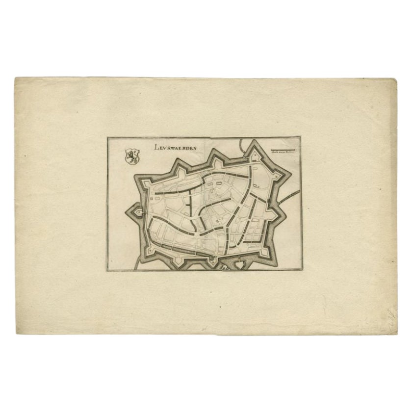
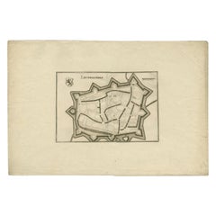
- Antique Map of the City of Leeuwarden by Merian, 1659Located in Langweer, NLAntique map titled 'Leurwaerden'. This print depicts the city of Leeuwarden (Friesland, The Netherlands). This print originates from 'Topographia Germaniae Inferioris (..)' by C. Mer...Category
Antique 17th Century Maps
MaterialsPaper
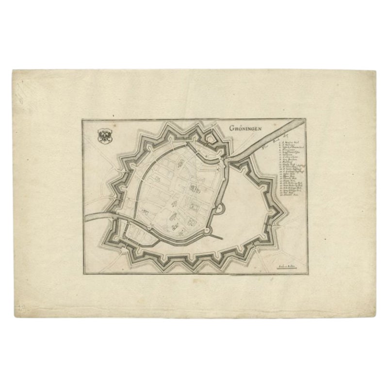
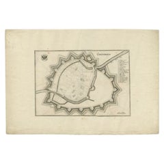
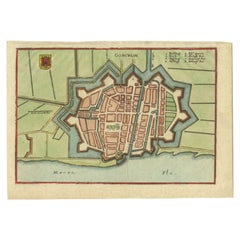
- Antique Map of the City of Groningen by Merian, 1659Located in Langweer, NLAntique map titled 'Gröningen'. This print depicts the city of Groningen, the Netherlands. This print originates from 'Topographia Germaniae Inferioris (..)' by C. Merian. Artist...Category
Antique 17th Century Maps
MaterialsPaper
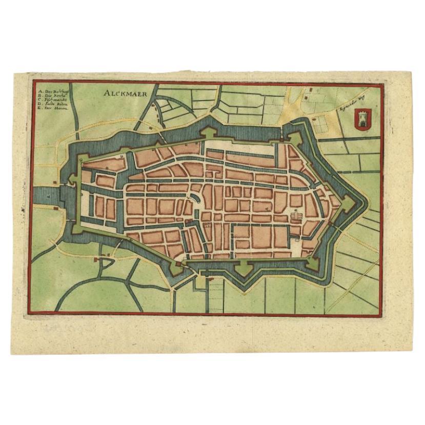
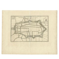
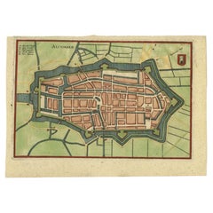
- Antique Map of the City of Alkmaar by Merian, 1659Located in Langweer, NLAntique map titled 'Alckmaer'. This print depicts the city of Alkmaar (The Netherlands). This print originates from 'Topographia Germaniae Inferioris (..)' by C. Merian. Artists and ...Category
Antique 17th Century Maps
MaterialsPaper
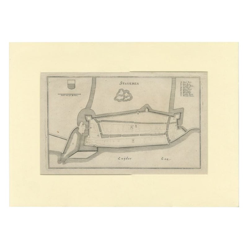
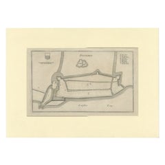
- Antique Map of the City of Stavoren by Merian, 1659Located in Langweer, NLAntique map titled 'Staveren'. Original antique map of the city of Stavoren, Friesland, the Netherlands. This map originates from 'Topographia Germania Inferioris' by C. Merian. Publ...Category
Antique 17th Century Maps
MaterialsPaper
- Antique Map of the City of Alkmaar by Merian, c.1659Located in Langweer, NLAntique map titled 'Alckmaer'. Old map of the city of Alkmaar, the Netherlands. This print originates from 'Topographia Germaniae Inferioris (..)'. Artists and Engravers: Caspar Meri...Category
Antique 17th Century Maps
MaterialsPaper
- Antique Map of the City of Gorinchem by Merian, c.1659Located in Langweer, NLAntique map titled 'Gorckum'. This print depicts the city of Gorinchem (or Gorcum/Gorkum, The Netherlands). This print originates from 'Topographia Germaniae Inferioris (..)'. Art...Category
Antique 17th Century Maps
MaterialsPaper
You May Also Like
- Antique 1630 Colored Belgium Map Flandria Gallica Flanders Henricus HondiusLocated in Dayton, OH"Antique hand colored map of Flanders, Belgium, circa 1630, engraved by Henricus Hondius. “Henricus Hondius II (1597 – 16 August 1651) was a Dutch eng...Category
Antique Early 17th Century Renaissance Maps
MaterialsPaper
- 1752 Vaugoundy Map of Flanders : Belgium, France, and the Netherlands, Ric.a002Located in Norton, MALarge Vaugoundy Map of Flanders: Belgium, France, and the Netherlands Colored -1752 Ric.a002 Description: This is a 1752 Didier Robert de Vaugondy map of Flanders. The map de...Category
Antique 17th Century Unknown Maps
MaterialsPaper
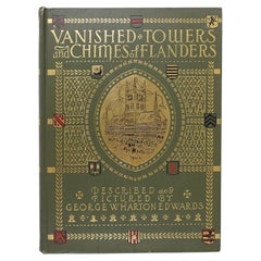
- Vanished Towers and Chimes of Flanders BookLocated in Seguin, TXVanished Towers and Chimes of flanders by George Wharton Edwards, illustrated by author. Published by Penn Publishing Company, Philadelphia, 191...Category
Early 20th Century North American Arts and Crafts Books
MaterialsPaper
- 1861 Topographical Map of the District of Columbia, by Boschke, Antique MapLocated in Colorado Springs, COPresented is an original map of Albert Boschke's extremely sought-after "Topographical Map of the District of Columbia Surveyed in the Years 1856 ...Category
Antique 1860s American Historical Memorabilia
MaterialsPaper
- 1907 Map of Colorado, Antique Topographical Map, by Louis NellLocated in Colorado Springs, COThis highly detailed pocket map is a topographical map of the state of Colorado by Louis Nell from 1907. The map "has been complied from all availabl...Category
Antique Early 1900s American Maps
MaterialsPaper
- 1643 Willem&Joan Blaeu Map NW Flanders "Flandriae Teutonicae Pars PrientaliorLocated in Norton, MA1643 Willem and Joan Blaeu map of northwest Flanders, entitled "Flandriae Teutonicae Pars Prientalior," Ric0012 " Authentic" - Map of the northwest Fl...Category
Antique 17th Century Dutch Maps
MaterialsPaper


Recently Viewed
View AllMore Ways To Browse
Antique And Collectable Fairs
Topographical Map
Belgium Map
Antique Map Fair
Antique Topographic Maps
Map Of Belgium
Belgium Antique Map
London Antique Maps
London Map Antique
Ship Map
Map Of Britain
Antique Law Office Furniture
Antique Maps Of London
Antique Map Of London
Antique Maps Amsterdam
Antique And Collectable Fairs
Antique Furniture South London
Antique Map England