Items Similar to Antique Map of Estates of The Year 1669 in Amsterdam, Published c.1767
Want more images or videos?
Request additional images or videos from the seller
1 of 5
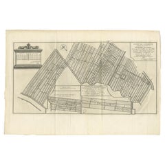
Antique Map of Estates of The Year 1669 in Amsterdam, Published c.1767
About the Item
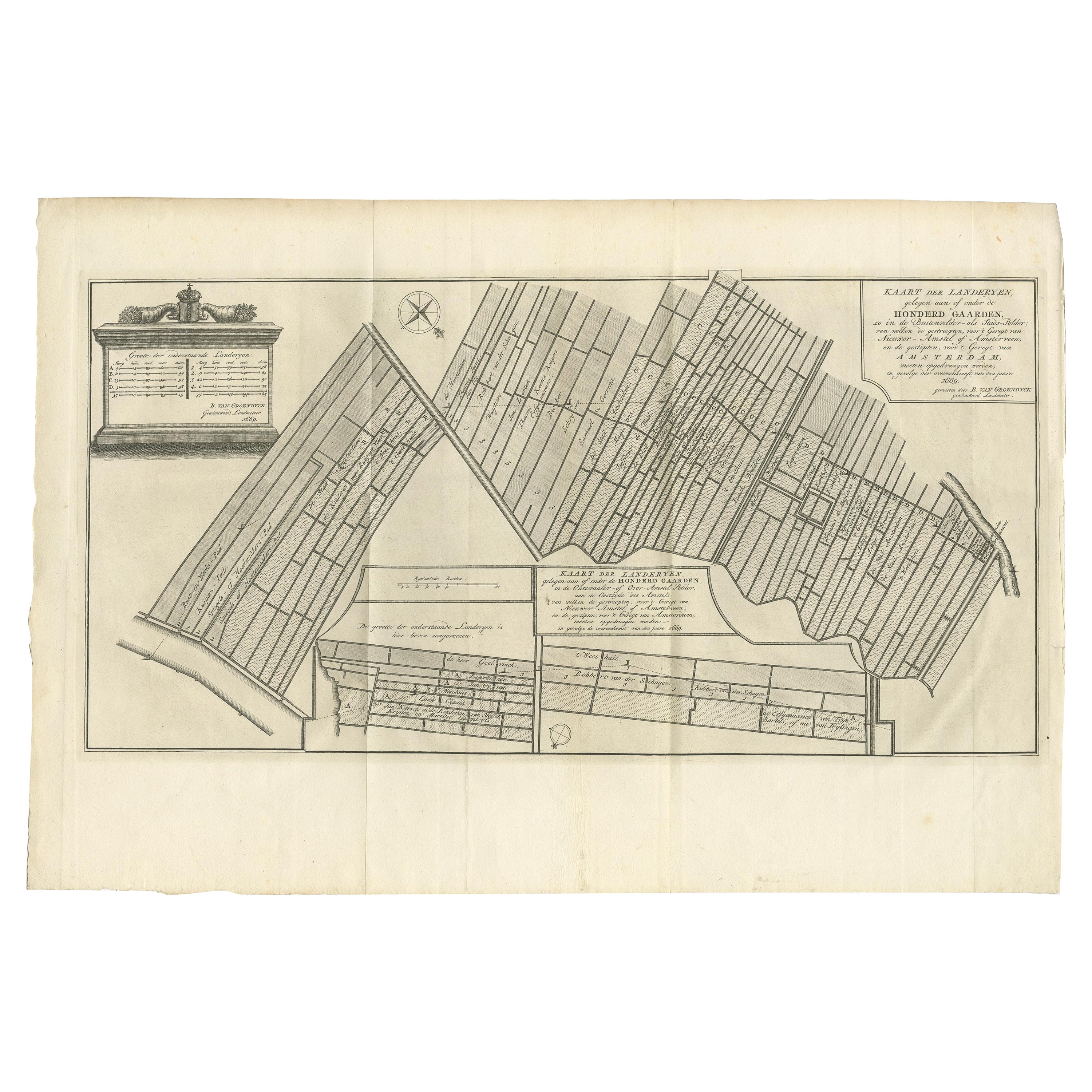
Antique map titled 'Kaart der Landerijen, gelegen aan of onder de rooyinge der honderd gaarden (..)'. Map showing estates in Amsterdam in 1669. Published by Yntema and Tieboel, 1767.
Artists and Engravers: Anonymous.
Condition: Good, given age. A few minor crinkles. Original folds as issued. General age-related toning and/or occasional minor defects from handling. Please study image carefully.
Date: c.1767
Overall size: 50.4 x 30.6 cm.
Image size: 47.2 x 23.5 cm.
We sell original antique maps to collectors, historians, educators and interior decorators all over the world. Our collection includes a wide range of authentic antique maps from the 16th to the 20th centuries. Buying and collecting antique maps is a tradition that goes back hundreds of years. Antique maps have proved a richly rewarding investment over the past decade, thanks to a growing appreciation of their unique historical appeal. Today the decorative qualities of antique maps are widely recognized by interior designers who appreciate their beauty and design flexibility. Depending on the individual map, presentation, and context, a rare or antique map can be modern, traditional, abstract, figurative, serious or whimsical. We offer a wide range of authentic antique maps for any budget.
- Dimensions:Height: 12.05 in (30.6 cm)Width: 19.85 in (50.4 cm)Depth: 0 in (0.01 mm)
- Materials and Techniques:
- Period:
- Date of Manufacture:circa 1767
- Condition:
- Seller Location:Langweer, NL
- Reference Number:
About the Seller
5.0
Platinum Seller
These expertly vetted sellers are 1stDibs' most experienced sellers and are rated highest by our customers.
Established in 2009
1stDibs seller since 2017
1,922 sales on 1stDibs
Typical response time: <1 hour
- ShippingRetrieving quote...Ships From: Langweer, Netherlands
- Return PolicyA return for this item may be initiated within 14 days of delivery.
More From This SellerView All
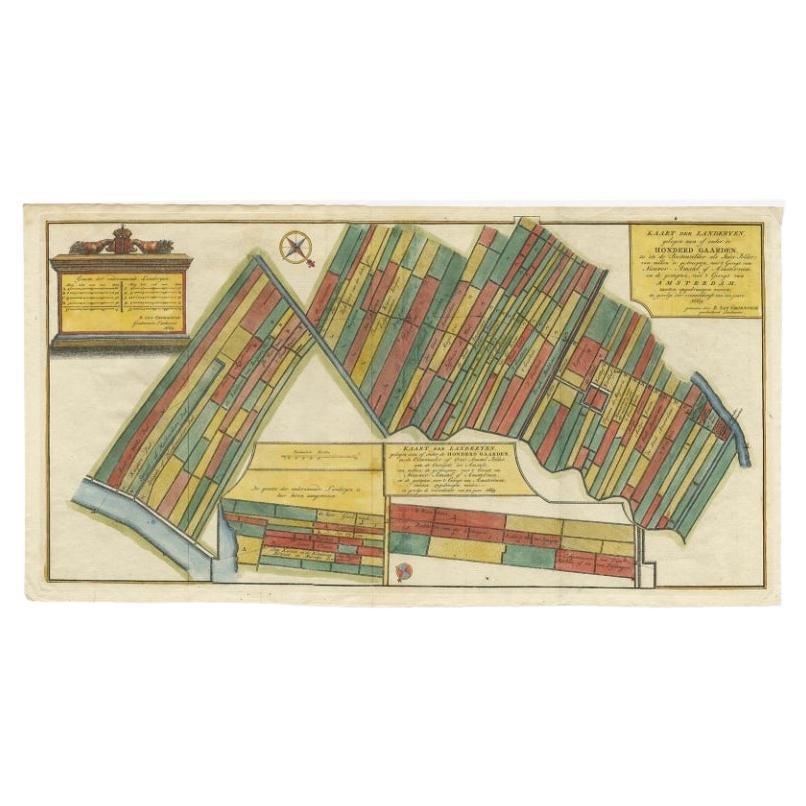
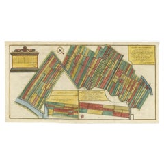
- Antique Map Showing Estates of 1669 in Amsterdam, Published in c.1767Located in Langweer, NLAntique map titled 'Kaart der landeryen, gelegen aan of onder de honderd gaarden, zo in de Buitenvelder- als Stads-polder; van welken de gestreepten, voor 't geregt van Nieuwer-Amste...Category
Antique 18th Century Maps
MaterialsPaper
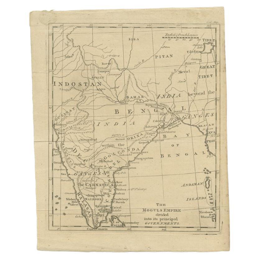
- Antique Map of the Mongol Empire, 1767Located in Langweer, NLAntique map titled 'The Moguls Empire divided into its principal governments'. Old map of India, Bangladesh, and parts of eastern China. Artists and Engravers: Published in the G...Category
Antique 18th Century Maps
MaterialsPaper
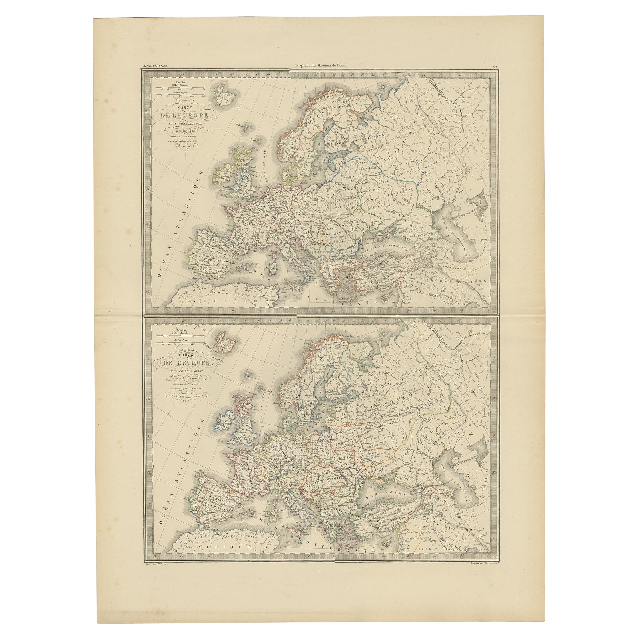
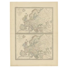
- Antique Map of Europe in the Year 800 and 1500, Published in 1842Located in Langweer, NLAntique map titled 'Carte de l'Europe'. Two maps of Europe. The upper map depicts Europe in the year 800, the lower map depicts Europe in 1500. This map originates from 'Atlas univer...Category
Antique 19th Century Maps
MaterialsPaper
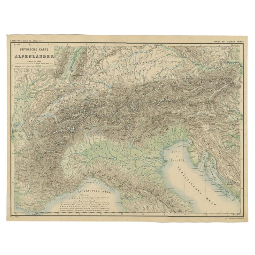
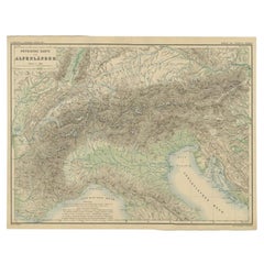
- Antique Map of the Alpine Countries, Published in Germany, c.1870Located in Langweer, NLAntique map titled 'Physische Karte der Alpenländer'. Old map of the Alpine countries. This map originates from 'H. Kiepert's Kleiner Atlas der Neueren Geographie für Schule und Haus...Category
Antique 19th Century Maps
MaterialsPaper
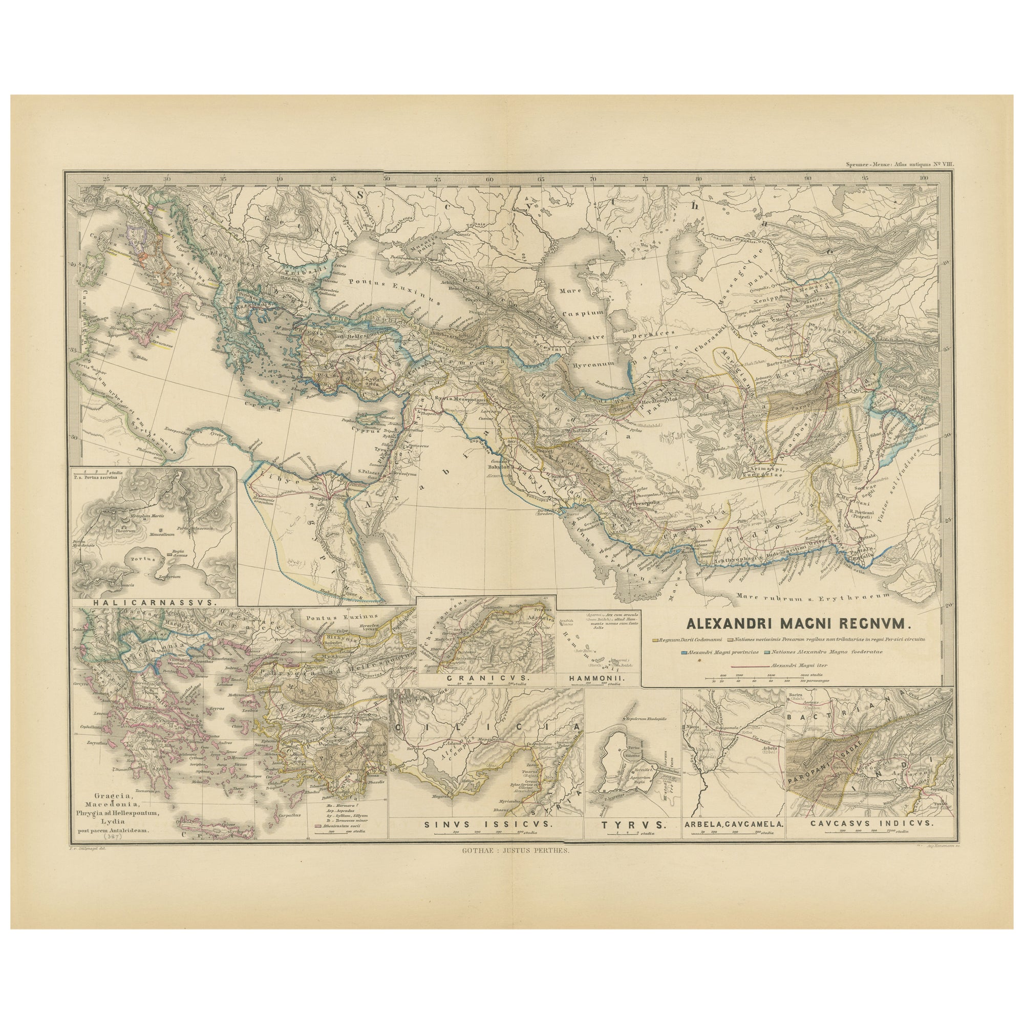
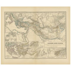
- Antique Map of The Kingdom of Alexander the Great, Published in 1880Located in Langweer, NLThe map is titled "ALEXANDRI MAGNI REGNUM," which translates to "The Kingdom of Alexander the Great." It depicts the vast territories conquered by Alexander the Great during his reig...Category
Antique 1880s Maps
MaterialsPaper

You May Also Like
- Antique Oarsman's Map of the River Thames, English, Cartography, Published 1912Located in Hele, Devon, GBThis is an antique copy of The Oarsman's and Angler's Map of the River Thames - New Edition. An English, bound map book, published in English by Edward Stanford, London, this new edi...Category
Early 20th Century British Other Books
MaterialsPaper
- 1840 Map of the City of Washington Published by William M. MorrisonLocated in Colorado Springs, COThis map, printed in 1840, is a detailed representation of Washington, D.C. in the mid-19th century. The map shows block numbers, wards, and government buildings as well as details o...Category
Antique 1840s American Federal Maps
MaterialsPaper
- 1842 Wall Map of the United States by J. H. Young, Published by S. A. MitchellLocated in Colorado Springs, COPresented is an 1842 hanging “Map of the United States,” engraved by J. H. Young and published by Samuel Augustus Mitchell, Philadelphia. This is a beautiful example of the rare 1842...Category
Antique 1840s American Maps
MaterialsPaper
- London 1744 Published Watercolour Antique Map of East Africa by Eman BowenLocated in GBWe are delighted to offer for sale this New and Accurate Map of Nubia & Abissinia, together with all the Kingdoms Tributary Thereto, and bordering upon them published in 1744 by Emanuel Bowen This is a decorative antique engraved map of East Africa...Category
Antique 1740s English George III Maps
MaterialsPaper
- Antique Paterson's Guide to Britain, English, Maps, Georgian, Published 1811Located in Hele, Devon, GBThis is an antique copy of Paterson's New and Accurate guide to Direct & Principal Crossroads. An English, bound book of maps and descriptive tables, published in English by Longman,...Category
Antique Early 19th Century British Georgian Books
MaterialsPaper
- 1861 Topographical Map of the District of Columbia, by Boschke, Antique MapLocated in Colorado Springs, COPresented is an original map of Albert Boschke's extremely sought-after "Topographical Map of the District of Columbia Surveyed in the Years 1856 ...Category
Antique 1860s American Historical Memorabilia
MaterialsPaper


Recently Viewed
View AllMore Ways To Browse
Antique Estate Furniture
Antique And Estate Furniture
Amsterdam 18th
Antique Maps Amsterdam
Amsterdam Map
Map Of Amsterdam
London Antique Maps
London Map Antique
Ship Map
Map Of Britain
Antique Law Office Furniture
Antique Maps Of London
Antique Map Of London
Antique Maps Amsterdam
Antique And Collectable Fairs
Antique Furniture South London
Antique Map England
Antique Maps England