Large Map Of Paris
4
to
26
208
156
167
120
102
78
51
49
41
39
37
32
26
22
22
21
20
20
16
13
12
12
12
9
9
8
7
6
6
4
4
4
4
4
4
4
3
3
3
3
2
2
2
2
1
1
1
1
1
1
42
42
16
12
12
Sort By
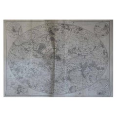
Original Large Antique Map of Paris, France by John Dower, 1861
Located in St Annes, Lancashire
Fabulous monochrome map of Paris.
Vignettes of St Germain En Laye, Saint Cloud, Versailles and
Category
Antique 1860s English Victorian Maps
Materials
Paper
No Reserve
H 25.5 in W 36 in D 0.07 in
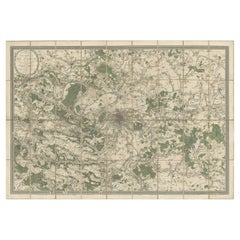
Large Folding Map of Paris, France, on Linen, 36 Segments, Published in 1836
Located in Langweer, NL
Antique map Paris titled 'Carte Topographique des Environs de Paris Nouvelle edition rectifié
Category
Antique 1830s Maps
Materials
Paper
H 27.96 in W 39.77 in D 0 in
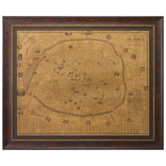
Plan of Paris, France, by A. Vuillemin, Antique Map, 1845
Located in Colorado Springs, CO
This large and detailed plan of Paris was published by Alexandre Vuillemin in 1845. The map conveys
Category
Antique 1840s American Maps
Materials
Paper
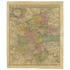
Antique Map of the Region of Paris by Homann Heirs, c.1720
By Homann Heirs
Located in Langweer, NL
. Centered on Paris, the map extends to show these cities at the extremities - Ablis, Messe, Herissy, Senlies
Category
Antique 18th Century Maps
Materials
Paper
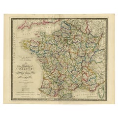
Antique Map of France according to the Treaty of Paris '1815', Published in 1854
Located in Langweer, NL
Paris. (1815)'. Large map of France. From James Wyld's 'A New General Atlas of Modern Geography
Category
Antique 19th Century Maps
Materials
Paper
H 23.04 in W 28.35 in D 0 in
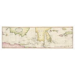
Rare Authentic Engraved Map of Large Part of Indonesia by Stavorinus, 1779
Located in Langweer, NL
Antique map titled 'Carte de la Navigation de Batavia a Amboina'. Rare chart of Indonesia including
Category
Antique 18th Century Maps
Materials
Paper
H 29.34 in W 9.06 in D 0 in
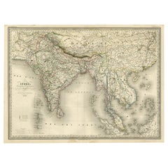
Superb, Large Map of British India, Chinese Empire, Indochina, Malaysia, 1860
Located in Langweer, NL
Antique map titled 'Indes, colonies Anglaises.'
Large map of the East Indies, British Colonies
Category
Antique 1860s Maps
Materials
Paper
H 22.8 in W 31.07 in D 0 in
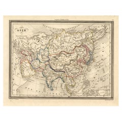
Antique Map of Asia, 1846
Located in Langweer, NL
Antique map titled 'Asie'. Original antique map of Asia. Source unknown, to be determined
Category
Antique 19th Century Maps
Materials
Paper
Portugal: A Large 17th Century Hand-colored Map by Sanson and Jaillot
By Nicolas Sanson
Located in Alamo, CA
This large hand-colored map entitled "Le Royaume de Portugal et des Algarves Divisee en see
Category
Antique 1690s French Maps
Materials
Paper
Africa: A Large 17th Century Hand-Colored Map by Sanson and Jaillot
By Nicolas Sanson
Located in Alamo, CA
This large original hand-colored copperplate engraved map of Africa entitled "L'Afrique divisee
Category
Antique 1690s French Maps
Materials
Paper
Antique Map of the Pacific Ocean by Renneville, 1725
Located in Langweer, NL
Rare map of the Southern Pacific, illustrating Le Maire's tracks, extending from the La Maire
Category
Antique 18th Century Maps
Materials
Paper
Antique Map of the Low Countries by Brué, 1822
Located in Langweer, NL
Antique map titled 'Carte du Royaume des Pays-Bas'. Large format map of the Low Countries. This map
Category
Antique 19th Century Maps
Materials
Paper
Original Antique Map of the Cape Verde Islands, 1746
Located in Langweer, NL
large number of maps of particular interest to the Ministere de la Marine.
Artist: Jacques Nicolas
Category
Antique 18th Century Maps
Materials
Paper
Antique Map of Hérault ‘France’ by V. Levasseur, 1854
Located in Langweer, NL
Antique map titled 'Dépt. de l'Hérault'. Map of the French department of Herault, France. This area
Category
Antique Mid-19th Century Maps
Materials
Paper
Antique Map of France by Covens & Mortier, c.1730
Located in Langweer, NL
Antique map titled 'Nova regni Galliae (..) La France'. Old map of France with large decorative
Category
Antique 18th Century Maps
Materials
Paper
Vienna, Austria: A Large 17th Century Hand-Colored Map by Sanson and Jaillot
By Nicolas Sanson
Located in Alamo, CA
This large 17th century hand-colored map of Vienna, Austria and the surrounding countryside and
Category
Antique 1690s French Maps
Materials
Paper
H 20 in W 24.88 in D 0.13 in
Southern & Eastern Europe: A Large 17th C. Hand-colored Map by Sanson & Jaillot
By Nicolas Sanson
Located in Alamo, CA
This large hand-colored map entitled "Estats de L'Empire des Turqs en Europe, ou sont les
Category
Antique 1690s French Maps
Materials
Paper
H 24.88 in W 38 in D 0.13 in
Antique Map of the Region of Artois by Covens & Mortier, c.1730
By Covens & Mortier
Located in Langweer, NL
Antique map titled 'Carte d'Artois et des environs'. Large map of the region of Artois, France
Category
Antique 18th Century Maps
Materials
Paper
Southern Greece: A Large 17th C. Hand-colored Map by Sanson and Jaillot
By Nicolas Sanson
Located in Alamo, CA
This large original hand-colored copperplate engraved map of southern Greece and the Pelopponese
Category
Antique 1690s French Maps
Materials
Paper
Antique Map of Guadeloupe, Island in the Caribbean, c.1757
Located in Langweer, NL
Antique map titled 'Carte de L'Isle de la Guadeloupe'.
A very decorative map of Guadeloupe in the
Category
Antique 18th Century Maps
Materials
Paper
Antique Map of Java and Madura Island, Indonesia, c.1760
Located in Langweer, NL
50 year career, he produced a large number of maps of particular interest to the Ministere de la
Category
Antique 18th Century Maps
Materials
Paper
Antique Map of Spain and Portugal by Tardieu, circa 1795
Located in Langweer, NL
The image is an antique map titled "Hispanie Betique et Lusitanie", which depicts the Iberian
Category
Antique Late 18th Century Maps
Materials
Paper
Antique Engraved Map with Original Hand Colour of French Guiana, 1876
Located in Langweer, NL
. Fisquet; Published by A. Le Vasseur, Paris [Grand atlas départemental]
**Type:** Antique engraved map
Category
Antique Late 19th Century Maps
Materials
Paper
Antique Map of the Coast of New Ireland, Earlier Part of German New Guinea, 1833
Located in Langweer, NL
Antique map titled 'Plan du Havre Carteret sur la Cote occidentale de la Nelle Irlande
Category
Antique 19th Century Maps
Materials
Paper
H 18.86 in W 25.44 in D 0 in
Antique Map of the Holy Land by Van Luchtenburg, c.1720
Located in Langweer, NL
Antique map titled 'Heylige Land verdeeld in de Twaalf Stammen Israels (..).' Highly detailed map
Category
Antique 18th Century Maps
Materials
Paper
1812 United States Map, by Pierre Tardieu, Antique French Map Depicting the U.S.
By Pierre François Tardieu
Located in Colorado Springs, CO
Map by Tardieu
This attractive map, published in Paris in 1812, is one of the most rare large
Category
Antique 1810s French Maps
Materials
Paper
H 43.5 in W 48 in D 2.25 in
Interesting Map of the Thousand Islands in the Bay of Batavia 'Jakarta', ca.1740
Located in Langweer, NL
de cartes et plans des quatre parties du Monde. Paris: Bellin, 1764, but again they are smaller. Map
Category
Antique 1740s Maps
Materials
Paper
H 11.42 in W 8.27 in D 0 in
1752 Vaugoundy Map of Flanders : Belgium, France, and the Netherlands, Ric.a002
Located in Norton, MA
Large Vaugoundy Map of Flanders:
Belgium, France, and the Netherlands
Colored -1752
Ric.a002
Category
Antique 17th Century Unknown Maps
Materials
Paper
H 51.5 in W 66 in D 1 in
Antique Map with Details of Berings' Expedition into Russians' Far East, 1737
Located in Langweer, NL
Antique map titled 'Carte Des Pays traverses par le Capne. Beerings depuis la Ville de Tobolsk
Category
Antique 1730s Maps
Materials
Paper
H 12.96 in W 22.64 in D 0 in
Highly Detailed Antique Map of the Holy Land Showing 12 Tribes of Israel, c.1720
Located in Langweer, NL
map of the Holy Land divided into 12 tribes of Israel. With beautiful large title cartouche, vignette
Category
Antique 1720s Maps
Materials
Paper
Free Shipping
H 17.72 in W 20.28 in D 0 in
Captain Cook's Exploration of Tahiti 18th C. Hand-Colored Map by Bellin
By Jacques-Nicolas Bellin
Located in Alamo, CA
and of the Royal Society of London. Over a 50 year career, he produced a large number of maps of
Category
Antique Mid-18th Century French Maps
Materials
Paper
H 11.38 in W 17.5 in D 0.13 in
Antique Hemisphere Map of the World 'Two on One Sheet' by Levasseur, '1875'
Located in Langweer, NL
Antique map titled 'Mappemonde projetée sur l'Horizon de Paris et de son Antipode - Mappemonde sur
Category
Antique Late 19th Century Maps
Materials
Paper
H 24.02 in W 18.71 in D 0.02 in
Antique Map of the Passage Between the Atlantic and Pacific Oceans, circa 1753
Located in Langweer, NL
trade route for the Dutch. The map is adorned with a fine compass rose.Source unknown, to be determined
Category
Antique 18th Century Maps
Materials
Paper
H 9.61 in W 12.8 in D 0 in
Authentique Map by Pilon of The French Colonies in The West Indies, 1876
Located in Langweer, NL
Vasseur, Paris [Grand atlas départemental]
**Type:** Antique engraved map with original hand coloring
Category
Antique Late 19th Century Maps
Materials
Paper
H 14.38 in W 16.54 in D 0 in
The Normandy Region of France: A 17th C. Hand-colored Map by Sanson and Jaillot
By Nicolas Sanson
Located in Alamo, CA
This large hand-colored map entitled "Le Duché et Gouvernement de Normandie divisée en Haute et
Category
Antique 1690s French Maps
Materials
Paper
H 24.88 in W 38 in D 0.13 in
Greece, "Graeciae Antiquae"" A 17th Century Hand-colored Map by Sanson
By Nicolas Sanson
Located in Alamo, CA
Tavernier (1594–1665) in 1636 in Paris. The map is embellished by seven sailing ships and seven sea monsters
Category
Antique Mid-17th Century French Maps
Materials
Paper
H 24.75 in W 29.75 in D 0.13 in
1630 Pierre Petit map "Description du Gouvernement de la Capelle" Ric0010
Located in Norton, MA
1630 Pierre Petit map entitled
"Description du Gouvernement de la Capelle,"
Ric0010
Pierre
Category
Antique 17th Century Dutch Maps
Materials
Paper
H 18.9 in W 22.45 in D 0.4 in
California, Alaska and Mexico: 18th Century Hand-Colored Map by de Vaugondy
By Didier Robert de Vaugondy
Located in Alamo, CA
), created by Didier Robert De Vaugondy and published in Paris in 1772 in Diderot's Encyclopedie. The map and
Category
Antique 1770s French Maps
Materials
Paper
H 13.75 in W 16.63 in D 0.13 in
Large Sea Chart of the Zuyder Zee & The Northsea with the Wadden Islands, 1773
By H. van Loon
Located in Langweer, NL
Paris.
Pieter Mortier obtained the privilege in 1690 to distribute maps and atlases from French
Category
Antique Late 18th Century Maps
Materials
Paper
H 25.2 in W 36.62 in D 0.02 in
Antique Engraving of Malaysia, Brunei, Singapore, Java, Borneo, Sumatra, c.1750
Located in Langweer, NL
, he produced a large number of maps of particular interest to the Ministère de la Marine.
Publisher
Category
Antique Mid-18th Century Maps
Materials
Paper
H 10.3 in W 12 in D 0.002 in
Mapping the Heart of France: Willem Blaeu's 17th Century Île-de-France, ca.1650
Located in Langweer, NL
encompassed a much larger area than the modern administrative region of the same name. It included Paris and
Category
Antique 1650s Maps
Materials
Paper
Free Shipping
H 20.08 in W 24.02 in D 0 in
Large French Paris Metro Map 1960s
Located in North Hollywood, CA
Large French Paris Metro Map 1960s.
A large Vintage French framed map of the Parisian Metro from
Category
Mid-20th Century French Industrial Prints
Materials
Wood, Paper
Large Paris Porcelain Map of Italy Cup and Saucer, circa 1810
Located in New York, NY
Large Paris porcelain map of Italy cup and saucer, circa 1810.
Category
Antique 1810s French Tea Sets
Materials
Porcelain
Chanel Vintage Multicolor Canvas Embellished Printed Map Of Paris Shoulder Bag
By Chanel
Located in Miami, FL
Chanel Vintage Multicolor Map Of Paris Shoulder Bag
Orange
Printed
Gold-Tone Hardware
Chain-Link
Category
Early 2000s French Tote Bags
H 7.5 in W 10.75 in D 3 in
Louis Vuitton Men's Large Navy Paris Topographical Map Globe T-Shirt Tee Sh125lv
By Louis Vuitton
Located in Dix hills, NY
: 29.5"
Size: Large
OVERALL EXCELLENT CONDITION
( 9/10 or A )
Men's Large
Shoulders: 19"
Pit to Pit
Category
21st Century and Contemporary T-Shirts
one of the earliest large-scale English maps of North America
By John Senex
Located in London, GB
one of the earliest large-scale English maps of North America
SENEX, John.
North America Corrected
Category
1710s Naturalistic More Art
Materials
Watercolor, Engraving
Mapped Location of Pronounced Situational Density
By Patricia Smith
Located in New York, NY
finish. This painting is created as psychological map that defines alliances.
Greed-Based, Guilt-Based
Category
21st Century and Contemporary Contemporary Abstract Drawings and Waterco...
Materials
Archival Ink, Archival Paper, Watercolor
Portugal: A Large 17th Century Hand-colored Map by Sanson and Jaillot
By Nicholas Sanson d'Abbeville
Located in Alamo, CA
This large hand-colored map entitled "Le Royaume de Portugal et des Algarves Divisee en see
Category
1690s Landscape Prints
Materials
Engraving
Utrecht, Netherlands: A Large 17th Century Hand-colored Map by Sanson & Jaillot
By Nicholas Sanson d'Abbeville
Located in Alamo, CA
This large hand-colored map entitled "La Seigneurie d'Utrecht. Dressé sur les memoires les plus
Category
1690s Landscape Prints
Materials
Engraving
Africa: A Large 17th Century Hand-colored Map By Sanson and Jaillot
By Nicholas Sanson d'Abbeville
Located in Alamo, CA
This large original hand-colored copperplate engraved map of Africa entitled "L'Afrique divisee
Category
1690s Landscape Prints
Materials
Engraving
Vienna, Austria: A Large 17th Century Hand-colored Map by Sanson and Jaillot
By Nicholas Sanson d'Abbeville
Located in Alamo, CA
This large 17th century hand-colored map of Vienna, Austria and the surrounding countryside and
Category
1690s Landscape Prints
Materials
Engraving
North Holland, Netherlands: A Large 17th C. Hand-colored Map by Sanson & Jaillot
By Nicholas Sanson d'Abbeville
Located in Alamo, CA
This large hand-colored map entitled "Le Comte De Hollande Dressee sur les Memoires les plus
Category
1690s Landscape Prints
Materials
Engraving
Southern & Eastern Europe: A Large 17th C. Hand-colored Map by Sanson & Jaillot
By Nicholas Sanson d'Abbeville
Located in Alamo, CA
This large hand-colored map entitled "Estats de L'Empire des Turqs en Europe, ou sont les
Category
1690s Landscape Prints
Materials
Engraving
Women and Hokusai's Maps
By Bastienne Schmidt
Located in Fairfield, CT
Bastienne Schmidt is a mixed media artist working with photography, painting and large scale
Category
21st Century and Contemporary Mixed Media
Materials
Paper, Mixed Media
Hungary & Eastern Europe: A Large 17th C. Hand-colored Map by Sanson & Jaillot
By Nicholas Sanson d'Abbeville
Located in Alamo, CA
This large hand-colored map entitled "Le Royaume De Hongrie et les Estats qui en ont este sujets et
Category
1690s Landscape Prints
Materials
Engraving
Southern Greece: A Large 17th Century Hand-colored Map By Sanson and Jaillot
By Nicholas Sanson d'Abbeville
Located in Alamo, CA
This large original hand-colored copperplate engraved map of southern Greece and the Pelopponese
Category
1690s Landscape Prints
Materials
Engraving
Original map of Corsica by Carriat-Rolant - Travel poster - Tourism
Located in PARIS, FR
dynamism. Drawn by Gabriel Carriat-Roland, the map presents the urban agglomerations in the form of small
Category
Mid-20th Century Prints and Multiples
Materials
Paper, Lithograph
Great Britain, N. France: A Large 17th C. Hand-colored Map by Sanson and Jaillot
By Nicholas Sanson d'Abbeville
Located in Alamo, CA
This large hand-colored 17th century copperplate engraved map entitled "Le Royaume D Angleterre
Category
1690s Landscape Prints
Materials
Engraving
Naples and S. Italy: A Large 17th C. Hand-colored Map by Sanson and Jaillot
By Nicholas Sanson d'Abbeville
Located in Alamo, CA
This large hand-colored map entitled "Le Royaume de Naples Divisé en Douze Provinces. sur les
Category
1690s Landscape Prints
Materials
Engraving
Captain Cook's Exploration of Tahiti: 18th C. Hand-colored Map by Bellin
By Jacques-Nicolas Bellin
Located in Alamo, CA
and of the Royal Society of London. Over a 50 year career, he produced a large number of maps of
Category
Late 18th Century Landscape Prints
Materials
Engraving
- 1
Get Updated with New Arrivals
Save "Large Map Of Paris", and we’ll notify you when there are new listings in this category.
Large Map Of Paris For Sale on 1stDibs
Surely you’ll find the exact large map of paris you’re seeking on 1stDibs — we’ve got a vast assortment for sale. In our selection of items, you can find modern examples as well as an abstract version. If you’re looking for a large map of paris from a specific time period, our collection is diverse and broad-ranging, and you’ll find at least one that dates back to the 18th Century while another version may have been produced as recently as the 21st Century. On 1stDibs, the right large map of paris is waiting for you and the choices span a range of colors that includes gray, beige, brown and blue. There have been many interesting large map of paris examples over the years, but those made by (after) Henri Matisse, Henri Matisse, David Burdeny, Alexis Hubert Jaillot and Nicholas Sanson d'Abbeville are often thought to be among the most thought-provoking. Artworks like these — often created in paper, lithograph and engraving — can elevate any room of your home.
How Much is a Large Map Of Paris?
A large map of paris can differ in price owing to various characteristics — the average selling price for items in our inventory is $1,752, while the lowest priced sells for $85 and the highest can go for as much as $922,167.
