Items Similar to Antique Map of the Netherlands by Petri, 1852


Want more images or videos?
Request additional images or videos from the seller
1 of 5
Antique Map of the Netherlands by Petri, 1852
About the Item
Antique map titled 'Het Koninkrijk der Nederlanden'. Map of the Netherlands, with coats of arms of all Dutch provinces. Also includes a small inset map of Luxembourg and the province of Limburg. This map originates from 'School-Atlas van alle deelen der Aarde' by Otto Petri.
Artists and Engravers: Published by A. Baedeker (Otto Petri).
Condition: Good, general age-related toning. Minor wear, mainly in margins. Blank verso, please study image carefully.
Date: 1852
Overall size: 34.5 x 27 cm.
Image size: 26.5 x 21 cm.
We sell original antique maps to collectors, historians, educators and interior decorators all over the world. Our collection includes a wide range of authentic antique maps from the 16th to the 20th centuries. Buying and collecting antique maps is a tradition that goes back hundreds of years. Antique maps have proved a richly rewarding investment over the past decade, thanks to a growing appreciation of their unique historical appeal. Today the decorative qualities of antique maps are widely recognized by interior designers who appreciate their beauty and design flexibility. Depending on the individual map, presentation, and context, a rare or antique map can be modern, traditional, abstract, figurative, serious or whimsical. We offer a wide range of authentic antique maps for any budget.
- Dimensions:Height: 10.63 in (27 cm)Width: 13.59 in (34.5 cm)Depth: 0 in (0.01 mm)
- Materials and Techniques:
- Period:
- Date of Manufacture:1852
- Condition:
- Seller Location:Langweer, NL
- Reference Number:
About the Seller
5.0
Platinum Seller
These expertly vetted sellers are 1stDibs' most experienced sellers and are rated highest by our customers.
Established in 2009
1stDibs seller since 2017
1,929 sales on 1stDibs
Typical response time: <1 hour
- ShippingRetrieving quote...Ships From: Langweer, Netherlands
- Return PolicyA return for this item may be initiated within 14 days of delivery.
More From This SellerView All
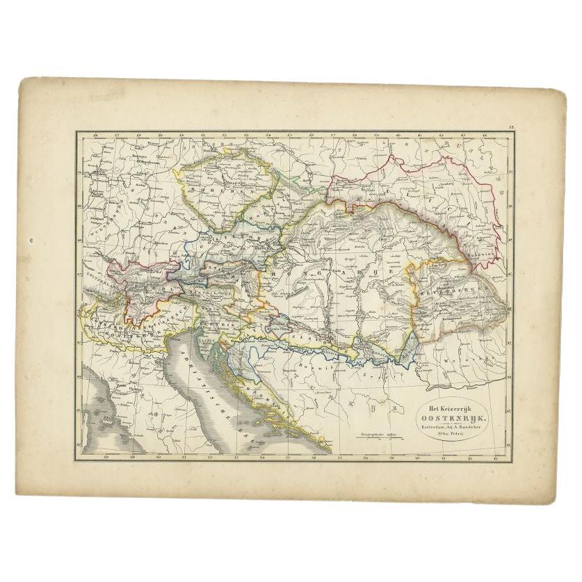
- Antique Map of the Austrian Empire by Petri, 1852Located in Langweer, NLAntique map titled 'Het Keizerrijk Oostenrijk'. Map of the Austrian Empire. This map originates from 'School-Atlas van alle deelen der Aarde' by Otto Petri....Category
Antique 19th Century Maps
MaterialsPaper
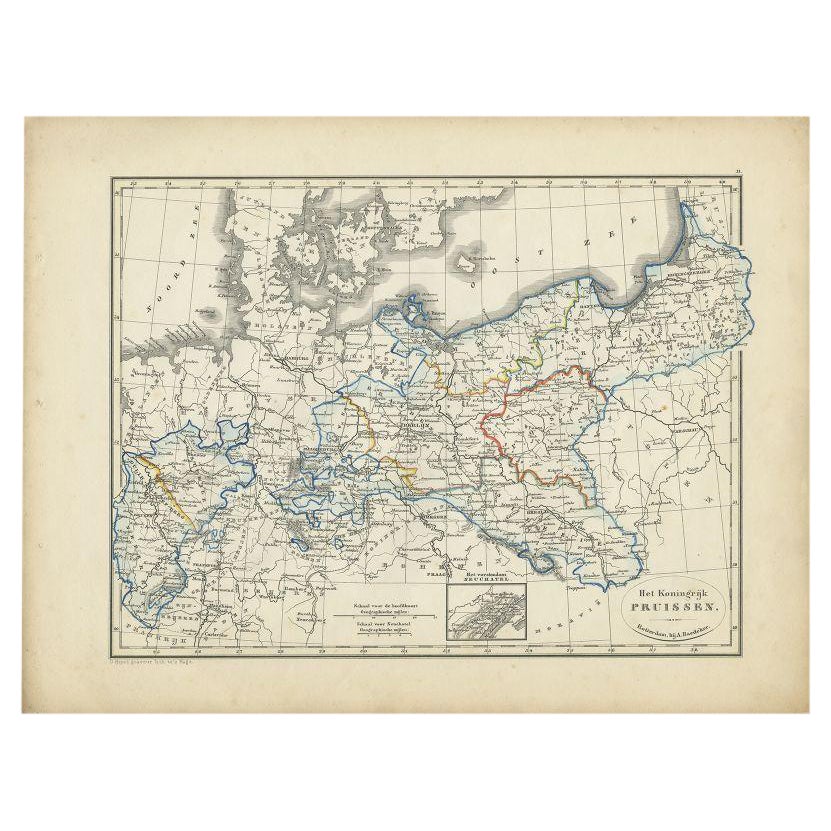
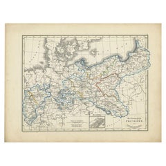
- Antique Map of the Kingdom of Prussia by Petri, 1852Located in Langweer, NLAntique map titled 'Het Koningrijk Pruissen'. Map of the Kingdom of Prussia. This map originates from 'School-Atlas van alle deelen der Aarde' by Otto Petri. Artists and Engraver...Category
Antique 19th Century Maps
MaterialsPaper
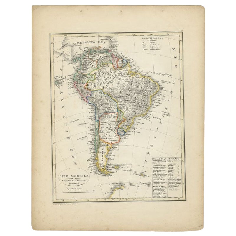
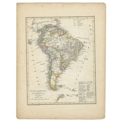
- Antique Map of South America by Petri, 1852By Thomas KitchinLocated in Langweer, NLAntique map titled 'Zuid-Amerika'. Map of South America. This map originates from 'School-Atlas van alle deelen der Aarde' by Otto Petri. Artists and Engrav...Category
Antique 19th Century Maps
MaterialsPaper
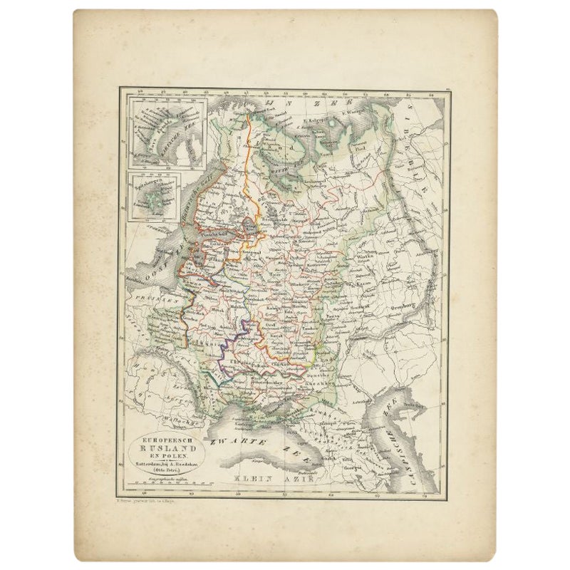
- Antique Map of Russia and Poland by Petri, 1852Located in Langweer, NLAntique map titled 'Europeesch Rusland en Polen'. Map of Russia in Europe and Poland. This map originates from 'School-Atlas van alle deelen der Aarde' by Otto Petri...Category
Antique 19th Century Maps
MaterialsPaper
- Antique Map of Sweden and Norway by Petri, 1852Located in Langweer, NLAntique map titled 'Zweden en Noorwegen'. Map of Sweden and Norway. This map originates from 'School-Atlas van alle deelen der Aarde' by Otto Petri. Artists...Category
Antique 19th Century Maps
MaterialsPaper
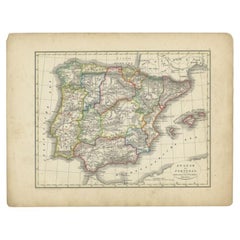
- Antique Map of Spain and Portugal by Petri, 1852Located in Langweer, NLAntique map titled 'Spanje en Portugal'. Map of Spain and Portugal. This map originates from 'School-Atlas van alle deelen der Aarde' by Otto Petri. Artists and Engravers: Published ...Category
Antique 19th Century Maps
MaterialsPaper


You May Also Like
- Original Antique Map of The Netherlands, Engraved by Barlow, Dated 1807Located in St Annes, LancashireGreat map of Netherlands Copper-plate engraving by Barlow Published by Brightly & Kinnersly, Bungay, Suffolk. Dated 1807 Unframed.Category
Antique Early 1800s English Maps
MaterialsPaper
- Original Antique Map of The Netherlands, Sherwood, Neely & Jones, Dated 1809Located in St Annes, LancashireGreat map of The Netherlands Copper-plate engraving by Cooper Published by Sherwood, Neely & Jones. Dated 1809 Unframed.Category
Antique Early 1800s English Maps
MaterialsPaper
- 1861 Topographical Map of the District of Columbia, by Boschke, Antique MapLocated in Colorado Springs, COPresented is an original map of Albert Boschke's extremely sought-after "Topographical Map of the District of Columbia Surveyed in the Years 1856 ...Category
Antique 1860s American Historical Memorabilia
MaterialsPaper
- School Chart or Pull Down Map of Geography of the Netherlands, 1950sLocated in Hemiksem, VANA beautiful old school map of the Netherlands, painted on linen. The map shows the 3 different reliefs (low, middle, high) of the Netherlands. The beau...Category
Vintage 1950s Belgian Mid-Century Modern Maps
MaterialsLinen, Paint
- Large1852 Map "Russian Empire" Ric.r0011Located in Norton, MALarge 1852 map "Russian Empire" George Phillips & Son 1852 Ric.r0011 Dimension: Paper: 67 cm W x 52 cm H ; Sight: 60cm W x 50 cm H Condition: Good Condition with aged tonin...Category
Antique 19th Century Unknown Maps
MaterialsPaper
- 1752 Vaugoundy Map of Flanders : Belgium, France, and the Netherlands, Ric.a002Located in Norton, MALarge Vaugoundy Map of Flanders: Belgium, France, and the Netherlands Colored -1752 Ric.a002 Description: This is a 1752 Didier Robert de Vaugondy map of Flanders. The map de...Category
Antique 17th Century Unknown Maps
MaterialsPaper


Recently Viewed
View AllMore Ways To Browse
Antique Netherlands
Antique Furniture Netherlands
Antique The Netherlands
Dutch School Antique
Vans Coat Of Arms
Map Of Luxembourg
Otto Petri
Antique Architecture Plan
Seven Fold
Antique Map Series
Antique Street Maps
Scottish Fold
Antique Doctors Office Furniture
Antique Prints Of A Cross
Atlas Furniture Company
Antique Map Set
Balinese Wood
Portuguese 16th