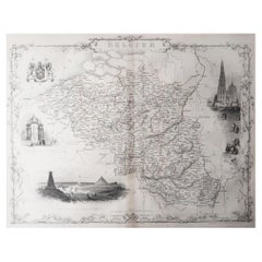
Original Antique Map London
16
to
38
329
29
136
109
108
103
87
31
27
26
20
13
13
12
12
11
11
11
9
7
7
6
5
4
4
4
3
3
3
3
3
3
3
3
3
2
2
2
2
2
2
1
1
1
1
1
1
1
1
1
1
1
42
42
9
4
3
Sort By
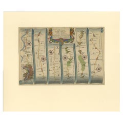
Original Antique Map of the Road from London to Bensington
Located in Langweer, NL
Antique map titled 'The Road from London to St. Davids in com: Pembroke (..)'. A strip map of the
Category
Antique Late 17th Century Maps
Materials
Paper
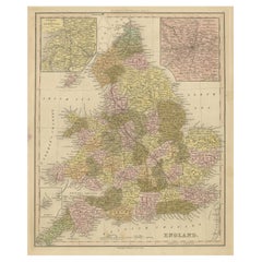
Antique Map of England with Inset Maps of the Region of Liverpool and London
Located in Langweer, NL
Antique map titled 'England'. Original antique map of England, with two inset maps of the region of
Category
Antique Mid-19th Century Maps
Materials
Paper
H 17.33 in W 13.86 in D 0.02 in
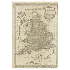
Original Antique Map of England and Wales
Located in Langweer, NL
Improvements'. Original antique map of England and Wales. Printed by Alex Hogg, London for George Henry
Category
Antique Late 18th Century Maps
Materials
Paper
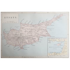
Original Antique Map of Cyprus. Circa 1880
Located in St Annes, Lancashire
Great map of Cyprus
Drawn and Engraved by R.Walker
Published W.Mackenzie, London
Original colour
Category
Antique 1880s English Maps
Materials
Paper
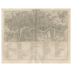
Antique Map of the City of London by Balbi '1847'
Located in Langweer, NL
Antique map titled 'London'. Original antique map of the city of London. This map originates from
Category
Antique Mid-19th Century Maps
Materials
Paper
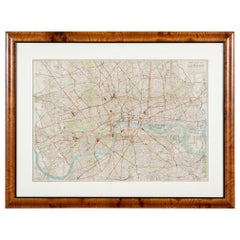
Antique "New Plan of London" Map by John Bartholomew, 1900
Located in Bridgeport, CT
Produced for the W.H. Smith guide, folded in the original. The map here is unfolded and framed flat
Category
Antique Early 1900s English Victorian Maps
Materials
Paper
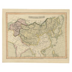
Original Antique Map of Central Asia by Smith, 1808
Located in Langweer, NL
.
We sell original antique maps to collectors, historians, educators and interior decorators all over
Category
Antique 19th Century Maps
Materials
Paper
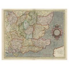
Original Old Map of South East England Incl London, Oxford, Cambridge, Etc, 1633
Located in Langweer, NL
Antique map titled 'Warwicum, Northhamtonia, Huntingdonia, Cantabrigia, Suffolcia, Oxonium
Category
Antique 1630s Maps
Materials
Paper
H 16.15 in W 21.26 in D 0 in
Original Antique Map of Belgium by Tallis, Circa 1850
Located in St Annes, Lancashire
Great map of Belgium
Steel engraving
Many lovely vignettes
Published by London Printing
Category
Antique 1850s English Maps
Materials
Paper
Decorative Original Antique Map of Southern Germany, c.1730
Located in Langweer, NL
"Antique map titled 'The South West Part of Germany. Containing ye Dominions of the Archbishops and
Category
Antique 18th Century Maps
Materials
Paper
Original Antique Map of the Cape Verde Islands, 1746
Located in Langweer, NL
Antique map titled 'Carte Des Isles Du Cap Verd.' Original antique map of the Cape Verde Islands
Category
Antique 18th Century Maps
Materials
Paper
London 1744 Published Watercolour Antique Map of East Africa by Eman Bowen
Located in GB
This is a decorative antique engraved map of East Africa, colored by kingdoms and provinces.
The map
Category
Antique 1740s English George III Maps
Materials
Paper
H 17.52 in W 21.07 in D 0.79 in
Antique Map of England and London with Two Large Allegorical Views, c.1720
Located in Langweer, NL
Antique map titled 'Nouvelle Carte du gouvernement civil d'Angleterre (..)'. Old plan of London
Category
Antique 18th Century Maps
Materials
Paper
No Reserve
H 16.54 in W 19.69 in D 0 in
Detailed Original Antique Map of Turkey in Europe, circa 1740
Located in Langweer, NL
x 16 cm.
We sell original antique maps to collectors, historians, educators and interior
Category
Antique 18th Century Maps
Materials
Paper
Original Antique Map of the Road from Andover to Crewkerne
Located in Langweer, NL
Antique map titled 'The Continuations of the Road from London to the Lands End'. Original antique
Category
Antique Late 17th Century Maps
Materials
Paper
Antique Map of London Showing the Area from Essex to Surrey, England, 1741
Located in Langweer, NL
Antique map titled 'Regionis quae est circa Londinum specialis repraesentatio (..)'
Very detailed
Category
Antique 18th Century Maps
Materials
Paper
No Reserve
H 24.89 in W 21.11 in D 0 in
Antique Zoological Map, 1843
Located in Langweer, NL
x 26.5 cm.
We sell original antique maps to collectors, historians, educators and interior
Category
Antique 19th Century Maps
Materials
Paper
Original Antique Map of the Road from Marlborough to Huntspil
Located in Langweer, NL
Antique map titled 'The Continuation of the Road from London to Bristol (..)'. A strip map of the
Category
Antique Late 17th Century Maps
Materials
Paper
Original Hand-Colored Antique County Map of Durham, England, 1804
Located in Langweer, NL
Antique county map of Durham first published c.1800. Villages, towns, and cities illustrated
Category
Antique Early 1800s Maps
Materials
Paper
No Reserve
H 21.26 in W 25.2 in D 0 in
Antique Map of France Divided into Departments, with Original Hand Coloring
Located in Langweer, NL
Antique map titled 'A New Map of France (..)'. Original old map of France, divided into departments
Category
Antique Late 18th Century Maps
Materials
Paper
H 21.66 in W 25.36 in D 0.02 in
Original Antique Map of the Harbour of Tongatabu by Cook, 1784
Located in Langweer, NL
original antique maps to collectors, historians, educators and interior decorators all over the world. Our
Category
Antique 18th Century Maps
Materials
Paper
Original Antique Map of the West Indies by J. Arrowsmith, 1842
Located in Langweer, NL
Title: "J. Arrowsmith's 19th Century Map of the West Indies"
This original antique map, crafted by
Category
Antique Early 19th Century Maps
Materials
Paper
No Reserve
H 20.87 in W 27.17 in D 0 in
Original Antique Map of the Channel Islands, Incl. Decorative Vignettes, 1851
Located in Langweer, NL
Antique map titled ‘Channel Islands’.
Includes decorative vignettes titled St. Peters Port
Category
Antique 1850s Maps
Materials
Paper
H 14.57 in W 10.24 in D 0 in
Original Antique Hand-colored Map of the United States, circa 1845
Located in Langweer, NL
Antique map titled 'United States'. Old map of the United States, includes the last part of the
Category
Antique Mid-19th Century Maps
Materials
Paper
Original Antique Map / City Plan of Brussels by Tallis, circa 1850
Located in St Annes, Lancashire
Great map of Brussels.
Steel engraving.
Published by London Printing & Publishing Co
Category
Antique 1850s English Maps
Materials
Paper
No Reserve
H 13.75 in W 10.75 in D 0.07 in
Original Antique Map of Hungary and Transylvania 'Modern Day Romania', C.1710
Located in Langweer, NL
Antique map titled 'Hungary and Transilvania'.
Original antique map of Hungary and Transylvania
Category
Antique 1710s Maps
Materials
Paper
H 9.45 in W 14.38 in D 0 in
Antique Map of Denmark with an Inset Map of Iceland, 1832
Located in Langweer, NL
.
Image size: 48 x 60 cm.
We sell original antique maps to collectors, historians, educators and
Category
Antique 19th Century Maps
Materials
Paper
Original Hand-Colored Antique Map of the County of Hereford in England, 1804
Located in Langweer, NL
Antique county map of Herefordshire first published c.1800. Villages, towns, and cities illustrated
Category
Antique Early 19th Century Maps
Materials
Paper
H 25.2 in W 21.26 in D 0.02 in
Original Antique Map of the Island of Dominica in the West Indies, 1794
Located in Langweer, NL
to both French and English influences.
Published in London in 1794 by John Stockdale, this map was a
Category
Antique 1790s Maps
Materials
Paper
Miniature Antique Map of England and Wales
Located in Langweer, NL
Miniature map titled 'England & Wales'. Original antique map of England & Wales. This map
Category
Antique Early 19th Century Maps
Materials
Paper
Antique Tidal Chart and Botanical Map, 1843
Located in Langweer, NL
.
Date: 1843
Overall size: 22.7 x 28.5 cm.
Image size: 19.5 x 26.5 cm.
We sell original antique maps
Category
Antique 19th Century Maps
Materials
Paper
Antique Map of the Coromandel Peninsula, 1754
Located in Langweer, NL
Antique map titled 'A map of Coromandel shewing the Seat of War on that coast'. Rare map of
Category
Antique 18th Century Maps
Materials
Paper
Antique Map of Asia by Guthrie, 1787
Located in Langweer, NL
Overall size: 25.5 x 21.5 cm.
Image size: 23 x 19 cm.
We sell original antique maps to collectors
Category
Antique 18th Century Maps
Materials
Paper
Antique Map of France by Faden, 1792
Located in Langweer, NL
Antique map titled 'France divided into Metropolitan Circles (..)'. Large, original antique map of
Category
Antique 18th Century Maps
Materials
Paper
Antique Map of Portugal by Moll, 1727
Located in Langweer, NL
Antique map Portugal titled 'Portugal Agreeable to Modern History'. Detailed map of Portugal
Category
Antique 18th Century Maps
Materials
Paper
Original Antique Map of the Peninsula of India with Part of Ceylon by Wyld, 1844
Located in Langweer, NL
This extensive map of India, spanning two sheets, draws from Reynell’s original map and
Category
Antique Mid-18th Century Maps
Materials
Paper
No Reserve
H 33.47 in W 23.23 in D 0 in
Antique Map of Suffren Island by Cook, 1784
Located in Langweer, NL
Overall size: 23.5 x 30.5 cm.
Image size: 21 x 25.5 cm.
We sell original antique maps to collectors
Category
Antique 18th Century Maps
Materials
Paper
Antique Map of Christmas Island by Cook, 1784
Located in Langweer, NL
sell original antique maps to collectors, historians, educators and interior decorators all over the
Category
Antique 18th Century Maps
Materials
Paper
Antique Map of Turkey in Europe, c.1780
Located in Langweer, NL
Antique map titled 'Bowles's new pocket map of Turky in Europe divided into its Provinces'. Large
Category
Antique 18th Century Maps
Materials
Paper
Antique Map of Holland with Colorful Vignettes, 1851
Located in Langweer, NL
carefully.
We sell original antique maps to collectors, historians, educators and interior decorators
Category
Antique 19th Century Maps
Materials
Paper
Antique Steel Engraved Map of Asia, c.1860
Located in Langweer, NL
cm.
We sell original antique maps to collectors, historians, educators and interior decorators all
Category
Antique 19th Century Maps
Materials
Paper
Large Antique Map of the Asian Continent, 1814
Located in Langweer, NL
50.5 cm.
We sell original antique maps to collectors, historians, educators and interior decorators
Category
Antique 19th Century Maps
Materials
Paper
Antique Map of Denmark by Hall, circa 1820
Located in Langweer, NL
Antique map titled 'Denmark'. A map of Denmark and the direct surroundings (northern Germany
Category
Antique 19th Century Maps
Materials
Paper
Antique Decorative French Map of Java, Indonesia, 1718
Located in Langweer, NL
-related toning. Please study image carefully.
Date: 1718
We sell original antique maps to collectors
Category
Antique 18th Century Maps
Materials
Paper
Antique Map of the British Isles by Johnston '1909'
Located in Langweer, NL
Antique map titled 'The British Isles'. Original antique map of the British Isles. With inset maps
Category
Early 20th Century Maps
Materials
Paper
Antique Physical Map of the World by Reynolds, 1849
Located in Langweer, NL
22.7 cm.
Image size: 27 x 21 cm.
We sell original antique maps to collectors, historians, educators
Category
Antique 19th Century Maps
Materials
Paper
Antique Map of Port Pallisers & Kersmis by Cook, 1784
Located in Langweer, NL
14 cm.
We sell original antique maps to collectors, historians, educators and interior decorators
Category
Antique 18th Century Maps
Materials
Paper
Antique Map of Australia and New Zealand, c.1860
Located in Langweer, NL
tears and repairs. Please study image carefully.
We sell original antique maps to collectors
Category
Antique 19th Century Maps
Materials
Paper
Antique Map of West Canada by Tallis 'c.1850'
Located in Langweer, NL
Antique map titled 'West Canada'. Original antique map of West Canada, with decorative vignettes
Category
Antique Mid-19th Century Maps
Materials
Paper
Antique Map of the Southern Hemipshere by Lowry '1852'
Located in Langweer, NL
Antique map titled 'Perspective Projection of The World on the horizon of London'. Original map of
Category
Antique Mid-19th Century Maps
Materials
Paper
Antique Map of the Northern Hemisphere by Lowry, '1852'
Located in Langweer, NL
Antique map titled 'Perspective Projection of the World on the horizon of London'. Original map of
Category
Antique Mid-19th Century Maps
Materials
Paper
Antique Map of the Middle East by Smith, 1809
Located in Langweer, NL
40 cm.
Image size: 55 x 35 cm.
We sell original antique maps to collectors, historians, educators
Category
Antique 19th Century Maps
Materials
Paper
Antique Map of the Koblentz Region by Moll, 1695
By Herman Moll
Located in Langweer, NL
size: 13.5 x 16.5 cm.
We sell original antique maps to collectors, historians, educators and
Category
Antique 17th Century Maps
Materials
Paper
Large Antique Map of Denmark by Bowles, c.1780
By Thomas
Located in Langweer, NL
size: 59.4 x 50.5 cm.
Image size: 53.4 x 47 cm.
We sell original antique maps to collectors
Category
Antique 18th Century Maps
Materials
Paper
Antique Map of Asia Showing Its Political Divisions, 1874
Located in Langweer, NL
sell original antique maps to collectors, historians, educators and interior decorators all over the
Category
Antique 19th Century Maps
Materials
Paper
Antique Map of the East Indies by Guthrie, 1787
Located in Langweer, NL
: 31 x 21 cm.
Image size: 28 x 19 cm.
We sell original antique maps to collectors, historians
Category
Antique 18th Century Maps
Materials
Paper
Antique Map of the Low Countries by Cary, 1813
Located in Langweer, NL
62.5 cm.
We sell original antique maps to collectors, historians, educators and interior decorators
Category
Antique 19th Century Maps
Materials
Paper
Antique Map of the Pacific Ocean by Anson, 1765
Located in Langweer, NL
sell original antique maps to collectors, historians, educators and interior decorators all over the
Category
Antique 18th Century Maps
Materials
Paper
Antique Map of the United Kingdom and Ireland, c.1873
Located in Langweer, NL
Overall size: 26 x 32.9 cm.
Image size: 22.3 x 29.8 cm.
We sell original antique maps to collectors
Category
Antique 19th Century Maps
Materials
Paper
Antique Map of the Port of Acapulco in Mexico, 1749
Located in Langweer, NL
Antique map titled 'Plan van de Haven van Acapulco (..) - Plan du Port d'Acapulco (..)'. Original
Category
Antique 18th Century Maps
Materials
Paper
- 1
Get Updated with New Arrivals
Save "Original Antique Map London", and we’ll notify you when there are new listings in this category.
Original Antique Map London For Sale on 1stDibs
At 1stDibs, there are many versions of the ideal original antique map london for your home. Each original antique map london for sale was constructed with extraordinary care, often using paper, wood and metal. There are 233 variations of the antique or vintage original antique map london you’re looking for, while we also have 1 modern editions of this piece to choose from as well. Your living room may not be complete without an original antique map london — find older editions for sale from the 18th Century and newer versions made as recently as the 21st Century. An original antique map london is a generally popular piece of furniture, but those created in Victorian, Georgian and Louis XVI styles are sought with frequency. You’ll likely find more than one original antique map london that is appealing in its simplicity, but Jacobus Houbraken, Thomas Kitchin and Ackermann and Fritze produced versions that are worth a look.
How Much is a Original Antique Map London?
Prices for an original antique map london can differ depending upon size, time period and other attributes — at 1stDibs, they begin at $30 and can go as high as $25,523, while the average can fetch as much as $481.
More Ways To Browse
Route Guide
World Map The World
Amen Corner
Antique Maps Of British Isles
Maps Cambridge England
Used Furniture Cabo San Lucas
Japanese Furniture 1700
Antique Maps Singapore
Antique Mexican Door
Antique Mexican Doors
Georgetown Antique
Antique Furniture County Durham
Congo Antique Map
Swan Garden Seat
Jeffery Brown
Atlas Indu
Map Of German
Map Of The Netherlands
