Items Similar to 1891 Map of Plymouth County Mass
Want more images or videos?
Request additional images or videos from the seller
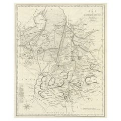
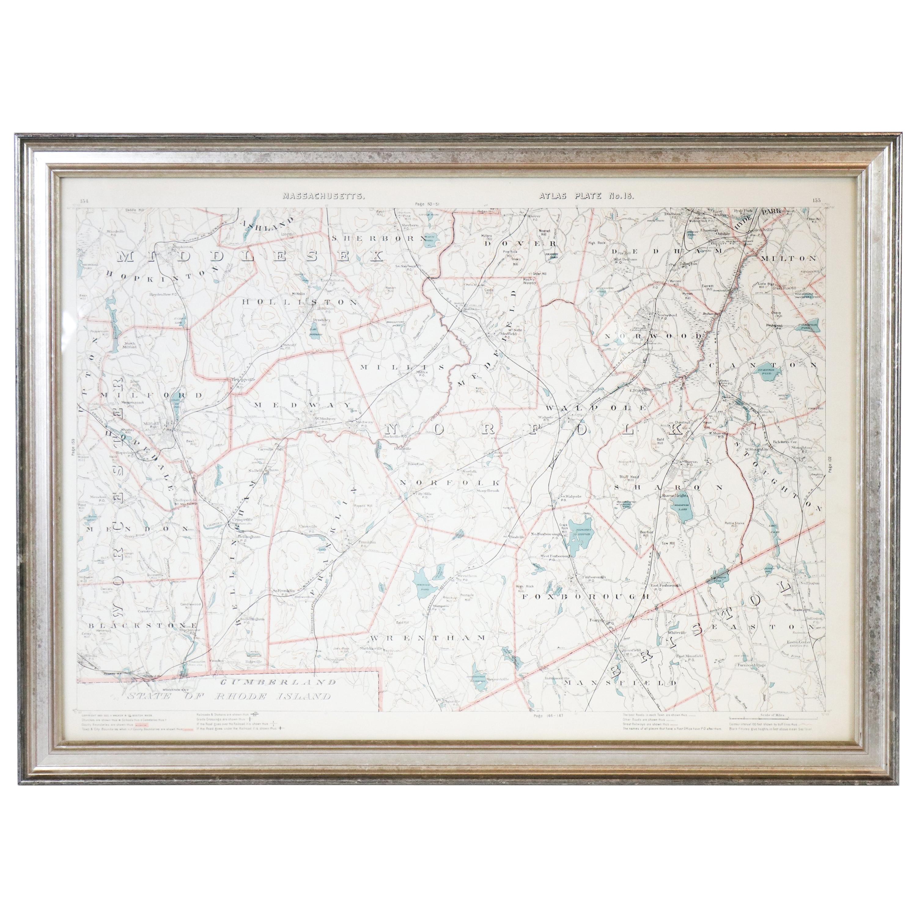
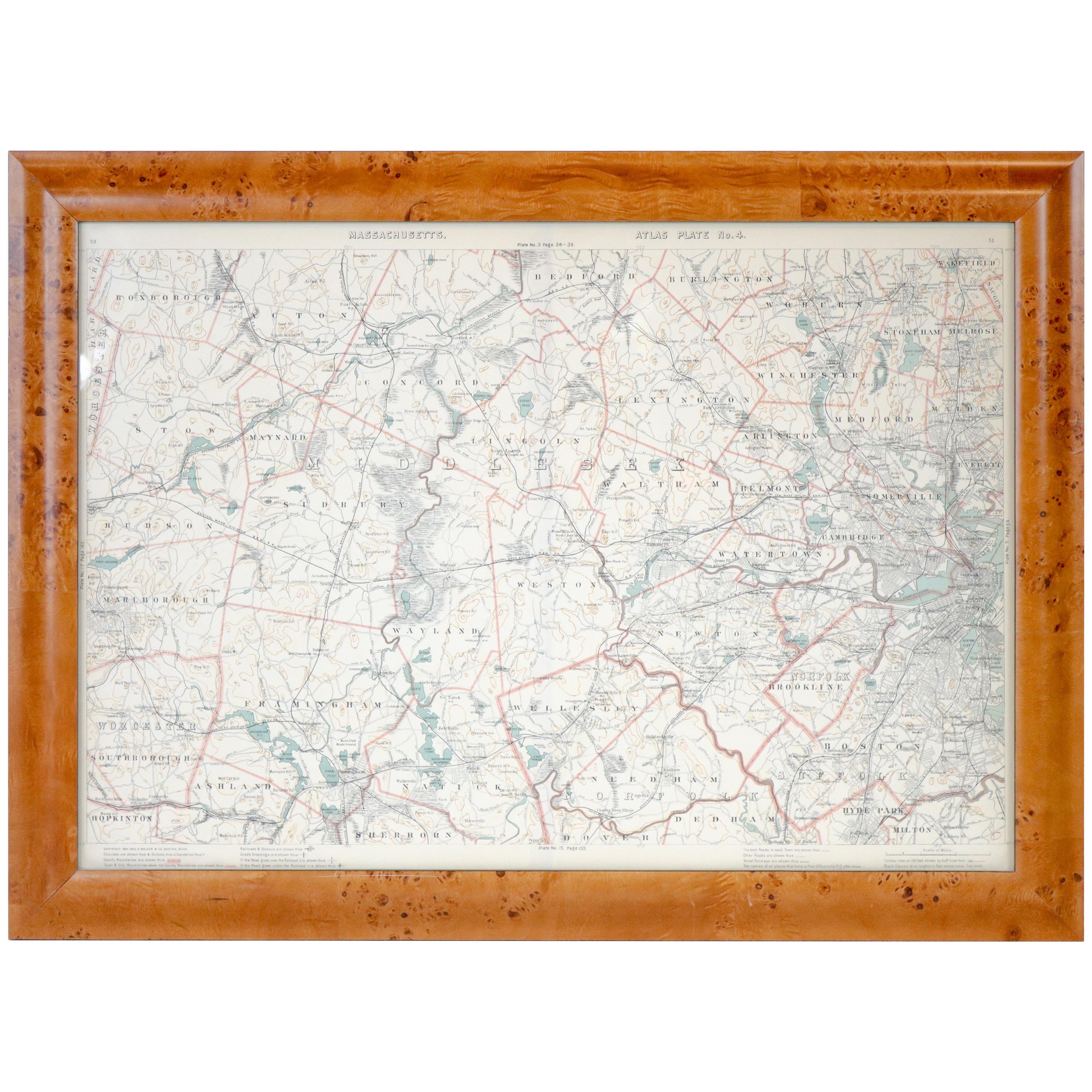
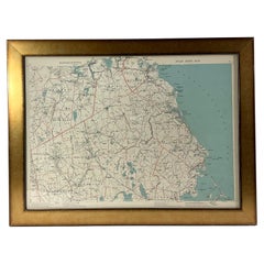
1891 Map of Plymouth County Mass
About the Item
Original 1891 map showing Sandwich, Bourne, Plymouth Carver, Middleborough, Plympton and Kingston. Showing Long Beach in Plymouth also as well as all shore points. Cape Cod Bay is marked on the map, marked George Walker 1891. This is Atlas Plate no. 7. Not a copy.
Weight: 8 lbs.
Overall Dimensions: 23"H x 31"W
Made: American
Material: Paper
Date: 1891
- Dimensions:Height: 23 in (58.42 cm)Width: 31 in (78.74 cm)Depth: 2 in (5.08 cm)
- Materials and Techniques:
- Place of Origin:
- Period:
- Date of Manufacture:1891
- Condition:
- Seller Location:Norwell, MA
- Reference Number:
About the Seller
5.0
Vetted Seller
These experienced sellers undergo a comprehensive evaluation by our team of in-house experts.
Established in 1967
1stDibs seller since 2015
347 sales on 1stDibs
Typical response time: 2 hours
- ShippingRetrieving quote...Ships From: Norwell, MA
- Return PolicyThis item cannot be returned.
More From This SellerView All
- 1891 Map of Norfolk County MassachusettsLocated in Norwell, MA1891 map of Norfolk county Massachusetts including the towns of Wrentham, Franklin, Medfield, Sherborn, Norwood etc., measures: 23 x 31.Category
Antique 19th Century Maps
- Original 1891 Walker MapLocated in Norwell, MAOriginal 1891 map of Massachusetts by Walker. Towns include Cambridge, Boston, Dedham, Ashland, Brookline, Newton etc... burl wood frame. Measures...Category
Antique 19th Century Maps
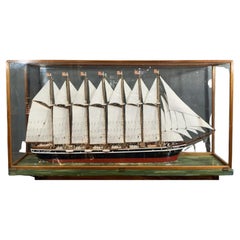
- Cased Model of the Famous Quincy MassLocated in Norwell, MACased model of the famous Quincy Mass built seven masted schooner Thomas W Lawson. Detailed with crew on deck and a full suit of sails. Fitted to a custom ...Category
Vintage 1950s Nautical Objects
MaterialsWood
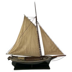
- Model of the Oyster Sloop Fanny Fern of Quincy MassLocated in Norwell, MAPeriod model of the sloop Fanny Fern of Quincy Mass. Exceptional antique model that shows the craft in great detail including the bulwarks, cabin, hatch, launch, winch, etc. Fitted with a pair of accurate sails. Set on a wood cradle...Category
Antique 1880s North American Models and Miniatures
MaterialsWood
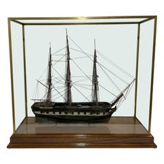
- Antique Model of the Packet Ship “Lady Gay” of Newbury MassLocated in Norwell, MAThis is a well-preserved model dating to the early 1900’s. in original paint. Vessel name is painted on the stern. Fully rigged with all appropriate cords. Mounted into a custom display case...Category
Antique Early 1900s North American Models and Miniatures
MaterialsWood
- 1891 Map of South Shore of BostonLocated in Norwell, MAOriginal 1891 map showing Cohasset, Scituate, Marshfield, Duxbury, Kingston, Norwell, Hanover, Hingham, Hull, Holbrook, Weymouth, Hanson, Pembroke, etc. Framed with glass. Circa 1891.Category
Antique 1890s North American Prints
MaterialsPaper


You May Also Like
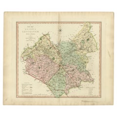
- Antique County Map of Leicestershire, England, 1804Located in Langweer, NLAntique county map of Leicestershire first published c.1800. Villages, towns, and cities illustrated include Lutterworth, Ashby, Hinkley, and Marke...Category
Antique Early 1800s Maps
MaterialsPaper
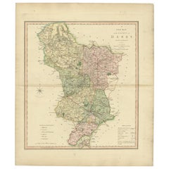
- Antique County Map of Derbyshire, England, 1804Located in Langweer, NLAntique county map of Derbyshire first published, circa 1800. Villages, towns, and cities illustrated include Chesterfield, Wirksworth, Derby, and ...Category
Antique Early 1800s Maps
MaterialsPaper
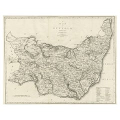
- Large Antique County Map of Suffolk, EnglandLocated in Langweer, NLAntique map titled 'A Map of Suffolk from the best Authorities'. Original old county map of Suffolk, England. Engraved by John Cary. Originates from 'New British Atlas' by John Stock...Category
Antique Early 19th Century Maps
MaterialsPaper
- Large Antique County Map of Cambridgeshire, EnglandLocated in Langweer, NLAntique map titled 'A Map of Cambridgeshire from the best Authorities'. Original old county map of Cambridgeshire, England. Engraved by John Cary. Originates from 'New British Atlas'...Category
Antique Early 19th Century Maps
MaterialsPaper
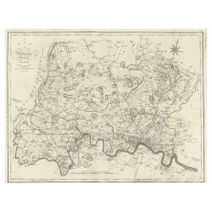
- Large Antique County Map of Middlesex, EnglandLocated in Langweer, NLAntique map titled 'A Map of Middlesex from the best Authorities'. Original old county map of Middlesex, England. Engraved by John Cary. Originates from 'New British Atlas' by John S...Category
Antique Early 19th Century Maps
MaterialsPaper
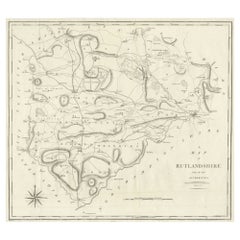
- Large Antique County Map of Ruthlandshire, EnglandLocated in Langweer, NLAntique map titled 'A Map of Ruthlandshire from the best Authorities'. Original old county map of Ruthlandshire, England. Engraved by John Cary. Originates from 'New British Atlas' b...Category
Antique Early 19th Century Maps
MaterialsPaper