Items Similar to Antique Italian Map of Viaggio da Roma a Napoli 1775


Want more images or videos?
Request additional images or videos from the seller
1 of 6
Antique Italian Map of Viaggio da Roma a Napoli 1775
About the Item
An original print from 1775 showing an early route map of the journey from Rome to Naples. This route map was part of a collection of travellers routes published in a book translated as the 'Directorate for Travelers in Italy' by Carlo Barbieri, Bologna in 1775.
The route takes the traveler from Rome on a passage that traverses a number of key cities and eventually arrives in Naples.
The map outlines precise directions and information about the cities, castles, customs points, rivers, post offices and the distances between these various notable points. The aim was to inform the traveler about the best route to take and where to find inns to rest and rent fresh horses to continue the journey either on horseback or by carriage.
The print and paper from 1775 is well preserved and still has the original folds showing how it fitted into the guide book. We have mounted this historic piece in card here in Florence but we recommend that it is framed and put under glass to preserve it well for centuries to come.
Dimensions: Mount: H28cm X W50cm Map: H14cm X W36cm
- Dimensions:Height: 5.91 in (15 cm)Width: 14.18 in (36 cm)Depth: 0.04 in (1 mm)
- Materials and Techniques:Parchment Paper,Etched
- Place of Origin:
- Period:1770-1779
- Date of Manufacture:1775
- Condition:
- Seller Location:Roma, IT
- Reference Number:1stDibs: LU8425236318272
About the Seller
5.0
Gold Seller
These expertly vetted sellers are highly rated and consistently exceed customer expectations.
Established in 2019
1stDibs seller since 2023
24 sales on 1stDibs
Typical response time: 5 hours
- ShippingRetrieving quote...Ships From: Amelia, Italy
- Return PolicyA return for this item may be initiated within 3 days of delivery.
More From This SellerView All
- Italian Parchment Map of the City of Pisa Dated, 1640By Matthäus Merian the ElderLocated in Roma, ITAn antique map of the Tuscan city of Pisa engraved for The 'Itinerarium Italiæ Nov-antiquæ' by Matthäus Merian the Elder and printed in 1640....Category
Antique 1640s Italian Maps
MaterialsPaper
- 1880s Map of The Italian Alps from Milan to Lake GardaLocated in Roma, ITGeographical Map of the Profile and Elevation of the Italian Alps from Milano to Lake Garda. The map features the name of each peak and key cities including Monza, Brescia and Bergam...Category
Antique 1880s Italian Maps
MaterialsParchment Paper
- Pair of 17th Century Italian Travertine MantlesLocated in Roma, ITA pair of 300 year old travertine mantles salvaged from a 17th century church in Le Marche. The stone is absolutely beautiful and the pieces have aged allowing for us still to see th...Category
Antique 17th Century Italian Abstract Sculptures
MaterialsTravertine
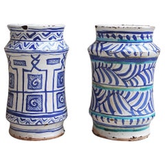
- Pair of Italian Hand-Painted Ceramic Pots / Albarelli made in the late 1800sLocated in Roma, ITA beautiful and rare pair of maiolica patterned Italian albarelli, late 1800s early 1900s. Found in Palazzo Torlogna in Rome. Alberelli were ancient storage containers often used in...Category
Antique Early 19th Century Italian Urns
MaterialsCeramic
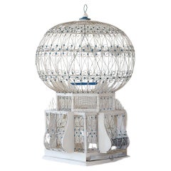
- Early 1900s Vintage Italian BirdcageLocated in Roma, ITI have been on the lookout for the ideal vintage birdcage for some time and recently came across this wonderful specimen in Rome. It is made of wood and metal wire in cream and blue....Category
Early 20th Century Italian Country Bird Cages
MaterialsMetal
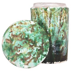
- 1800s Large Italian Fig PotLocated in Roma, ITFound in Southern Italy, this exquisite and unusual green pot made in the late 1800s was originally used to preserve dried figs. More commonly seen in a cream ceramic, this particular piece is an extraordinary green colour due to its copper and iron oxide glaze. This extravagant copper and iron oxide green was usually used for details on ceramics due to its extremely high cost. These green pots are very rare and difficult to find, we are lucky that our friends in Southern Italy salvaged...Category
Antique Late 19th Century European Planters, Cachepots and Jardinières
MaterialsCeramic


You May Also Like
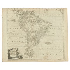
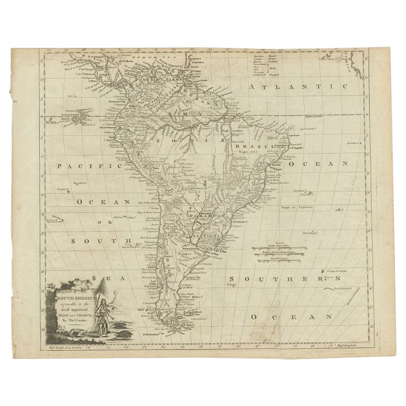
- Antique Map of South America by Conder, c.1775Located in Langweer, NLAntique map titled 'South America agreeable to the most approved maps and charts'. Rare map of South America depicting Chili, La Plata, Paraguay, Brazil, Peru, the Amazon and surroun...Category
Antique 18th Century Maps
MaterialsPaper
- Antique Map of South America by J. Cook, 1775Located in Langweer, NLAntique map titled 'Kaart van het Zuidlyk Eind van Amerika'. Map of the sourthern part of South America, focusing on Cook's tracks around the Cape Horn and T...Category
Antique Mid-18th Century Maps
MaterialsPaper
- Antique Map of South America by J. Cook (1775)Located in Langweer, NLAntique map titled 'Kaart van het Zuidlyk Eind van Amerika'. Map of the sourthern part of South America, focusing on Cook's tracks around the Cape Horn and Tierra del Fuego in 1775. ...Category
Antique Late 18th Century Maps
MaterialsPaper
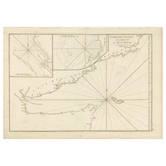
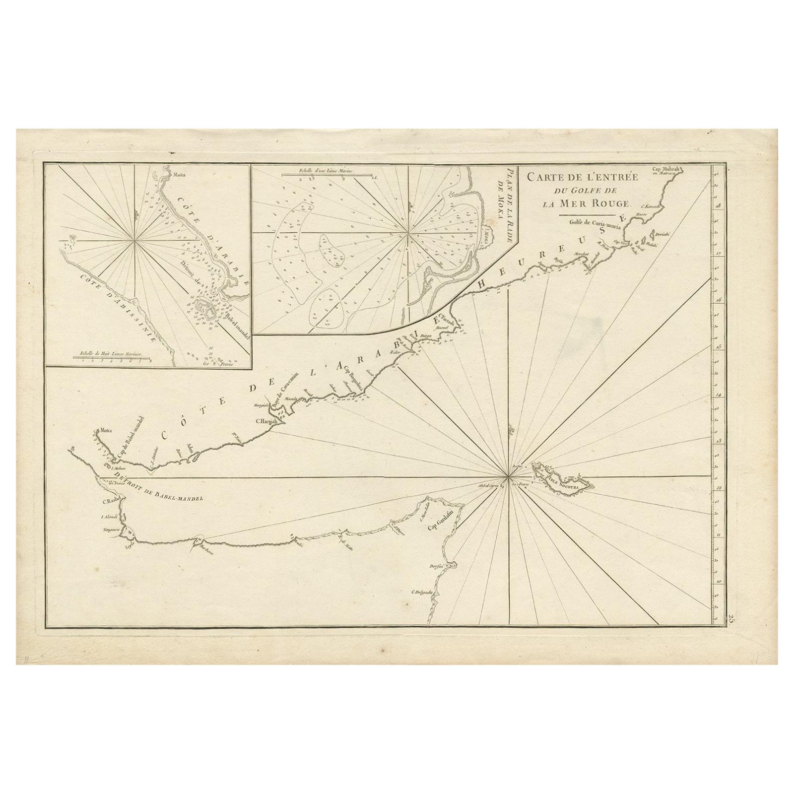
- Original Antique Engraved Map of Part of the Red Sea, Arabia, 1775Located in Langweer, NLAntique map titled 'Carte de l'Entrée du Golfe de la Mer Rouge'. Uncommon sea chart of the entrance to the Red Seas as far as Mocha, with rhumb lines and soundings. Two insets of the...Category
Antique Late 18th Century Maps
MaterialsPaper
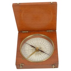
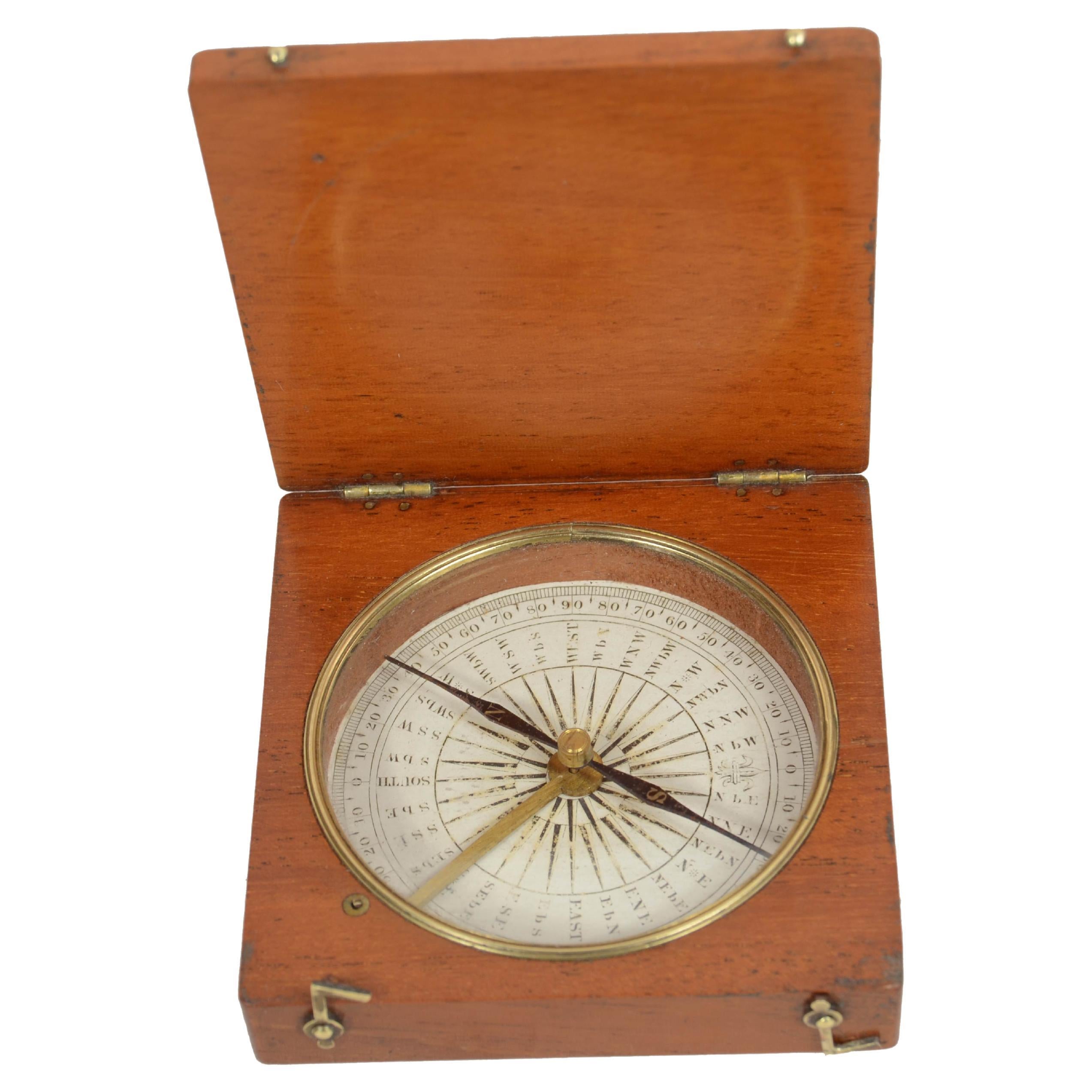
- Bussola magnetica da topografo da viaggio in legno di rovere e ottone metà '800Located in Milan, ITBussola magnetica da topografo e da viaggio, in legno di rovere e ottone; strumento costituito da un ago calamitato libero di ruotare su un piano orizzontale segnando con la punta de...Category
Antique Mid-19th Century Scientific Instruments
MaterialsWood
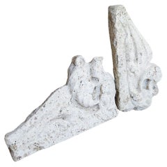
- Antique Map of South American, The West Indies & Most of Africa, Ca.1775Located in Langweer, NLAntique map titled 'Carte pour Servir a l' Histoire Philosophique et Politique des Etablissemens et du Commerce des Europeens dans les deux Indes'. This map is roughly centered o...Category
Antique 1770s Maps
MaterialsPaper