Items Similar to Antique Map of the Coast of Northwest Africa by Dien, 1820

Want more images or videos?
Request additional images or videos from the seller
1 of 5
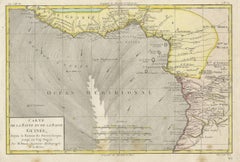
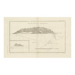
Antique Map of the Coast of Northwest Africa by Dien, 1820
About the Item
Antique map Africa titled 'Partie Occidentale de l'Ancien Continent, depuis Lisbonne jusquá la Riviere de Sierra Leona'. Detailed map of Coastal North and West Africa, from Biafra and Sierra Leone (Royaume de Mandinga) to Gibralter and Fez, also showing Madeira, the Canaries and Cape Verde Islands. This map originates from a reissue of Raynal's 'Atlas de toutes les parties du Globe Terrestre (..)'.
Artists and Engravers: Engraved by Dien
Condition: Good, general age-related toning. Some soiling and creasing, please study image carefully.
Date: 1820
Overall size: 26.5 x 42 cm.
Image size: 21 x 31.5 cm.
We sell original antique maps to collectors, historians, educators and interior decorators all over the world. Our collection includes a wide range of authentic antique maps from the 16th to the 20th centuries. Buying and collecting antique maps is a tradition that goes back hundreds of years. Antique maps have proved a richly rewarding investment over the past decade, thanks to a growing appreciation of their unique historical appeal. Today the decorative qualities of antique maps are widely recognized by interior designers who appreciate their beauty and design flexibility. Depending on the individual map, presentation, and context, a rare or antique map can be modern, traditional, abstract, figurative, serious or whimsical. We offer a wide range of authentic antique maps for any budget
- Dimensions:Height: 16.54 in (42 cm)Width: 10.44 in (26.5 cm)Depth: 0 in (0.01 mm)
- Materials and Techniques:
- Period:
- Date of Manufacture:1820
- Condition:
- Seller Location:Langweer, NL
- Reference Number:
About the Seller
5.0
Platinum Seller
These expertly vetted sellers are 1stDibs' most experienced sellers and are rated highest by our customers.
Established in 2009
1stDibs seller since 2017
1,965 sales on 1stDibs
Typical response time: <1 hour
- ShippingRetrieving quote...Ships From: Langweer, Netherlands
- Return PolicyA return for this item may be initiated within 14 days of delivery.
More From This SellerView All
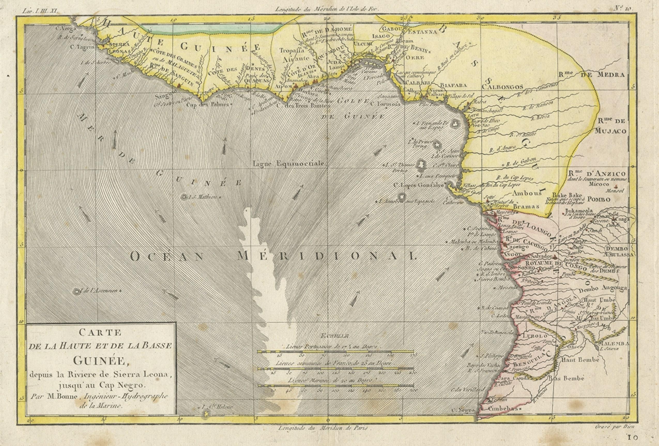
- Antique Map of the Coast of Guinea, Africa, 1820Located in Langweer, NLAntique map Africa titled 'Carte de la Haute et de la Basse Guinée'. Map of the Coast of Guinea, Africa. Represents modern day Liberia, Ivory Coast, Ghana, Nigeria, Cameroon, Gabon, Congo, and Equatorial Guinea...Category
Antique 19th Century Maps
MaterialsPaper
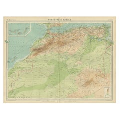
- Antique Map of Northwest Africa by Bartholomew, 1922Located in Langweer, NLAntique map of Africa titled 'North-West Africa'. Old map of north-west Africa depicting Morocco, Algeria, Tunis and surroundings. This map originates from 'The Times' atlas. Artists...Category
20th Century Maps
MaterialsPaper
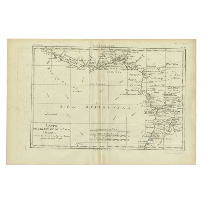
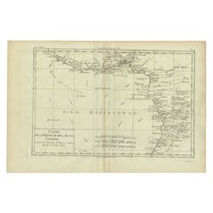
- Antique Map of the Coast of Guinea, Africa, c.1780Located in Langweer, NLAntique map Africa titled 'Carte de la Haute et de la Basse Guinée'. Map of the Coast of Guinea, Africa. Represents modern day Liberia, Ivory Coast, Ghana, Nigeria, Cameroon, Gabon, Congo, and Equatorial Guinea...Category
Antique 18th Century Maps
MaterialsPaper
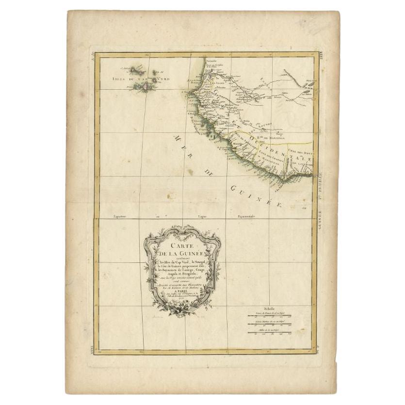
- Antique Map of the West Coast of Africa, 1771By Rigobert BonneLocated in Langweer, NLAntique map titled 'Carte de la Guinee contenant les Isles du Cap Verd, le Senegal, la Cote de Guinee proprement dite, les Royaumes de Loango, Congo, Angola, et Benguela avec les Pay...Category
Antique 18th Century Maps
MaterialsPaper
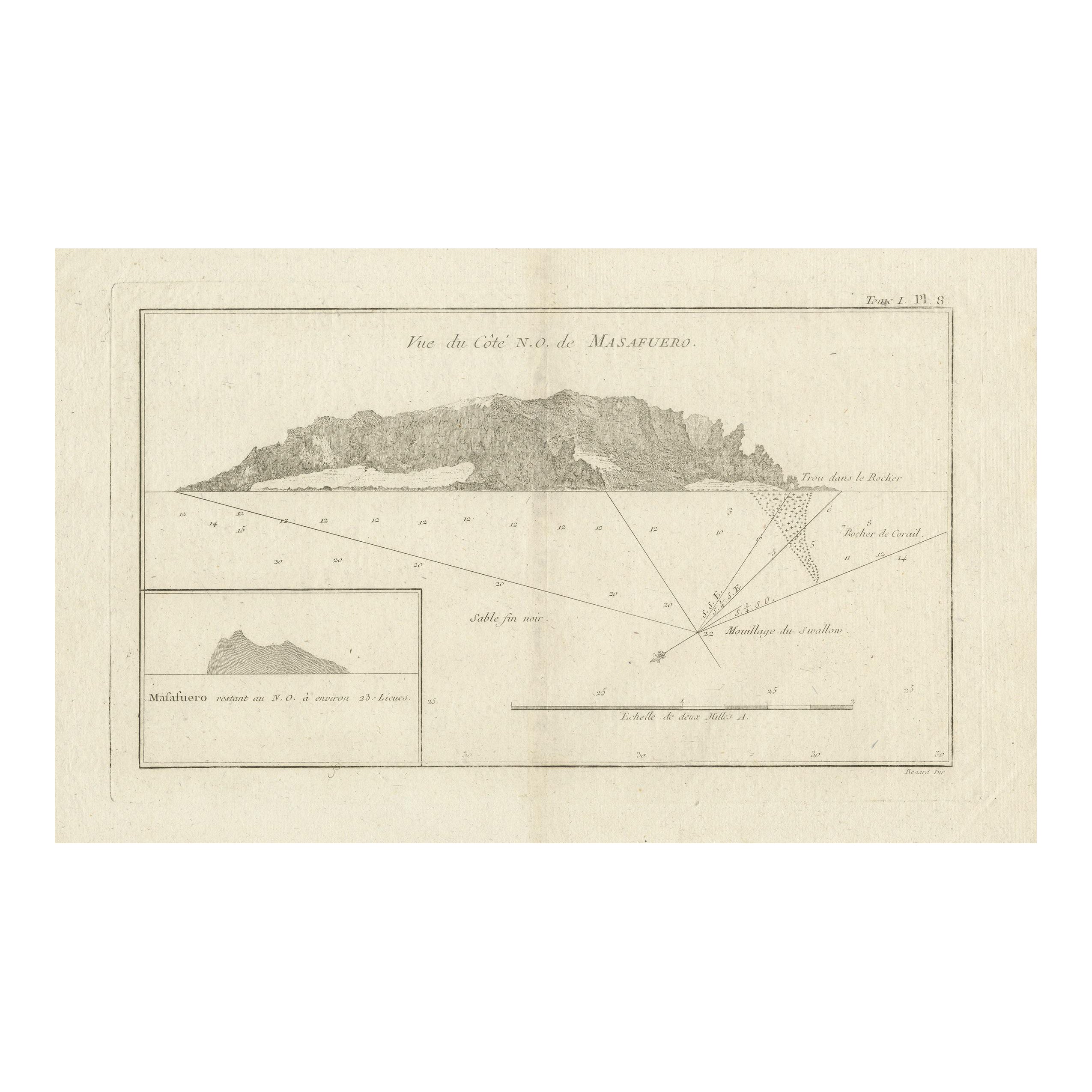
- Antique Map of the Northwest Coast of Masafuera Island or Selkirk IslandLocated in Langweer, NLAntique map titled 'Vue de Cote N.O. de Masafuero'. Profile view of the north-west coast of Masafuera Island (also called Alejandro Selkirk Island...Category
Antique Late 18th Century Maps
MaterialsPaper
- Original Detailed Antique Map of the East Coast of Africa, 1747Located in Langweer, NLAntique map titled 'Carte de la coste Orientale d'Afrique - Kaart van de Oostkust van Afrika'. Original antique map of the east coast of Africa. Reaches from Cape of Good Hope an...Category
Antique 1740s Maps
MaterialsPaper


You May Also Like
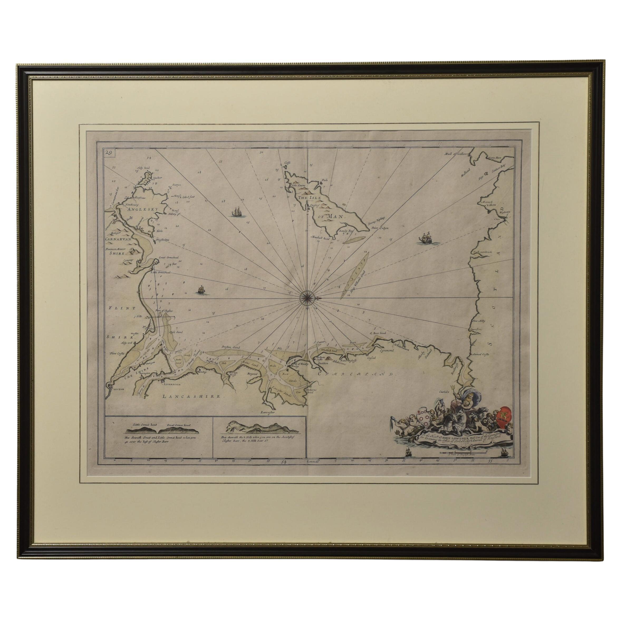
- Northwest Coast and Isle of Man MapLocated in Cheshire, GBGreenville Collins Northwest Coast and Isle of Man. hand coloured chart, encased in an ebonised frame. Dimensions Height 26.5 Inches Width 30 Inches Depth 1 InchesCategory
Early 20th Century British Maps
MaterialsPaper
- Original Antique Map of South Africa, Arrowsmith, 1820Located in St Annes, LancashireGreat map of South Africa. Drawn under the direction of Arrowsmith. Copper-plate engraving. Published by Longman, Hurst, Rees, Orme and Br...Category
Antique 1820s English Maps
MaterialsPaper
- Northwest Coast Totem by Marlin AlphonseBy Native American ArtLocated in Coeur d'Alene, IDColorful Alaskan three figure winged totem. Carved and painted by Marlin Alphonse. Noted on back "purchased by Brad and Hazel Ritter on board Royal Princes, Sitka, Alaska 1986. His name heavily carved on back. PERIOD: 1986 ORIGIN: Alaska SIZE: 13"H x 12"W x 3 1/2"D Family Owned & Operated Cisco’s Gallery deals in the rare, exceptional, and one-of-a-kind pieces that define the history of America and the Old West. Our pieces range from American Indian to Cowboy Western and include original items of everyday life, commerce, art, and warfare that tamed America’s frontier. Our 14,000 square foot gallery opened in 1996 in beautiful Coeur d’Alene, Idaho. Personal Service Cisco’s operates on old fashioned values – honesty and integrity, and all of our items are backed by our money back guarantee. We appreciate the opportunity to earn your business. Whether you desire assistance with a jewelry purchase, choosing a gift, identification, or even selling – we hope to be your trusted source. Native American carvings & totems native American Indian native American totem poles n.Category
Vintage 1980s American Native American Native American Objects
MaterialsCedar
- Circa 1900 Pair of Northwest Coast TotemsBy Native American ArtLocated in Coeur d'Alene, IDMatching pair of Northwest Coast carved model totem poles. Polychrome decorated with carved humanoid and bird figures. Each twice signed "Betty Sanners" back and bottom. Provenance Hudson Bay Fur Company, Seattle, Washington. 29"H Period: Early 20th century Origin: Northwest Coast Size: 29" base 4 1/2 x 3 1/2 Family Owned & Operated Cisco’s Gallery deals in the rare, exceptional, and one-of-a-kind pieces that define the history of America and the Old West. Our pieces range from American Indian to Cowboy Western and include original items of everyday life, commerce, art, and warfare that tamed America’s frontier. Our 14,000 square foot gallery opened in 1996 in beautiful Coeur d’Alene, Idaho. Personal Service Cisco’s operates on old fashioned values – honesty and integrity, and all of our items are backed by our money back guarantee. We appreciate the opportunity to earn your business. Whether you desire assistance with a jewelry purchase, choosing a gift, identification, or even selling – we hope to be your trusted source. Native American carvings & totems native American Indian native American totem poles n.Category
Antique Early 1900s American Native American Native American Objects
MaterialsCedar
- Original Antique Map of China, Arrowsmith, 1820Located in St Annes, LancashireGreat map of China Drawn under the direction of Arrowsmith Copper-plate engraving Published by Longman, Hurst, Rees, Orme and Brown, 1820 Unfr...Category
Antique 1820s English Maps
MaterialsPaper
- Original Antique Map of Canada, Arrowsmith, 1820Located in St Annes, LancashireGreat map of Canada. Drawn under the direction of Arrowsmith. Copper-plate engraving. Published by Longman, Hurst, Rees, Orme and Brown, 1820 ...Category
Antique 1820s English Maps
MaterialsPaper


Recently Viewed
View AllMore Ways To Browse
From The 1820
North By Northwest
North Africa Map
Antique Canary
Cape Verde
Antique Fez
42 North Antiques
Madeira Antique
1820 World Map
Sierra Leone Antique Map
Antique Nautical Map
Antique Nautical Maps
Map Of Arabia
Antique Stand Up Scale
Civil War Map
Antique Furniture Cyprus
Antique Linen Map
Antique Nautical Charts