Items Similar to Antique Map of Greece and Ionian Islands by A & C. Black, 1870


Want more images or videos?
Request additional images or videos from the seller
1 of 6
Antique Map of Greece and Ionian Islands by A & C. Black, 1870
About the Item
Antique map titled 'Hellas or Greece'. Original antique map of Greece and Ionian Islands with inset map of Corfu. This map originates from ‘Black's General Atlas of The World’. Published by A & C. Black, 1870.
- Dimensions:Height: 13 in (33 cm)Width: 17.52 in (44.5 cm)Depth: 0.02 in (0.5 mm)
- Materials and Techniques:
- Period:
- Date of Manufacture:1870
- Condition:Wear consistent with age and use. General age-related toning. some foxing, Please study image carefully.
- Seller Location:Langweer, NL
- Reference Number:
About the Seller
5.0
Platinum Seller
These expertly vetted sellers are 1stDibs' most experienced sellers and are rated highest by our customers.
Established in 2009
1stDibs seller since 2017
1,973 sales on 1stDibs
Typical response time: <1 hour
- ShippingRetrieving quote...Ships From: Langweer, Netherlands
- Return PolicyA return for this item may be initiated within 14 days of delivery.
More From This SellerView All
- Antique Map of Italy and Greece by H. Kiepert, circa 1870By Heinrich KiepertLocated in Langweer, NLAntique map titled 'Italiae pars media'. This map originates from 'Atlas Antiquus. Zwölf Karten zur Alten Geschichte' by H. Kiepert. Published in Berlin, circa 187.Category
Antique Late 19th Century Maps
MaterialsPaper
- Antique Map of Switzerland by A & C. Black, 1870Located in Langweer, NLAntique map titled 'Switzerland'. Original antique map of Switzerland. This map originates from ‘Black's General Atlas of The World’. Published by A & C. Black, 1870.Category
Antique Late 19th Century Maps
MaterialsPaper
- Antique Map of Africa by A & C, Black, 1870Located in Langweer, NLAntique map titled 'Africa'. Original antique map of Africa. This map originates from ‘Black's General Atlas of The World’. Published by A & C. Black, 1870.Category
Antique Late 19th Century Maps
MaterialsPaper
- Antique Map of China by A & C, Black, 1870Located in Langweer, NLAntique map titled 'China'. Original antique map of China. This map originates from ‘Black's General Atlas of The World’. Published by A & C. Black, 1870.Category
Antique Late 19th Century Maps
MaterialsPaper
- Antique Map of Asia by A & C, Black, 1870Located in Langweer, NLAntique map titled 'Asia'. Original antique map of Asia. This map originates from ‘Black's General Atlas of The World’. Published by A & C. Black, 1870.Category
Antique Late 19th Century Maps
MaterialsPaper
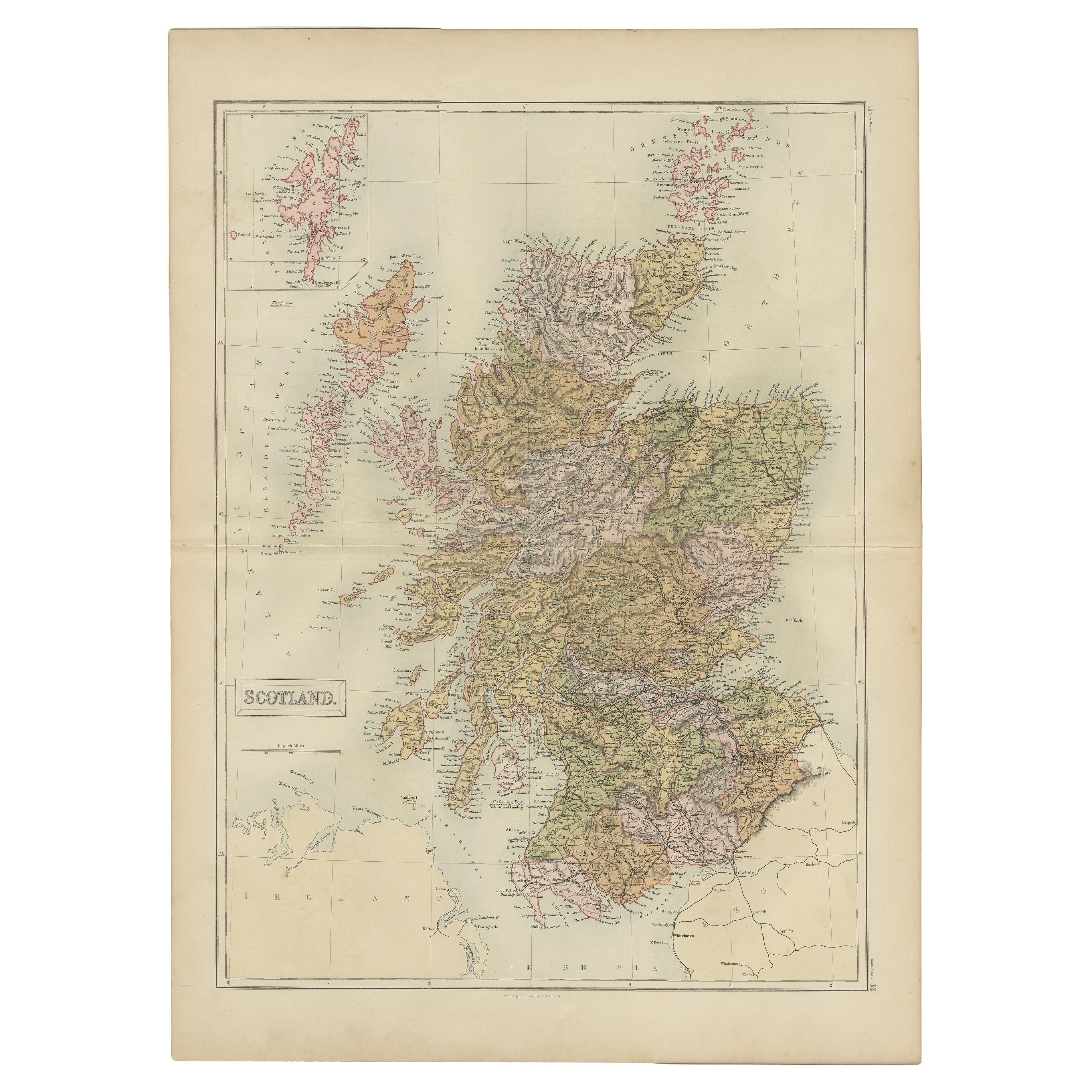
- Antique Map of Scotland by A & C. Black, 1870Located in Langweer, NLAntique map titled 'Scotland'. Original antique map of Scotland with inset map of Shetland island. This map originates from ‘Black's General Atlas of The World’. Published by A & C. ...Category
Antique Late 19th Century Maps
MaterialsPaper


You May Also Like
- Original Antique Map of Ancient Greece- Boeotia, Thebes, 1787Located in St Annes, LancashireGreat map of Ancient Greece. Showing the region of Boeotia, including Thebes Drawn by J.D. Barbie Du Bocage Copper plate engraving by P.F T...Category
Antique 1780s French Other Maps
MaterialsPaper
- Original Antique Map of Ancient Greece, Achaia, Corinth, 1786Located in St Annes, LancashireGreat map of Ancient Greece. Showing the region of Thessaly, including Mount Olympus Drawn by J.D. Barbie Du Bocage Copper plate engraving by P.F Tardieu Original hand color...Category
Antique 1780s French Other Maps
MaterialsPaper
- Original Antique Map of Ancient Greece, Phocis, Gulf of Corinth, 1787Located in St Annes, LancashireGreat map of Ancient Greece. Showing the region of Phocis, including the Gulf of Corinth Drawn by J.D. Barbie Du Bocage Copper plate engraving by P.F Tardieu Original hand c...Category
Antique 1780s French Other Maps
MaterialsPaper
- Southern Greece: A Large 17th C. Hand-colored Map by Sanson and JaillotBy Nicolas SansonLocated in Alamo, CAThis large original hand-colored copperplate engraved map of southern Greece and the Pelopponese Peninsula entitled "La Moree Et Les Isles De Zante, Cefalonie, Ste. Marie, Cerigo & C...Category
Antique 1690s French Maps
MaterialsPaper
- Antique Map of Italy by Andriveau-Goujon, 1843By Andriveau-GoujonLocated in New York, NYAntique Map of Italy by Andriveau-Goujon, 1843. Map of Italy in two parts by Andriveau-Goujon for the Library of Prince Carini at Palazzo Carini i...Category
Antique 1840s French Maps
MaterialsLinen, Paper
- Antique Map of Principality of MonacoBy Antonio Vallardi EditoreLocated in Alessandria, PiemonteST/619 - "Old Geographical Atlas of Italy - Topographic map of ex-Principality of Monaco" - ediz Vallardi - Milano - A somewhat special edition ---Category
Antique Late 19th Century Italian Other Prints
MaterialsPaper


Recently Viewed
View AllMore Ways To Browse
Greek Map
Map Greece
Map Of Greece
Antique Map Greece
Antique Maps Of Greece
Rare Collectable Chinese
Antique Map Of Italy
Antique Maps Of Italy
Fine Antique Maps
Furniture Russian 18th Century
Antique Map Fair
Antique State Maps
Antique Maps And Charts
Antique Collectible Bears
Antique Eastern European Furniture
Antique Map Border
Orbis Map
Antique Map India