Items Similar to Antique Map of Palestine with Vignettes of the Temples of Solomon and Herodotus


Want more images or videos?
Request additional images or videos from the seller
1 of 6
Antique Map of Palestine with Vignettes of the Temples of Solomon and Herodotus
About the Item
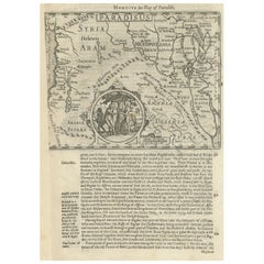
Two maps on one sheet titled 'Palestine divisée en 12 Tribus' and 'Palestine sous les Machabées et sous Hérode'. Maps of Palestine, with vignettes of temples of Solomon and Herodotus. This map originates from 'Nouvel Atlas Illustre Geographie Universelle. Comprenant La Geographie, L'Histoire, L'Administration, La Statistique (..)' by L. E. Desbuissons and J. Migeon, published 1892.
- Dimensions:Height: 15.52 in (39.4 cm)Width: 20.52 in (52.1 cm)Depth: 0.02 in (0.5 mm)
- Materials and Techniques:
- Period:
- Date of Manufacture:1892
- Condition:Age-related toning. Original folding line. Shows some wear and foxing. Blank verso. Please study image carefully.
- Seller Location:Langweer, NL
- Reference Number:
About the Seller
5.0
Platinum Seller
These expertly vetted sellers are 1stDibs' most experienced sellers and are rated highest by our customers.
Established in 2009
1stDibs seller since 2017
1,970 sales on 1stDibs
Typical response time: <1 hour
- ShippingRetrieving quote...Ships From: Langweer, Netherlands
- Return PolicyA return for this item may be initiated within 14 days of delivery.
More From This SellerView All
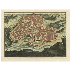
- Antique Map of Ancient Jerusalem, depicting The Temple of Solomon, c.1725Located in Langweer, NLAntique map titled 'Nieuwe Plattegrond van het Oude Jeruzalem Volgens den Schryver.' Bird's-eye view of the ancient city of Jerusalem shows its divisions with prominent depiction...Category
Antique 18th Century Maps
MaterialsPaper
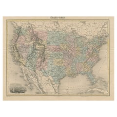
- Antique Map of the United States with Vignette of WashingtonLocated in Langweer, NLAntique map titled 'États-Unis'. A very attractive and detailed late 19th century map of the United States, with a fine decorative vignette of Washington. The extensive railway netwo...Category
Antique Late 19th Century Maps
MaterialsPaper
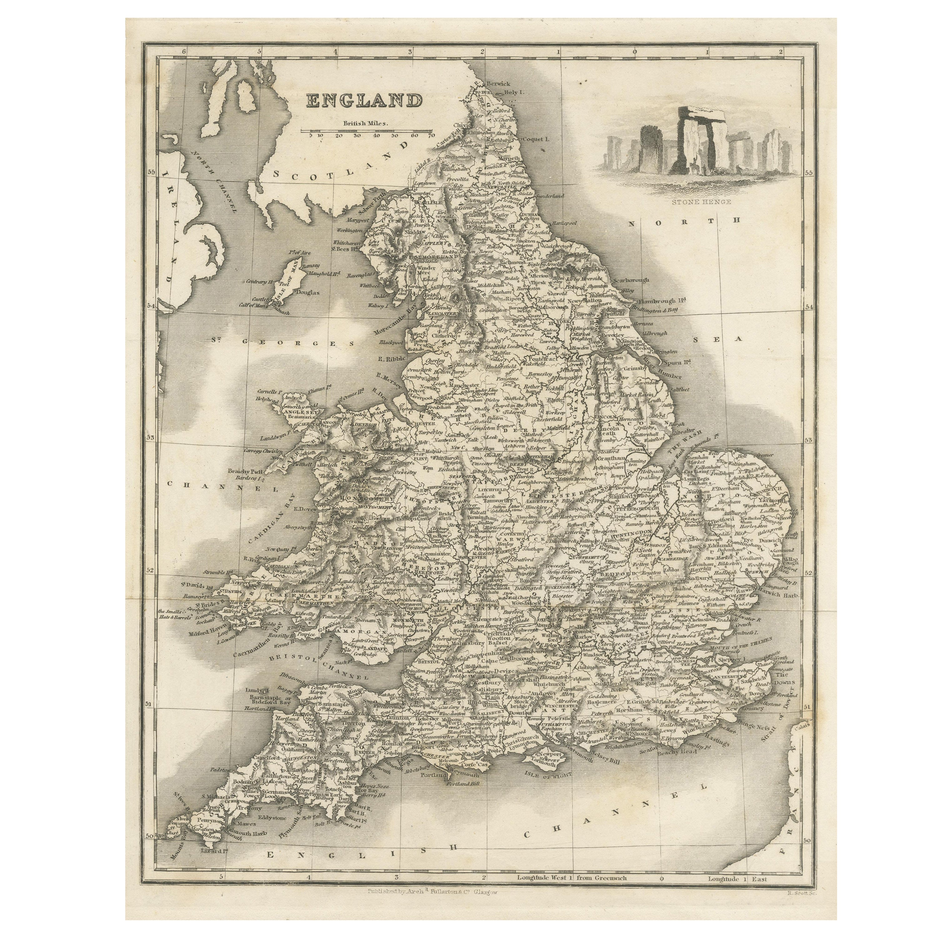
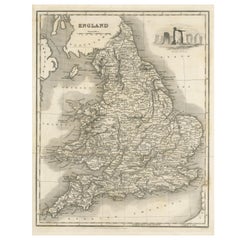
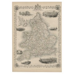
- Antique Map of England with Vignette of StonehengeLocated in Langweer, NLAntique map titled 'England'. Original antique map of England, with decorative vignette of stonehenge. Engraved by R. Scott. Published by Fulla...Category
Antique Mid-19th Century Maps
MaterialsPaper
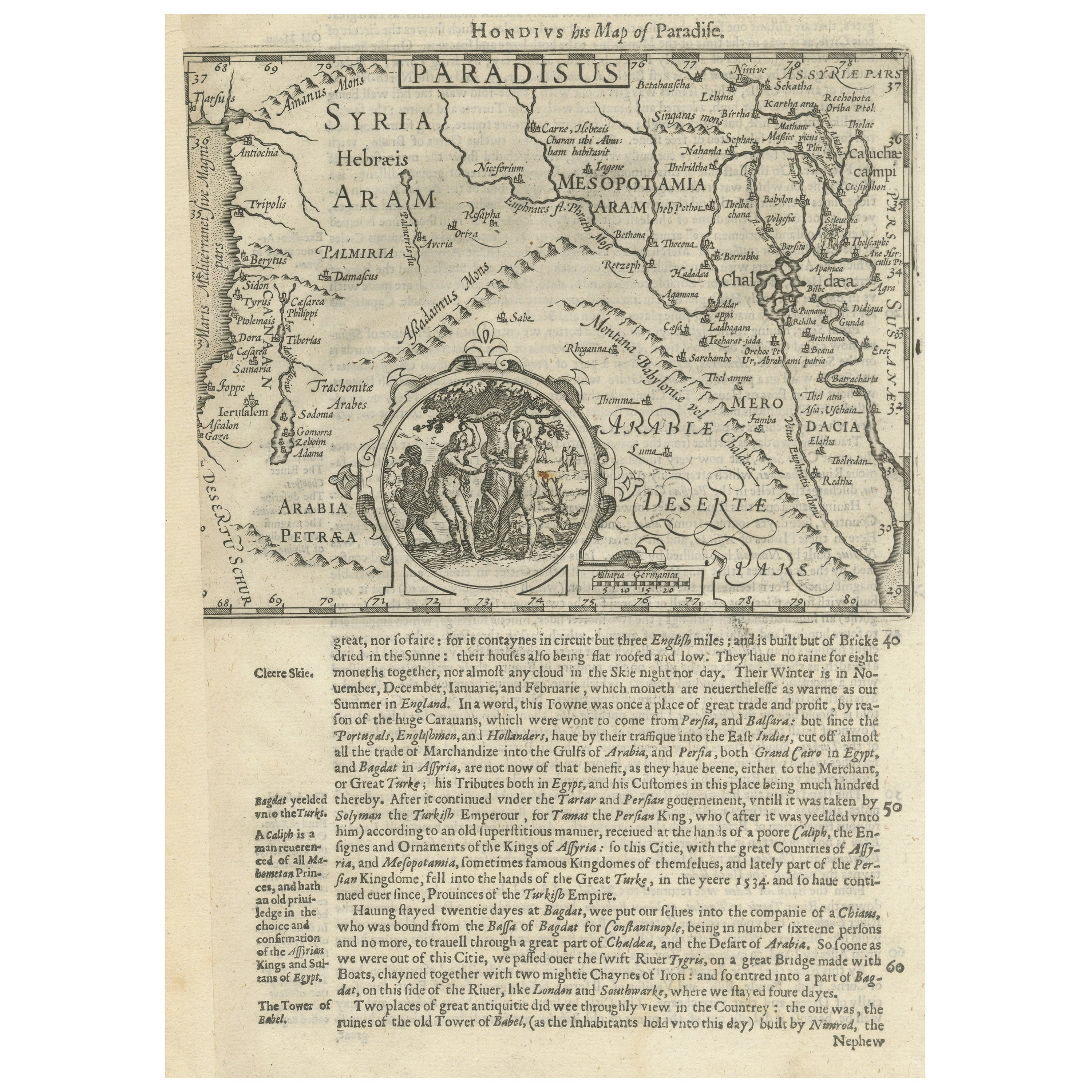
- Antique Map of the Holy Land, with vignette of the Garden of EdenLocated in Langweer, NLAntique map titled 'Hondius his Map of Paradise'. Beautiful map of the region bounded by the Holy Land. Syria, Mesopotamia, Chaldea and part of Arabia. W...Category
Antique Mid-17th Century Maps
MaterialsPaper
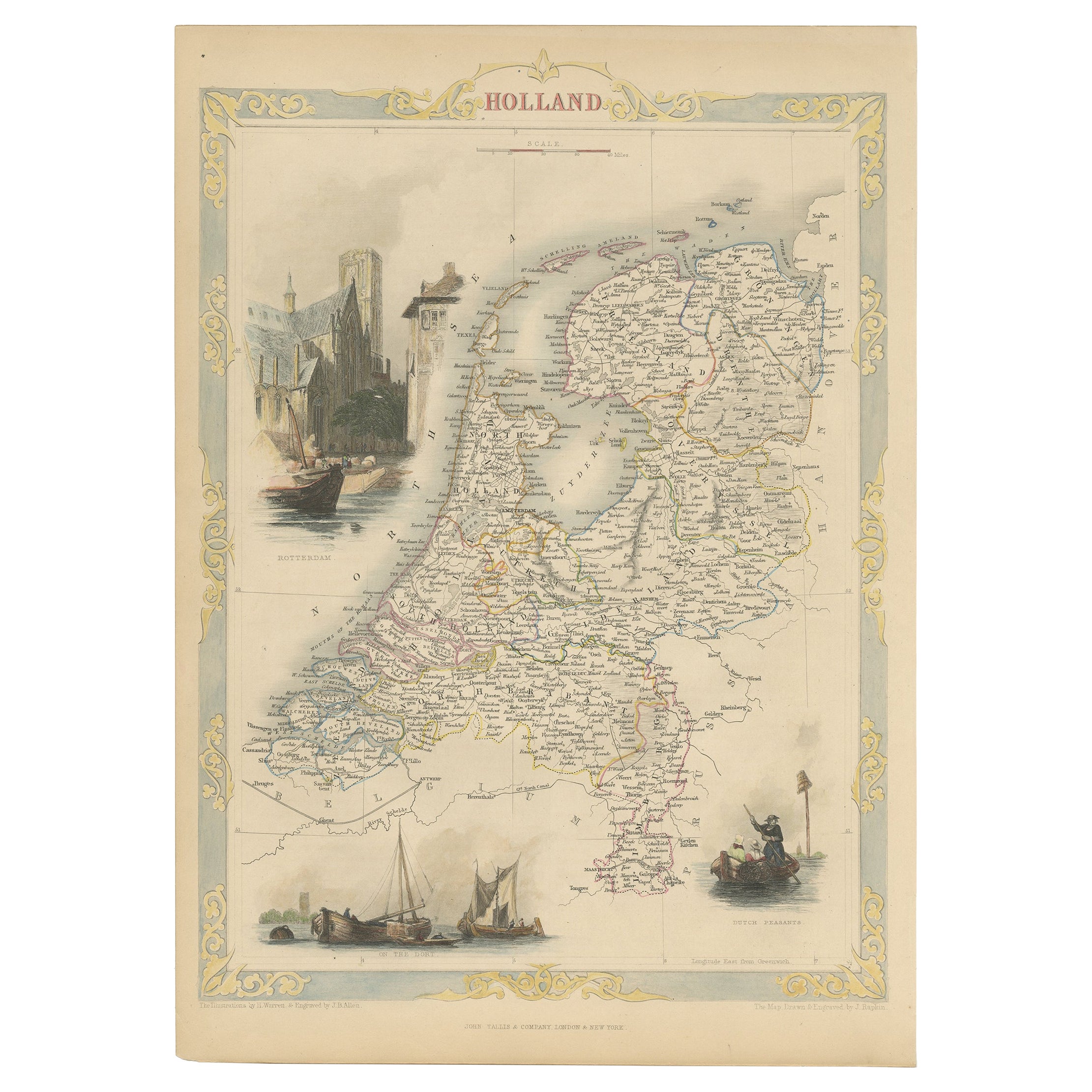
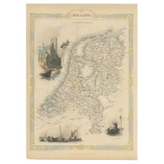
- Antique Map of Holland with Colorful Vignettes, 1851Located in Langweer, NLAntique map titled 'Holland'. Decorative map of Holland. Includes vignettes of Rotterdam, Dutch Peasants and a boating scene on the Dort, the Netherlands. Originates from 'Th...Category
Antique 19th Century Maps
MaterialsPaper
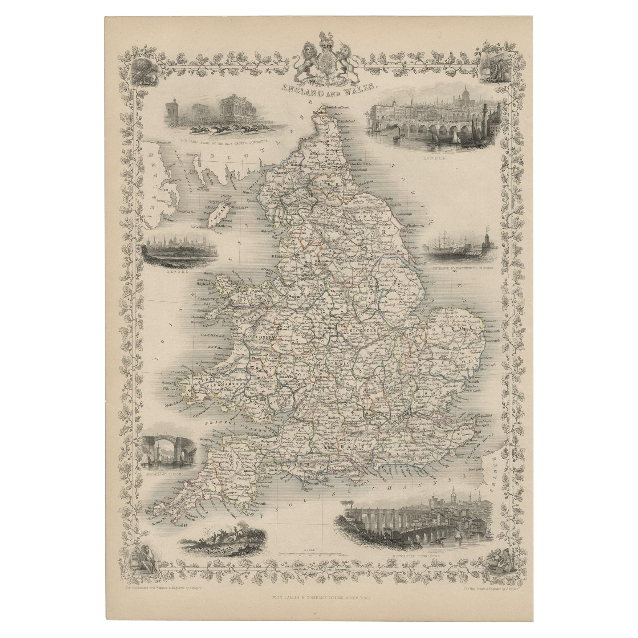
- Antique Map of England and Wales with Decorative Vignettes, 1851Located in Langweer, NLAntique map titled ‘England and Wales’. Includes decorative vignettes titled The grand stand on the race ground Doncaster, London, Oxford, Entrance to Portsmouth Harbour, Sunderland ...Category
Antique 19th Century Maps
MaterialsPaper
You May Also Like
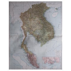
- Large Original Vintage Map of S.E Asia, with a Vignette of SingaporeLocated in St Annes, LancashireGreat map of South East Asia Original color. Good condition Published by Alexander Gross Unframed.Category
Vintage 1920s English Maps
MaterialsPaper
- Antique Map of American Cities, Vignette of New York City, circa 1920Located in St Annes, LancashireGreat maps of American Cities Unframed Original color By John Bartholomew and Co. Edinburgh Geographical Institute Published, circa 1920Category
Vintage 1920s British Maps
MaterialsPaper
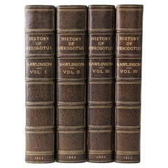
- 4 Volumes, George Rawlinson, History of HerodotusLocated in New York, NY4 Volumes. George Rawlinson, History of Herodotus. Second Edition. Bound in 3/4 green morocco and linen boards double bordered in gilt-tooling. The spines display raised bands, borde...Category
Antique Mid-19th Century English Books
MaterialsLeather
- 1861 Topographical Map of the District of Columbia, by Boschke, Antique MapLocated in Colorado Springs, COPresented is an original map of Albert Boschke's extremely sought-after "Topographical Map of the District of Columbia Surveyed in the Years 1856 ...Category
Antique 1860s American Historical Memorabilia
MaterialsPaper
- 1854 Map of Massachusetts, Connecticut and Rhode Island, Antique Wall MapLocated in Colorado Springs, COThis striking wall map was published in 1854 by Ensign, Bridgman & Fanning and has both full original hand-coloring and original hardware. This impression is both informative and highly decorative. The states are divided into counties, outlined in red, green, and black, and subdivided into towns. Roads, canals, and railroad lines are prominently depicted, although they are not all labeled. The mapmakers also marked lighthouses, banks, churches, and prominent buildings, with a key at right. The map is an informative and comprehensive overview of the infrastructural development of New England prior to the Civil War. Physical geographies depicted include elevation, conveyed with hachure marks, rivers and lakes. The impression features an inset map of Boston...Category
Antique 19th Century American Maps
MaterialsPaper
- Original Antique Map of the American State of Washington, 1889Located in St Annes, LancashireGreat map of Washington Drawn and Engraved by W. & A.K. Johnston Published By A & C Black, Edinburgh. Original colour Unframed.Category
Antique 1880s Scottish Victorian Maps
MaterialsPaper


Recently Viewed
View AllMore Ways To Browse
Palestine Antique
Le Nouvel
Map Of Palestine
Palestine Map
Antique Map Palestine
Migeon Et Migeon
Antique Maps Of Florida
Jamaican Antique
Louisiana Antiques
Romania Antique Map
South Arabian
Antique Hawaii Map
Antique Map Of Hawaii
Antique Map Of Jersey
Antique Maps Hawaii
Antique Maps Of Hawaii
Burma Antique Map
Charles Landseer