Items Similar to Antique Map of the Region of Oranjewoud by Kuyper, 1868
Want more images or videos?
Request additional images or videos from the seller
1 of 5
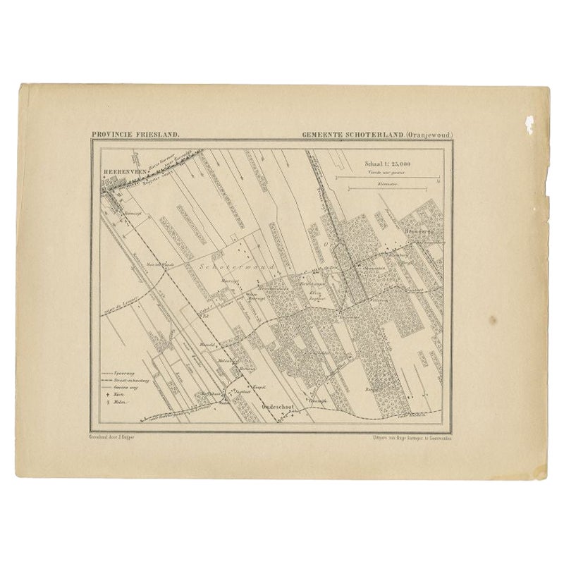
Antique Map of the Region of Oranjewoud by Kuyper, 1868
About the Item
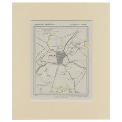
Antique map titled 'Provincie Friesland - Gemeente Schoterland (Oranjewoud)'. Map of the township of Schoterland with a focus on the region of Oranjewoud. This map originates from 'Gemeente-Atlas van Nederland' by J. Kuyper.
Artists and Engravers: Published by H. Suringar.
Condition: Very good, given age. General age-related toning and/or occasional minor defects from handling. Please study image carefully.
Date: 1868
Overall size: 25.2 x 18.9 cm.
Image size: 18.2 x 15.5 cm.
We sell original antique maps to collectors, historians, educators and interior decorators all over the world. Our collection includes a wide range of authentic antique maps from the 16th to the 20th centuries. Buying and collecting antique maps is a tradition that goes back hundreds of years. Antique maps have proved a richly rewarding investment over the past decade, thanks to a growing appreciation of their unique historical appeal. Today the decorative qualities of antique maps are widely recognized by interior designers who appreciate their beauty and design flexibility. Depending on the individual map, presentation, and context, a rare or antique map can be modern, traditional, abstract, figurative, serious or whimsical. We offer a wide range of authentic antique maps for any budget.
- Dimensions:Height: 7.45 in (18.9 cm)Width: 9.93 in (25.2 cm)Depth: 0 in (0.01 mm)
- Materials and Techniques:
- Period:
- Date of Manufacture:1868
- Condition:
- Seller Location:Langweer, NL
- Reference Number:
About the Seller
5.0
Platinum Seller
These expertly vetted sellers are 1stDibs' most experienced sellers and are rated highest by our customers.
Established in 2009
1stDibs seller since 2017
1,965 sales on 1stDibs
Typical response time: <1 hour
- ShippingRetrieving quote...Ships From: Langweer, Netherlands
- Return PolicyA return for this item may be initiated within 14 days of delivery.
More From This SellerView All
- Antique Map of the Region of Oranjewoud by Kuyper, 1868Located in Langweer, NLAntique map titled 'Provincie Friesland - Gemeente Schoterland (Oranjewoud)'. Map of the township of Schoterland with a focus on the region of Oranjewoud. This map originates from 'G...Category
Antique 19th Century Maps
MaterialsPaper
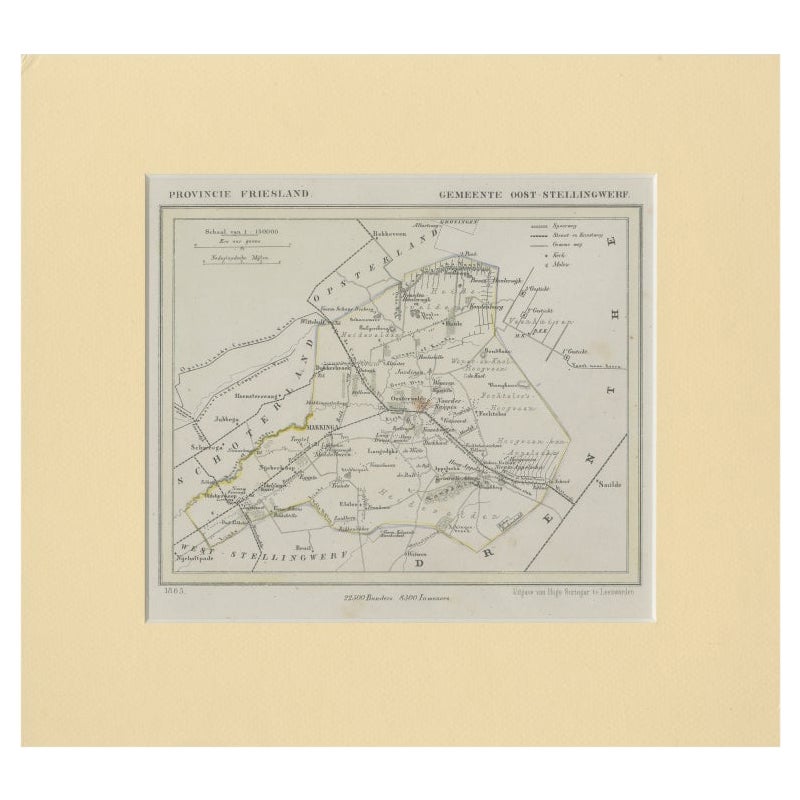
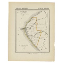
- Antique Map of Ooststellingwerf by Kuyper, 1868Located in Langweer, NLAntique map titled 'Provincie Friesland - Gemeente Oost-Stellingwerf'. Map of the township of Ooststellingwerf including Makkinga, Oosterwolde and many other villages. This map origi...Category
Antique 19th Century Maps
MaterialsPaper
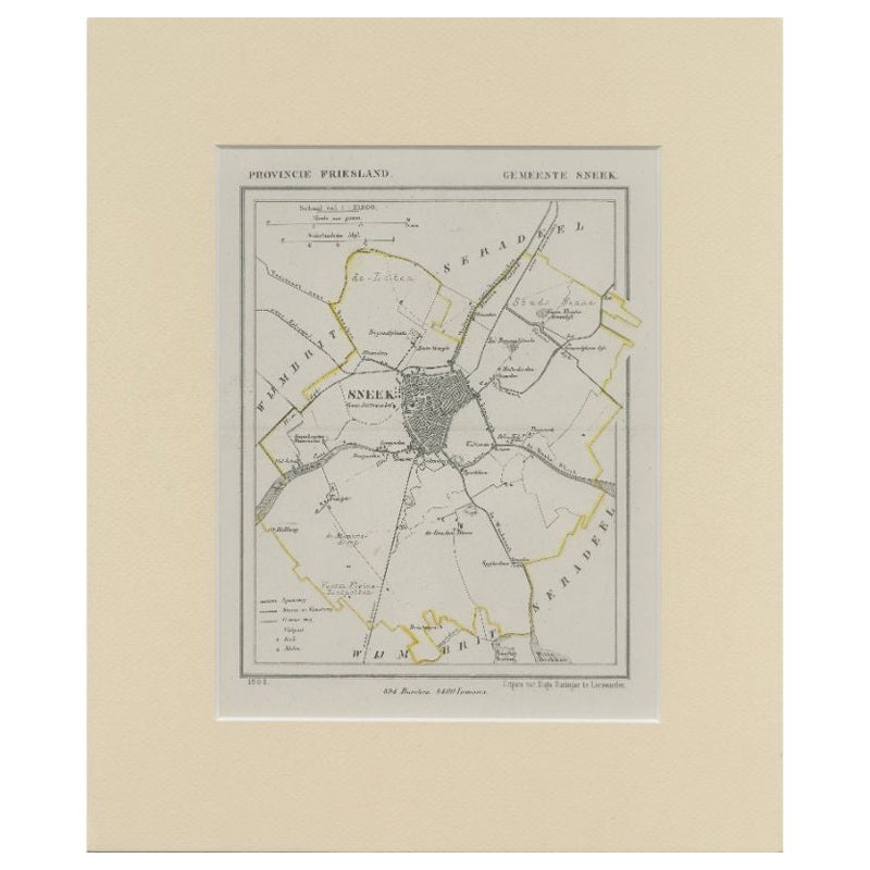
- Antique Map of Sneek by Kuyper, 1868Located in Langweer, NLAntique map titled 'Provincie Friesland - Gemeente Sneek'. Map of the township of Sneek, Friesland. This map originates from 'Gemeente-Atlas van Nederland' by J. Kuyper. Artists and ...Category
Antique 19th Century Maps
MaterialsPaper
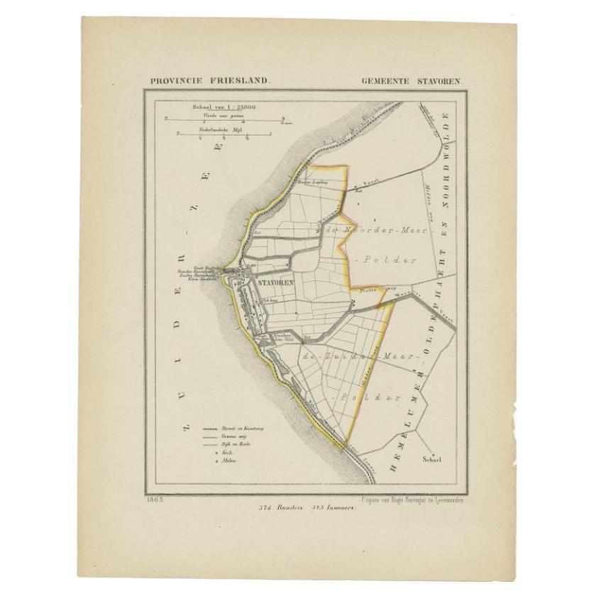
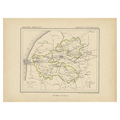
- Antique Map of Stavoren by Kuyper, 1868Located in Langweer, NLAntique map titled 'Provincie Friesland - Gemeente Stavoren'. Map of the township of Stavoren, Friesland. This map originates from 'Gemeente-Atlas van Nederland' by J. Kuyper. Artist...Category
Antique 19th Century Maps
MaterialsPaper
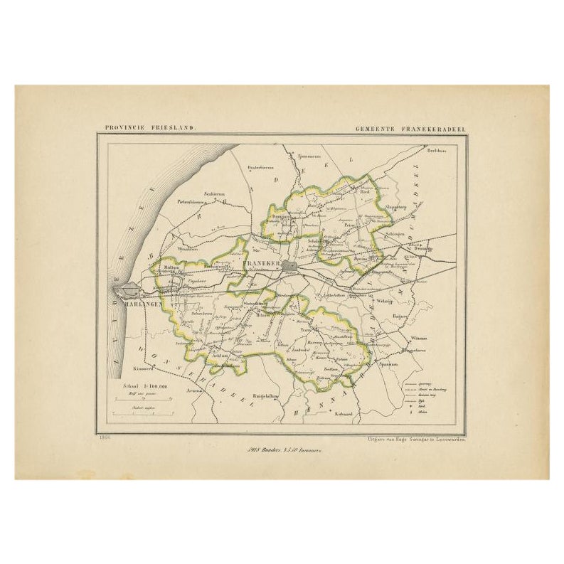
- Antique Map of Franekeradeel by Kuyper, 1868Located in Langweer, NLAntique map titled 'Provincie Friesland - Gemeente Franekeradeel'. Map of the township of Franekeradeel including Franeker, Achlum, Dongjum, Midlum and many other villages. This map ...Category
Antique 19th Century Maps
MaterialsPaper
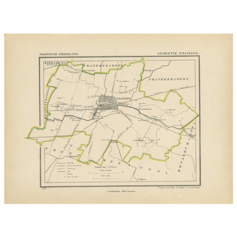
- Antique Map of Franeker by Kuyper, 1868Located in Langweer, NLAntique map titled 'Provincie Friesland - Gemeente Franeker'. Map of the township of Franeker, Friesland. This map originates from 'Gemeente-Atlas van Nederland' by J. Kuyper. Artist...Category
Antique 19th Century Maps
MaterialsPaper

You May Also Like
- 1868 Map of the Upper Part of the Island of Manhattan Above 86th StreetBy Wm. Rogers Mfg. Co.Located in San Francisco, CAThis wonderful piece of New York City history is over 150 years old. It depicts 86th street and above. It was lithographed by WC Rogers and company. It was made to show what was the Battle of Harlem during the Revolutionary war...Category
Antique 1860s American American Colonial Maps
MaterialsPaper
- 1861 Topographical Map of the District of Columbia, by Boschke, Antique MapLocated in Colorado Springs, COPresented is an original map of Albert Boschke's extremely sought-after "Topographical Map of the District of Columbia Surveyed in the Years 1856 ...Category
Antique 1860s American Historical Memorabilia
MaterialsPaper
- 1594 Maurice Bouguereau Map of the Region Limoges, France, Ric0015Located in Norton, MA1594 Maurice Bouguereau map of the region Limoges, France, entitled "Totivs Lemovici et Confinium Pro Uinciarum Quantum ad Dioecefin Lemo Uicenfen Fpectant," Hand Colored Ric0015 Jean IV Le Clerc...Category
Antique 16th Century Dutch Maps
MaterialsPaper
- 17th Century Hand Colored Map of the Liege Region in Belgium by VisscherBy Nicolaes Visscher IILocated in Alamo, CAAn original 17th century map entitled "Leodiensis Episcopatus in omnes Subjacentes Provincias distincté divisusVisscher, Leodiensis Episcopatus" by Nicolaes Visscher II, published in Amsterdam in 1688. The map is centered on Liege, Belgium, includes the area between Antwerp, Turnhout, Roermond, Cologne, Trier and Dinant. This attractive map is presented in a cream-colored mat measuring 30" wide x 27.5" high. There is a central fold, as issued. There is minimal spotting in the upper margin and a tiny spot in the right lower margin, which are under the mat. The map is otherwise in excellent condition. The Visscher family were one of the great cartographic families of the 17th century. Begun by Claes Jansz Visscher...Category
Antique Late 17th Century Dutch Maps
MaterialsPaper
- The Normandy Region of France: A 17th C. Hand-colored Map by Sanson and JaillotBy Nicolas SansonLocated in Alamo, CAThis large hand-colored map entitled "Le Duché et Gouvernement de Normandie divisée en Haute et Basse Normandie en divers Pays; et par evêchez, avec le Gouvernement General du Havre ...Category
Antique 1690s French Maps
MaterialsPaper
- Original Antique Map of The World by Thomas Clerk, 1817Located in St Annes, LancashireGreat map of The Eastern and Western Hemispheres On 2 sheets Copper-plate engraving Drawn and engraved by Thomas Clerk, Edinburgh. Published by Mackenzie And Dent, 1817 ...Category
Antique 1810s English Maps
MaterialsPaper


Recently Viewed
View AllMore Ways To Browse
Antique Furniture Columbus
Bay Area Antique Furniture
Antique Framed Map Engravings
Bible Maps
John Tallis Map
Mediterranean Sea Map
Sedan Antique
Singapore Antique
Antique Map Venice
Antique Maps New Zealand
Antique Maps Venice
Antique Railroad Maps
Cape Verde
Antique Florida Collectibles
Antique Map Of New Zealand
Antique Map Of Venice
Relief Map
West Coat Of Arms