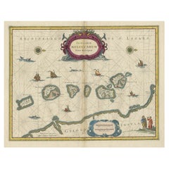
Items Similar to Beautiful Antique Map of Madagascar, The Comoros Islands & Reunion Island, 1667


Want more images or videos?
Request additional images or videos from the seller
1 of 7
Beautiful Antique Map of Madagascar, The Comoros Islands & Reunion Island, 1667
About the Item
Antique map titled 'Isle d'Auphine, communement Nommée par les Europeens Madagascar, et St. Laurens, et par les Habitans du pays Madecase'.
Beautiful map of Madagascar, perhaps the finest and most up to date of its time, utilized by contemporary explorers. This map also depicts the Comoros Islands in the North West and the Reunion Island in the South East. With decorative title cartouche representing some natives, a compass rose and a vessel in the Indian Ocean.
Artists and engravers: Pierre Mariette II (1634-1716) was a French print dealer and Publisher. Guillaume Sanson (1633-1703) was a French cartographer and geographer at the court of the king of France, son of Nicolas Sanson.
- Dimensions:Height: 22.64 in (57.5 cm)Width: 18 in (45.7 cm)Depth: 0 in (0.02 mm)
- Materials and Techniques:
- Period:1660-1669
- Date of Manufacture:1667
- Condition:Repaired: Some tears have been repaired with tape on verso. Wear consistent with age and use. Condition: Good, general age-related toning. Some tears and tape on verso. Please study image carefully.
- Seller Location:Langweer, NL
- Reference Number:
About the Seller
5.0
Platinum Seller
These expertly vetted sellers are 1stDibs' most experienced sellers and are rated highest by our customers.
Established in 2009
1stDibs seller since 2017
1,969 sales on 1stDibs
Typical response time: <1 hour
- ShippingRetrieving quote...Ships From: Langweer, Netherlands
- Return PolicyA return for this item may be initiated within 14 days of delivery.
More From This SellerView All
- Antique Map of the Atlantic Islands, 1817Located in Langweer, NLAntique map titled 'Atlantic Islands'. Large map of the Atlantic Islands include the Cape Verde islands, Canary islands, Azore islands and Madeira islands. Also included a view of th...Category
Antique Early 19th Century Maps
MaterialsPaper
- Beautiful Antique Map of the Moluccas or Spice Islands, Indonesia, ca.1650Located in Langweer, NLAntique map titled 'Insularum Moluccarum Nova Descriptio.' Beautiful map of the Moluccas. The famous Spice Islands, the cornerstone of the Dutc...Category
Antique 1650s Maps
MaterialsPaper
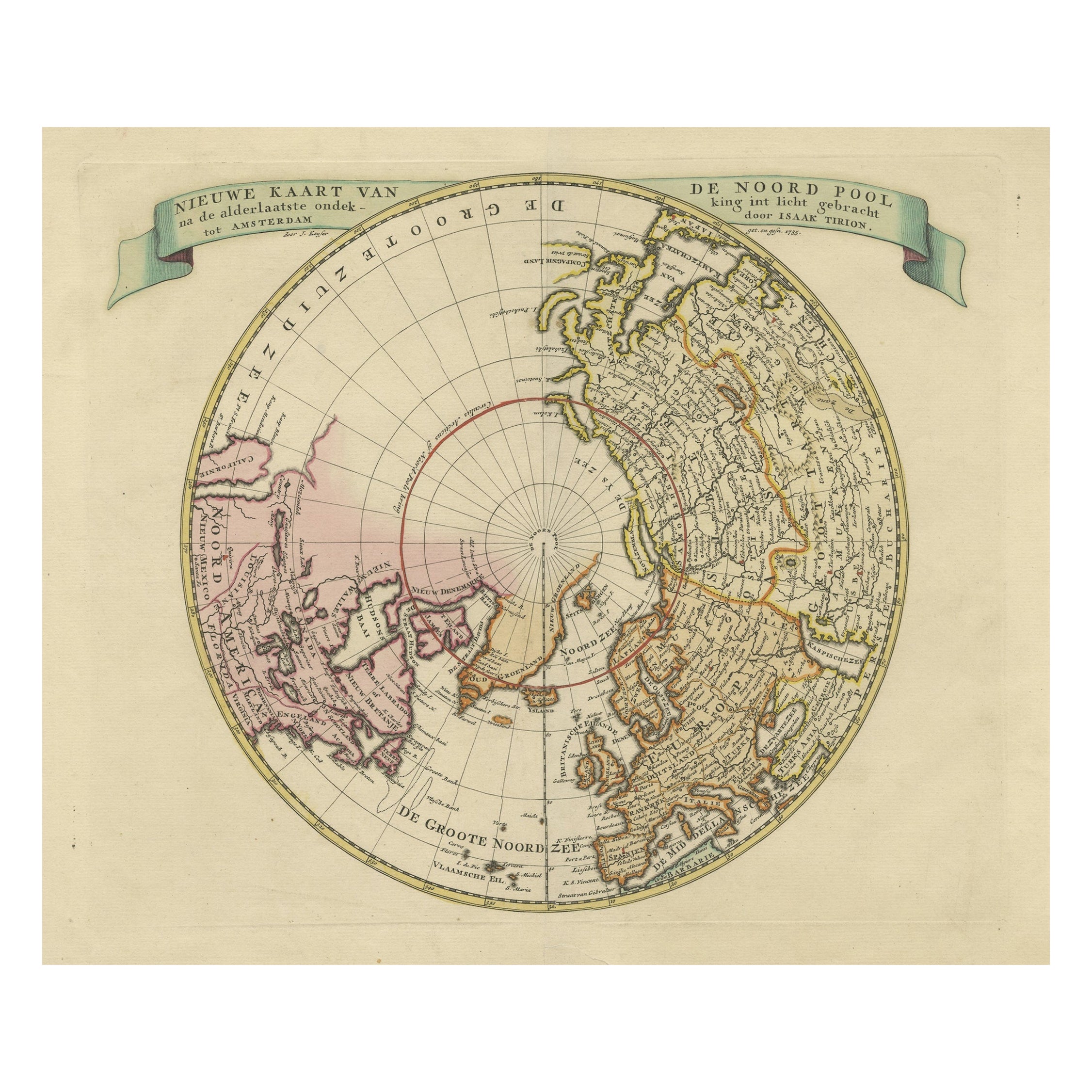
- Beautiful Antique Map of the Northern Hemisphere with California as an IslandBy Isaak TirionLocated in Langweer, NLAntique map titled 'Nieuwe Kaart van de Noord Pool na de alderlaatste ontdekking int licht gebracht tot Amsterdam door Isaak Tirion'. Beautiful map of the Northern Hemisphere and Nor...Category
Antique Mid-18th Century Maps
MaterialsPaper
- Antique Map of the Islands of the Atlantic by J. TallisLocated in Langweer, NLA highly decorative and detailed mid-19th century map of the Islands of the Atlantic -- including the Azores, Madeira, Bermuda, the Canary Islands and the Cape Verde Islands -- which...Category
Antique Mid-19th Century Maps
MaterialsPaper
- Antique Map of the Island Java, Indonesia, c.1650Located in Langweer, NLAntique map titled 'Insulae Iavae cum parte insularum Boreno Sumatrae (..)'. Beautiful map of the island of Java and part of Borneo, Bali, Madura and Sumatra. With decorative carto...Category
Antique 17th Century Maps
MaterialsPaper
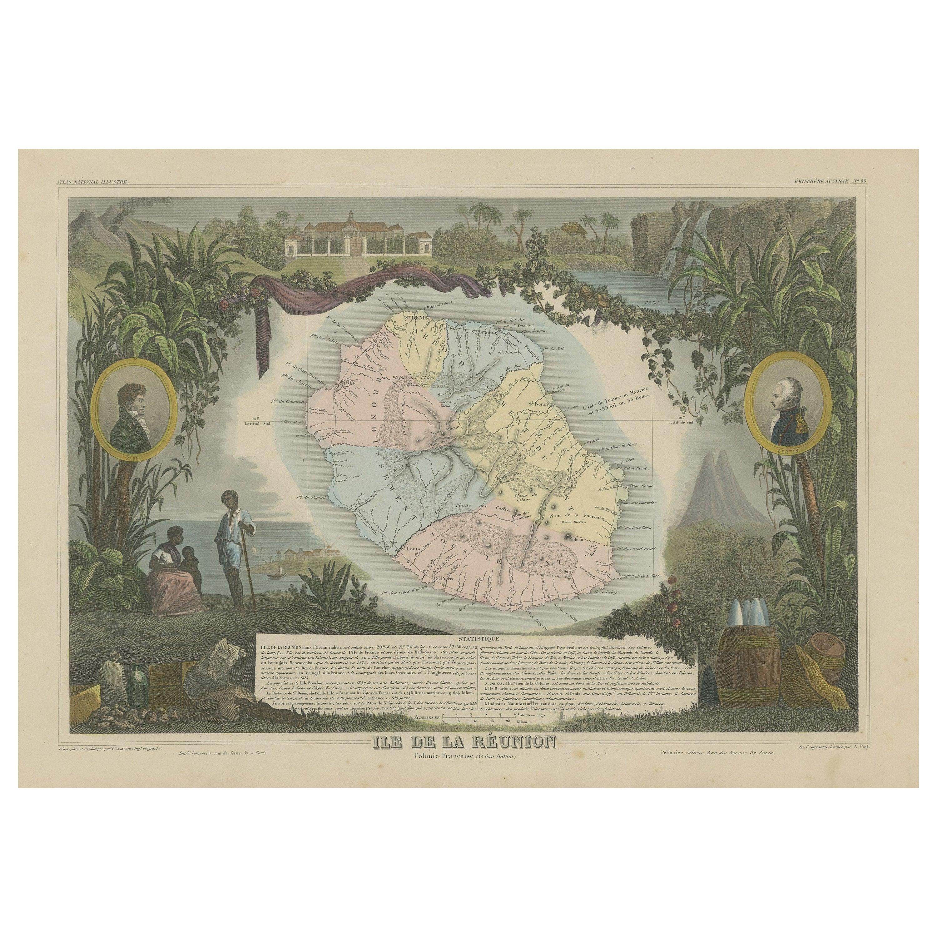
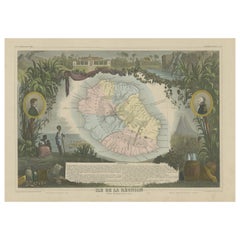
- Antique Map of Bourbon, or Reunion, Colony of FranceLocated in Langweer, NLOriginal antique map titled 'Ile de la Réunion'. This is a fascinating map of the French department of Ile. Bourbon or Reunion. Bourbon, or Reunion, is a volcanic island off the coas...Category
Antique Mid-19th Century Maps
MaterialsPaper


You May Also Like
- Map of the Republic of GenoaLocated in New York, NYFramed antique hand-coloured map of the Republic of Genoa including the duchies of Mantua, Modena, and Parma. Europe, late 18th century. Dimension: 25...Category
Antique Late 18th Century European Maps
- Hand-Colored 18th Century Homann Map of Denmark and Islands in the Baltic SeaBy Johann Baptist HomannLocated in Alamo, CAAn 18th century copper plate hand-colored map entitled "Insulae Danicae in Mari Balthico Sitae utpote Zeelandia, Fionia, Langelandia, Lalandia, Falstria, Fembria Mona" created by Joh...Category
Antique Early 18th Century German Maps
MaterialsPaper
- Antique Map of Principality of MonacoBy Antonio Vallardi EditoreLocated in Alessandria, PiemonteST/619 - "Old Geographical Atlas of Italy - Topographic map of ex-Principality of Monaco" - ediz Vallardi - Milano - A somewhat special edition ---Category
Antique Late 19th Century Italian Other Prints
MaterialsPaper
- Original Antique Map of The World by Thomas Clerk, 1817Located in St Annes, LancashireGreat map of The Eastern and Western Hemispheres On 2 sheets Copper-plate engraving Drawn and engraved by Thomas Clerk, Edinburgh. Published by Mackenzie And Dent, 1817 ...Category
Antique 1810s English Maps
MaterialsPaper
- Antique 18th Century Map of the Province of Pensilvania 'Pennsylvania State'Located in Philadelphia, PAA fine antique of the colony of Pennsylvania. Noted at the top of the sheet as a 'Map of the province of Pensilvania'. This undated and anonymous map is thought to be from the Gentleman's Magazine, London, circa 1775, although the general appearance could date it to the 1760's. The southern boundary reflects the Mason-Dixon survey (1768), the western boundary is placed just west of Pittsburgh, and the northern boundary is not marked. The map has a number of reference points that likely refer to companion text and appear to be connected to boundaries. The western and southern boundaries are marked Q, R, S, for example. A diagonal line runs from the Susquehanna R to the Lake Erie P. A broken line marked by many letters A, B, N, O, etc., appears in the east. There are no latitude or longitude markings, blank verso. Framed in a shaped contemporary gilt wooden frame and matted under a cream colored matte. Bearing an old Graham Arader Gallery...Category
Antique 18th Century British American Colonial Maps
MaterialsPaper
- Map "Estuary- Mouth of the Thames"Located in Alessandria, PiemonteST/426 - Antique French Map of the estuary of the Thames, map dated 1769 - "Mape of the entrance of the Thames. Designed by filing of Navy cards fo...Category
Antique Mid-18th Century French Other Prints
MaterialsPaper


Recently Viewed
View AllMore Ways To Browse
Antique Islands
Antique Island Furniture
Map Of South Of France
Antique Map Of The South Of France
Antique Indian Maps
Indian Ocean Antique Map
Madagascar Antique Map
Map Of Madagascar
Antique Furniture Building Plans
Map Of Egypt
Tirion Map
Island Colonial
Iran Map
Antique Wine Maps
Amsterdam Coat Of Arms
Pacific Map
Antique English County Maps
Antique Maps Wales