Items Similar to Framed Mercator Hondius Hispania Nova Atlas Minor Map


Want more images or videos?
Request additional images or videos from the seller
1 of 13
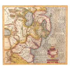
Framed Mercator Hondius Hispania Nova Atlas Minor Map
About the Item
Framed colored example of this decorative and important minature map. Newly framed in brown wood frame with gold trim.
Mercator Hondius “Atlas Minor” published in Amsterdam in 1648 at Jannsonius with a copy of the original german text on verso. The miniature version of the Mercator Hondius map of Mexico from the Atlas Minor, published by Claesz and Jan Jansson.
In 1607 Jodocus Hondius published a reduced size version of Mercator’s “Atlas”, itself suitably titled “Atlas Minor”. The maps were copied from those of the great cartographer Mercator of circa 1580-1590 or were reductions of Hondius’ own maps of 1606.
- Dimensions:Height: 12.5 in (31.75 cm)Width: 14.25 in (36.2 cm)Depth: 1 in (2.54 cm)
- Style:Spanish Colonial (In the Style Of)
- Materials and Techniques:
- Place of Origin:
- Period:
- Date of Manufacture:1600s
- Condition:Additions or alterations made to the original: Has been reframed. Wear consistent with age and use. Minimal overall wear/ map has not been examined outside of the frame.
- Seller Location:Stamford, CT
- Reference Number:1stDibs: LU1860319808392
About the Seller
5.0
Platinum Seller
These expertly vetted sellers are 1stDibs' most experienced sellers and are rated highest by our customers.
Established in 2010
1stDibs seller since 2016
397 sales on 1stDibs
Typical response time: 1 hour
- ShippingRetrieving quote...Ships From: Santa Barbara, CA
- Return PolicyA return for this item may be initiated within 2 days of delivery.
More From This SellerView All
- 1705 Golfe de Mexico and Florida Framed MapLocated in Stamford, CTFramed map of Mexico & Florida circa 1705, Paris. Small map with Mexico and the Gulf Coast. Inset text indicating Panama, Acapulco, Mexico City and the Mississippi. Extends North to ...Category
Antique Early 1700s French Spanish Colonial Maps
MaterialsGlass, Wood, Paper
- Framed 1820s Hand Colored Map of the United StatesLocated in Stamford, CTFramed 1820s hand colored map photos of North America and South America. As found framed in giltwood frame.Category
Antique 1820s American Spanish Colonial Maps
MaterialsGiltwood, Paper, Glass
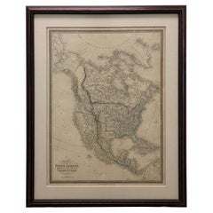
- 1830 Mexico and United States Framed MapLocated in Stamford, CTMap of North America published circa 1830. Map shows United States into Canada. Mexico extending into the upper California territory. Texas appears in name but prior to the period of...Category
Antique 1830s American American Classical Maps
MaterialsGlass, Wood, Paper
- Framed 1838 Mexico & Gulf of Mexico MapLocated in Stamford, CTFramed 1838 Mexico & Gulf of Mexico map. Printed by Fisher, Son & Co. of London in 1838. As found framed condition. Map has not been examined outside of th...Category
Antique 1830s English American Classical Maps
MaterialsGlass, Wood, Paper
- Framed 1838 North America & Recent Discoveries MapLocated in Stamford, CT1838 map of North America & recent discoveries. Engraved color map by J. Wyld, London, England. This map shows Texas as a Republic without its panhandle. Framed in brown carved wood...Category
Antique 1830s American American Classical Maps
MaterialsGlass, Wood, Paper
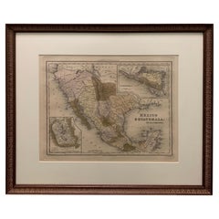
- 1834 Mexico & Guatemala Framed Map by H.S. TannerLocated in Stamford, CT1834 Mexico & Guatemala map of published by H.S. Tanner, Philadelphia, Pennsylvania. Engraved by J. Knight. As found high end custom framing with carved wood frame, custom matting a...Category
Antique 1830s American American Classical Maps
MaterialsGlass, Wood, Paper


You May Also Like
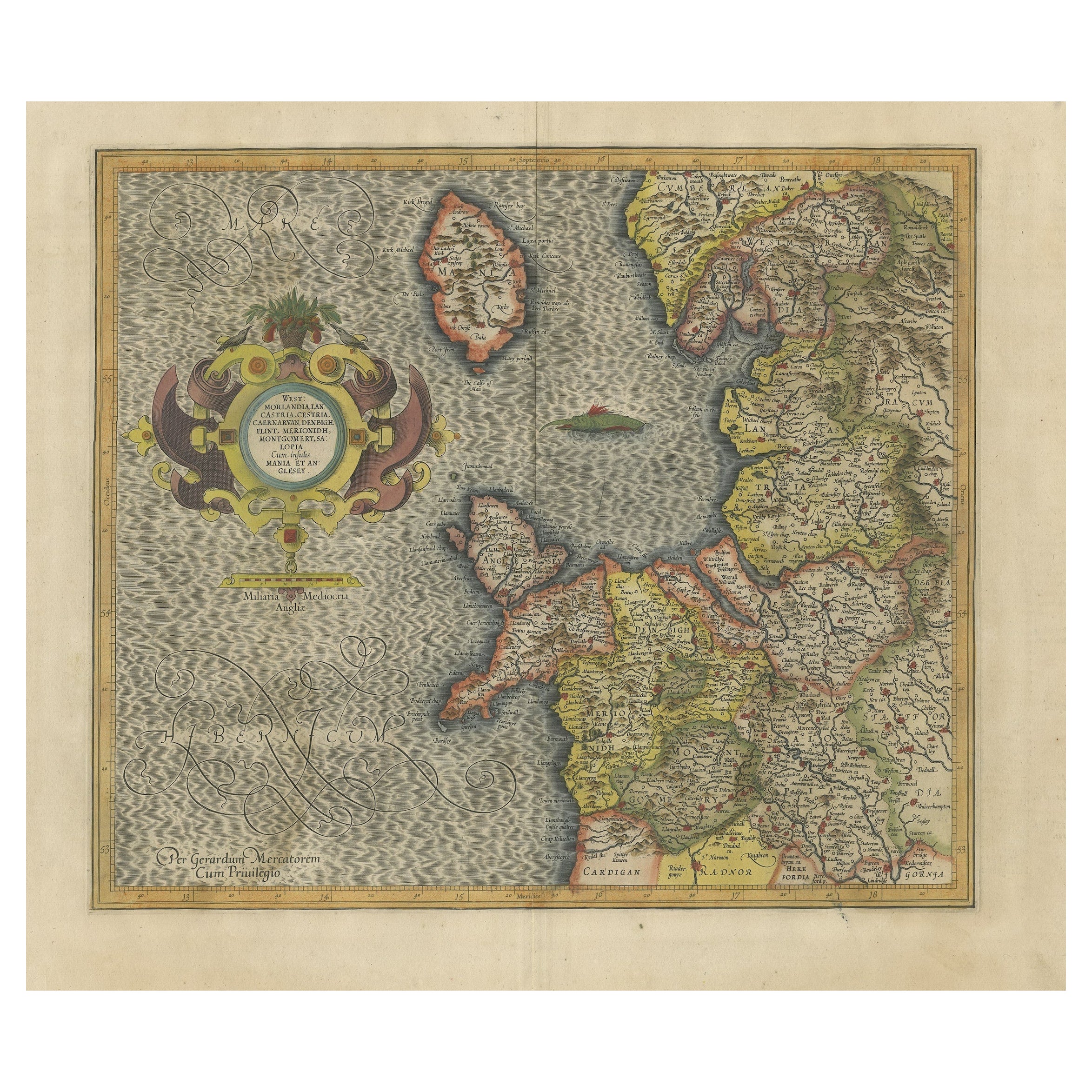
- Antique Map of England by Mercator/Hondius, circa 1600Located in Langweer, NLAntique map titled 'Westmorlandia, Lancastria, Caernvan, Denbigh, Flint, Merionidh, Dalopia cum issulis Mania et Anglesey'. Original antique map of England...Category
Antique 16th Century Maps
MaterialsPaper
- Antique Map of Westfalia, Germany by Mercator/Hondius, circa '1620'Located in Langweer, NLAntique map titled 'Westfalia cum dioecelsi Bremensi'. Original antique map of Germany. Published by Mercator/Hondius, circa '1620' 17th Century antique detailled map of Westphali...Category
Antique 16th Century Maps
MaterialsPaper
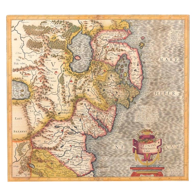
- Antique Map of Northern Ireland by Mercator/Hondius, Early 1600'sLocated in Langweer, NLAntique map titled 'Ultoniae Orientalis Pars'. Original antique map of Northern Ireland. Published by Mercator/Hondius, ca. 1600. Superb early map of the eastern part of Ulster, featuring Down and Antrim Counties in Northern Ireland. Mercator's famous moire pattern in the sea is used. Strong topographical features in the interior and ornamented with a title cartouche incorporating the distance scale. This was one of five Irish maps...Category
Antique 16th Century Maps
MaterialsPaper
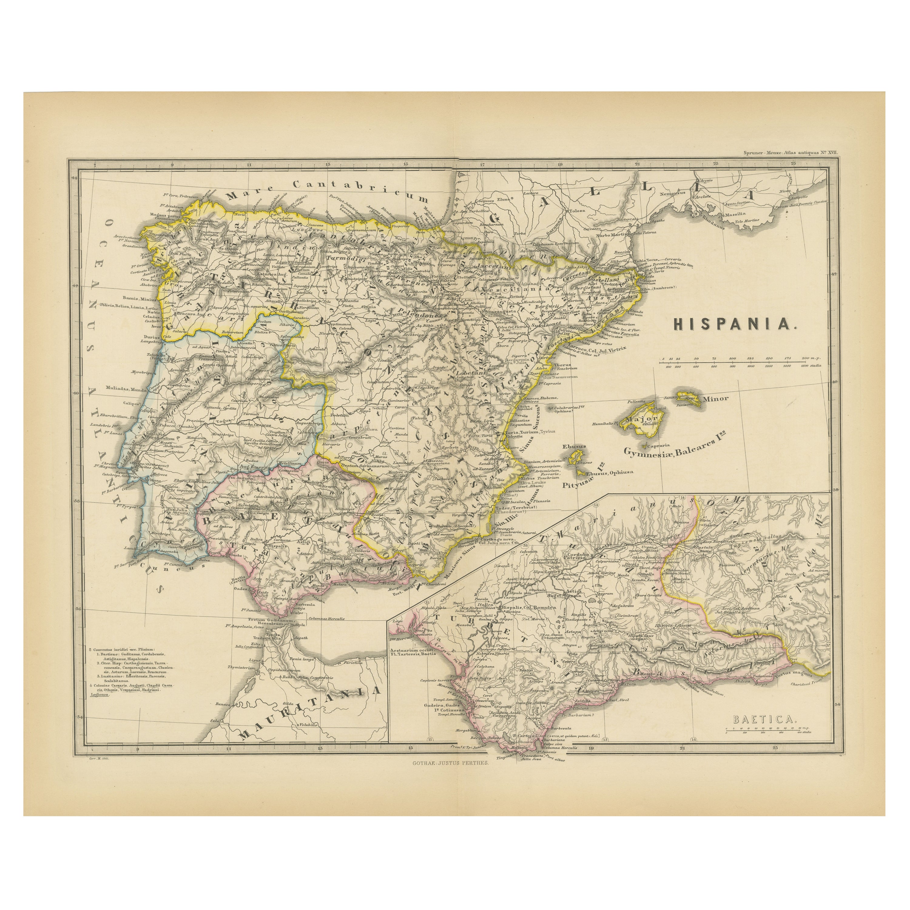
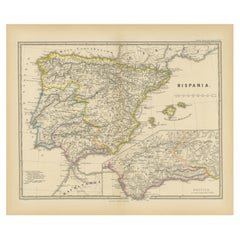
- Ancient Iberia: Hispania Map from Spruner-Menke Atlas Antiquus, 1880Located in Langweer, NLThis map is titled "HISPANIA," indicating it is a historical map of ancient Spain. It is an original antique map from the "Spruner-Menke Atlas Antiquus," a 19th-century historical a...Category
Antique 1880s Maps
MaterialsPaper
- Southeastern Ireland: A 17th Century Hand Colored Map by Mercator and HondiusBy Gerard MercatorLocated in Alamo, CAA 17th century copperplate hand-colored map entitled "The Second Table of Ireland, Udrone" by Gerard Mercator and Jodocus Hondius, published in Amsterdam in 1635 in 'Cosmographicall ...Category
Antique Mid-17th Century Dutch Maps
MaterialsPaper
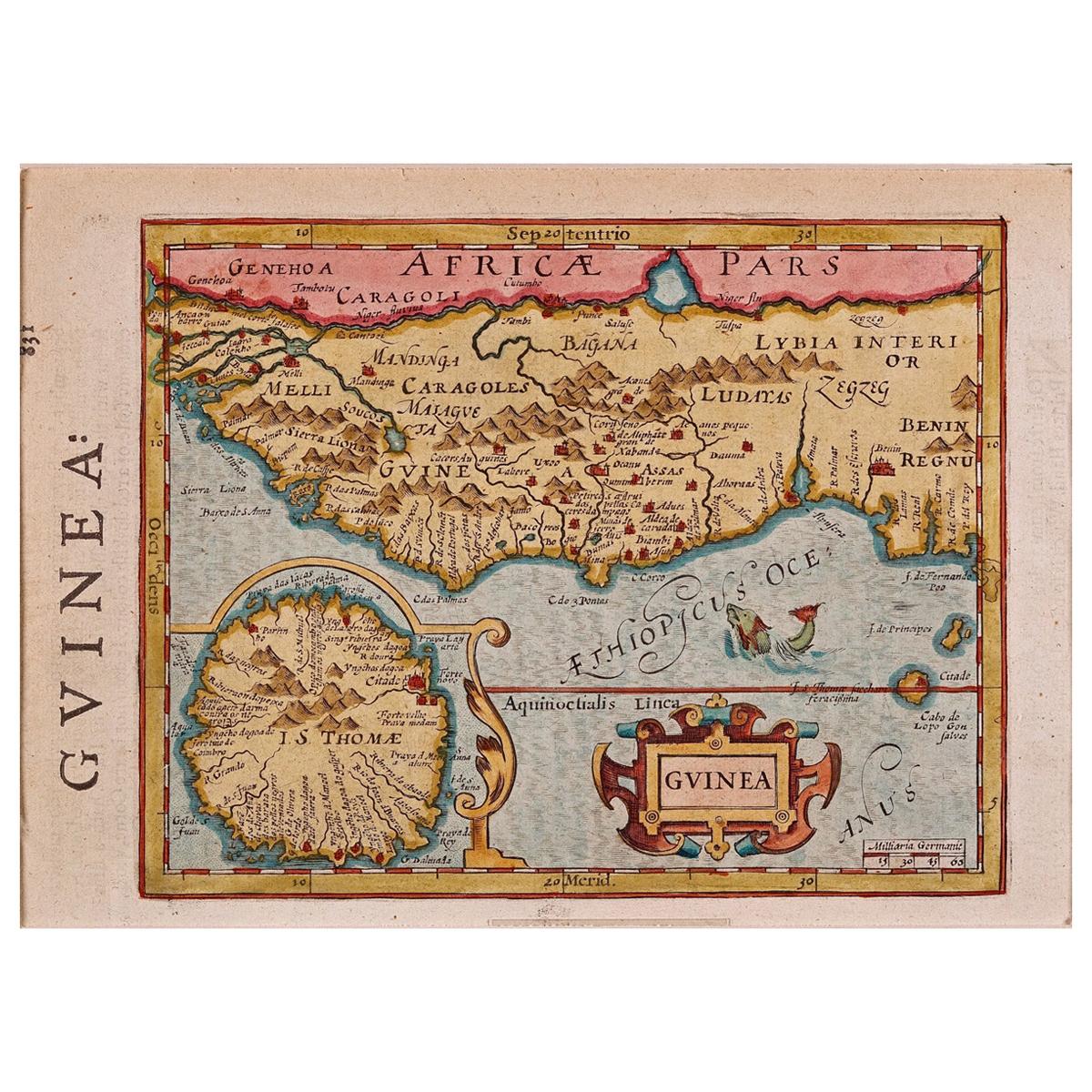
- 17th Century Hand-Colored Map of West Africa by Mercator/HondiusLocated in Alamo, CAA 17th century hand-colored map entitled "Guineae Nova Descriptio" by Gerard Mercator and Jodocus Hondius, published in their 'Atlas Minor' in Amsterdam in 1635. It is focused on the...Category
Antique Mid-17th Century Dutch Maps
MaterialsPaper


Recently Viewed
View AllMore Ways To Browse
Antique Maps Amsterdam
Amsterdam Map
Map Spain
Maps Spain
Map Of Spain
Framed Map
Antique Map Framing
Antique Maps Framed
Framing Antique Maps
Antique Maps Spain
Antique Maps Of Spain
Colonial Spanish Frame
Mercator Map
Mercator Antique
Spanish Netherlands
Map Hondius
Miniature Maps
Antique Colonial Mexican Furniture