Items Similar to Large University Chart “Africa Physical ” by Bacon


Want more images or videos?
Request additional images or videos from the seller
1 of 6
Large University Chart “Africa Physical ” by Bacon
About the Item
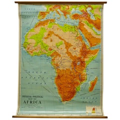
Large University chart “Africa Physical ” by Bacon
W&A K Johnston’s charts of physical maps by G W Bacon,
This is a Physical map of Africa, it is lithograph set on Linen mounted on wooden rods, the chart is in very good bright condition, it is 36” high and 31” wide
GB129.
- Dimensions:Height: 36 in (91.44 cm)Width: 31 in (78.74 cm)Depth: 1 in (2.54 cm)
- Style:Beaux Arts (In the Style Of)
- Materials and Techniques:
- Period:
- Date of Manufacture:1920
- Condition:
- Seller Location:Chillerton, GB
- Reference Number:
About the Seller
4.9
Platinum Seller
These expertly vetted sellers are 1stDibs' most experienced sellers and are rated highest by our customers.
Established in 1980
1stDibs seller since 2017
699 sales on 1stDibs
Typical response time: 2 hours
- ShippingRetrieving quote...Ships From: Chillerton, United Kingdom
- Return PolicyA return for this item may be initiated within 7 days of delivery.
More From This SellerView All
- Large University Chart “Physical Map of Africa” by BaconLocated in Chillerton, Isle of WightLarge university chart “Physical Map of Africa” by Bacon W&A K Johnston’s Charts of Physical Maps By G W Bacon, This is colorful Physical map of North America, it is large lithograph set...Category
Early 20th Century Folk Art Posters
MaterialsLinen
- Large University Chart “Political Map of North America” by BaconLocated in Chillerton, Isle of WightLarge University Chart “Political Map of North America” by Bacon W&A K Johnston’s Charts of Physical Maps By G W Bacon, This is colourful Physical map ...Category
Early 20th Century American Empire Posters
MaterialsLinen
- Large University Chart “Political Map of North America” by BaconLocated in Chillerton, Isle of WightLarge University chart “Political Map of North America” by Bacon W&A K Johnston’s Charts of Political Maps by G W Bacon, This is colorful Physical ...Category
Early 20th Century American Empire Posters
MaterialsLinen
- W&A K Johnston’s Charts of Physical Maps by G W BaconLocated in Chillerton, Isle of WightLarge University chart “Africa Physical Political” by Bacon W&A K Johnston’s charts of physical maps by G W Bacon, This is a Physical Political map...Category
Early 20th Century Rustic Posters
MaterialsLinen
- University Chart “Black Map of North AmericaLocated in Chillerton, Isle of WightUniversity Chart “Black Map of North America W&A K Johnston’s Charts of Physical Maps By G W Bacon, This is a Black Physical map of North A...Category
Early 20th Century Industrial Maps
MaterialsLinen
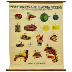
- Large University Anatomical Chart “Organs of Sense & Voice” by TurnerLocated in Chillerton, Isle of WightLarge University anatomical chart “Organs of Sense & Voice” by Turner W&A K Johnston’s Charts of Anatomy and Physiology By Dr William Turner, Professor of Anatomy University of Edinburgh/A J Nystrom & Co US Agents Chicago This is plate 9, Organs of Sense & Voice, by Turner, it is large lithograph set...Category
Early 20th Century Beaux Arts Posters
MaterialsLinen


You May Also Like
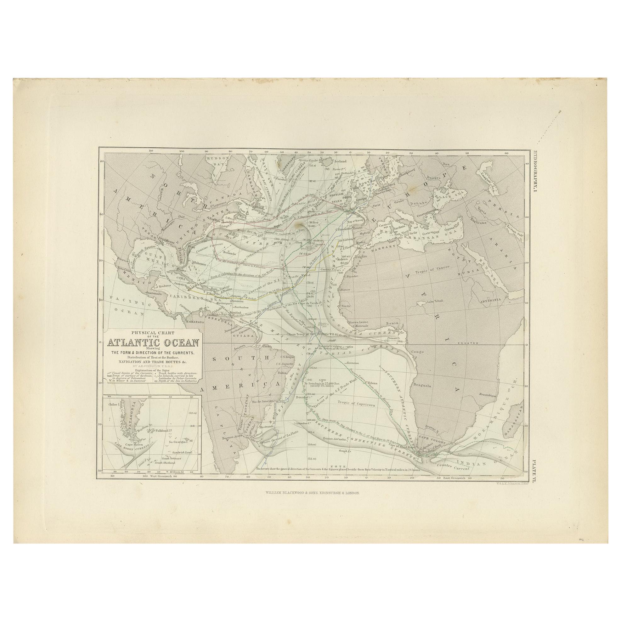
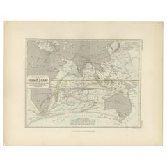
- Antique Physical Chart of the Atlantic Ocean by Johnston '1850'Located in Langweer, NLAntique map titled 'Physical Chart of the Atlantic Ocean showing the form and direction of the currents'. Original antique chart of the Atlantic Ocean. This map originates from 'The ...Category
Antique Mid-19th Century Maps
MaterialsPaper
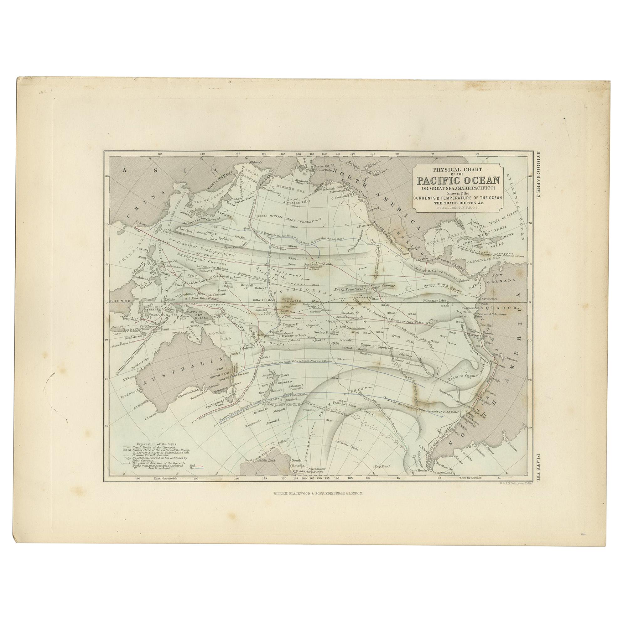
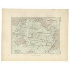
- Antique Physical Chart of the Pacific Ocean by Johnston, '1850'Located in Langweer, NLAntique map titled 'Physical Chart of the Pacific Ocean showing the currents and temperature of the ocean'. Original antique chart of the Pacific Ocean. This map originates from 'The...Category
Antique Mid-19th Century Maps
MaterialsPaper
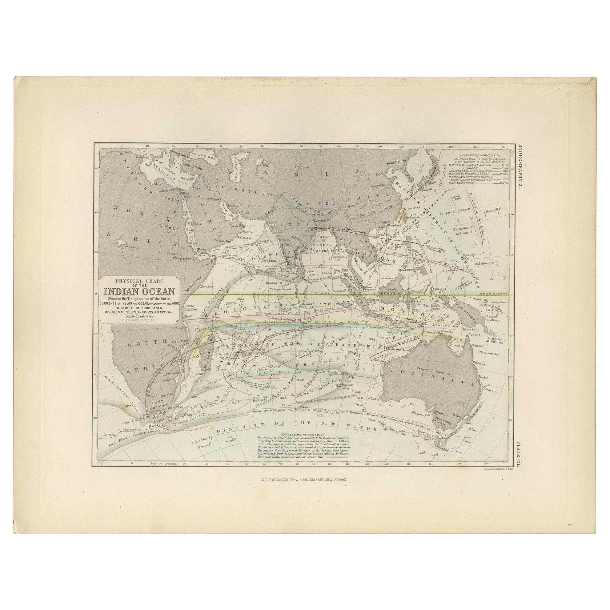
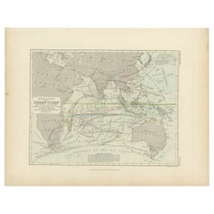
- Antique Physical Chart of the Indian Ocean by Johnston '1850'Located in Langweer, NLAntique map titled 'Physical Chart of the Indian Ocean showing the temperature of the water'. Original antique chart of the Indian Ocean. This map originates from 'The Physical Atlas...Category
Antique Mid-19th Century Maps
MaterialsPaper
- Antique Physical Chart of the Indian Ocean by Johnston, 1850Located in Langweer, NLAntique map titled 'Physical Chart of the Indian Ocean'. This map shows the temperature of the water, currents of the air and ocean, direction of the wind, districts of hurricanes, t...Category
Antique 19th Century Maps
MaterialsPaper
- Peggy Bacon, Personalities and Places by Peggy BaconLocated in valatie, NYPeggy Bacon, Personalities and Places: Exhibition at the National Collection of Fine Arts, Smithsonian Institution, Washington, D.C., ...Category
Vintage 1970s American Books
MaterialsPaper
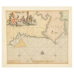
- Original Hand-Coloured Nautical Chart of West-Africa, c.1680Located in Langweer, NLNIEUWE PASKAERT VAN DE KUST VAN GENEHOA (Senegal) alsmede een gedeelte van Gambia beginnende an C. Blanco tot C. Verde (...). Amsterdam, Johannus van Keulen, c. 1680. Large folio...Category
Antique 17th Century Maps
MaterialsPaper

Recently Viewed
View AllMore Ways To Browse
African Collectables
Map Of Africa
Antique Charts
Antique Maps And Charts
Very Large African
Antique Map Of Africa
Antique Maps Of Africa
Antique Linen Map
Amsterdam Map
Map Of England
Old Antique World Map
Old World Antique Maps
Antique European Map
Antique Map Europe
Europe Map Antique
Antique Maps Of Europe
Dutch 16th Century Furniture
Map Of Britain