Items Similar to Original Antique Map of Oceania, the 5th Continent, 1816

Want more images or videos?
Request additional images or videos from the seller
1 of 5
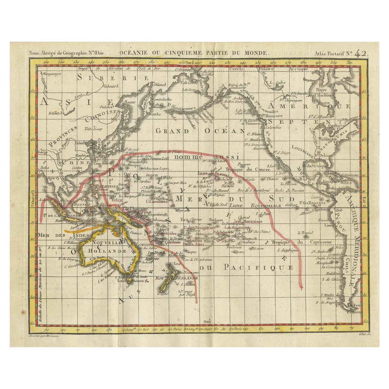
Original Antique Map of Oceania, the 5th Continent, 1816
About the Item
Antique map titled ‘Océanie ou cinquième partie du monde‘.
This is an original antique map of Oceania, the 5th continent, by Herisson taken from atlas "Nouv. Abrége de Géographie".
Artists and Engravers: Eustache Hérisson (1759 – 1818) was a French cartographer and geographical engineer active in Paris during the early years of the 19th century. Hérisson was a student of the 18th century hydrography Rigobert Bonne. He was a member of the Société Royale. Much of his work was republished posthumously by Bassett, Brue, and others.
Condition: Good, general age-related toning. Small weak spot on folding line. Original folding lines, blank verso. Please study image carefully.
- Dimensions:Height: 7.88 in (20 cm)Width: 9.45 in (24 cm)Depth: 0 in (0.02 mm)
- Materials and Techniques:
- Period:
- Date of Manufacture:1816
- Condition:Wear consistent with age and use.
- Seller Location:Langweer, NL
- Reference Number:
About the Seller
5.0
Platinum Seller
These expertly vetted sellers are 1stDibs' most experienced sellers and are rated highest by our customers.
Established in 2009
1stDibs seller since 2017
1,965 sales on 1stDibs
Typical response time: <1 hour
- ShippingRetrieving quote...Ships From: Langweer, Netherlands
- Return PolicyA return for this item may be initiated within 14 days of delivery.
More From This SellerView All
- Antique Map of Oceania by Hérisson, 1816Located in Langweer, NLAntique map titled "Océanie ou cinquième partie du monde". This is an original antique map of Oceania, the 5th continent, by Herisson taken from atlas "Nouv. Abrége de Géographie". A...Category
Antique 19th Century Maps
MaterialsPaper
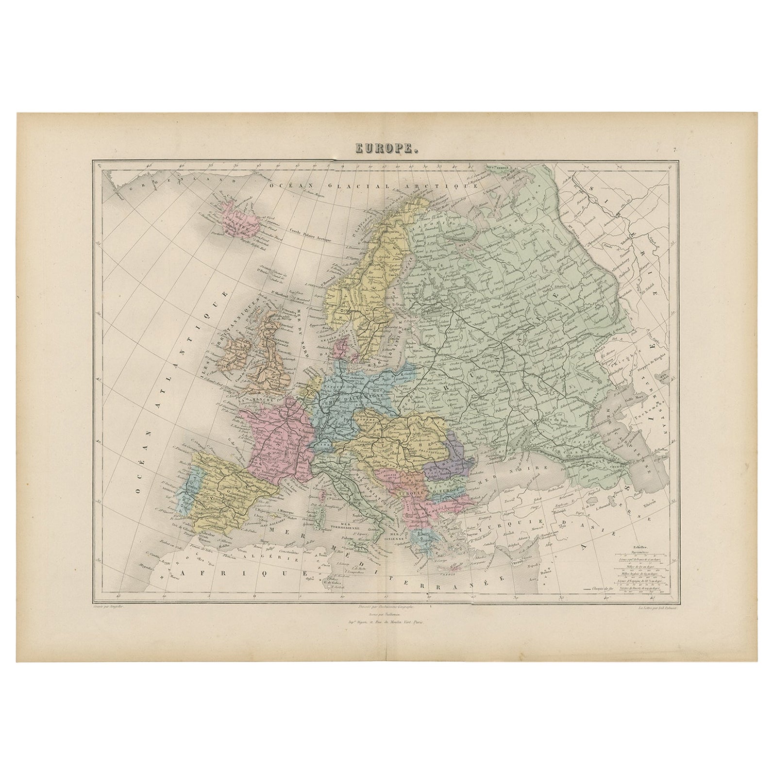
- Antique Map of the European Continent, 1882Located in Langweer, NLAntique map titled 'Europe'. Old map of the European continent. This map originates from 'The Royal Atlas of Modern Geography, Exhibiting, in a Series of Entirely Original and Authen...Category
Antique 19th Century Maps
MaterialsPaper
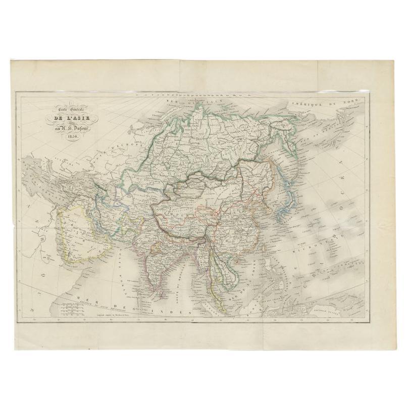
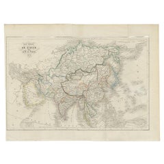
- Antique Map of The Asian Continent, 1855Located in Langweer, NLAntique map titled 'Carte Générale de l 'Asie'. Beautiful map of the Asian continent. This map originates from 'Voyage en Asie et en Afrique, d'aprés les récits des derniers voyageur...Category
Antique 19th Century Maps
MaterialsPaper
- Antique Map of the Europe Continent, 1880Located in Langweer, NLAntique map titled 'Europe'. Old map of the European continent. This map originates from 'Géographie Universelle Atlas-Migeon' by J. Migeon. Artists and Engravers: Published by J....Category
Antique 19th Century Maps
MaterialsPaper
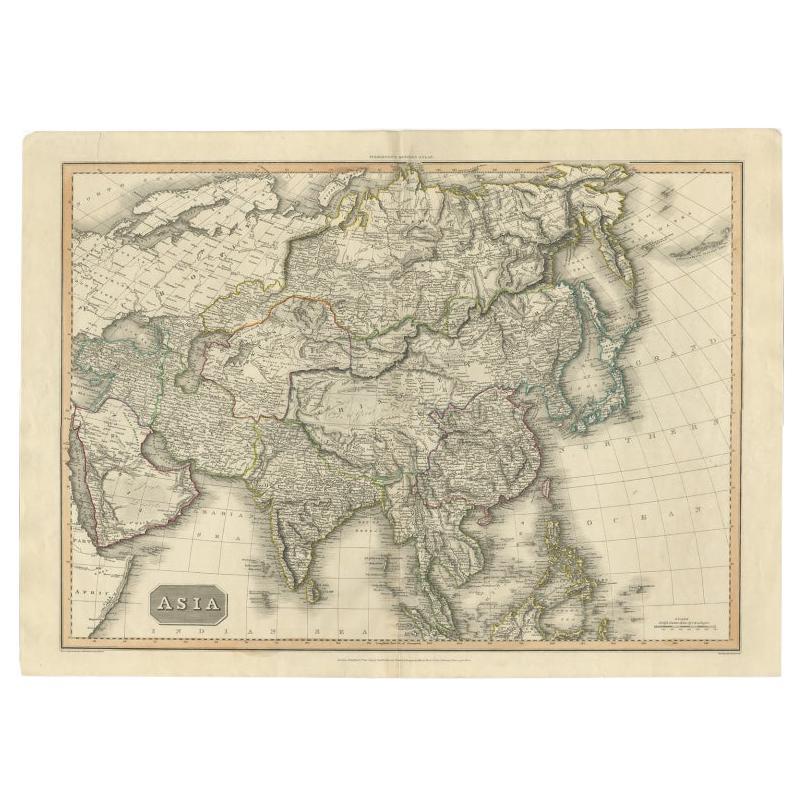
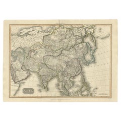
- Large Antique Map of the Asian Continent, 1814Located in Langweer, NLAntique map titled 'Asia'. Large antique map of the Asian continent. Drawn under the direction of Mr. Pinkerton by L. Hebert. Artists and Engraver...Category
Antique 19th Century Maps
MaterialsPaper
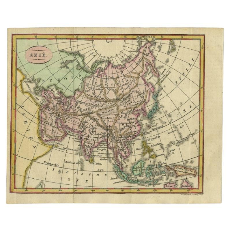
- Small Antique Map of the Asian Continent, 1841Located in Langweer, NLAntique map titled 'Azie.' Small map of the Asian continent. This map originates from 'De Aarde, beschouwd in haren Natuurlijken Toestand en Verdeeling (..)' by N.G. van Kampen. Publ...Category
Antique 19th Century Maps
MaterialsPaper


You May Also Like
- Large Original Antique Map of The World, Fullarton, C.1870Located in St Annes, LancashireGreat map of the World. Showing both hemispheres From the celebrated Royal Illustrated Atlas Lithograph. Original color. Published by Fullarton, Edinburgh, C.1870 Unframed. Rep...Category
Antique 1870s Scottish Maps
MaterialsPaper
- Original Antique Map of the American State of Washington, 1889Located in St Annes, LancashireGreat map of Washington Drawn and Engraved by W. & A.K. Johnston Published By A & C Black, Edinburgh. Original colour Unframed.Category
Antique 1880s Scottish Victorian Maps
MaterialsPaper
- Original Antique Map of the American State of Oregon, 1889Located in St Annes, LancashireGreat map of Oregon Drawn and Engraved by W. & A.K. Johnston Published By A & C Black, Edinburgh. Original colour Unframed.Category
Antique 1880s Scottish Victorian Maps
MaterialsPaper
- Original Antique Map of the American State of Nevada, 1889Located in St Annes, LancashireGreat map of Nevada Drawn and Engraved by W. & A.K. Johnston Published By A & C Black, Edinburgh. Original colour Unframed.Category
Antique 1880s Scottish Victorian Maps
MaterialsPaper
- Africa: the Fashion ContinentBy Rizzoli International PublicationsLocated in New York, NYGain new perspective on the vibrant and innovative world of contemporary African fashion design, bursting with fresh creativity and free from reductive stereotypes. From the runway in Lagos and music festivals in Casablanca or Nairobi, to the “image makers” of Marrakech and the influencers of Dakar or Accra, a new generation of African fashion designers, photographers, bloggers, and hair and makeup artists are redefining the aesthetic contours of the continent. Audacious, humorous, disruptive, and innovative are the bywords of these young creatives who, while drawing upon and revalorizing their heritage, offer an ultra-contemporary perspective on fashion today. A creative revolution is spreading in an extension of continental revindication through cultural reappropriation and the invention of a visual language. Appliqué figures straight from Ghanaian Asafo flags seem to chant modern slogans as they march across silk dresses, traditional textile prints give power back to women, and Xhosa beaded embroidery serves as an inspiration for modern knitwear. Body-artists transform themselves into platforms for activism, and photographers—using clothing...Category
21st Century and Contemporary Books
MaterialsPaper
- Original Antique Map of Indonesia, 1861Located in St Annes, LancashireGreat map of Indonesia Drawn and engraved by Edward Weller Original color Published in The Weekly Dispatch Atlas, 1861 Repairs to minor e...Category
Antique 1860s English Victorian Maps
MaterialsPaper


Recently Viewed
View AllMore Ways To Browse
Bonne Map
Map Monde Antique
Used Bassett Furniture
Atlas Du Monde Antique
Antique Bassett Furniture
Bassett Furniture Antique
Antique Map Of New England
Antique Maps New England
Ireland Map
Map Of Ireland
Caribbean Antique Furniture
Old Italian Map
18th Century Maps America
Map Of Portugal
Antique Caribbean Furniture
Portugal Map
18th Century Compass
Antique Map New York