18th Century Maps
39
1,887
to
471
1,850
35
1,887
1,887
1,887
21
1
2,875
2,116
411
5
229
29
11
85
7
56
6
3
3
4
5
2
1,873
13
4
3
2
98
27
23
18
17
26
16
13
13
13
Period: 18th Century
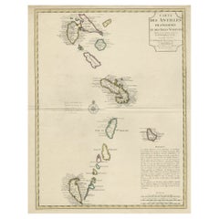
Detailed Antique Map of the Windward Islands in the Caribbean
Located in Langweer, NL
Antique map titled 'Carte des Antilles Francoises et des Isles Voisines'. Original antique map of the French Antilles, covering an area stretching from Guadeloupe in the north to Gre...
Category
Antique 18th Century Maps
Materials
Paper
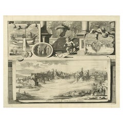
Antique Print of the Tiber River in Rome, Italy, 1704
Located in Langweer, NL
Antique print titled 'Insulae Tiberinae et Pontis Senatorii Vestigia'. This original antique print shows a view of the Tiber River in Rome with the Bridge 'Ponte dei Senatori'. Above more images of Rome. Originates from 'Beschryving van Oud en Nieuw Rome. Verdeelt in drie Deelen. In 't Fransch beschreven door den Heer Francois Desseine. En in 't Nederduitsch vertaalt.', by Francois Desseine and published by Francois Halma in 1704, first published in French in 1690. Copies of this work are rarely complete as the maps and engravings are of high quality matching the work of Piranesi.
Artists and Engravers: Jan Goeree (1670-1731) was a Dutch engraver and poet. He was the son of the Middelburg bookseller Willem Goeree. Born in Middelburg, but soon they moved to Amsterdam. Initially he focussed on painting, assumably a student of Gerard de Lairesse...
Category
Antique 18th Century Maps
Materials
Paper
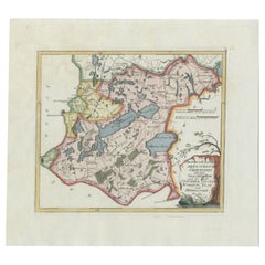
Antique Map of the Region of Gaasterland, Friesland, The Netherlands, 1791
Located in Langweer, NL
Antique map titled 'Der Provinz Westergo zwey südliche Grietenyen mit dem Gaasterland und der Stadt Staveren, Sloten, Workum, Ylst und Hindelopen'. Map of the region of Gaasterland, ...
Category
Antique 18th Century Maps
Materials
Paper
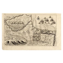
Antique Map of the Region of Pasuruan, Java, Indonesia, 1726
Located in Langweer, NL
"Map of the region around Pasuruan. It shows the location of rice fields, the village Bangil, as well as three places named Pagger (also Pagar), a cluster of buildings surrounded by a bamboo fence. The location of a earthen wall with pallisade and small cannons...
Category
Antique 18th Century Maps
Materials
Paper
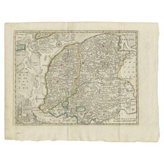
Antique Map of the Province of Friesland by Keizer & De Lat, 1788
Located in Langweer, NL
Antique map titled 'Friesland'. Uncommon antique map of the province of Friesland, the Netherlands. This map originates from 'Nieuwe Natuur- Geschied- en Handelkundige Zak- en Reisat...
Category
Antique 18th Century Maps
Materials
Paper
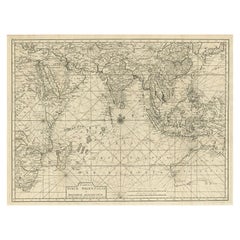
Antique Map of Southeast Asia and the Indian Ocean by Valentijn, 1726
Located in Langweer, NL
Antique map titled 'Tabula Indiae Orientalis'. Beautiful detailed map of Australia, Southeast Asia and the Indian Ocean. The map features a fine depiction of the outlines of the western two-thirds of Australia, based on the discoveries of explorers working for the Dutch East India Company (the VOC). These include Willem Jansz's discoveries in the Gulf of Carpentaria in 1606; the encounters of Dirk Hartog...
Category
Antique 18th Century Maps
Materials
Paper
Antique Architecture Print of a Composite Portico by Neufforge, c.1770
Located in Langweer, NL
Antique print titled 'Plan et Elevation d'un Portique Composite (..)'. Old print showing the design of a Composite portico. This print originates from 'Recueil Élémentaire d?Architec...
Category
Antique 18th Century Maps
Materials
Paper
Biblical Map of the Region from the Mediterranean through the Persian Gulf, 1720
Located in Langweer, NL
Antique map titled 'Carte de la Situation du Paradis Terrestre, Et des Pais Habitez par les Patriarches Dressee pour bien entendre l'Histoire Sainte, Par Messire Pierre Daniel Huet.'
This interesting map covers the region from the Mediterranean through the Persian Gulf. Detail is omitted in favor of Biblical depictions including the Sermon on the Mount...
Category
Antique 18th Century Maps
Materials
Paper
Highly Detailed Antique Map of the Holy Land Showing 12 Tribes of Israel, c.1720
Located in Langweer, NL
Antique map titled 'Heylige Land verdeeld in de Twaalf Stammen Israels (..).'
Highly detailed map of the Holy Land divided into 12 tribes of Israel...
Category
Antique 18th Century Maps
Materials
Paper
Old Print of VOC Ships in the Sea Near Batavia (Jakarta, Indonesia), 1779
Located in Langweer, NL
Antique print Batavia titled 'De Reede van Batavia'.
Beautiful view of the sea near Batavia (Jakarta, Indonesia), with several ships lying at anchor.
Artists and Engravers: Ma...
Category
Antique 18th Century Maps
Materials
Paper
Ancient World Map of Europe, Asia & Northern Africa with Ancient Names, 1725
Located in Langweer, NL
Antique map titled 'Geografische Kaarte van de Oude Weereld (..).'
Original antique map of the ancient world depicting Europe, Asia, and northern Africa with ancient place names....
Category
Antique 18th Century Maps
Materials
Paper
Engraving of a Map of Florida, the Gulf Coast, Caribbean & Central America, 1728
Located in Langweer, NL
This exceptional antique map, titled "Nouvelle Carte Marine de Toute les Cotes de l´Amerique" and alternatively known as "Nieuwe groote en seer Curieuse Paskaart van Geheel-WestIndie...
Category
European Antique 18th Century Maps
Materials
Paper
Antique Map of South East Asia, Australia and the Indian Ocean, 1726
By F. Valentijn
Located in Langweer, NL
Antique map titled 'Tabula Indiae Orientalis'.
Beautiful detailed map of Australia, Southeast Asia and the Indian Ocean. The map features a fine depiction of the outlines of the western two-thirds of Australia, based on the discoveries of explorers working for the Dutch East India Company (the VOC). These include Willem Jansz's discoveries in the Gulf of Carpentaria in 1606; the encounters of Dirk...
Category
Dutch Antique 18th Century Maps
Materials
Paper
Antique Map of the Mouth of the Yangtze River 'China' by J.N. Bellin, 1764
Located in Langweer, NL
This detailed regional map of China is a historical cartographic work from the mid-18th century and is attributed to Antoine-François Prévost, a prominent French cartographer and geo...
Category
Antique 18th Century Maps
Materials
Paper
Antique Map of the Lorraine 'North-East France' by J. B. Homann, circa 1720
Located in Langweer, NL
Antique map of Lorraine in north-east France by J. B. Homann. Covering the area around Metz, Nancy and Sarrebruck with Luxembourg in the North and Mulhouse in Southeast. With a decor...
Category
Antique 18th Century Maps
Materials
Paper
Antique Map of the British Isles by H. Chatelain, 1719
Located in Langweer, NL
Beautiful hand colored large format map of the British Isles, with large insets of the Eastern and Western Hemispheres and the coats of arms for Engl...
Category
Antique 18th Century Maps
Materials
Paper
Hand-Colored Antique Map of part of Germany by M. Seutter, c. 1730
Located in Langweer, NL
Antique map titled 'Mappa Circuli Rhenani Superioris (..). Original map with hand coloring of part of Germany. It includes the region of Kassel, Göttingen, Eisenach, Schweinfurt, Wer...
Category
Antique 18th Century Maps
Materials
Paper
Decorative Original HandColoredAntique Map of South America by J.B. Elwe, 1792
By J.B. Elwe
Located in Langweer, NL
This image depicts 'L'Amerique Meridionale', an antique map of South America. The map is carefully hand-colored, showcasing the diverse countries within the continent, including Braz...
Category
Antique 18th Century Maps
Materials
Paper
Four 18th Century Engraved and Hand-Colored Maps by Weigel
By Christoph Weigel
Located in Copenhagen, K
Small collection of four engraved maps of Italy, Balkan and of Central Asia.
Two are of Italy, one Corsica and Northern Italy and the other of the Southern Italian boot...
Category
German Antique 18th Century Maps
Materials
Paper
Antique Map of a Bay of Borneo, Indonesia, c.1760
Located in Langweer, NL
Antique map titled 'La Baye de l'isle et Ville de Borneo'. Small map depicting a Bay of Borneo.
Artists and Engravers: Anonymous.
Condition: Good, general age-related toning. ...
Category
Antique 18th Century Maps
Materials
Paper
Antique Map of India during the height of the Mughal Imperial Expansion, 1713
Located in Langweer, NL
Antique map titled 'L'Inde de ca le Gange (..)'. Beautiful original antique map embracing most of India, made during the height of the Mughal imperial expansion. The map encompasses ...
Category
Antique 18th Century Maps
Materials
Paper
Antique Map of the City of Copenhagen in Denmark c.1720
Located in Langweer, NL
Antique map titled 'Copenhagen'. Original antique map of the city of Copenhagen, Denmark. This map originates from 'Unterschiedliche dieser Zeit Beruffene Laender, Gegenden, Staedte ...
Category
Antique 18th Century Maps
Materials
Paper
Original Antique Bird's Eye View of Banten or Bantam in Java, Indonesia, 1725
Located in Langweer, NL
Antique print titled 'La Ville de Bantam capitale du Roiaume de meme nom'.
A bird's eye view of the city Banten or Bantam near the western end of Java in Indonesia. Several tall ...
Category
Antique 18th Century Maps
Materials
Paper
Map of Ireland Titled "Hiberniae Britannicae Insulae Nova Descriptio Irland"
Located in San Francisco, CA
Abraham Ortelius (1527-1598) was a cartographer, geographer and maker from Antwerp in the Spanish Netherlands. He created the first modern atlas titled in Latin Theatrum Orbis Terrar...
Category
Belgian Antique 18th Century Maps
Materials
Paper
Antique Map of the Coast of Southern France, 1793
Located in Langweer, NL
Antique map titled '14th Chart of the Coast of France, from Port Vendres to the Petit Rhône'. Original map with later hand coroling of the coast of Southern France. This map originat...
Category
Antique 18th Century Maps
Materials
Paper
Detailed Regional Map of the Gulf of Bengal and the Lower Ganges River, ca.1750
Located in Langweer, NL
Title of this original and rare antique map: Nouvelle Carte Du Royaume De Bengale
Mapmaker: Jacques-Nicolas Bellin (1703-1772).
He was among the most important mapmakers of the eighteenth century. In 1721, at only the age of 18, he was appointed Hydrographer to the French Navy. In August 1741, he became the first Ingénieur de la Marine of the Dépôt des cartes...
Category
Antique 18th Century Maps
Materials
Paper
Antique Map of New England and Part of Canada by Vaugondy 'circa 1755'
Located in Langweer, NL
Antique map titled 'Partie de l'Amérique septent qui comprend la nouvelle France ou le Canada'. Decorative and highly detailed map of New England an...
Category
Antique 18th Century Maps
Materials
Paper
Senex Map of Castile, Leon & La Mancha in The Spanish Heartland, 1714
Located in Langweer, NL
This antique map, titled "A Map of Old & New Castile from the Observations of Rodrigo Mendes Silva and others," depicts the regions of Old Castile and New Castile in Spain, along wit...
Category
Antique 18th Century Maps
Materials
Paper
Antique Map of the Northern Portion of the Philippines by J.N. Bellin, 1764
Located in Langweer, NL
Detailed map of the Northern portion of the Philippines, extending from Batanes and Babuyanes to Mindonoro and Masbate, and centered on Luzon. One of the most detailed maps of the pe...
Category
Antique 18th Century Maps
Materials
Paper
Amsterdam city plan - Joost van Sassen
Located in UTRECHT, UT
“Afbeeldinge der Stad Amsterdam, gelyk deselve in den jaren 1536 door Cornelis Antonisz na ’t leven is geschildert, en Ao 1544 in druk uytgegeven.”, engraved by Joost van Sassen and ...
Category
Dutch Other Antique 18th Century Maps
Materials
Paper
Utrecht city plan
Located in UTRECHT, UT
“Platte grond der Stad Utrecht vertonende alle Gragten, Straaten, Stegen, Gangen, Markten, en plaatsen der openbare Gebouwen”, engraving published by Johannes van Schoonhoven in Amst...
Category
Dutch Other Antique 18th Century Maps
Materials
Paper
Original Antique Map of West Central France in Frame, 1748
Located in Langweer, NL
A nicely framed and hand-coloured decorative map titled "Gouvernemens Generaux De Poitou et De Saintonge" and engraved by M. Robert. This historical international map includes severa...
Category
Antique 18th Century Maps
Materials
Paper
Old Map of The Mughal Empire and the Indian Peninsula South of the Ganges, 1787
Located in Langweer, NL
This is a historical map titled "L'Empire Du Mogol, Et La Presqu Isle De L'Inde En Deca Du Gange."
An original authentic map, created by Rigobert Bonne (1727-1794), an influential ...
Category
Antique 18th Century Maps
Materials
Paper
Historical Map of the Black Sea and Surrounding Regions, 1705
Located in Langweer, NL
Title: "Map of Turcomania, Georgia, and Comania"
This print presents an intricately detailed map of the Caucasus region, titled “Turcomania, Georgien Commanie,” by the esteemed cart...
Category
Antique 18th Century Maps
Materials
Paper
Charting the Course of Empire: Bonne's 1770 Masterpiece Maps of the Indian Ocean
Located in Langweer, NL
A voyage through history with an exquisite collection of Rigobert Bonne's 1770 maps, as featured in the coveted Atlas Moderne circa 1770. Each map, a cartographic treasure, captures ...
Category
Antique 18th Century Maps
Materials
Paper
Antique Map of the Sunda Islands Including Sumatra, Java, and Borneo, 1705
Located in Langweer, NL
Title: “Antique Map of the Sunda Islands Including Sumatra, Java, and Borneo”
This print is a beautifully detailed and relatively rare map of Western Indonesia, encompassing the reg...
Category
Antique 18th Century Maps
Materials
Paper
Cartographic Elegance of the Mughal Dominion in a Hand-Colored Antique Map, 1705
Located in Langweer, NL
This original antique map titled “'T Ryk van den Grooten Mogol” by Nicolas Sanson from 1705 is an interesting historical artifact. It depicts the extent of the Mughal Empire in North...
Category
Antique 18th Century Maps
Materials
Paper
Antique Coaching Road Map, Devon, English, Regional Cartography, Georgian, 1720
Located in Hele, Devon, GB
This is an antique coaching road map of Devon. An English, framed lithograph engraving of regional interest, dating to the early 18th century and later.
Fascinating 18th century hig...
Category
British Georgian Antique 18th Century Maps
Materials
Wood
Authentic Antique Map of the Caribbean, Gulf Coast and Central America, 1787
Located in Langweer, NL
Antique map titled 'Les Isles Antilles et le Golfe du Méxique'. Original old map of the Caribbean, Gulf Coast and Central America. With inset map of Bermuda. Originates from 'Histoir...
Category
Antique 18th Century Maps
Materials
Paper
Antique Coaching Road Map, South Devon, English, Framed, Cartography, Georgian
Located in Hele, Devon, GB
This is an antique coach road map of South Devon. An English, framed lithograph engraving of regional interest, dating to the early 18th century and later.
Delightful early 18th cen...
Category
British Georgian Antique 18th Century Maps
Materials
Wood
18th Century Antique Map of the Virgin Islands and Caribbean Inset Maps
Located in Langweer, NL
A fascinating piece of cartographic history! The map, titled "Carte du supplément pour les Isles Antilles," featuring inset maps of various islands in the Caribbean, is from the "Atl...
Category
Antique 18th Century Maps
Materials
Paper
Antique Coach Road Map, East Devon, English, Framed, Cartography, Georgian, 1720
Located in Hele, Devon, GB
This is an antique coach road map of East Devon. An English, framed lithograph engraving of regional interest, dating to the early 18th century and later.
Fascinating 18th century h...
Category
British Georgian Antique 18th Century Maps
Materials
Wood
Original Antique Map of the Virgin Islands with Insets of Caribbean Isles, 1787
Located in Langweer, NL
Antique map titled 'Supplément pour les Isles Antilles (..)'. Original old map of the Virgin Islands, with insets of Barbuda, St. Kits, Antigua, Dominica, St. Lucia, Barbados, St. Vi...
Category
Antique 18th Century Maps
Materials
Paper
Antique Lithography Map, Cumbria, English, Framed Cartography Interest, Georgian
Located in Hele, Devon, GB
This is an antique lithography map of Cumbria. An English, framed engraving of cartographic interest, dating to the early 18th century and later.
...
Category
British Georgian Antique 18th Century Maps
Materials
Wood
Antique Lithography Map, Durham, English, Framed, Cartography, Early Georgian
Located in Hele, Devon, GB
This is an antique lithography map of Durham. An English, framed engraving of cartographic interest, dating to the early 18th century and later, circa 1720.
Superb lithography of Du...
Category
British Georgian Antique 18th Century Maps
Materials
Wood
1797 Tardieu Map of Southeast Asia: The Malay Archipelago and Beyond
Located in Langweer, NL
An original historical map titled 'Presqu' Île Au Dela Du Gange et Archipel De L'Inde', created by Pierre Francois Tardieu and published in the "Atlas Universel" by Pierre Grégoire C...
Category
Antique 18th Century Maps
Materials
Paper
Old Map of Part of France: Poitou, Berry, Bourbonnais, and Nivernais in 1768
Located in Langweer, NL
The map with text neatly mounted on both sides of the map on the plate, is a section of an old map with accompanying French text. The map mentions several historical French provinces...
Category
Antique 18th Century Maps
Materials
Paper
The Valley of Inspruck: An 18th-Century Engraved Perspective, 1792
Located in Langweer, NL
Title: "The Valley of Inspruck: An 18th-Century Engraved Perspective"
This elegant original antique engraving, titled "The Valley of Inspruck," showcases a serene view of the Innsbruck Valley. The artwork is delicately rendered, capturing the grandeur of the mountains and the pastoral tranquility of the valley.
The print depicts a detailed landscape scene, replete with towering craggy peaks that loom over a peaceful settlement nestled in the valley. A striking feature is the contrast between the ruggedness of the natural environment and the cultivated lands and architecture, indicating a harmonious coexistence of humanity with nature.
It was published as directed on January 1, 1792, by T & G Egerton of Whitehall for the author. Albanis Beaumont is credited with the original design ('Del.' for delineavit, indicating he drew the initial illustration), and Cornelis Apostool is noted for the engraving work ('Sculp.' for sculpsit, indicating he engraved the image).
The publication of this print during the late 18th century aligns with a time when there was a heightened interest in natural beauty and the picturesque, reflected in the art and literature of the Romantic period. This print would have appealed to those with an appreciation for both the aesthetic and the sublime qualities of the European landscape.
The publication by T & G Egerton, a reputable firm known for their work in the arts, and the involvement of a skilled artist and engraver like Beaumont and Apostool, respectively, underline the quality and desirability of the print. It is a piece that would attract collectors of fine engravings and admirers of European landscapes, offering a window into the aesthetic values and artistic endeavors of the late 18th century.
As a historical piece, this print offers a view into the past, inviting contemplation of the rich cultural and natural heritage of the Innsbruck area. It is a valuable collectible for enthusiasts of antique maps and prints...
Category
Antique 18th Century Maps
Materials
Paper
Stunning Decorative Antique Map of Venice in Italy, ca.1787
Located in Langweer, NL
Title: Piano elevato dell'inclita città di Venezia
Bird's-eye view (etching) of Venice.
Print made by: Marco Sebastiano Giampiccoli
After: Matthäus Merian I
Two copper engraved sh...
Category
Antique 18th Century Maps
Materials
Paper
Antique Map of the Philippines and Guam by Scherer, circa 1702
Located in Langweer, NL
Antique map titled 'Nova et Vera Exhibitio Geographica Insularum Marianarum (..)'. Rare and very attractive map of the Mariana Islands, Philippines, Ko...
Category
Antique 18th Century Maps
Materials
Paper
Colored wall map of the WORLD
By Chambon
Located in ZWIJNDRECHT, NL
“Mappe Monde, contenant les Parties Connues du Globe Terrestre”
CHAMBON, Gobert-Denis (France, 17.. - 1781)
Paris, Longchamps et Janvier, 1754
Size H. 115 x W. 145 cm.
Gobert-Denis Chambon made copper engraving after the work of Guillaume De L’Isle, published in 1754 by Jean Janvier and S.G. Longschamps.
A huge wall map of the world in two hemispheres printed on two sheets, depicting the Eastern and Western hemispheres supported by two male figures, decorated at the bottom right and left with two celestial hemispheres (boreal and southern) and at the bottom in the middle with an armillary sphere, in addition.
This map is most notable for its depiction of the Sea of Japan labeled "Mer de Corée" and of "Mer de L'Ouest" or Sea of the West - a great sea, easily the size of the Mediterranean, to flow from the then-known Strait of Juan de Fuca...
Category
French French Provincial Antique 18th Century Maps
Materials
Wood, Paper
1720 Panoramic Vista of Istanbul and the Bosphorus - with Column of Pompey
Located in Langweer, NL
Title: "1701-1720 Bosphore de Thrace and Views of Istanbul - Chatelain/Guedeville"
Description: This finely detailed folio from Chatelain's 'Atlas Historique', dated 1720, features ...
Category
Antique 18th Century Maps
Materials
Paper
1726 Valentyn's Map of Bali and Lombok, Original Engraving
Located in Langweer, NL
This antique map is a detailed 18th-century chart of the island of Bali, one of the many islands of Indonesia, with an inset of the neighboring island Lombok, attributed to François ...
Category
Antique 18th Century Maps
Materials
Paper
Old 18th Century Composite Map of Key Caribbean Islands with Descriptive Texts
Located in Langweer, NL
Antique map titled 'Dominia Anglorum in praecipuis Insulis Americae ut sunt Insula S. Christophori, Antegoa, Iamaica, Barbados nec non Insulae Bermudes vel Sommers dictae. Die Englis...
Category
Antique 18th Century Maps
Materials
Paper
Original Engraving of the West Indies, Gulf of Mexico, Antilles, Caribbean, 1780
Located in Langweer, NL
Rigobert Bonne and G. Raynal's 1780 map of the West Indies, Gulf of Mexico, Antilles, and the Caribbean stands as a remarkable cartographic piece, offering a detailed and expansive v...
Category
Antique 18th Century Maps
Materials
Paper
Roseaux, St. Lucia Island Map by BELLIN, Handcolored Engraving, 1763
Located in Langweer, NL
Dating back to around 1763, this antique hand-colored print, a creation by Jacques Nicolas Bellin, unveils a meticulously detailed "Plan du Cul de Sac des Roseaux dans l'Isle de Ste....
Category
Antique 18th Century Maps
Materials
Paper
Super Rare Antique French Map of Chine and the Chinese Empire, 1780
Located in Amsterdam, Noord Holland
Super Rare Antique French Map of Chine and the Chinese Empire, 1780
Very nice map of Asia. 1780 Made by Bonne.
Additional information:
Type: Map
...
Category
European Antique 18th Century Maps
Materials
Paper
Original Antique Map of the Island of Dominica in the West Indies, 1794
Located in Langweer, NL
MAP OF THE ISLAND OF DOMINICA for the History of the West Indies, by Bryan Edwards. Esq.
Dominica, an island renowned for its lucrative exports of sugar, cocoa, and coffee, operated...
Category
Antique 18th Century Maps
Materials
Paper
Recently Viewed
View AllMore Ways To Browse
Albania Antique Map
Antique Gate Architectural Antiques
Antique Louisiana Map
Antique Map Louisiana
Antique Map Palestine
Antique Maps Of Louisiana
Antique Maps Of North Carolina
Armenia Map
Armenian Map
Brooklyn Map
Gibraltar Antique Map
Greenland Map
Hyde Park Antiques
Map Colorado
Map Of Armenia
Map Of Colorado
Map Of Gulf Of Mexico
Mughal Map
