Items Similar to Title: Mid-19th Century Map of Australasia by Carl Flemming - 1855


Want more images or videos?
Request additional images or videos from the seller
1 of 8
Title: Mid-19th Century Map of Australasia by Carl Flemming - 1855
About the Item
Title: "Mid-19th Century Map of Australasia by Carl Flemming - 1855"
Description: This original 1855 antique map from the Sohr-Berghaus Atlas, created by Carl Flemming, is a detailed cartographic representation of Australasia, encompassing Australia, New Zealand, parts of Indonesia and Polynesia, as well as the broader Pacific Ocean. The map is annotated in German, with "Australië" indicating the focus on the Australian continent, which is depicted with its major geographical features, including mountain ranges, rivers, and regional boundaries.
Australia is centrally highlighted, with "AUSTRAL-LAND" boldly marked, showing the territories as they were known in the mid-19th century. The map's detail extends to the surrounding regions, noting significant islands, the expanse of the Pacific Ocean, and parts of the East Indies and the Far East, including China.
At the bottom, the map includes meticulously crafted diagrams and charts. These likely represent the comparative lengths of rivers and mountain elevations, common inclusions for maps of this era to provide additional context and understanding of the region's topography.
The map's historical value is notable, as it would have been used for educational purposes and by those with interests in geography, navigation, and colonial activities during that time. It serves as a historical snapshot, capturing the state of geographical knowledge and territorial understanding of Australasia in the 1850s.
- Dimensions:Height: 14.06 in (35.7 cm)Width: 17.52 in (44.5 cm)Depth: 0 in (0.02 mm)
- Materials and Techniques:
- Period:
- Date of Manufacture:1855
- Condition:Very good. General age-related toning and/or occasional minor defects from handling. Please study scan carefully.
- Seller Location:Langweer, NL
- Reference Number:
About the Seller
5.0
Platinum Seller
These expertly vetted sellers are 1stDibs' most experienced sellers and are rated highest by our customers.
Established in 2009
1stDibs seller since 2017
1,967 sales on 1stDibs
Typical response time: <1 hour
- ShippingRetrieving quote...Ships From: Langweer, Netherlands
- Return PolicyA return for this item may be initiated within 14 days of delivery.
More From This SellerView All
- Antique Map of Australasia by Lowry, 1852Located in Langweer, NLAntique map titled 'Australasia'. Original map of Australasia. This map originates from 'Lowry's Table Atlas constructed and engraved from the most recent Authorities' by J.W. Lowry....Category
Antique Mid-19th Century Maps
MaterialsPaper
- Antique Map of Polynesia and Australasia by Neele, 1825Located in Langweer, NLAntique map titled 'Polynesia and Australasia'. It shows Australia (New Holland), part of Asia, New Zealand and many islands. This map originates from 'Encyclopedia Londinensis'.Category
Antique Early 19th Century Maps
MaterialsPaper
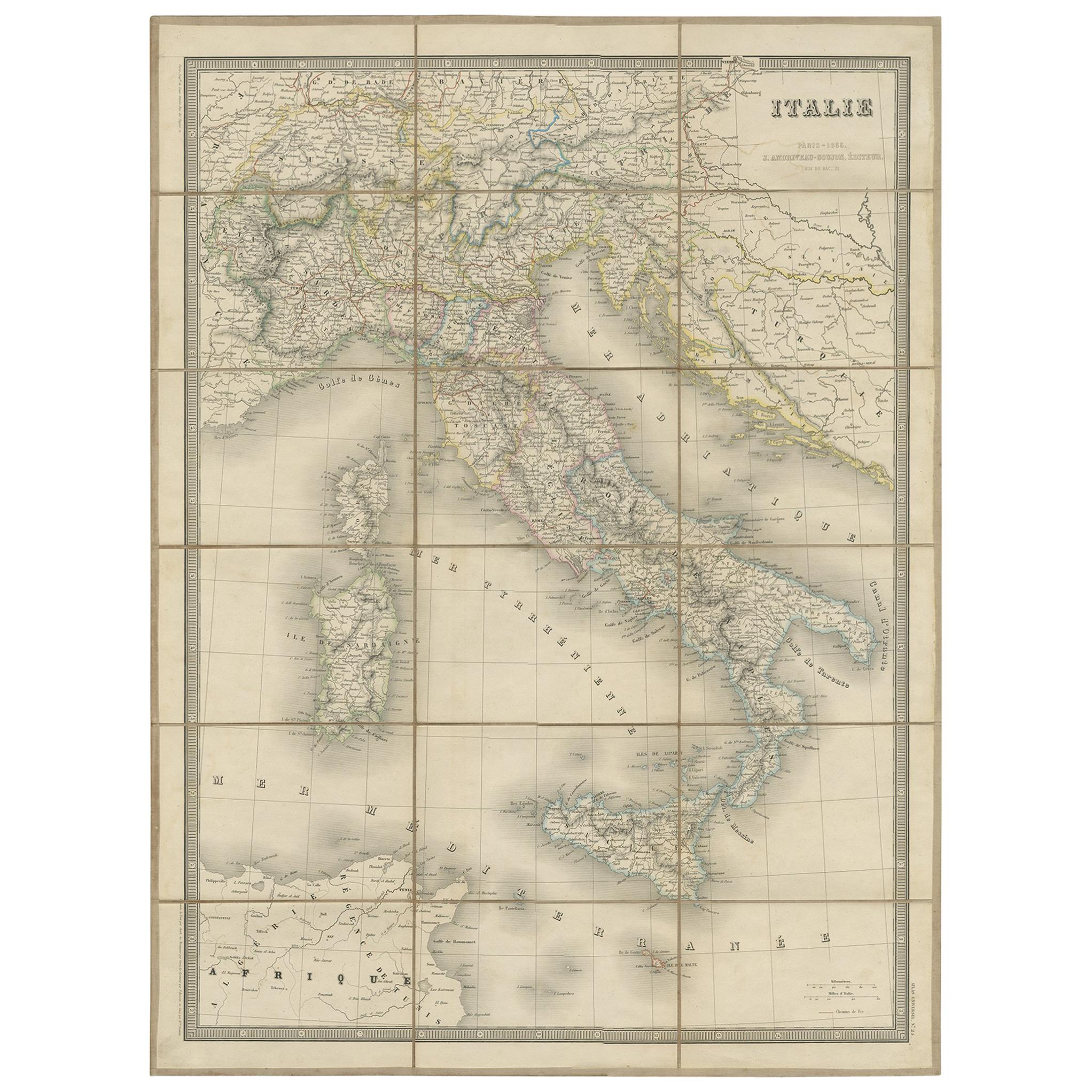
- Antique Map of Italy by Andriveau-Goujon, 1855Located in Langweer, NLAntique folding map of Italy titled 'Italie'. Detailed map of Italy. The map originates from 'Atlas Universel' and is mounted on linen.Category
Antique Mid-19th Century Maps
MaterialsPaper
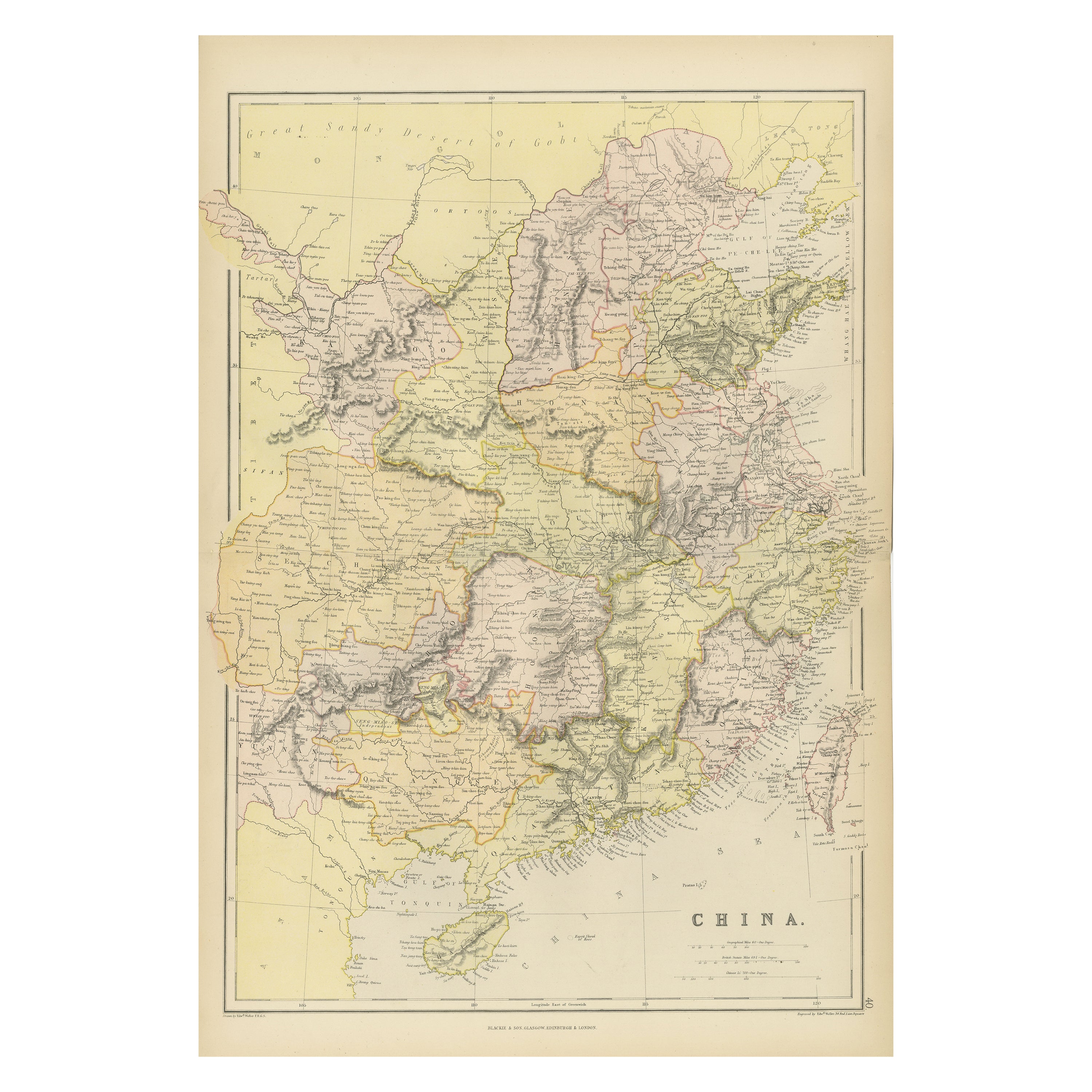
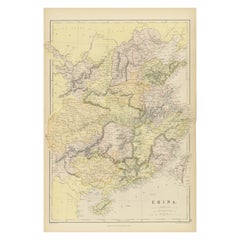
- Antique 19th Century Map of China by Blackie & Son, 1882Located in Langweer, NLThis map is an 1882 Blackie & Son map of China. The title "CHINA." is prominently displayed at the bottom. The map is colored to differentiate various regions, possibly indicating di...Category
Antique 1880s Maps
MaterialsPaper
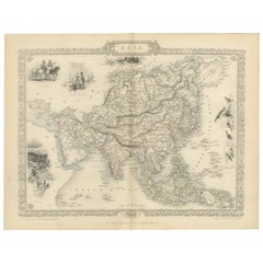
- Mid-19th Century Decorative Map of Asia with Cultural and Natural VignettesLocated in Langweer, NLJohn Tallis & Company, known for their decorative mid-19th-century maps, created this map of Asia. These maps were distinctive for their elaborate borders and detailed vignettes. The...Category
Antique 1850s Maps
MaterialsPaper
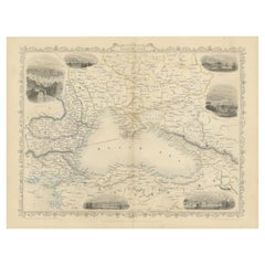
- Mid 19th Century Map of the Black Sea with Decorative Vignettes, 1851Located in Langweer, NLMap of the Black Sea and contingent lands, including Turkey, Russia, Georgia, Azerbaijan, Bulgaria, Crimea and Armenia, with decorative vignettes views of Sebastopol, Varna, Odessa, Sinope, Constantinople and Silistria. Fine antique map...Category
Antique Mid-19th Century Maps
MaterialsPaper


You May Also Like
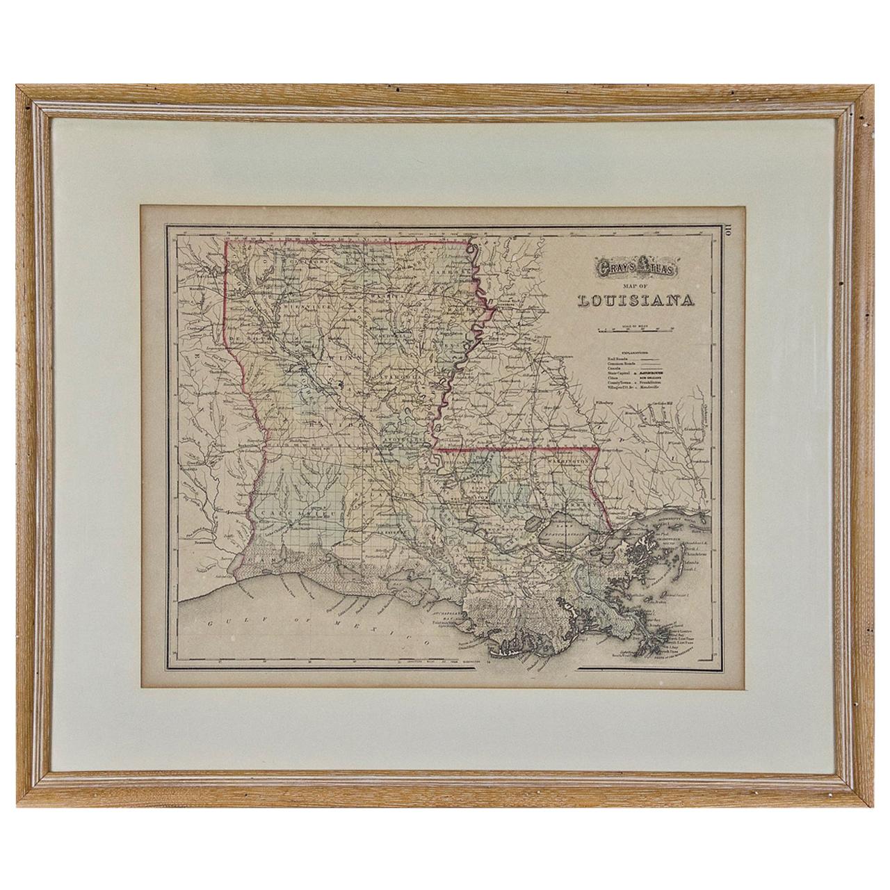
- Louisiana: A Framed 19th Century Map by O. W. GrayBy Gray and CoLocated in Alamo, CAThis framed 19th century map of the Louisiana territory was published in "Gray's Atlas of the United States with General Maps of the World, accompanied by Descriptions Geographical, Historical, Scientific and Statistica" published in 1873 in Philadelphia by O.W. Gray and Son and Stedman, Brown and Lyon. It is a highly detailed map of Louisiana...Category
Antique Mid-19th Century American Other Maps
MaterialsPaper
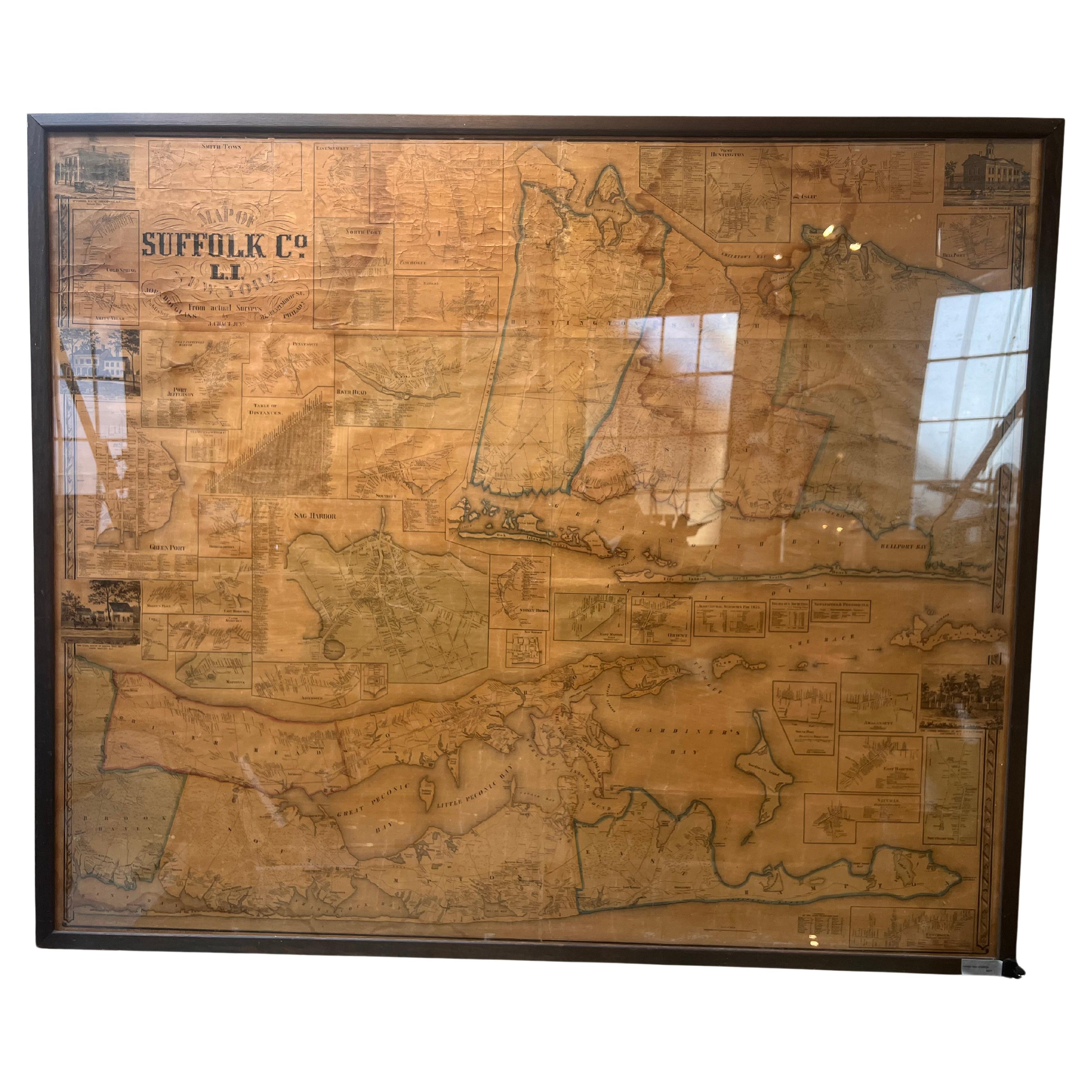
- Framed Mid-19th Century Wall Map of Long Island, the HamptonsLocated in Sag Harbor, NYA Framed museum quality find. This large wall map dates to the mid-1800s. Detailed inset maps of, Sag Harbor, East Hampton, Amagansett, Shelter Island and most villages in Long Island. It also has agriculture stats for 1855. Detailed prints of homes on Scuttle Hole in Bridgehampton as well as several other detailed prints. Lists of businesses, distance tables and railroad schedules and stops. The total amount of detailed information about Suffolk County Long Island is staggering. A unique rare New York map...Category
Antique Mid-19th Century American Maps
MaterialsLinen, Paper
- America "Amérique Septentrionale": A 19th Century French Map by DelamarcheBy Maison Delamarche 1Located in Alamo, CAThis framed mid 19th century map of North America entitled "Amérique Septentrionale" by Felix Delamarche was published in Paris in 1854 by Quay de l'Horloge du Palais, avec les Carte...Category
Antique Mid-19th Century American Other Maps
MaterialsPaper
- 19th Century Lithograph Map of Lower Manhattan, New YorkLocated in Haddonfield, NJ1859 hand colored map of Lower Manhattan or New Amsterdam by George H. Moore.Category
Antique 19th Century English Folk Art Maps
MaterialsPaper
- Early 19th Century Hand Coloured Map of North America by Aaron ArrowsmithBy Aaron ArrowsmithLocated in Hamilton, OntarioHand coloured map in French by English cartographer Aaron Arrowsmith (1750–1823) titled "Amerique Septentionale" (North America). Map size: 9.5" x 8" Mat size: 20.5" x 14.25".Category
Antique Early 19th Century English Maps
MaterialsPaper
- 1855 "New-York City & County Map" by Charles MagnusBy Charles MagnusLocated in Colorado Springs, COThis is a beautiful hand-colored map titled “New York City & County Map with Vicinity entire Brooklyn, Williamsburgh, Jersey City &c.” The work was published in 1855 by Charles Magnu...Category
Antique 1850s American Maps
MaterialsPaper


Recently Viewed
View AllMore Ways To Browse
Pacific Furniture Mid Century
Antique Furniture New Zealand
New Zealand Antique Furniture
Indonesian Colonial
Chinese Antique Australia
Antique Diagrams
German Colonial
Australian Colonial
Australian Colonial Furniture
Australasia Antique Map
Antique Geological Maps
Antique Map Fabric
Antique Map Of New Jersey
Antique Map Singapore
Antique Maps Of New Jersey
Antique Maps Singapore
Constantinople Map
Map Colonial Africa