Items Similar to Antique Frontispiece of Book about The Turkish Empire in Asia and Africa, 1733

Want more images or videos?
Request additional images or videos from the seller
1 of 6
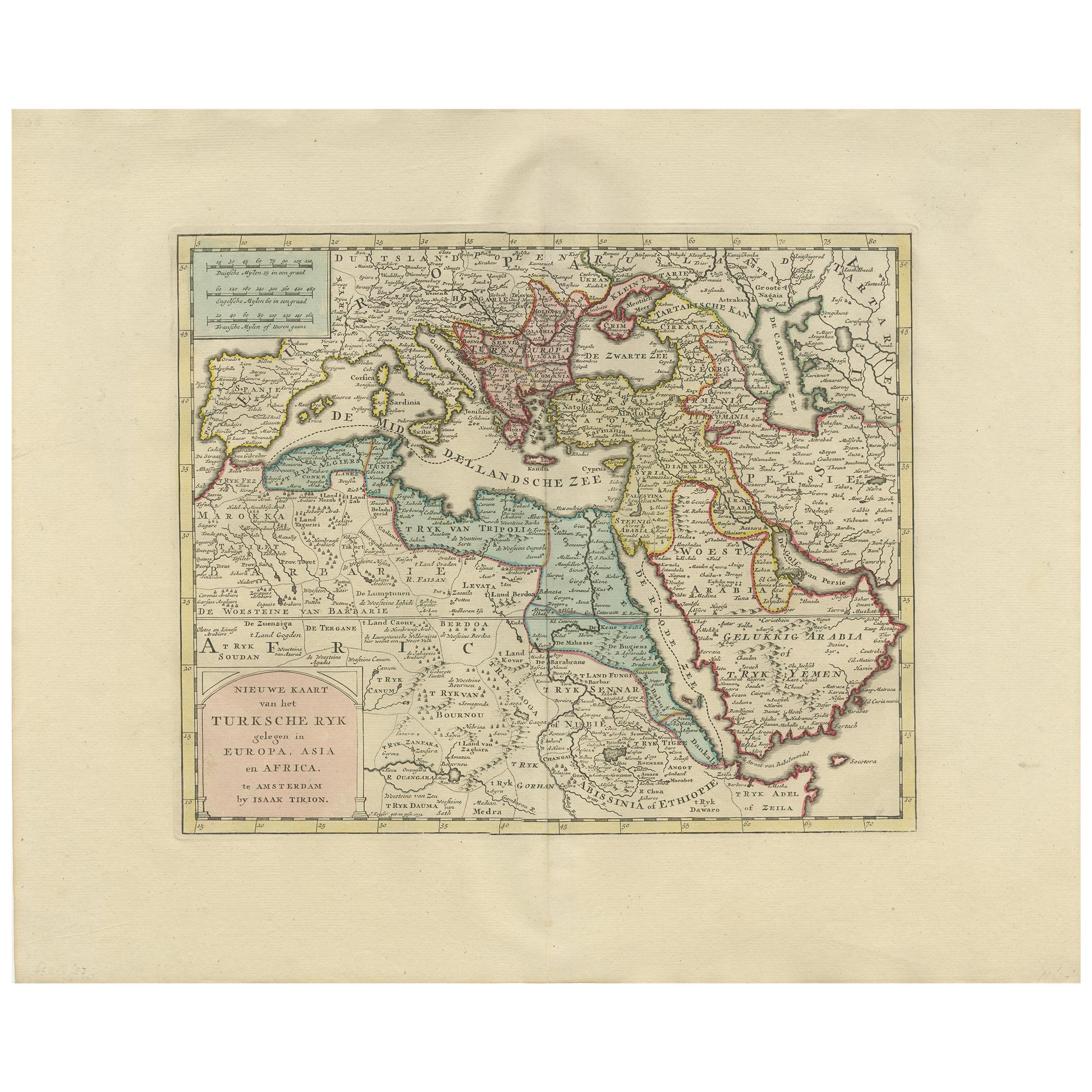
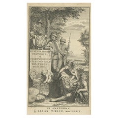
Antique Frontispiece of Book about The Turkish Empire in Asia and Africa, 1733
About the Item
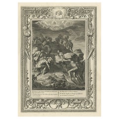
Antique frontispiece of the 5th volume of 'Hedendaagsche historie of tegenwoordige staat van allen volkeren (..)' by Thomas Salmon. This volume describes the Turkish Empire in Asia and Africa.
Artists and Engravers: Published by I. Tirion, Amsterdam.
Condition: Very good, general age-related toning. Please study image carefully.
Date: 1733
Overall size: 12 x 20 cm.
Image size: 10 x 16 cm.
- Dimensions:Height: 7.88 in (20 cm)Width: 4.73 in (12 cm)Depth: 0 in (0.01 mm)
- Materials and Techniques:
- Period:
- Date of Manufacture:1733
- Condition:
- Seller Location:Langweer, NL
- Reference Number:
About the Seller
5.0
Platinum Seller
These expertly vetted sellers are 1stDibs' most experienced sellers and are rated highest by our customers.
Established in 2009
1stDibs seller since 2017
1,965 sales on 1stDibs
Typical response time: <1 hour
- ShippingRetrieving quote...Ships From: Langweer, Netherlands
- Return PolicyA return for this item may be initiated within 14 days of delivery.
More From This SellerView All
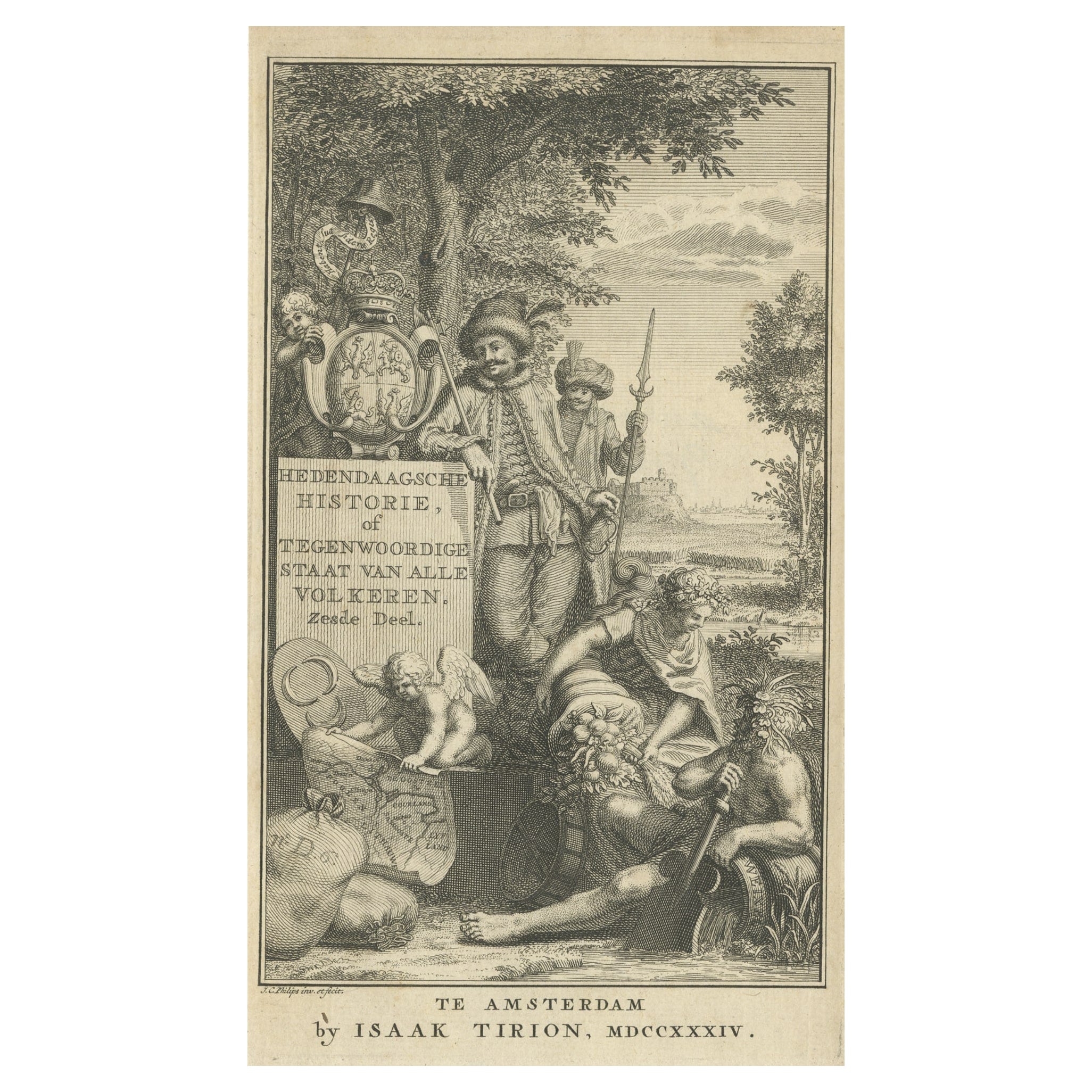
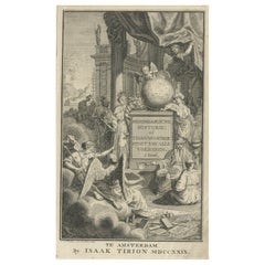
- Antique Frontispiece of a Book about Europe by Tirion, 1734Located in Langweer, NLAntique frontispiece of the 6th volume of 'Hedendaagsche historie of tegenwoordige staat van allen volkeren (..)' by Thomas Salmon. This volume describes par...Category
Antique 18th Century Prints
MaterialsPaper
- Antique Frontispiece of a Book About Japan, China and the Philippines, 1736Located in Langweer, NLAntique frontispiece of the 1st volume of 'Hedendaegsche historie of tegenwoordige staat van allen volkeren (..)' by Thomas Salmon. This volume describes Jap...Category
Antique 18th Century Prints
MaterialsPaper
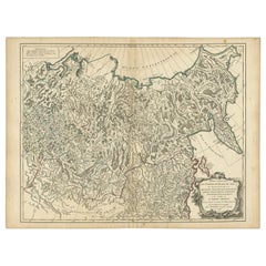
- Detailed Original Antique Map of the Russian Empire in Asia, 1750Located in Langweer, NLAntique map titled 'Partie Orientale de l'Empire de Russie en Asie (..)'. Detailed map of the Russian Empire in Asia. Artists and Engravers: Gilles Robert de Vaugondy (1688-1766) was the head of a leading family of geographers in eighteenth century France. Gilles got his start when he jointly inherited the shop of Pierre-Moullart Sanson, grandson of the famous geographer Nicholas Sanson. The inheritance included the business, its stock of plates, and a roller press...Category
Antique 1750s Maps
MaterialsPaper
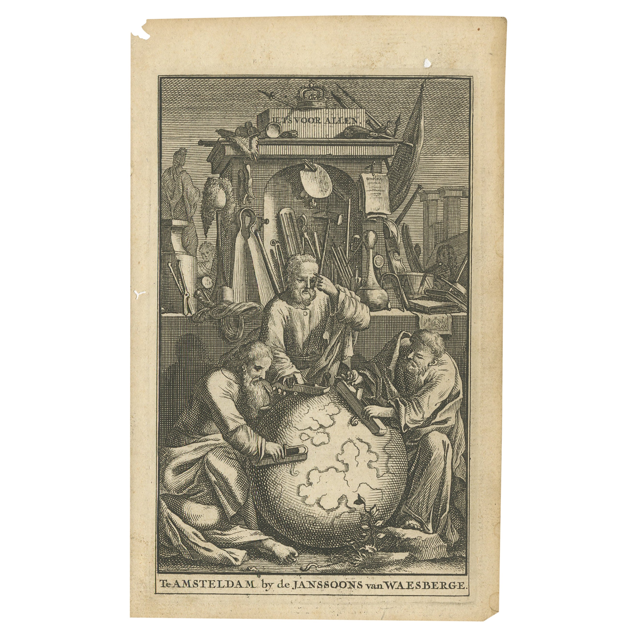
- Antique Frontispiece of an Old Dutch Book Depicting Globe Makers, 1717Located in Langweer, NLAntique frontispiece titled 'Iets voor Allen'. This print originates from 'Iets voor Allen, zijnde een Verhandeling en Verbeelding Van allerhande Standen, Studien, Konsten, Wetenscha...Category
Antique 18th Century Prints
MaterialsPaper
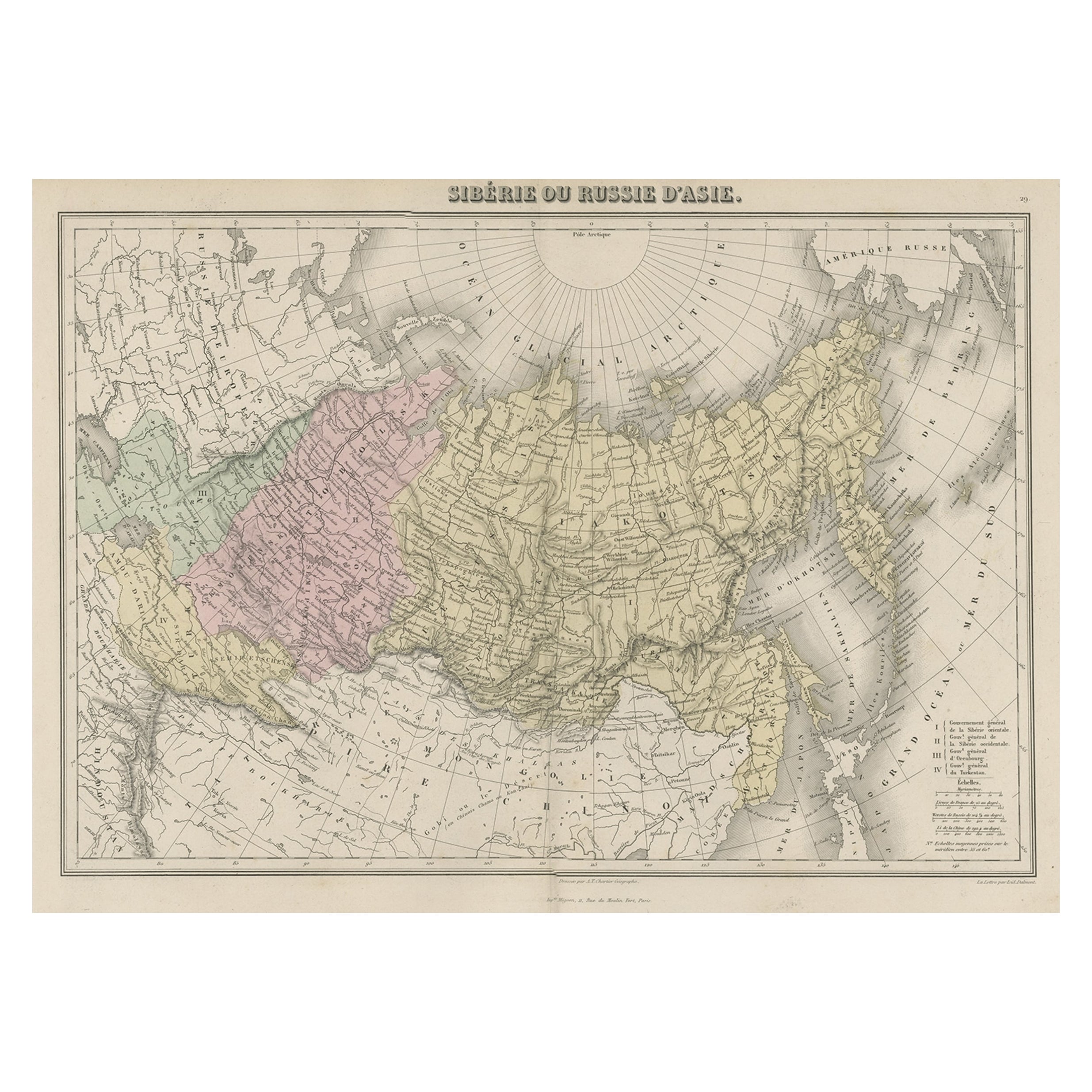
- Original Antique Map Covering the Russian Empire in Asia, 1880Located in Langweer, NLAntique map titled 'Sibérie ou Russie d'Asie'. Migeon's map covers the Russian empire in Asia from european Russia and the Ural Mountains to the Bering Strait and from the Arctic...Category
Antique 1880s Maps
MaterialsPaper
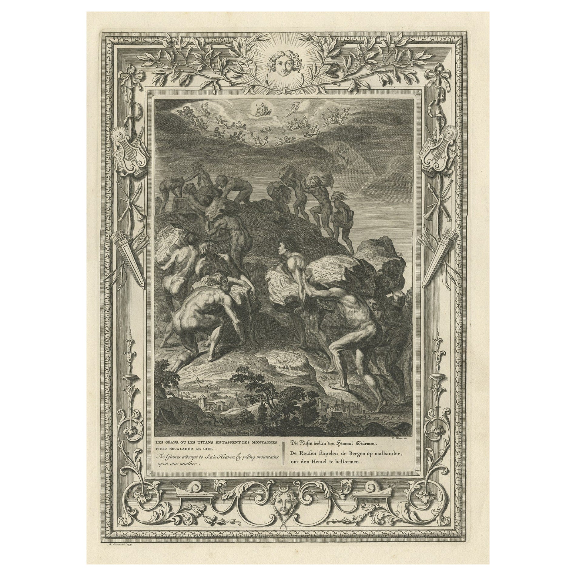
- Antique Print of the Giants Attempting to Scale Heaven, 1733Located in Langweer, NLAntique print titled 'Les Géans ou les Titans (..)'. This print depicts the Giants attempting to Scale Heaven by piling mountains upon one another. Giants were the children of Gaia o...Category
Antique 18th Century Prints
MaterialsPaper


You May Also Like
- Hand-Colored 18th Century Homann Map of the Black Sea, Turkey and Asia MinorBy Johann Baptist HomannLocated in Alamo, CAAn attractive original early 18th century hand-colored map of the Black Sea and Turkey entitled "Carte de L'Asie Minevre ou de la Natolie et du Pont Evxin Tiree des Voyages et des Ob...Category
Antique Early 18th Century German Maps
MaterialsPaper
- Original Antique Map of Asia. C.1780Located in St Annes, LancashireGreat map of Asia Copper-plate engraving Published C.1780 Two small worm holes to right side of map Unframed.Category
Antique Early 1800s English Georgian Maps
MaterialsPaper

- Original Antique Map of South Africa, Arrowsmith, 1820Located in St Annes, LancashireGreat map of South Africa. Drawn under the direction of Arrowsmith. Copper-plate engraving. Published by Longman, Hurst, Rees, Orme and Br...Category
Antique 1820s English Maps
MaterialsPaper
- Original Antique Map of South East Asia, Arrowsmith, 1820Located in St Annes, LancashireGreat map of South East Asia Drawn under the direction of Arrowsmith Copper-plate engraving Published by Longman, Hurst, Rees, Orme and Brown, 1820 Unframed.Category
Antique 1820s English Maps
MaterialsPaper
- Original Antique Map of South East Asia by Becker, circa 1840Located in St Annes, LancashireGreat map of South East Asia Steel engraving with original color outline Engraved by Becker Published by Virtue, circa 1840. Unframed.Category
Antique 1840s English Other Maps
MaterialsPaper
- Original Antique Map of South East Asia by Thomas Clerk, 1817Located in St Annes, LancashireGreat map of South East Asia Copper-plate engraving Drawn and engraved by Thomas Clerk, Edinburgh. Published by Mackenzie And Dent, 1817 Unframed.Category
Antique 1810s English Maps
MaterialsPaper


Recently Viewed
View AllMore Ways To Browse
Philip Tarlow
Picasso Book Ceramiques
Raden Saleh
Rene Grau
Renee Farca
Richard Kemble
Ron Lewis The Moonwalkers
Ruffed Grouse
Salvador Dali Divine Comedy E
Scientific Chart Of Snake
Shirley Pettibone
Sir John Vanbrugh
Snaffles Jock
Spy Magazine Gentlemen Prints
The Burial Of Atala
The Dinky Bird Maxfield Parrish
Toni Hermansson
Tretchikoff Vintage Prints