Items Similar to Castellón de la Plana 1901: A Cartographic Perspective of the Valencian Coast

Want more images or videos?
Request additional images or videos from the seller
1 of 6
Castellón de la Plana 1901: A Cartographic Perspective of the Valencian Coast
About the Item
The authentic map depicts the province of Castellón de la Plana, often referred to simply as Castellón, situated in the eastern part of Spain in the Valencian Community, and the map is from the year 1901. Here's an overview of its features:
The map shows the mountainous terrain, likely including the Desert de les Palmes mountain range near the coast and the interior mountain ranges.
It outlines the coastal line along the Mediterranean Sea, indicative of Castellón's location on the eastern coast of Spain. Blue lines represent rivers flowing through the province, which may include the Mijares and Palancia rivers. Red lines trace the road and rail networks, showing how the province is connected both internally and with neighboring regions. Symbols indicate the locations of cities, towns, and villages, with the capital city of Castellón de la Plana likely given prominence. Dotted lines suggest the provincial boundaries within the Valencian Community. There is a legend (Signos Convencionales) detailing the map's symbols for provincial capitals, roads, railways, and boundaries.
The coat of arms of Castellón is featured prominently, displaying a castle and a lion, both common heraldic symbols with historical significance.
About the province of Castellón:
Castellón is renowned for its beautiful coastline, the Costa del Azahar, known for its orange blossoms. The province's interior is characterized by mountainous terrain and picturesque villages, along with the presence of natural parks like the Prat de Cabanes-Torreblanca. The economy of Castellón has historically been based on agriculture, particularly citrus fruits, and it has developed a significant ceramics and tile industry, which is one of the most important in Spain. The capital city, Castellón de la Plana, is an economic and cultural center with a rich history reflected in its architecture and festivals. The province also has several protected natural areas and a variety of landscapes, from beaches to high mountain peaks.
- Dimensions:Height: 14.77 in (37.5 cm)Width: 20.08 in (51 cm)Depth: 0 in (0.02 mm)
- Materials and Techniques:
- Period:1900-1909
- Date of Manufacture:1901
- Condition:Good condition. Central vertical folding lines as issued. Aged paper with typically warm, yellowish-brown hue, especially around the edges. Check the images carefully.
- Seller Location:Langweer, NL
- Reference Number:
About the Seller
5.0
Platinum Seller
These expertly vetted sellers are 1stDibs' most experienced sellers and are rated highest by our customers.
Established in 2009
1stDibs seller since 2017
1,965 sales on 1stDibs
Typical response time: <1 hour
- ShippingRetrieving quote...Ships From: Langweer, Netherlands
- Return PolicyA return for this item may be initiated within 14 days of delivery.
More From This SellerView All
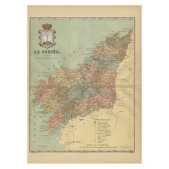
- La Coruña 1901: A Cartographic View of Galicia's Maritime ProvinceLocated in Langweer, NLThis antique map for sale showcases the province of La Coruña (in Galician, A Coruña), located in the northwest of Spain, within the autonomous community of Galicia, as of the year 1...Category
Antique Early 1900s Maps
MaterialsPaper
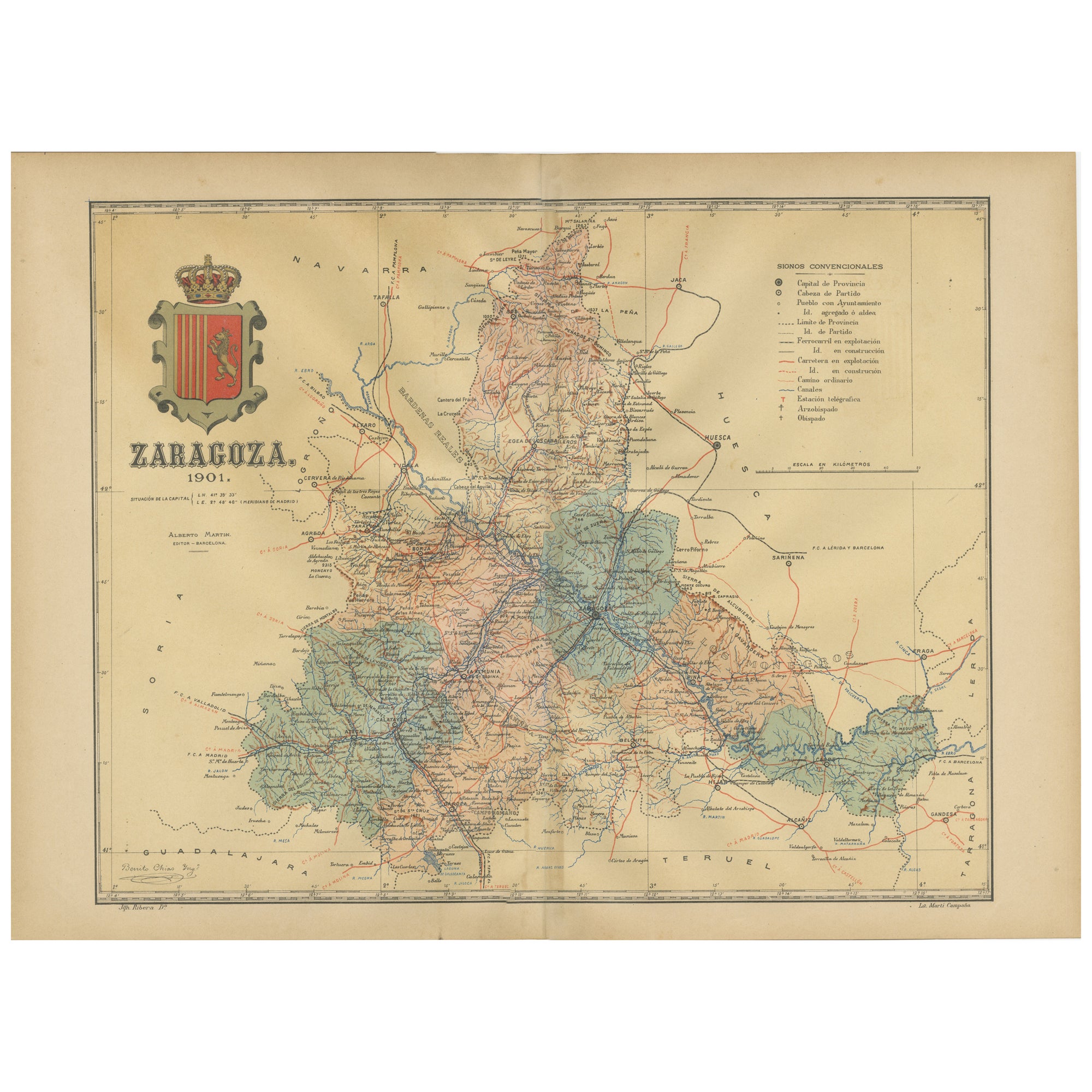
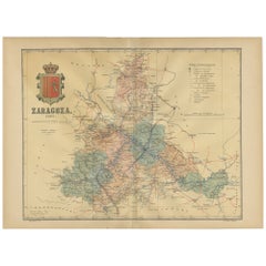
- Zaragoza: Crossroads of Heritage - The 1901 Cartographic ChronicleLocated in Langweer, NLThe print on sale is a historical map of the province of Zaragoza, Spain, dated 1901. The title on the map is "ZARAGOZA. 1901." This map details the geo...Category
Antique Early 1900s Maps
MaterialsPaper
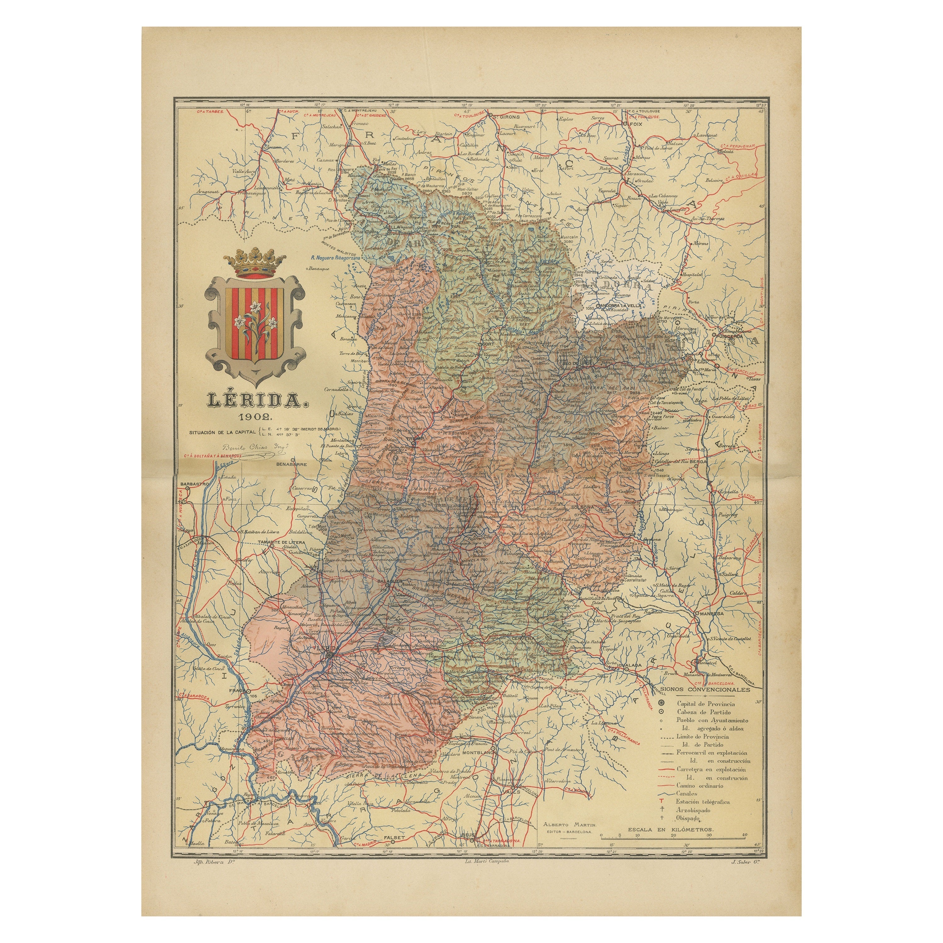
- Lleida 1902: A Cartographic Perspective of Catalonia's Gateway to the PyreneesLocated in Langweer, NLThe map for sale shows the province of Lleida, located in the western part of Catalonia, Spain, as of 1902. Here are the key features depicted on the map: - **Topography**: The map ...Category
Antique Early 1900s Maps
MaterialsPaper
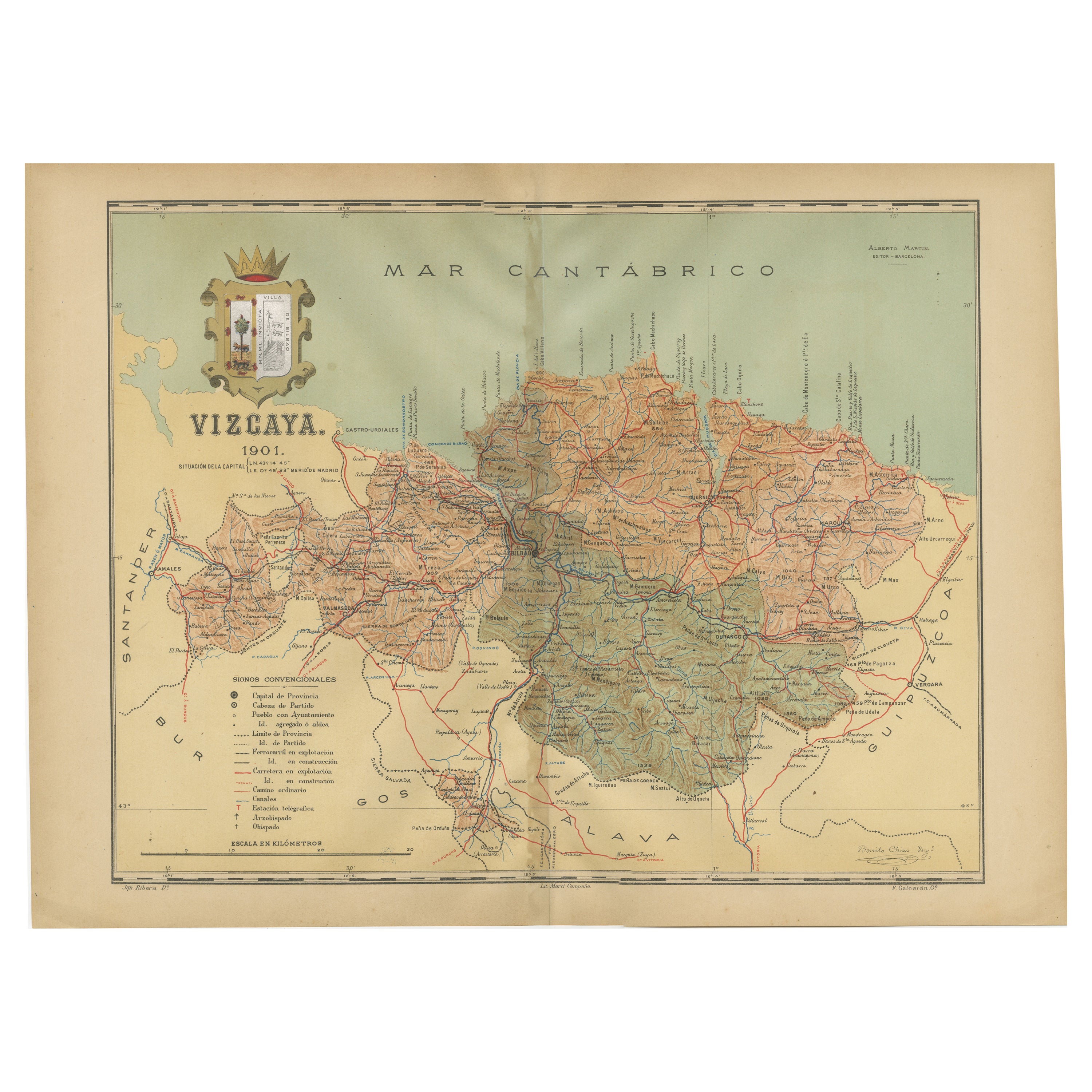
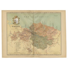
- Cartographic Heritage: The 1901 Map of the Vizcaya Province in SpainLocated in Langweer, NLThis is a historical map of the province of Vizcaya (Biscay) in Spain, dated 1901. The title on the map is "VIZCAYA. 1901." It shows the topographical details of the region with cont...Category
Antique Early 1900s Maps
MaterialsPaper
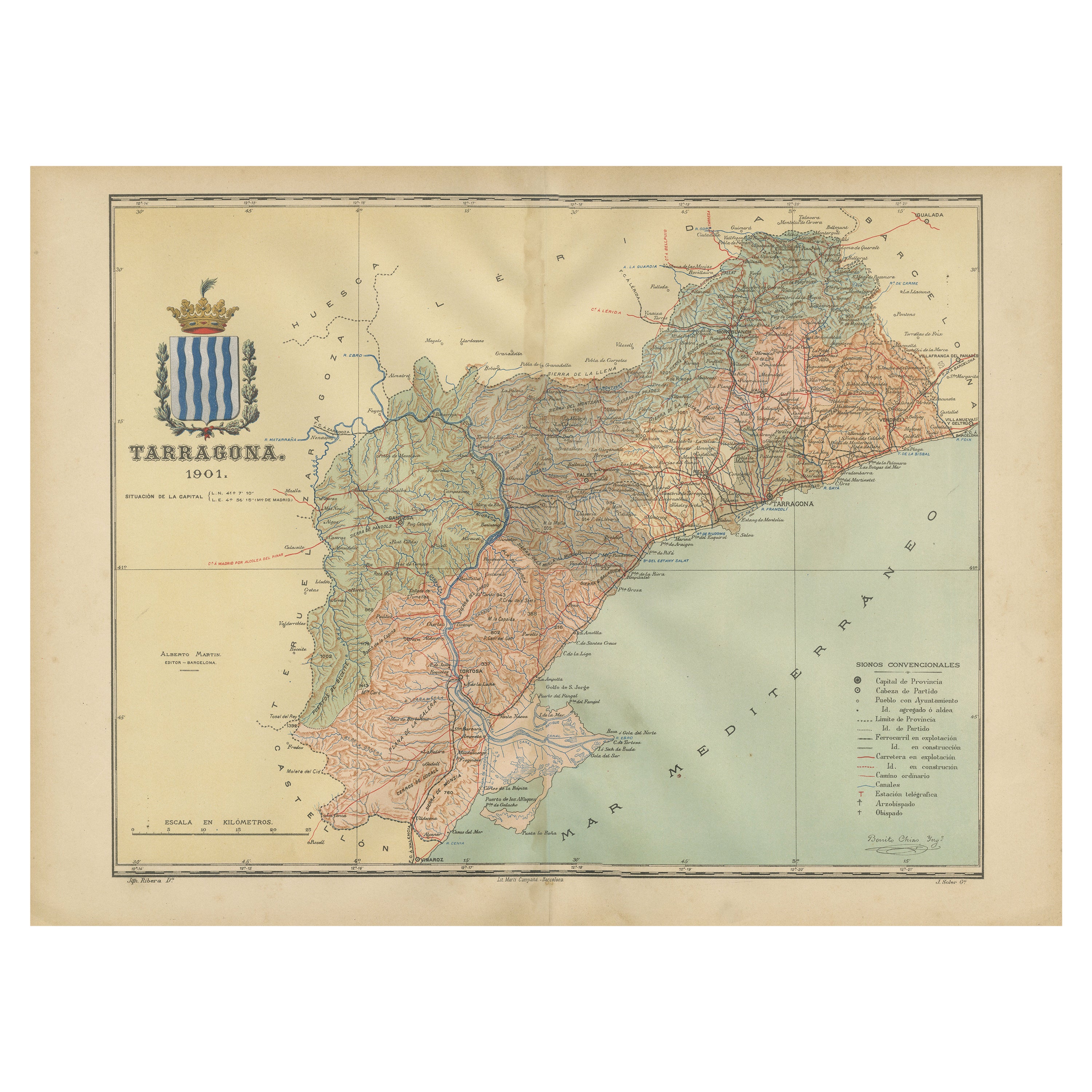
- A Catalonian Cartographic Depiction of Tarragona Province, 1901Located in Langweer, NLThis image depicts a historical map of the province of Tarragona, which is in the northeastern part of Spain, within the autonomous community of Catalonia. The map is dated 1901, sug...Category
Antique Early 1900s Maps
MaterialsPaper
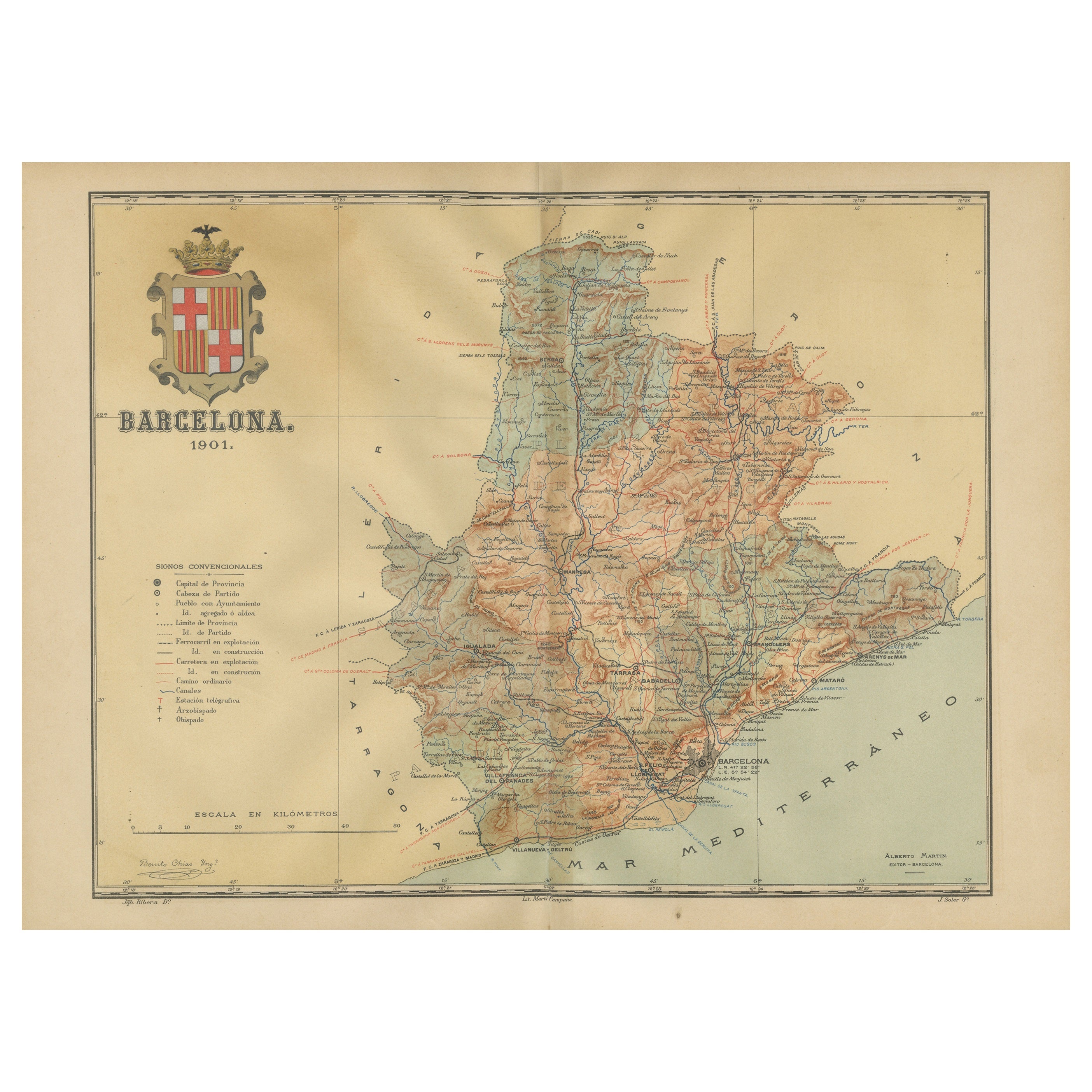
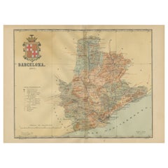
- Barcelona 1901: A Cartographic Portrait of Catalonia's Capital ProvinceLocated in Langweer, NLThis orignal antique map is a historical depiction of the province of Barcelona from 1901. It showcases the varied terrain of the province, with the Serra de Collserola ridge near the city of Barcelona and the Pyrenees to the north. The map includes the coastline along the Mediterranean Sea, indicating Barcelona's position as a coastal province. Blue lines indicate rivers, such as the Llobregat and Besòs, which are significant features in the province's geography. Dotted lines may signify the borders of the province within Catalonia. The coat of arms of Barcelona, highlighted with gold, is prominently displayed, featuring the Cross of Saint George (Cruz de Sant Jordi), the patron saint of Catalonia, and the red and yellow bars which are a symbol of the Aragonese and Catalan heritage. About the province of Barcelona: The province of Barcelona is part of the autonomous community of Catalonia in northeastern Spain. It is the most economically significant region of Catalonia, playing a crucial role in the country's economy due to its port, manufacturing, and service industries. The city of Barcelona is the capital and the second most populous city in Spain, known for its rich cultural heritage, architecture by Antoni Gaudí, such as the Sagrada Família, and its influential art scene. The province enjoys a Mediterranean climate and features diverse landscapes from the beaches along the coast to the mountains in the interior. Barcelona is also known for its vibrant festivals, cuisine, fashion, and sports, particularly football, being home to FC Barcelona...Category
Antique Early 1900s Maps
MaterialsPaper


You May Also Like
- 1901-03 The Novels of Jane AustenLocated in Bath, GBA smart set of the major novels of beloved author, Jane Austen, this set with the lively illustrations of Hugh Thomson. A smart set containing the major novels of Austen, complete w...Category
Antique Early 1900s British Books
MaterialsPaper
- Le Salaire de la Peur / The Wages of FearLocated in London, GBOriginal French artwork used to create the French 31 x 24 inch film poster for the films 1960's re-release of the 1953 adventure thriller film Le Salaire de la Peur / The Wages of Fear...Category
Vintage 1960s French Posters
MaterialsPaper
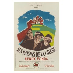
- The Grapes of Wrath / Les Raisins de la CoiereLocated in London, GBOriginal French film poster for the 1940 masterpiece directed John Ford and starred Henry Fonda, John Carradine, Jane Darwell. The striking artwork is ...Category
Vintage 1940s French Posters
MaterialsPaper
- Antique Oarsman's Map of the River Thames, English, Cartography, Published 1912Located in Hele, Devon, GBThis is an antique copy of The Oarsman's and Angler's Map of the River Thames - New Edition. An English, bound map book, published in English by Edward Stanford, London, this new edi...Category
Early 20th Century British Other Books
MaterialsPaper
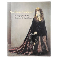
- La Divine Comtesse Photographs of the Countess De Castiglione BookLocated in Seguin, TXLa Divine Comtesse: Photographs of the Countess de Castiglione (Metropolitan Museum of Art Series) Mr. Pierre Apraxine et al. Published by Yale University...Category
Early 2000s American Empire Revival Books
MaterialsPaper
- Le Salaire de la Peur / The Wages of Fear / Vita VenduteLocated in London, GBOriginal Italian film poster for the 1953 adventure thriller film Le Salaire de la Peur / The Wages of Fear. This film was directed by Henri-Georges...Category
Vintage 1950s Italian Posters
MaterialsPaper


Recently Viewed
View AllMore Ways To Browse
Antique Cartography
Orange Furniture La
Spanish Provincial
Heraldic Coat Of Arms
Railway Map
Mountain Lion
Tile From Spain
Lion Heraldic
Near Eastern Antique
Used Furniture Palm Desert
Antique Spanish Tile
Antique Spanish Tiles Tiles
Antique Spanish Tiles
Spanish Antique Tiles Spanish Tiles
Used Furniture Orange Park
Rail Road
Antique Coat Rail
Rail Road Collectables