Items Similar to Small Detailed Antique Map of France, c.1780


Want more images or videos?
Request additional images or videos from the seller
1 of 5
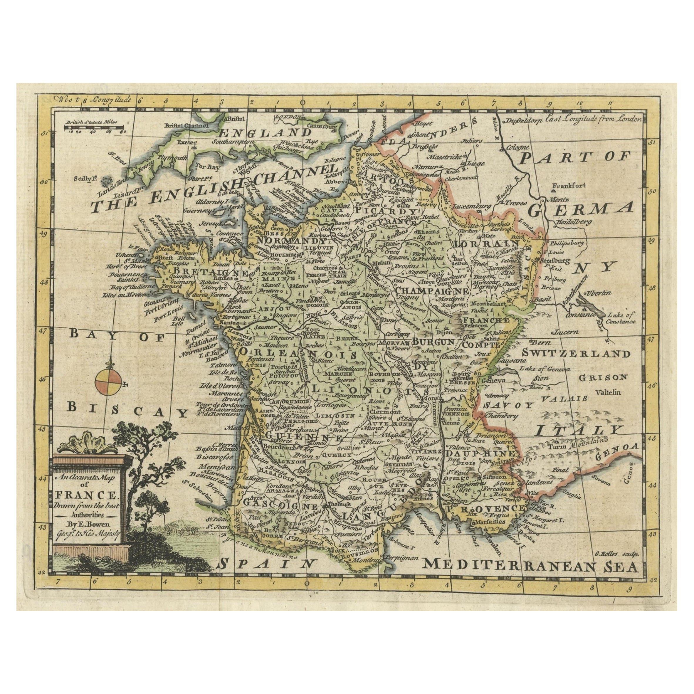
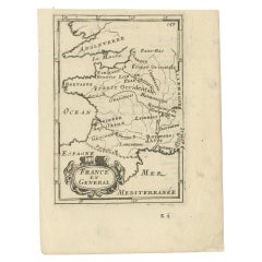
Small Detailed Antique Map of France, c.1780
About the Item
Antique map titled 'France'. Small, detailed map of France with legend. Also depicting the English Channel, Bay of Biscay, Part of Spain, the Mediterranean Sea, Part of Italy, Switzerland and Part of Germany. Source unknown, to be determined.
Artists and Engravers: Anonymous.
Condition: Very good, please study image carefully.
Date: c.1780
Overall size: 21 x 18 cm.
Image size: 14 x 13 cm.
We sell original antique maps to collectors, historians, educators and interior decorators all over the world. Our collection includes a wide range of authentic antique maps from the 16th to the 20th centuries. Buying and collecting antique maps is a tradition that goes back hundreds of years. Antique maps have proved a richly rewarding investment over the past decade, thanks to a growing appreciation of their unique historical appeal. Today the decorative qualities of antique maps are widely recognized by interior designers who appreciate their beauty and design flexibility. Depending on the individual map, presentation, and context, a rare or antique map can be modern, traditional, abstract, figurative, serious or whimsical. We offer a wide range of authentic antique maps for any budget.
- Dimensions:Height: 7.09 in (18 cm)Width: 8.27 in (21 cm)Depth: 0 in (0.01 mm)
- Materials and Techniques:
- Period:
- Date of Manufacture:circa 1780
- Condition:
- Seller Location:Langweer, NL
- Reference Number:
About the Seller
5.0
Platinum Seller
These expertly vetted sellers are 1stDibs' most experienced sellers and are rated highest by our customers.
Established in 2009
1stDibs seller since 2017
1,965 sales on 1stDibs
Typical response time: <1 hour
- ShippingRetrieving quote...Ships From: Langweer, Netherlands
- Return PolicyA return for this item may be initiated within 14 days of delivery.
More From This SellerView All
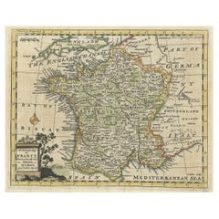
- Small Detailed Antique Map of France, with Decorative Title Cartouche, 1754Located in Langweer, NLAntique map France titled 'An Accurate Map of France drawn from the best authorities'. Small, detailed map of France. With decorative title cartouche. ...Category
Antique 1750s Maps
MaterialsPaper
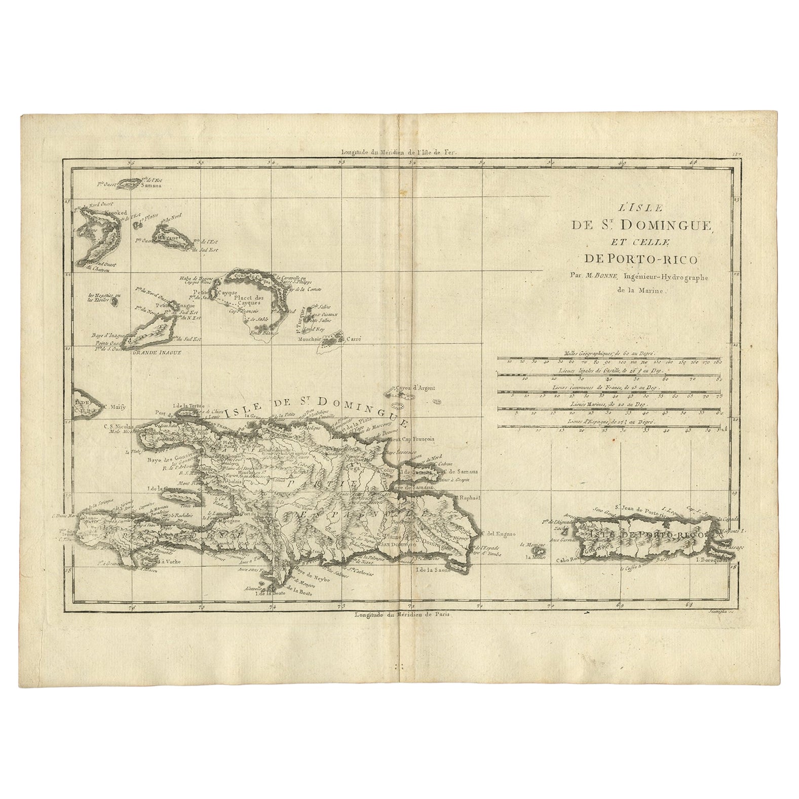
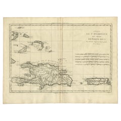
- Detailed Antique Map of Santa Domingo, Puerto Rico, Eastern Bahamas, ca. 1780Located in Langweer, NLDescription: Antique map titled 'L'Isle De St. Domingue, et celle De Porto-Rico.' Detailed map of Santa Domingo, Puerto Rico, etc. Includes substanti...Category
Antique 1780s Maps
MaterialsPaper
- Detailed Antique Miniature Map of France by Mallet, c.1683Located in Langweer, NLAntique map titled 'France en General'. BG-11796-55. Originates from Mallet's 'Description de l'Univers'. Artists and Engravers: Alain Manneson Mallet (1630-1706) spent the first ...Category
Antique 17th Century Maps
MaterialsPaper
- Antique Map of Sumatra, Indonesia 'c.1780'Located in Langweer, NLAntique map titled 'Neue Karte von der Insel Sumatra'. Extremely rare map of Sumatra, Indonesia. Published circa 1780.Category
Antique Late 18th Century Maps
MaterialsPaper
- Antique Map of Europe by R. Bonne, 1780Located in Langweer, NLA fine example of Rigobert Bonne and Guilleme Raynal’s 1780 map of Europe. Drawn by R. Bonne for G. Raynal’s Atlas de Toutes les Parties Connues du Globe Terrestre, Dressé pour l'His...Category
Antique Late 18th Century Maps
MaterialsPaper
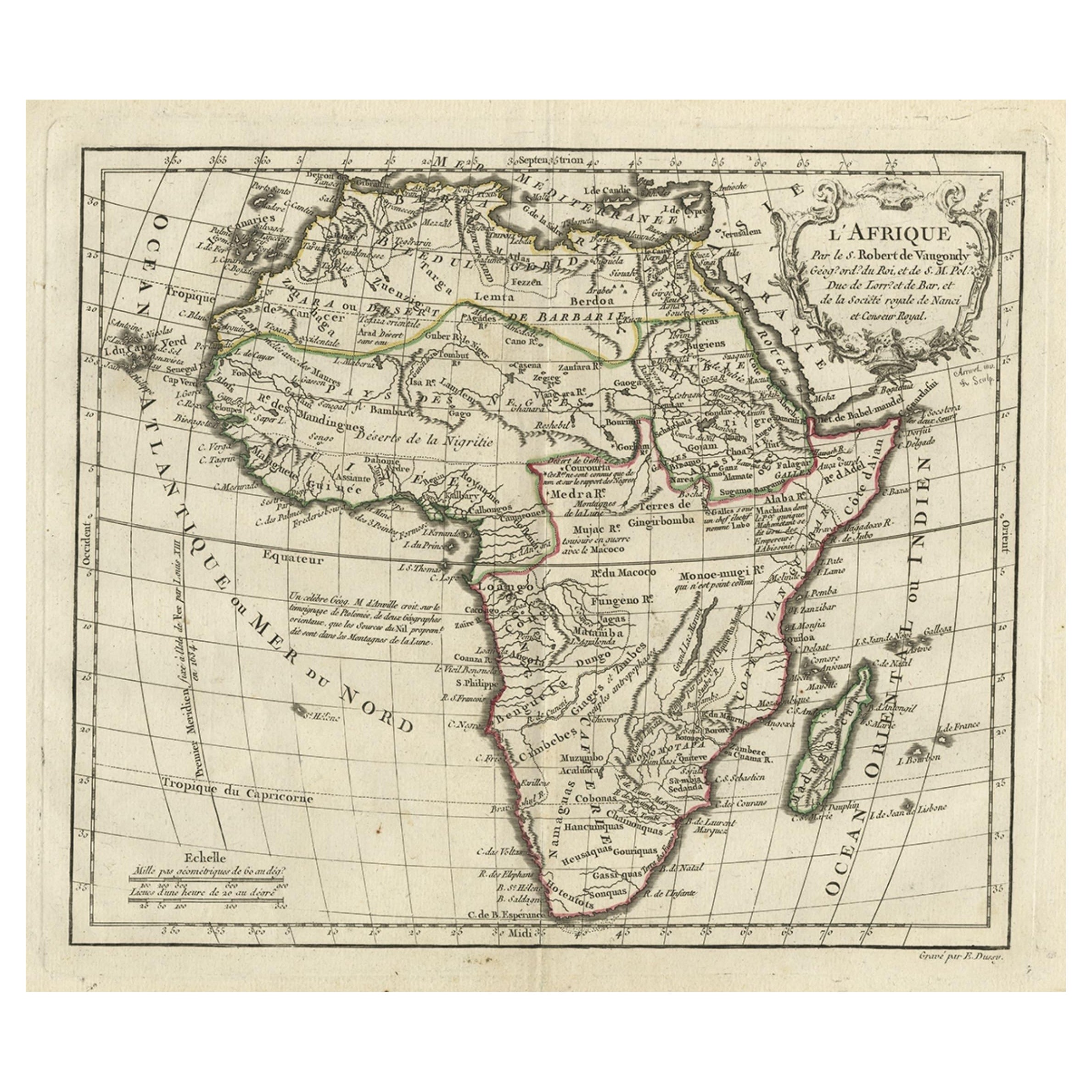
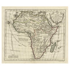
- Antique Map of Africa with French Cartouche and Scale, c.1780Located in Langweer, NLAntique map titled 'L'Afrique'. Original antique map of Africa. With beautiful title cartouche and scale. Source unknown, to be determined. Artists and Engravers: Gilles Robert de...Category
Antique 18th Century Maps
MaterialsPaper


You May Also Like
- Super Rare Antique French Map of Chine and the Chinese Empire, 1780Located in Amsterdam, Noord HollandSuper Rare Antique French Map of Chine and the Chinese Empire, 1780 Very nice map of Asia. 1780 Made by Bonne. Additional information: Type: Map ...Category
Antique 18th Century European Maps
MaterialsPaper
- Original Antique Map of France, Arrowsmith, 1820Located in St Annes, LancashireGreat map of France Drawn under the direction of Arrowsmith. Copper-plate engraving. Published by Longman, Hurst, Rees, Orme and Brown, 1820 Unframed.Category
Antique 1820s English Maps
MaterialsPaper
- Antique Map of Principality of MonacoBy Antonio Vallardi EditoreLocated in Alessandria, PiemonteST/619 - "Old Geographical Atlas of Italy - Topographic map of ex-Principality of Monaco" - ediz Vallardi - Milano - A somewhat special edition ---Category
Antique Late 19th Century Italian Other Prints
MaterialsPaper
- Plan of Paris, France, by A. Vuillemin, Antique Map, 1845Located in Colorado Springs, COThis large and detailed plan of Paris was published by Alexandre Vuillemin in 1845. The map conveys a wonderful amount of information and is decorated throughout with pictorial vigne...Category
Antique 1840s American Maps
MaterialsPaper
- Geographical Antique Map of Principality of MonacoBy Bruno SantiniLocated in Alessandria, PiemonteST/609 - Interesting antique color map of Monaco Principality in French language : "Carte qui contient le Principauté de Piémont, le Monferrat et la comté de...Category
Antique Late 18th Century Italian Other Maps
MaterialsPaper
- Original Antique Map of France, Sherwood, Neely & Jones, Dated 1809Located in St Annes, LancashireGreat map of France Copper-plate engraving by Cooper Published by Sherwood, Neely & Jones. Dated 1809 Unframed.Category
Antique Early 1800s English Maps
MaterialsPaper


Recently Viewed
View AllMore Ways To Browse
Spanish French Antiques
Antique Maps Spain
Antique Maps Of Spain
16th C Italian
18c French Furniture
Map Of Switzerland
Swiss Antiques And Collectables
Maps Of Mediterranean
Map Mediterranean
Antique Mediterranean Map
Antique Map Of Switzerland
Antique Map Switzerland
18c English Furniture
Mediterranean Sea Map
Furniture Spanish 18c
Used Furniture Depot
Antique Maps Spain
Antique Maps Of Spain