Objekte ähnlich wie Map of Ariège France with Foix and Pyrenees Landscape by Vuillemin, 19th c


Möchten Sie mehr Bilder oder Videos?
Zusätzliche Bilder oder Videos von dem*der Anbieter*in anfordern
1 von 11
Map of Ariège France with Foix and Pyrenees Landscape by Vuillemin, 19th c
120 €Einschließlich MwSt.
Angaben zum Objekt
Map of Ariège France with Foix and Pyrenees Landscape by Vuillemin, 19th c
Description:
This beautifully detailed 19th-century map of the Ariège department in southwestern France was drawn by the French cartographer Alexandre Vuillemin and published by Migeon in Paris as part of the illustrated Nouvel Atlas Illustré. Rich in visual and historical content, the map offers a fascinating portrait of this mountainous border region adjacent to Spain and Andorra.
The map shows the full expanse of Ariège with clear labeling of towns, rivers, roads, and departmental borders, the latter highlighted in hand-applied yellow watercolor. The department is nestled against the Pyrenees mountain range, with Foix, Saint-Girons, and Pamiers as its major towns. The topographical relief hints at the region's rugged alpine character.
To the lower left is a picturesque vignette of Foix, the departmental capital, with its famous medieval castle perched dramatically on a rocky hill above the town. On the lower right is a view of the southern borderlands facing the Spanish frontier. At the upper right appears a portrait of General Bertrand Clausel, a native of Ariège who served in the Napoleonic Wars and later became governor of Algeria. Beneath him is the coat of arms of the department, with its vertical stripes and laurel branch motif.
Ariège is known for its striking mountain scenery, medieval fortresses, Cathar heritage, and natural thermal springs. Although not widely recognized as a major wine-producing area, it does have a tradition of small-scale viticulture, especially in the foothills, with rustic wines from local grapes. The area is more renowned for sheep cheese (such as tomme and Bethmale), honey, and mountain herbal products. Today, it is popular among hikers, cyclists, and nature lovers for its unspoiled valleys and ancient hilltop villages.
Alexandre Vuillemin was a leading 19th-century French cartographer noted for integrating history, culture, and art into his maps. His works were both educational and decorative, making them highly collectible. The publisher, Migeon, specialized in atlases that appealed to a broad public through refined design and engraving quality.
Condition summary:
Very good condition with light age toning and a few minor foxing marks in the margins. Engraved lines are sharp, and the hand coloring is clean and well preserved.
Framing tips:
This map would look excellent in a walnut or natural wood frame to complement its rustic and mountainous theme. A soft cream or ivory mat will enhance the engraved detail and yellow border. Museum glass is recommended for optimal preservation.
- Maße:Höhe: 26,1 cm (10,28 in)Breite: 32,5 cm (12,8 in)Tiefe: 0,2 mm (0,01 in)
- Materialien und Methoden:Papier,Graviert
- Herkunftsort:
- Zeitalter:
- Herstellungsjahr:circa 1850
- Zustand:Very good condition with light age toning and a few minor foxing marks in the margins. Engraved lines are sharp, and the hand coloring is clean and well preserved.
- Anbieterstandort:Langweer, NL
- Referenznummer:Anbieter*in: BG-13331-81stDibs: LU3054345359562
Anbieterinformationen
5,0
Anerkannte Anbieter*innen
Diese renommierten Anbieter*innen sind führend in der Branche und repräsentieren die höchste Klasse in Sachen Qualität und Design.
Platin-Anbieter*in
Premium-Anbieter*innen mit einer Bewertung über 4,7 und 24 Stunden Reaktionszeit
Gründungsjahr 2009
1stDibs-Anbieter*in seit 2017
2.531 Verkäufe auf 1stDibs
Typische Antwortzeit: <1 Stunde
- VersandAngebot wird abgerufen …Versand von: Langweer, Niederlande
- Rückgabebedingungen
Einige Inhalte dieser Seite wurden automatisch übersetzt. Daher kann 1stDibs nicht die Richtigkeit der Übersetzungen garantieren. Englisch ist die Standardsprache dieser Website.
Authentizitätsgarantie
Im unwahrscheinlichen Fall eines Problems mit der Echtheit eines Objekts kontaktieren Sie uns bitte innerhalb von 1 Jahr für eine volle Rückerstattung. DetailsGeld-Zurück-Garantie
Wenn Ihr Objekt nicht der Beschreibung entspricht, beim Transport beschädigt wurde oder nicht ankommt, kontaktieren Sie uns bitte innerhalb von 7 Tagen für eine vollständige Rückerstattung. DetailsStornierung innerhalb von 24 Stunden
Sie können Ihren Kauf jederzeit innerhalb von 24 Stunden stornieren, ohne jegliche Gründe dafür angeben zu müssen.Geprüfte Anbieter*innen
Unsere Anbieter*innen unterliegen strengen Dienstleistungs- und Qualitätsstandards, wodurch wir die Seriosität unserer Angebote gewährleisten können.Preisgarantie
Wenn Sie feststellen, dass ein*e Anbieter*in dasselbe Objekt anderswo zu einem niedrigeren Preis anbietet, werden wir den Preis entsprechend anpassen.Zuverlässige weltweite Lieferung
Unsere erstklassigen Versandunternehmen bieten spezielle Versandoptionen weltweit, einschließlich individueller Lieferung.Mehr von diesem*dieser Anbieter*in
Alle anzeigenMap of Ardèche France with Annonay and Vineyards by Vuillemin, 19th c
Map of Ardèche France with Annonay and Vineyards by Vuillemin, 19th c
This beautifully engraved 19th-century map of Ardèche, a department in southeastern France, comes from Alexandr...
Kategorie
Antik, Mittleres 19. Jahrhundert, Französisch, Landkarten
Materialien
Papier

Map of Côtes-du-Nord France with Saint-Brieuc and Brittany Coastline, c.1850
Map of Côtes-du-Nord France with Saint-Brieuc and Brittany Coastline, 19th c
Description:
This elegant 19th-century map of Côtes-du-Nord, the historic name for what is now known as ...
Kategorie
Antik, Mittleres 19. Jahrhundert, Französisch, Landkarten
Materialien
Papier

Map of Allier France with Saint-Pourçain Wine Region by Vuillemin, 19th c
Map of Allier France with Saint-Pourçain Wine Region by Vuillemin, 19th c
This decorative 19th-century map of Allier, a central department of France, comes from the celebrated Nouve...
Kategorie
Antik, Mittleres 19. Jahrhundert, Französisch, Landkarten
Materialien
Papier

Map of Aude France with Carcassonne and Languedoc Vineyards, 19th Century
Map of Aude France with Carcassonne and Languedoc Vineyards, 19th Century
Description:
This elegant 19th-century map of Aude, a department in southern France along the Mediterranean...
Kategorie
Antik, Mittleres 19. Jahrhundert, Französisch, Landkarten
Materialien
Papier

Map of Aisne France with Soissons and Champagne Vineyards by Vuillemin, 19th c
Map of Aisne France with Soissons and Champagne Vineyards by Vuillemin, 19th c
Description:
This richly detailed 19th-century engraved and hand-colored map of the department of Aisn...
Kategorie
Antik, Mittleres 19. Jahrhundert, Französisch, Landkarten
Materialien
Papier

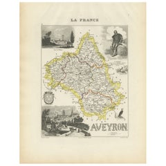
Map of Aveyron France with Rodez, Millau and Wine Routes, 19th Century
Map of Aveyron France with Rodez, Millau and Wine Routes, 19th Century
Description:
This detailed and decorative 19th-century map of Aveyron, a department in southern France, was dr...
Kategorie
Antik, Mittleres 19. Jahrhundert, Französisch, Landkarten
Materialien
Papier
Das könnte Ihnen auch gefallen
Lozere, Frankreich. Antike Karte einer französischen Abteilung, 1856
Von Victor Levasseur
dept. de La Lozere", Stahlstich mit originaler Handkolorierung der Umrisse, 1856, aus dem "Atlas National Illustre" von Levasseur.
Dieser abgelegene, gebirgige Teil des Languedoc i...
Kategorie
19. Jahrhundert, Naturalismus, Landschaftsdrucke
Materialien
Gravur

L'Isere, Frankreich. Antike Karte der französischen Abteilung, 1856
Von Victor Levasseur
dept. de L'Isere", Stahlstich mit Originalumriss von Hand koloriert, 1856, aus Levasseurs "Atlas National Illustre".
Dieses Gebiet ist bekannt für die Herstellung von Bleu du Verco...
Kategorie
19. Jahrhundert, Naturalismus, Landschaftsdrucke
Materialien
Gravur

Pyrenees Orientales, Frankreich. Antike Karte einer französischen Abteilung, 1856
Von Victor Levasseur
dept. des Pyrenees Orientales", Stahlstich mit originaler Handkolorierung der Umrisse, 1856, aus dem "Atlas National Illustre" von Levasseur.
Dieses Gebiet ist ein bekanntes Weinan...
Kategorie
19. Jahrhundert, Naturalismus, Landschaftsdrucke
Materialien
Gravur

Aude, Frankreich. Antike Karte einer französischen Abteilung, 1856
Von Victor Levasseur
dept. de L' Aude", Stahlstich mit Originalumriss von Hand koloriert, 1856, aus Levasseurs "Atlas National Illustre".
Diese Region Frankreichs ist berühmt für ihre große Vielfalt an...
Kategorie
19. Jahrhundert, Naturalismus, Landschaftsdrucke
Materialien
Gravur

Beinahe Frankreich. Antike Karte einer französischen Abteilung, 1856
Von Victor Levasseur
dept. de L'Aube", Stahlstich mit originaler Handkolorierung der Umrisse, 1856, aus dem "Atlas National Illustre" von Levasseur.
Diese Region Frankreichs ist bekannt für die Herstel...
Kategorie
19. Jahrhundert, Naturalismus, Landschaftsdrucke
Materialien
Gravur

Hautes Alpes, Frankreich. Antike Karte einer französischen Abteilung, 1856
Von Victor Levasseur
dept. des Hautes Alpes", Stahlstich mit originaler Handkolorierung der Umrisse, 1856, aus dem "Atlas National Illustre" von Levasseur.
Dieses Gebiet Frankreichs ist bekannt für die...
Kategorie
19. Jahrhundert, Naturalismus, Landschaftsdrucke
Materialien
Gravur
