Objekte ähnlich wie Map of Aude France with Carcassonne and Languedoc Vineyards, 19th Century


Möchten Sie mehr Bilder oder Videos?
Zusätzliche Bilder oder Videos von dem*der Anbieter*in anfordern
1 von 10
Map of Aude France with Carcassonne and Languedoc Vineyards, 19th Century
120 €Einschließlich MwSt.
Angaben zum Objekt
Map of Aude France with Carcassonne and Languedoc Vineyards, 19th Century
Description:
This elegant 19th-century map of Aude, a department in southern France along the Mediterranean coast, was engraved for the Nouvel Atlas Illustré and published in Paris by Migeon. It offers a rich visual and historical depiction of a region known for its medieval heritage, wine production, and proximity to both the Pyrenees and the Mediterranean Sea.
The map presents the full layout of Aude with towns, roads, and rivers carefully labeled, and department borders highlighted in soft hand-applied lavender tones. At the center lies Carcassonne, one of the most iconic fortified cities in Europe, whose medieval citadel is a UNESCO World Heritage site. The surrounding landscape is marked by mountain foothills, river valleys, and vineyards, reflecting the area's diverse topography.
To the left is a portrait of General Antoine-François Andréossy, a distinguished artillery officer and diplomat born in Castelnaudary. Below him, an engraving depicts a southern French village with a Romanesque church, typical of the Aude countryside. In the lower right corner, a lively harbor view shows the port at Gruissan, linking the department to Mediterranean trade and culture. The inclusion of the coat of arms and classical decorative motifs adds to the historical charm of the print.
Aude is part of the historic Languedoc wine region and is especially known for producing robust red wines and sparkling wines like Blanquette de Limoux, considered by many to be the world’s oldest sparkling wine. The vineyards around Limoux and the Corbières hills yield Grenache, Syrah, Mourvèdre, and other varietals that define the rich, earthy character of southern French wines. The climate, shaped by both mountain and sea, creates ideal growing conditions.
This map is not only a piece of cartographic history but also a reflection of the cultural identity of Aude during the 19th century, capturing its architecture, prominent individuals, and viticultural heritage.
Condition summary:
Very good condition with light toning around the edges and minor foxing in the margins. Engraving is crisp and the original hand coloring remains bright and clean.
Framing tips:
A warm wood or gilded frame would enhance the classic feel of this map. Pair it with an off-white or pale grey mat to complement the pastel coloring. UV-protective glass is recommended to preserve the paper and detail.
- Maße:Höhe: 26,1 cm (10,28 in)Breite: 32,5 cm (12,8 in)Tiefe: 0,2 mm (0,01 in)
- Materialien und Methoden:Papier,Graviert
- Herkunftsort:
- Zeitalter:
- Herstellungsjahr:circa 1850
- Zustand:Very good condition with light toning around the edges and minor foxing in the margins. Engraving is crisp and the original hand coloring remains bright and clean.
- Anbieterstandort:Langweer, NL
- Referenznummer:Anbieter*in: BG-13331-101stDibs: LU3054345359612
Anbieterinformationen
5,0
Anerkannte Anbieter*innen
Diese renommierten Anbieter*innen sind führend in der Branche und repräsentieren die höchste Klasse in Sachen Qualität und Design.
Platin-Anbieter*in
Premium-Anbieter*innen mit einer Bewertung über 4,7 und 24 Stunden Reaktionszeit
Gründungsjahr 2009
1stDibs-Anbieter*in seit 2017
2.531 Verkäufe auf 1stDibs
Typische Antwortzeit: <1 Stunde
- VersandAngebot wird abgerufen …Versand von: Langweer, Niederlande
- Rückgabebedingungen
Einige Inhalte dieser Seite wurden automatisch übersetzt. Daher kann 1stDibs nicht die Richtigkeit der Übersetzungen garantieren. Englisch ist die Standardsprache dieser Website.
Authentizitätsgarantie
Im unwahrscheinlichen Fall eines Problems mit der Echtheit eines Objekts kontaktieren Sie uns bitte innerhalb von 1 Jahr für eine volle Rückerstattung. DetailsGeld-Zurück-Garantie
Wenn Ihr Objekt nicht der Beschreibung entspricht, beim Transport beschädigt wurde oder nicht ankommt, kontaktieren Sie uns bitte innerhalb von 7 Tagen für eine vollständige Rückerstattung. DetailsStornierung innerhalb von 24 Stunden
Sie können Ihren Kauf jederzeit innerhalb von 24 Stunden stornieren, ohne jegliche Gründe dafür angeben zu müssen.Geprüfte Anbieter*innen
Unsere Anbieter*innen unterliegen strengen Dienstleistungs- und Qualitätsstandards, wodurch wir die Seriosität unserer Angebote gewährleisten können.Preisgarantie
Wenn Sie feststellen, dass ein*e Anbieter*in dasselbe Objekt anderswo zu einem niedrigeren Preis anbietet, werden wir den Preis entsprechend anpassen.Zuverlässige weltweite Lieferung
Unsere erstklassigen Versandunternehmen bieten spezielle Versandoptionen weltweit, einschließlich individueller Lieferung.Mehr von diesem*dieser Anbieter*in
Alle anzeigenMap of Ardèche France with Annonay and Vineyards by Vuillemin, 19th c
Map of Ardèche France with Annonay and Vineyards by Vuillemin, 19th c
This beautifully engraved 19th-century map of Ardèche, a department in southeastern France, comes from Alexandr...
Kategorie
Antik, Mittleres 19. Jahrhundert, Französisch, Landkarten
Materialien
Papier

Map of Allier France with Saint-Pourçain Wine Region by Vuillemin, 19th c
Map of Allier France with Saint-Pourçain Wine Region by Vuillemin, 19th c
This decorative 19th-century map of Allier, a central department of France, comes from the celebrated Nouve...
Kategorie
Antik, Mittleres 19. Jahrhundert, Französisch, Landkarten
Materialien
Papier

Map of Ariège France with Foix and Pyrenees Landscape by Vuillemin, 19th c
Map of Ariège France with Foix and Pyrenees Landscape by Vuillemin, 19th c
Description:
This beautifully detailed 19th-century map of the Ariège department in southwestern France wa...
Kategorie
Antik, Mittleres 19. Jahrhundert, Französisch, Landkarten
Materialien
Papier

Map of Gard France with Pont du Gard and Wine Regions by Vuillemin, 19th c
Title: Map of Gard France with Pont du Gard and Wine Regions by Vuillemin, 19th c
Description:
This finely engraved 19th-century map of the department of Gard in southern France was...
Kategorie
Antik, Mittleres 19. Jahrhundert, Französisch, Landkarten
Materialien
Papier

Map of Aube France with Troyes and Champagne Wine Region, 19th Century
Map of Aube France with Troyes and Champagne Vineyards by Vuillemin, 19th c
Description:
This 19th-century map of the Aube department in the Grand Est region of northeastern France ...
Kategorie
Antik, Mittleres 19. Jahrhundert, Französisch, Landkarten
Materialien
Papier

Map of Côtes-du-Nord France with Saint-Brieuc and Brittany Coastline, c.1850
Map of Côtes-du-Nord France with Saint-Brieuc and Brittany Coastline, 19th c
Description:
This elegant 19th-century map of Côtes-du-Nord, the historic name for what is now known as ...
Kategorie
Antik, Mittleres 19. Jahrhundert, Französisch, Landkarten
Materialien
Papier

Das könnte Ihnen auch gefallen
Aude, Frankreich. Antike Karte einer französischen Abteilung, 1856
Von Victor Levasseur
dept. de L' Aude", Stahlstich mit Originalumriss von Hand koloriert, 1856, aus Levasseurs "Atlas National Illustre".
Diese Region Frankreichs ist berühmt für ihre große Vielfalt an...
Kategorie
19. Jahrhundert, Naturalismus, Landschaftsdrucke
Materialien
Gravur

Beinahe Frankreich. Antike Karte einer französischen Abteilung, 1856
Von Victor Levasseur
dept. de L'Aube", Stahlstich mit originaler Handkolorierung der Umrisse, 1856, aus dem "Atlas National Illustre" von Levasseur.
Diese Region Frankreichs ist bekannt für die Herstel...
Kategorie
19. Jahrhundert, Naturalismus, Landschaftsdrucke
Materialien
Gravur

Große Karte von Frankreich aus dem 19.
Große Karte von Frankreich aus dem 19. Jahrhundert.
Bemerkenswerter Zustand, mit einer angenehmen altersbedingten Patina.
Kürzlich gerahmt.
Frankreich CIRCA 1874.
Kategorie
Antik, Spätes 19. Jahrhundert, Französisch, Landkarten
Materialien
Leinen, Papier

Anlehnung an Loire und Loire, Frankreich. Antike Karte einer französischen Abteilung, 1856
Von Victor Levasseur
dept. de Saone et Loire", Stahlstich mit originaler Handkolorierung der Umrisse, 1856, aus: Atlas National Illustre von Levasseur.
Das französische Departement Saone et Loire ist d...
Kategorie
19. Jahrhundert, Naturalismus, Landschaftsdrucke
Materialien
Gravur

Karte der Wiener Haute Vienne – Originallithographie – 19. Jahrhundert
Die Karte der Haute Vienne ist eine Original-Lithographie, die von einem Anonymer Graveur des 19. Jahrhunderts.
Gedruckt in der Reihe der "Frankreich pittoresk".
Unter dem Titel ...
Kategorie
19. Jahrhundert, Moderne, Figurative Drucke
Materialien
Lithografie

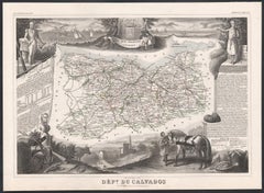
Calvados, Frankreich. Antike Karte einer französischen Abteilung, 1856
Von Victor Levasseur
Dept. du Calvados", Stahlstich mit originaler Handkolorierung der Umrisse, 1856, aus Levasseurs "Atlas National Illustre".
Diese Region Frankreichs ist bekannt für die Herstellung ...
Kategorie
19. Jahrhundert, Naturalismus, Landschaftsdrucke
Materialien
Gravur