Objekte ähnlich wie Map of Cape Verde and the Mouth of the River Niger by Coronelli, 1691

Möchten Sie mehr Bilder oder Videos?
Zusätzliche Bilder oder Videos von dem*der Anbieter*in anfordern
1 von 11
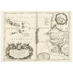
Map of Cape Verde and the Mouth of the River Niger by Coronelli, 1691
1.060 €Einschließlich MwSt.
Versand
Angebot wird abgerufen …Das Versprechen von 1stDibs:
Authentizitätsgarantie,
Geld-Zurück-Garantie,
Stornierung innerhalb von 24 Stunden
Angaben zum Objekt
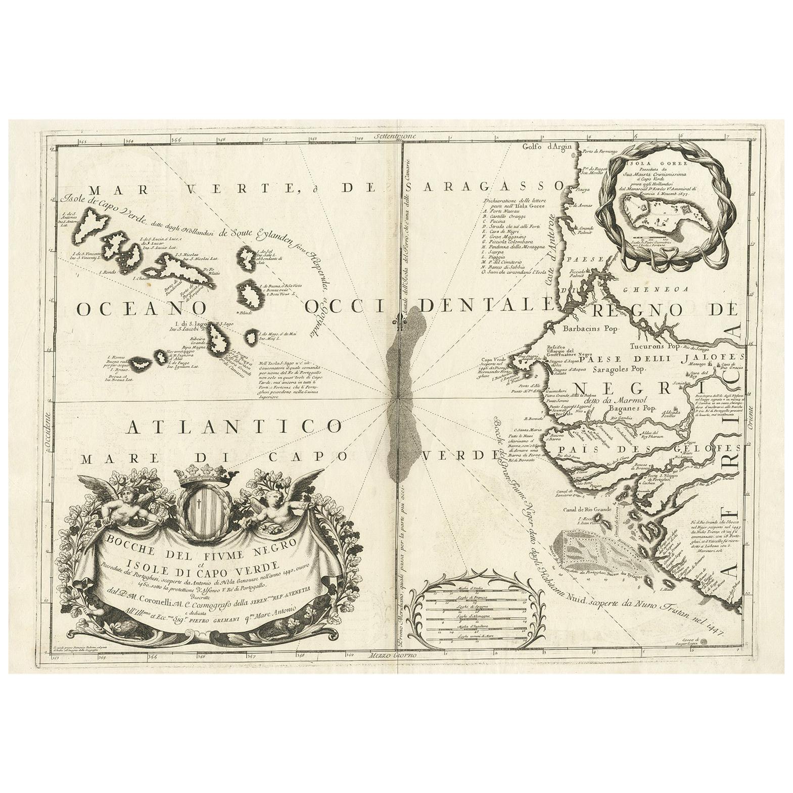
Map of Cape Verde and the Mouth of the River Niger by Coronelli, 1691
This finely engraved map, titled "Bocche del Fiume Negro et Isole di Capo Verde," was created in 1691 by Vincenzo Maria Coronelli, a Venetian cosmographer, cartographer, and Franciscan friar who was among the most influential mapmakers of the late 17th century. Known for his scientific precision and artistic flourish, Coronelli produced this map as part of his celebrated *Atlante Veneto* series, a monumental geographical work that contributed to Europe's understanding of distant regions during the Age of Exploration.
The map focuses on the Atlantic coastal region of West Africa, particularly the Cape Verde Islands and the adjacent coastline near the mouth of the River Niger. Prominently featured are the islands of the Cape Verde archipelago, rendered in vivid hand-coloring, with clear indications of individual islands such as Santiago, Boa Vista, Maio, and São Vicente. The African coast is shown in detailed relief, including regions historically inhabited by the Jaloff (Wolof) people, and settlements such as Capo Verde, Bissau, and the depiction of the Island of Gorée, an important trading post.
This map reflects the maritime interests of European powers in the Atlantic during the late 1600s and captures the navigational routes and knowledge of the region as it was understood by European cartographers. The cartouche, richly decorated with allegorical figures and a heraldic crest, underscores the baroque aesthetics of Coronelli’s work.
As a scientific and artistic object, the map is a testament to the ambition of early modern geography. Coronelli’s maps were esteemed not only for their accuracy but also for their visual appeal, often combining scholarly detail with elaborate ornamentation.
Condition:
Very good to excellent early impression with original hand-coloring. The strong paper is clean and well-preserved with wide margins and only minor age-related toning to the edges. Center fold as issued.
Framing tips:
Frame this piece in a classic walnut or dark oak frame with a warm cream or off-white mat to complement the aged paper and hand-coloring. Avoid overly modern styles to preserve the historical character of the print. Non-reflective museum glass is recommended.
- Maße:Höhe: 49,1 cm (19,34 in)Breite: 69,6 cm (27,41 in)Tiefe: 0,2 mm (0,01 in)
- Materialien und Methoden:Papier,Graviert
- Zeitalter:Spätes 17. Jahrhundert
- Herstellungsjahr:1691
- Zustand:Very good to excellent early impression with original hand-coloring. Paper is clean and well-preserved with wide margins and only minor age-related toning to the edges. Center fold as issued.
- Anbieterstandort:Langweer, NL
- Referenznummer:Anbieter*in: BG-13730-21stDibs: LU3054345364082
Anbieterinformationen
5,0
Anerkannte Anbieter*innen
Diese renommierten Anbieter*innen sind führend in der Branche und repräsentieren die höchste Klasse in Sachen Qualität und Design.
Platin-Anbieter*in
Premium-Anbieter*innen mit einer Bewertung über 4,7 und 24 Stunden Reaktionszeit
Gründungsjahr 2009
1stDibs-Anbieter*in seit 2017
2.494 Verkäufe auf 1stDibs
Typische Antwortzeit: 1 Stunde
- VersandAngebot wird abgerufen …Versand von: Langweer, Niederlande
- Rückgabebedingungen
Einige Inhalte dieser Seite wurden automatisch übersetzt. Daher kann 1stDibs nicht die Richtigkeit der Übersetzungen garantieren. Englisch ist die Standardsprache dieser Website.
Authentizitätsgarantie
Im unwahrscheinlichen Fall eines Problems mit der Echtheit eines Objekts kontaktieren Sie uns bitte innerhalb von 1 Jahr für eine volle Rückerstattung. DetailsGeld-Zurück-Garantie
Wenn Ihr Objekt nicht der Beschreibung entspricht, beim Transport beschädigt wurde oder nicht ankommt, kontaktieren Sie uns bitte innerhalb von 7 Tagen für eine vollständige Rückerstattung. DetailsStornierung innerhalb von 24 Stunden
Sie können Ihren Kauf jederzeit innerhalb von 24 Stunden stornieren, ohne jegliche Gründe dafür angeben zu müssen.Geprüfte Anbieter*innen
Unsere Anbieter*innen unterliegen strengen Dienstleistungs- und Qualitätsstandards, wodurch wir die Seriosität unserer Angebote gewährleisten können.Preisgarantie
Wenn Sie feststellen, dass ein*e Anbieter*in dasselbe Objekt anderswo zu einem niedrigeren Preis anbietet, werden wir den Preis entsprechend anpassen.Zuverlässige weltweite Lieferung
Unsere erstklassigen Versandunternehmen bieten spezielle Versandoptionen weltweit, einschließlich individueller Lieferung.Mehr von diesem*dieser Anbieter*in
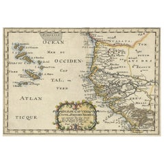
Alle anzeigenAntike Karte der Inseln Kap Verde und eines Teils des Senegal, Westafrika, 1690
Antike Karte mit dem Titel "Bocche del Fivme Negro et Isole di Capo Verde". Schöne doppelseitige Karte der Kapverdischen Inseln und eines Teils der Küste Senegals, mit großer dekorat...
Kategorie
Antik, 17. Jahrhundert, Italienisch, Landkarten
Materialien
Papier

Antike Karte von Westafrika und den Kapverdischen Inseln von Coronelli, 1691
Von Vincenzo Coronelli
Antike Karte mit dem Titel "Bocche del Fiume Negro et Isole di Capo Verde". Antike Landkarte von Westafrika mit den Kapverdischen Inseln und einem Ausschnitt der Insel Goree. Stammt ...
Kategorie
Antik, Spätes 17. Jahrhundert, Italienisch, Landkarten
Materialien
Papier
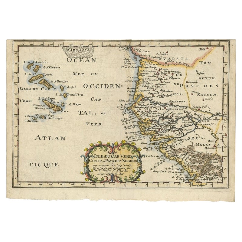
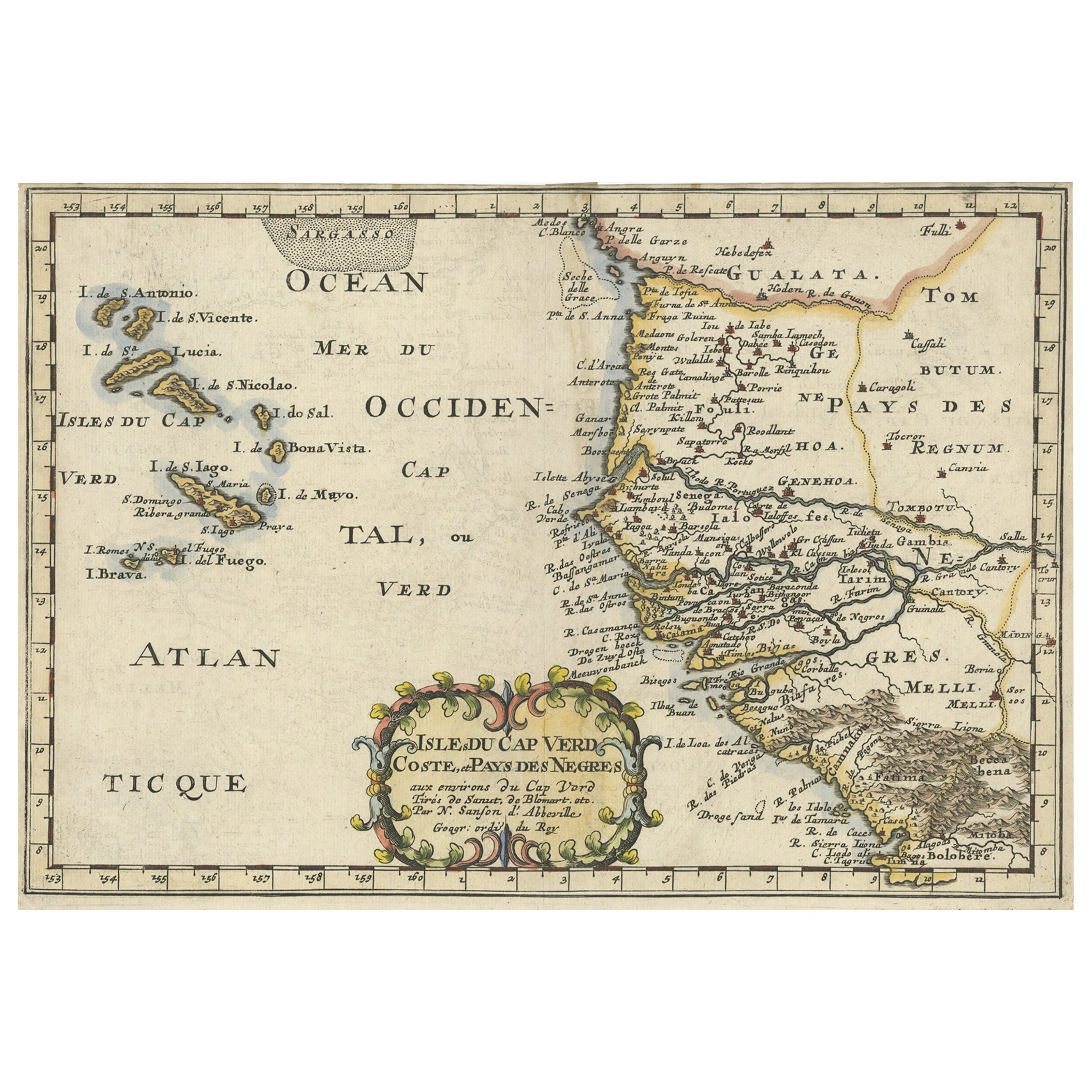
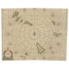
Antike Karte der westafrikanischen Küste und der Inseln Kap Verde, um 1680
Antike Karte Afrika mit dem Titel 'Isles du Cap Verd Coste et Pays des Negres'. Antike Karte der Küste Afrikas und der Kapverdischen Inseln.
Artisten und Graveure: Nicholas Sanson ...
Kategorie
Antik, 17. Jahrhundert, Landkarten
Materialien
Papier

288 € Angebotspreis
20 % Rabatt
Antike Karte der afrikanischen Küste und der Inseln Kap Verde, ca. 1680
Antike Karte Afrika mit dem Titel 'Isles du Cap Verd Coste et Pays des Negres'.
Antike Karte der Küste Afrikas und der Kapverdischen Inseln.
Künstler und Graveure: Nicholas S...
Kategorie
Antik, 1680er, Landkarten
Materialien
Papier
280 € Angebotspreis
20 % Rabatt
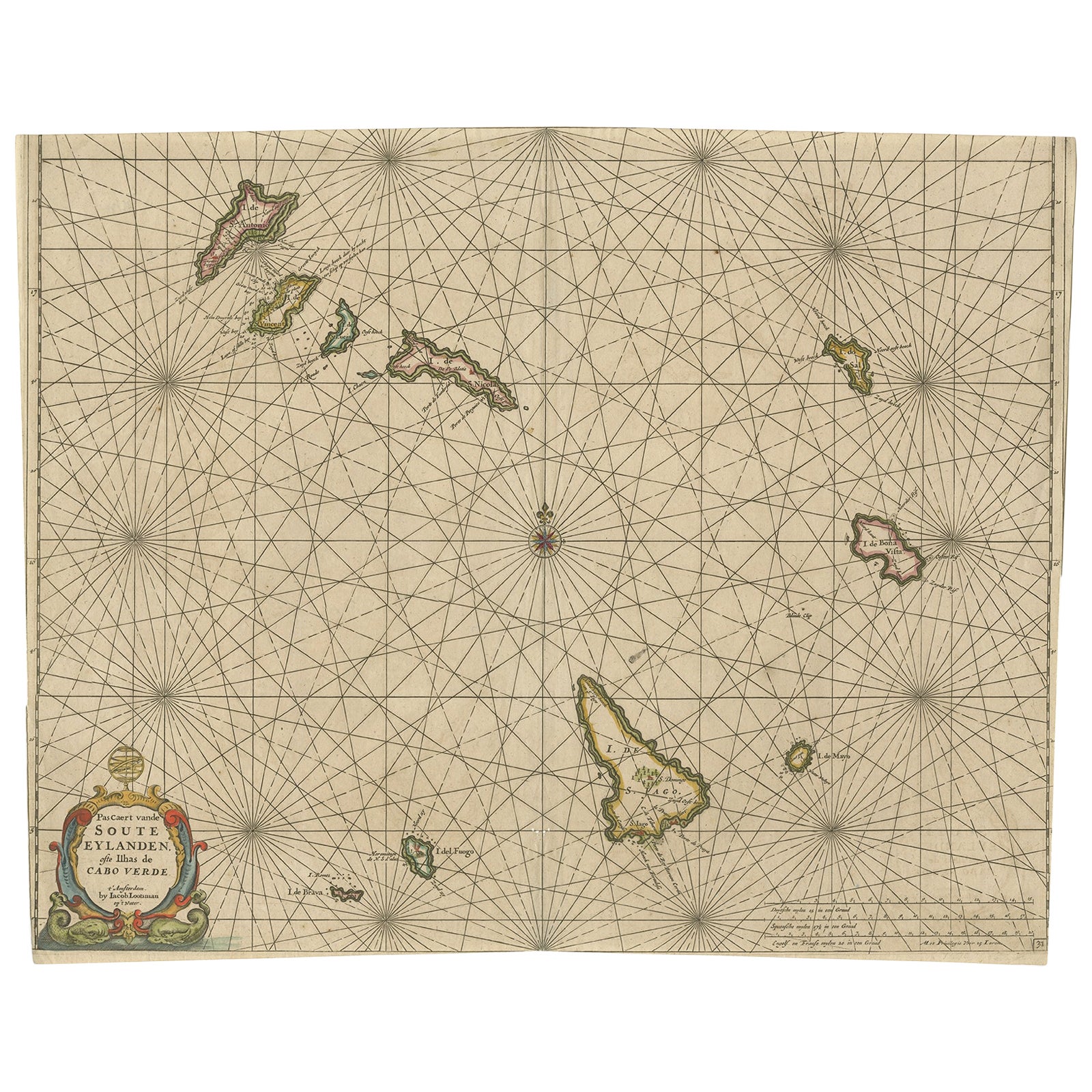
Antike Karte der Kap Verde-Inseln, Afrika, ca. 1670
Antike Karte mit dem Titel 'Pascaert van de Soute Eylanden ofte Ilhas de Cabo Verde'.
Diese Karte zeigt die Kapverdischen Inseln (Afrika). Inseln mit den Bezeichnungen "Ile de Br...
Kategorie
Antik, 1670er, Landkarten
Materialien
Papier
528 € Angebotspreis
20 % Rabatt
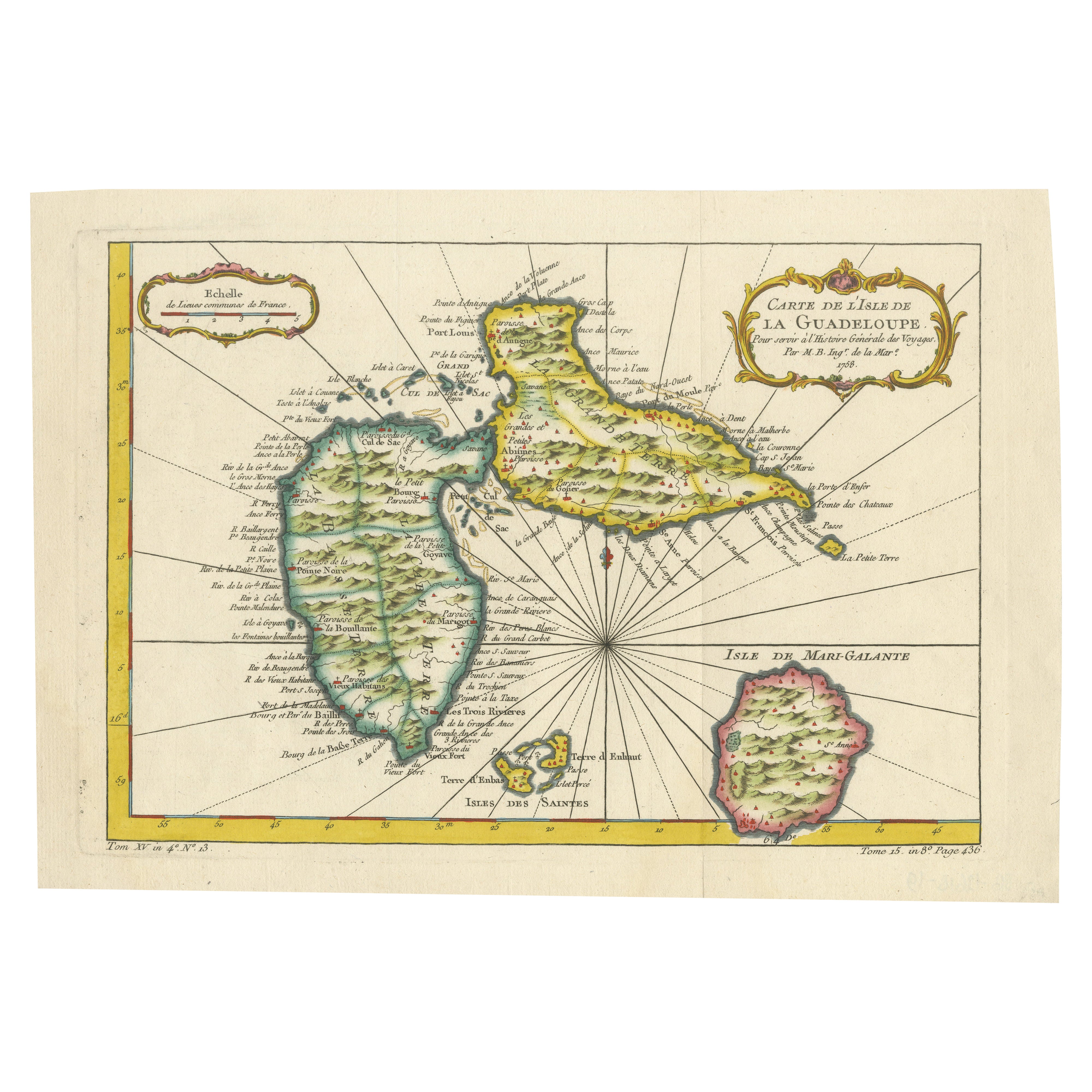
1758 Bellin Karte von Guadeloupe und Marie-Galante - Karibische Inseln
Vielen Dank, dass Sie das richtige Datum auf der Karte vermerkt haben. Hier ist Ihre **aktualisierte Klartext-Katalogliste**:
---
**Titel (weniger als 80 Zeichen):**
1758 Bellin Ka...
Kategorie
Antik, Mitte des 18. Jahrhunderts, Französisch, Landkarten
Materialien
Papier

Das könnte Ihnen auch gefallen
Westafrika: Eine handkolorierte Karte aus dem 17. Jahrhundert von Mercator/Hondius
Von Gerard Mercator
Eine handkolorierte Karte aus dem 17. Jahrhundert mit dem Titel "Guineae Nova Descriptio" von Gerard Mercator und Jodocus Hondius, veröffentlicht in ihrem "Atlas Minor" in Amsterdam ...
Kategorie
1630er, Landschaftsdrucke
Materialien
Gravur

Bellin Karte der Westküste Afrikas, 18. Jahrhundert; Guinea und Sierra Leone
Jacques Bellins Kupferstichkarte mit dem Titel "Partie de la Coste de Guinee Dupuis la Riviere de Sierra Leona Jusquau Cap das Palmas", die die Küste von Guinea und Sierra Leone in W...
Kategorie
1740er, Alte Meister, Landschaftsdrucke
Materialien
Gravur

Westafrikanische Westküste, Guinea und Sierra Leone: Eine Karte aus dem 18. Jahrhundert von Bellin
Von Jacques-Nicolas Bellin
Die Kupferstichkarte von Jacques Bellin mit dem Titel "Partie de la Coste de Guinee Dupuis la Riviere de Sierra Leona Jusquau Cap das Palmas", die die Küste von Guinea und Sierra Leo...
Kategorie
Antik, Mitte des 18. Jahrhunderts, Französisch, Landkarten
Materialien
Papier

Antike Karte – Mare Pacificum – Radierung von Johannes Janssonius – 1650er Jahre
Von Johannes Janssonius
Mare Pacificum ist eine antike Karte aus dem Jahr 1650 von Johannes Janssonius (1588-1664).
Die Karte ist handkolorierte Radierung, mit Coeval Aquarellang.
Guter Zustand mit leicht...
Kategorie
1650er, Moderne, Figurative Drucke
Materialien
Radierung

Antike Karte – Mar Di Athiopia – Radierung von Johannes Janssonius – 1650er Jahre
Von Johannes Janssonius
Antike Landkarte - Mar Di Athiopia ist eine antike Landkarte aus dem Jahre 1650 von Johannes Janssonius (1588-1664).
Die Karte ist handkolorierte Radierung, mit Coeval Aquarellang.
...
Kategorie
1650er, Moderne, Figurative Drucke
Materialien
Radierung

Afrika: Eine große handkolorierte Karte aus dem 17. Jahrhundert von Sanson und Jaillot
Von Nicholas Sanson d'Abbeville
Diese große original handkolorierte Kupferstichkarte von Afrika mit dem Titel "L'Afrique divisee suivant l'estendue de ses principales parties ou sont distingues les uns des autres, ...
Kategorie
1690er, Landschaftsdrucke
Materialien
Gravur
