Objekte ähnlich wie Map of Doubs France with Besançon and Swiss Border Landscape, 19th Century


Möchten Sie mehr Bilder oder Videos?
Zusätzliche Bilder oder Videos von dem*der Anbieter*in anfordern
1 von 10
Map of Doubs France with Besançon and Swiss Border Landscape, 19th Century
120 €Einschließlich MwSt.
Versand
Angebot wird abgerufen …Das Versprechen von 1stDibs:
Authentizitätsgarantie,
Geld-Zurück-Garantie,
Stornierung innerhalb von 24 Stunden
Angaben zum Objekt
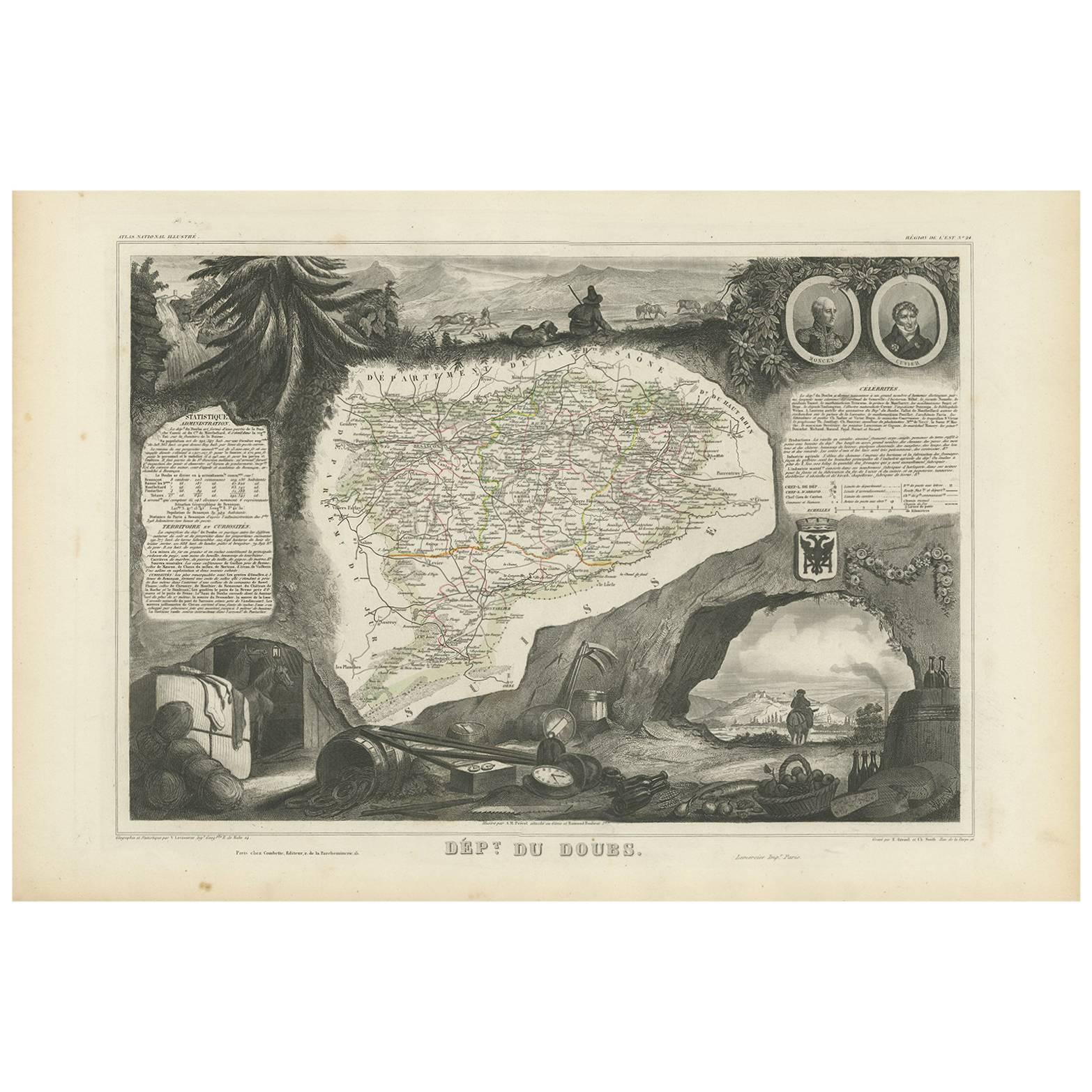
Map of Doubs France with Besançon and Swiss Border Landscape, 19th Century
Description:
This decorative 19th-century map of the department of Doubs in eastern France was drawn by Alexandre Vuillemin and published in Paris by Migeon as part of the *Nouvel Atlas Illustré*. Situated along the Swiss border, Doubs is a region defined by its mountainous terrain, rich natural beauty, and a long history of scientific and cultural achievement—all reflected in this finely engraved and hand-colored map.
The map shows the department in great detail, with towns, roads, rivers, and mountain ranges clearly engraved and bordered in soft violet watercolor. Besançon, the prefecture and historic heart of the region, is prominently displayed near the center. Other communes such as Montbéliard, Pontarlier, Morteau, and Baume-les-Dames are also clearly labeled.
In the lower left corner is a portrait of Georges Cuvier, the renowned naturalist and paleontologist born in Montbéliard. His scientific legacy is subtly honored in the floral and shell motifs surrounding his likeness. The vignette in the lower right captures the fortified city of Besançon along the Doubs River, nestled among hills and cliffs—an iconic scene that speaks to the city's strategic and cultural importance. The right edge also features the coat of arms of Doubs and a small image of the Saut du Doubs, a picturesque waterfall near the Swiss border.
Doubs is located within the Jura Mountains and forms part of the historic region of Franche-Comté. While not a major wine-producing department like nearby Burgundy, Doubs is known for its production of regional specialties including Comté cheese, smoked sausages, absinthe (especially around Pontarlier), and Jura wines from adjacent departments. Its mountainous terrain supports dairy farming, forestry, and small-scale viticulture along select valleys.
This map is not only a fine piece of decorative cartography, but also a celebration of Doubs’ blend of natural science, alpine beauty, and borderland heritage. It is ideal for collectors with interests in French geography, scientific history, or 19th-century engraving.
Condition summary:
Very good condition with some light foxing and toning in the margins. The engraved lines remain sharp and the original hand coloring is fresh and clean.
Framing tips:
This map suits a dark wood or black frame to emphasize the borderland topography. Pair with a light beige or soft lavender mat to enhance the violet border tones. Use UV-protective glass for long-term preservation.
- Maße:Höhe: 26,1 cm (10,28 in)Breite: 32,5 cm (12,8 in)Tiefe: 0,2 mm (0,01 in)
- Materialien und Methoden:Papier,Graviert
- Herkunftsort:
- Zeitalter:
- Herstellungsjahr:circa 1850
- Zustand:Very good condition with some light foxing and toning in the margins. The engraved lines remain sharp and the original hand coloring is fresh and clean.
- Anbieterstandort:Langweer, NL
- Referenznummer:Anbieter*in: BG-13331-241stDibs: LU3054345363862
Anbieterinformationen
5,0
Anerkannte Anbieter*innen
Diese renommierten Anbieter*innen sind führend in der Branche und repräsentieren die höchste Klasse in Sachen Qualität und Design.
Platin-Anbieter*in
Premium-Anbieter*innen mit einer Bewertung über 4,7 und 24 Stunden Reaktionszeit
Gründungsjahr 2009
1stDibs-Anbieter*in seit 2017
2.493 Verkäufe auf 1stDibs
Typische Antwortzeit: <1 Stunde
- VersandAngebot wird abgerufen …Versand von: Langweer, Niederlande
- Rückgabebedingungen
Einige Inhalte dieser Seite wurden automatisch übersetzt. Daher kann 1stDibs nicht die Richtigkeit der Übersetzungen garantieren. Englisch ist die Standardsprache dieser Website.
Authentizitätsgarantie
Im unwahrscheinlichen Fall eines Problems mit der Echtheit eines Objekts kontaktieren Sie uns bitte innerhalb von 1 Jahr für eine volle Rückerstattung. DetailsGeld-Zurück-Garantie
Wenn Ihr Objekt nicht der Beschreibung entspricht, beim Transport beschädigt wurde oder nicht ankommt, kontaktieren Sie uns bitte innerhalb von 7 Tagen für eine vollständige Rückerstattung. DetailsStornierung innerhalb von 24 Stunden
Sie können Ihren Kauf jederzeit innerhalb von 24 Stunden stornieren, ohne jegliche Gründe dafür angeben zu müssen.Geprüfte Anbieter*innen
Unsere Anbieter*innen unterliegen strengen Dienstleistungs- und Qualitätsstandards, wodurch wir die Seriosität unserer Angebote gewährleisten können.Preisgarantie
Wenn Sie feststellen, dass ein*e Anbieter*in dasselbe Objekt anderswo zu einem niedrigeren Preis anbietet, werden wir den Preis entsprechend anpassen.Zuverlässige weltweite Lieferung
Unsere erstklassigen Versandunternehmen bieten spezielle Versandoptionen weltweit, einschließlich individueller Lieferung.Mehr von diesem*dieser Anbieter*in
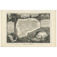
Alle anzeigenAntike Karte von Doubs 'Frankreich' von V. Levasseur, 1854
Von Victor Levasseur
Antike Karte mit dem Titel 'Dépt. du Doubs'. Karte des französischen Departements Doubs, Frankreich. Das Ganze ist von aufwendigen dekorativen Gravuren umgeben, die sowohl die natürl...
Kategorie
Antik, Mittleres 19. Jahrhundert, Landkarten
Materialien
Papier
144 € Angebotspreis
20 % Rabatt
Map of Aude France with Carcassonne and Languedoc Vineyards, 19th Century
Map of Aude France with Carcassonne and Languedoc Vineyards, 19th Century
Description:
This elegant 19th-century map of Aude, a department in southern France along the Mediterranean...
Kategorie
Antik, Mittleres 19. Jahrhundert, Französisch, Landkarten
Materialien
Papier

Map of Aube France with Troyes and Champagne Wine Region, 19th Century
Map of Aube France with Troyes and Champagne Vineyards by Vuillemin, 19th c
Description:
This 19th-century map of the Aube department in the Grand Est region of northeastern France ...
Kategorie
Antik, Mittleres 19. Jahrhundert, Französisch, Landkarten
Materialien
Papier

Map of Côtes-du-Nord France with Saint-Brieuc and Brittany Coastline, c.1850
Map of Côtes-du-Nord France with Saint-Brieuc and Brittany Coastline, 19th c
Description:
This elegant 19th-century map of Côtes-du-Nord, the historic name for what is now known as ...
Kategorie
Antik, Mittleres 19. Jahrhundert, Französisch, Landkarten
Materialien
Papier

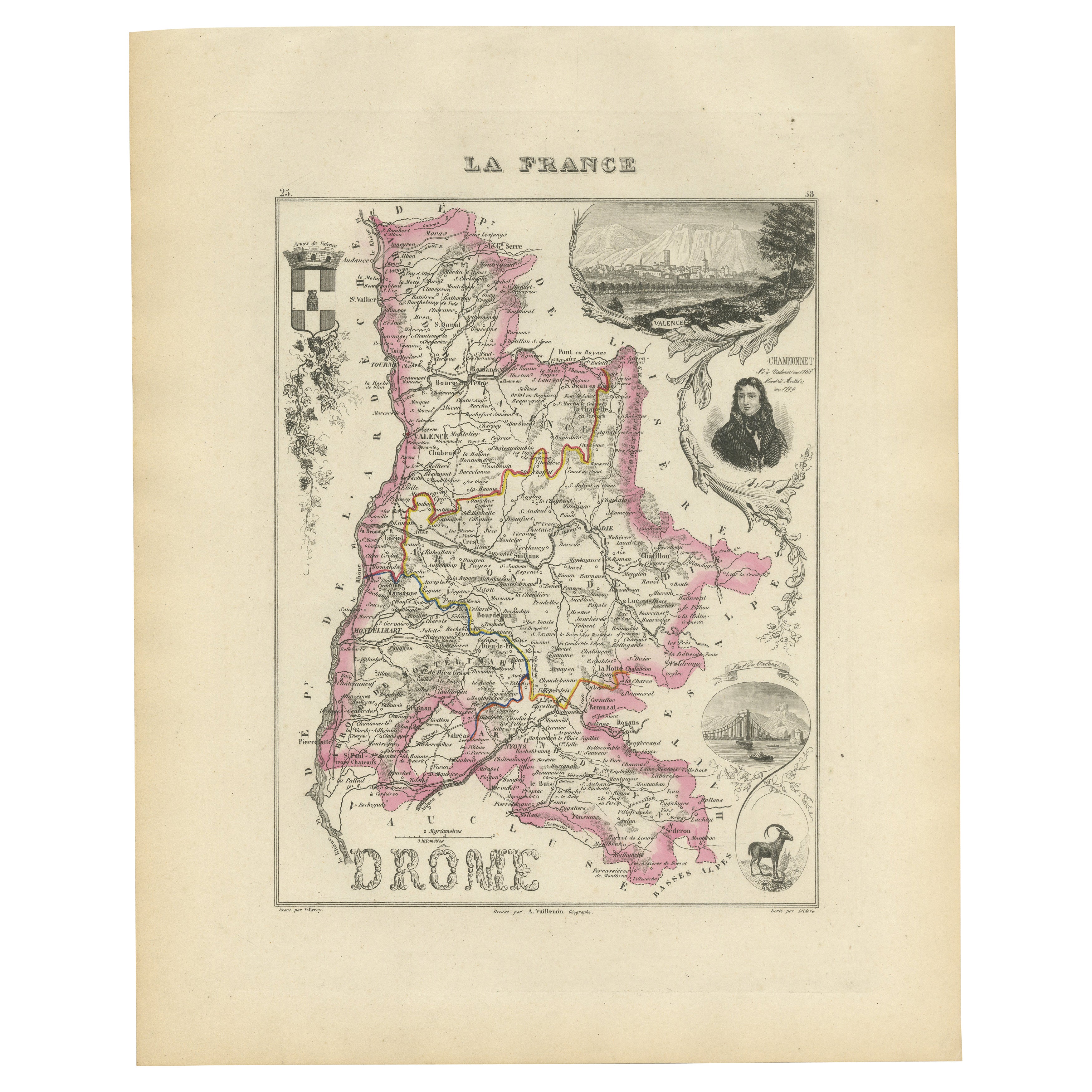
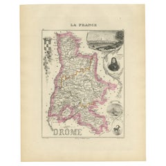
Map of Drôme France with Valence and Rhône Valley Wine Region, 19th Century
Map of Drôme France with Valence and Rhône Valley Wine Region, 19th Century
Description:
This beautifully engraved 19th-century map of the Drôme department in southeastern France wa...
Kategorie
Antik, Mittleres 19. Jahrhundert, Französisch, Landkarten
Materialien
Papier
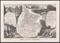
Map of Ariège France with Foix and Pyrenees Landscape by Vuillemin, 19th c
Map of Ariège France with Foix and Pyrenees Landscape by Vuillemin, 19th c
Description:
This beautifully detailed 19th-century map of the Ariège department in southwestern France wa...
Kategorie
Antik, Mittleres 19. Jahrhundert, Französisch, Landkarten
Materialien
Papier

Das könnte Ihnen auch gefallen
Beinahe Frankreich. Antike Karte einer französischen Abteilung, 1856
Von Victor Levasseur
dept. de L'Aube", Stahlstich mit originaler Handkolorierung der Umrisse, 1856, aus dem "Atlas National Illustre" von Levasseur.
Diese Region Frankreichs ist bekannt für die Herstel...
Kategorie
19. Jahrhundert, Naturalismus, Landschaftsdrucke
Materialien
Gravur

Jura, Frankreich. Antike Karte einer französischen Abteilung, 1856
Von Victor Levasseur
dept. du Jura", Stahlstich mit Originalumriss von Hand koloriert, 1856, aus Levasseurs "Atlas National Illustre".
Die Jura-Weine sind sehr charakteristisch und ungewöhnlich, wie zu...
Kategorie
19. Jahrhundert, Naturalismus, Landschaftsdrucke
Materialien
Gravur

Karte von Deux Svres – Original-Radierung – 19. Jahrhundert
Die Karte von Deux Sèvres ist eine antike Original-Radierung, die von einem anonymen Graveur des 19.
Gedruckt in einer Reihe von "France Pittoresque" in der oberen Mitte.
Der Erhal...
Kategorie
19. Jahrhundert, Moderne, Figurative Drucke
Materialien
Radierung

Bas Rhin, Frankreich. Antike Karte einer französischen Abteilung, 1856
Von Victor Levasseur
Dept. du Bas Rhin", Stahlstich mit originaler Handkolorierung der Umrisse, 1856, aus dem Atlas National Illustre von Levasseur.
Teil der Weinregion Elsass, die Straßburg umgibt. Di...
Kategorie
19. Jahrhundert, Naturalismus, Landschaftsdrucke
Materialien
Gravur

Große Karte von Frankreich aus dem 19.
Große Karte von Frankreich aus dem 19. Jahrhundert.
Bemerkenswerter Zustand, mit einer angenehmen altersbedingten Patina.
Kürzlich gerahmt.
Frankreich CIRCA 1874.
Kategorie
Antik, Spätes 19. Jahrhundert, Französisch, Landkarten
Materialien
Leinen, Papier

Hautes Pyreneen, Frankreich. Antike Karte einer französischen Abteilung, 1856
Von Victor Levasseur
dept. des Hautes Pyrenees", Stahlstich mit Originalumriss von Hand koloriert, 1856, aus Levasseurs Atlas National Illustre.
In diesem Gebiet befindet sich das Weinanbaugebiet Madir...
Kategorie
19. Jahrhundert, Naturalismus, Landschaftsdrucke
Materialien
Gravur