Artículos similares a Map of Aude France with Carcassonne and Languedoc Vineyards, 19th Century


¿Quieres más imágenes o vídeos?
Solicita imágenes o vídeos adicionales al vendedor
1 de 10
Map of Aude France with Carcassonne and Languedoc Vineyards, 19th Century
120 €IVA incluido
Acerca del artículo
Map of Aude France with Carcassonne and Languedoc Vineyards, 19th Century
Description:
This elegant 19th-century map of Aude, a department in southern France along the Mediterranean coast, was engraved for the Nouvel Atlas Illustré and published in Paris by Migeon. It offers a rich visual and historical depiction of a region known for its medieval heritage, wine production, and proximity to both the Pyrenees and the Mediterranean Sea.
The map presents the full layout of Aude with towns, roads, and rivers carefully labeled, and department borders highlighted in soft hand-applied lavender tones. At the center lies Carcassonne, one of the most iconic fortified cities in Europe, whose medieval citadel is a UNESCO World Heritage site. The surrounding landscape is marked by mountain foothills, river valleys, and vineyards, reflecting the area's diverse topography.
To the left is a portrait of General Antoine-François Andréossy, a distinguished artillery officer and diplomat born in Castelnaudary. Below him, an engraving depicts a southern French village with a Romanesque church, typical of the Aude countryside. In the lower right corner, a lively harbor view shows the port at Gruissan, linking the department to Mediterranean trade and culture. The inclusion of the coat of arms and classical decorative motifs adds to the historical charm of the print.
Aude is part of the historic Languedoc wine region and is especially known for producing robust red wines and sparkling wines like Blanquette de Limoux, considered by many to be the world’s oldest sparkling wine. The vineyards around Limoux and the Corbières hills yield Grenache, Syrah, Mourvèdre, and other varietals that define the rich, earthy character of southern French wines. The climate, shaped by both mountain and sea, creates ideal growing conditions.
This map is not only a piece of cartographic history but also a reflection of the cultural identity of Aude during the 19th century, capturing its architecture, prominent individuals, and viticultural heritage.
Condition summary:
Very good condition with light toning around the edges and minor foxing in the margins. Engraving is crisp and the original hand coloring remains bright and clean.
Framing tips:
A warm wood or gilded frame would enhance the classic feel of this map. Pair it with an off-white or pale grey mat to complement the pastel coloring. UV-protective glass is recommended to preserve the paper and detail.
- Dimensiones:Altura: 26,1 cm (10,28 in)Anchura: 32,5 cm (12,8 in)Profundidad: 0,2 mm (0,01 in)
- Materiales y técnicas:Papel,Grabado
- Lugar de origen:
- Época:
- Fecha de fabricación:circa 1850
- Estado:Very good condition with light toning around the edges and minor foxing in the margins. Engraving is crisp and the original hand coloring remains bright and clean.
- Ubicación del vendedor:Langweer, NL
- Número de referencia:Vendedor: BG-13331-101stDibs: LU3054345359612
Sobre el vendedor
5,0
Vendedor reconocido
Estos prestigiosos vendedores son líderes del sector y representan el escalón más alto en cuanto a calidad y diseño de artículos.
Vendedor Platino
Vendedores premium con una calificación de +4,7 y tiempos de respuesta de 24 horas
Establecido en 2009
Vendedor de 1stDibs desde 2017
2567 ventas en 1stDibs
Tiempo de respuesta usual: <1 hora
- EnvíoRecuperando presupuesto…Envío desde: Langweer, Países Bajos
- Política de devolución
Partes de esta página se han traducido automáticamente. 1stDibs no puede garantizar la exactitud de las traducciones. El inglés es el idioma predeterminado de este sitio web.
Garantía de autenticidad
En el improbable caso de que haya algún problema con la autenticidad de un artículo, ponte en contacto con nosotros en un plazo de 1 año para recibir un reembolso total. DetallesGarantía de devolución de dinero
Si tu artículo no es como se describe, sufre daños durante el transporte o no llega, ponte en contacto con nosotros en un plazo de 7 días para recibir un reembolso total. DetallesCancelación dentro de las 24 horas
Tienes un período de gracia de 24 horas para reconsiderar tu compra, sin preguntas.Vendedores profesionales aprobados
Nuestros vendedores de primera clase deben cumplir estrictos estándares de servicio para mantener la integridad de nuestros anuncios.Garantía de igualación de precios
Si encuentras que un vendedor publicó el mismo artículo por un precio menor en otro lado, igualaremos ese precio.Entrega global de confianza
Nuestra red de transporte de primera ofrece opciones de envío especializado en todo el mundo, que incluye envío personalizado.Más de este vendedor
Ver todoMap of Ardèche France with Annonay and Vineyards by Vuillemin, 19th c
Map of Ardèche France with Annonay and Vineyards by Vuillemin, 19th c
This beautifully engraved 19th-century map of Ardèche, a department in southeastern France, comes from Alexandr...
Categoría
Antiguo, Mediados del siglo XIX, Francés, Mapas
Materiales
Papel

Map of Allier France with Saint-Pourçain Wine Region by Vuillemin, 19th c
Map of Allier France with Saint-Pourçain Wine Region by Vuillemin, 19th c
This decorative 19th-century map of Allier, a central department of France, comes from the celebrated Nouve...
Categoría
Antiguo, Mediados del siglo XIX, Francés, Mapas
Materiales
Papel

Map of Ariège France with Foix and Pyrenees Landscape by Vuillemin, 19th c
Map of Ariège France with Foix and Pyrenees Landscape by Vuillemin, 19th c
Description:
This beautifully detailed 19th-century map of the Ariège department in southwestern France wa...
Categoría
Antiguo, Mediados del siglo XIX, Francés, Mapas
Materiales
Papel

Map of Gard France with Pont du Gard and Wine Regions by Vuillemin, 19th c
Title: Map of Gard France with Pont du Gard and Wine Regions by Vuillemin, 19th c
Description:
This finely engraved 19th-century map of the department of Gard in southern France was...
Categoría
Antiguo, Mediados del siglo XIX, Francés, Mapas
Materiales
Papel

Map of Aube France with Troyes and Champagne Wine Region, 19th Century
Map of Aube France with Troyes and Champagne Vineyards by Vuillemin, 19th c
Description:
This 19th-century map of the Aube department in the Grand Est region of northeastern France ...
Categoría
Antiguo, Mediados del siglo XIX, Francés, Mapas
Materiales
Papel

Map of Côtes-du-Nord France with Saint-Brieuc and Brittany Coastline, c.1850
Map of Côtes-du-Nord France with Saint-Brieuc and Brittany Coastline, 19th c
Description:
This elegant 19th-century map of Côtes-du-Nord, the historic name for what is now known as ...
Categoría
Antiguo, Mediados del siglo XIX, Francés, Mapas
Materiales
Papel

También te puede gustar
Aude, Francia. Mapa antiguo de un departamento francés, 1856
Por Victor Levasseur
"Dept. de L' Aude", grabado en acero con contorno original coloreado a mano., 1856, del "Atlas National Illustre" de Levasseur.
Esta zona de Francia es famosa por su gran variedad ...
Categoría
siglo XIX, Naturalista, Impresiones de paisajes
Materiales
Grabado

Aube, Francia. Mapa antiguo de un departamento francés, 1856
Por Victor Levasseur
Dept. de L'Aube", grabado en acero con contorno original coloreado a mano, 1856, del "Atlas National Illustre" de Levasseur.
Esta zona de Francia es conocida por su producción de C...
Categoría
siglo XIX, Naturalista, Impresiones de paisajes
Materiales
Grabado

Gran mapa de Francia del siglo XIX
Gran mapa de Francia del siglo XIX.
Notable estado, con una agradable pátina desgastada por el tiempo.
Recientemente enmarcado.
Francia Circa 1874.
Categoría
Antiguo, Fines del siglo XIX, Francés, Mapas
Materiales
Lino, Papel

Saona y Loira, Francia. Mapa antiguo de un departamento francés, 1856
Por Victor Levasseur
Dept. de Saone et Loire", grabado en acero con contorno original coloreado a mano, 1856, del Atlas National Illustre de Levasseur.
El departamento francés de Saone et Loire está en...
Categoría
siglo XIX, Naturalista, Impresiones de paisajes
Materiales
Grabado

Mapa de la Haute Vienne - Litografía original - Siglo XIX
Mapa de la Haute Vienne es una obra de arte litográfica original realizada por un Grabador anónimo del siglo XIX.
Impreso en la serie de "Francia Pittoresca".
Titulado "Francia P...
Categoría
siglo XIX, Moderno, Impresiones figurativas
Materiales
Litografía

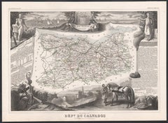
Calvados, Francia. Mapa antiguo de un departamento francés, 1856
Por Victor Levasseur
"Dept. du Calvados", grabado en acero con contorno original coloreado a mano., 1856, del "Atlas National Illustre" de Levasseur.
Esta zona de Francia es conocida por su producción ...
Categoría
siglo XIX, Naturalista, Impresiones de paisajes
Materiales
Grabado