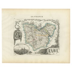
Artículos similares a Map of Eure-et-Loir France with Chartres Cathedral and Marceau Portrait, c.1850


¿Quieres más imágenes o vídeos?
Solicita imágenes o vídeos adicionales al vendedor
1 de 10
Map of Eure-et-Loir France with Chartres Cathedral and Marceau Portrait, c.1850
140 €IVA incluido
Acerca del artículo
Map of Eure-et-Loir France with Chartres Cathedral and Marceau Portrait, 19th c
This detailed and elegantly illustrated 19th-century map of the Eure-et-Loir department in north-central France was drawn by Alexandre Vuillemin and published in Paris by Migeon as part of the *Nouvel Atlas Illustré*. Combining precise cartography with rich historical symbolism, the map captures the agricultural and cultural identity of a region closely tied to the history of the French monarchy and the Catholic Church.
Outlined in soft lilac hand-coloring, the map shows the full extent of Eure-et-Loir, including its road networks, towns, and rivers. The city of Chartres, the department’s capital, is prominently featured near the center. Other important towns such as Dreux, Nogent-le-Rotrou, and Châteaudun are also clearly marked, reflecting the region’s strategic position between Paris and the Loire Valley.
At the top right is a finely engraved portrait of General François-Séverin Marceau, a revolutionary army officer born in Chartres in 1769. His military legacy is commemorated through his prominent placement on the map. At the bottom, two vignettes feature striking views of the region’s medieval fortresses and ruined châteaux, offering a glimpse into its feudal and architectural past. One engraving is likely a view of the ruins near Châteaudun or Nogent-le-Rotrou, reinforcing the historical depth of the area.
Eure-et-Loir lies within the Beauce plain, one of the most productive agricultural areas in France, often referred to as the "granary of France" due to its vast wheat fields. Though not a major wine-producing department, the region is vital for its grain and livestock production and has a long ecclesiastical tradition. Chartres Cathedral, a UNESCO World Heritage site, is one of the most celebrated examples of Gothic architecture in Europe, known for its towering spires and remarkably preserved stained-glass windows.
This map is an ideal addition for collectors interested in French history, military heritage, or ecclesiastical art, offering both visual charm and regional significance.
Condition summary:
Very good condition with light age toning and minor foxing in the margins. The engraving remains sharp and the original hand coloring is well preserved.
Framing tips:
A dark walnut or black frame will emphasize the historical gravitas of this map. Pair it with an ivory or soft grey mat to enhance the coloring and support the Gothic architectural details. UV-protective glass is recommended for display and archival care.
- Dimensiones:Altura: 32,5 cm (12,8 in)Anchura: 26,1 cm (10,28 in)Profundidad: 0,2 mm (0,01 in)
- Materiales y técnicas:Papel,Grabado
- Lugar de origen:
- Época:
- Fecha de fabricación:circa 1850
- Estado:Very good condition with light age toning and minor foxing in the margins. The engraving remains sharp and the original hand coloring is well preserved.
- Ubicación del vendedor:Langweer, NL
- Número de referencia:Vendedor: BG-13331-271stDibs: LU3054345363892
Sobre el vendedor
5,0
Vendedor reconocido
Estos prestigiosos vendedores son líderes del sector y representan el escalón más alto en cuanto a calidad y diseño de artículos.
Vendedor Platino
Vendedores premium con una calificación de +4,7 y tiempos de respuesta de 24 horas
Establecido en 2009
Vendedor de 1stDibs desde 2017
2516 ventas en 1stDibs
Tiempo de respuesta usual: <1 hora
- EnvíoRecuperando presupuesto…Envío desde: Langweer, Países Bajos
- Política de devolución
Partes de esta página se han traducido automáticamente. 1stDibs no puede garantizar la exactitud de las traducciones. El inglés es el idioma predeterminado de este sitio web.
Garantía de autenticidad
En el improbable caso de que haya algún problema con la autenticidad de un artículo, ponte en contacto con nosotros en un plazo de 1 año para recibir un reembolso total. DetallesGarantía de devolución de dinero
Si tu artículo no es como se describe, sufre daños durante el transporte o no llega, ponte en contacto con nosotros en un plazo de 7 días para recibir un reembolso total. DetallesCancelación dentro de las 24 horas
Tienes un período de gracia de 24 horas para reconsiderar tu compra, sin preguntas.Vendedores profesionales aprobados
Nuestros vendedores de primera clase deben cumplir estrictos estándares de servicio para mantener la integridad de nuestros anuncios.Garantía de igualación de precios
Si encuentras que un vendedor publicó el mismo artículo por un precio menor en otro lado, igualaremos ese precio.Entrega global de confianza
Nuestra red de transporte de primera ofrece opciones de envío especializado en todo el mundo, que incluye envío personalizado.Más de este vendedor
Ver todoMap of Côtes-du-Nord France with Saint-Brieuc and Brittany Coastline, c.1850
Map of Côtes-du-Nord France with Saint-Brieuc and Brittany Coastline, 19th c
Description:
This elegant 19th-century map of Côtes-du-Nord, the historic name for what is now known as ...
Categoría
Antiguo, Mediados del siglo XIX, Francés, Mapas
Materiales
Papel

Map of Eure France with Evreux, Poussin and Normandy Countryside, 19th Century
Map of Eure France with Evreux, Poussin and Normandy Countryside, 19th Century
Description:
This 19th-century engraved map of the Eure department in the Normandy region of northern ...
Categoría
Antiguo, Mediados del siglo XIX, Francés, Mapas
Materiales
Papel
Map of Allier France with Saint-Pourçain Wine Region by Vuillemin, 19th c
Map of Allier France with Saint-Pourçain Wine Region by Vuillemin, 19th c
This decorative 19th-century map of Allier, a central department of France, comes from the celebrated Nouve...
Categoría
Antiguo, Mediados del siglo XIX, Francés, Mapas
Materiales
Papel

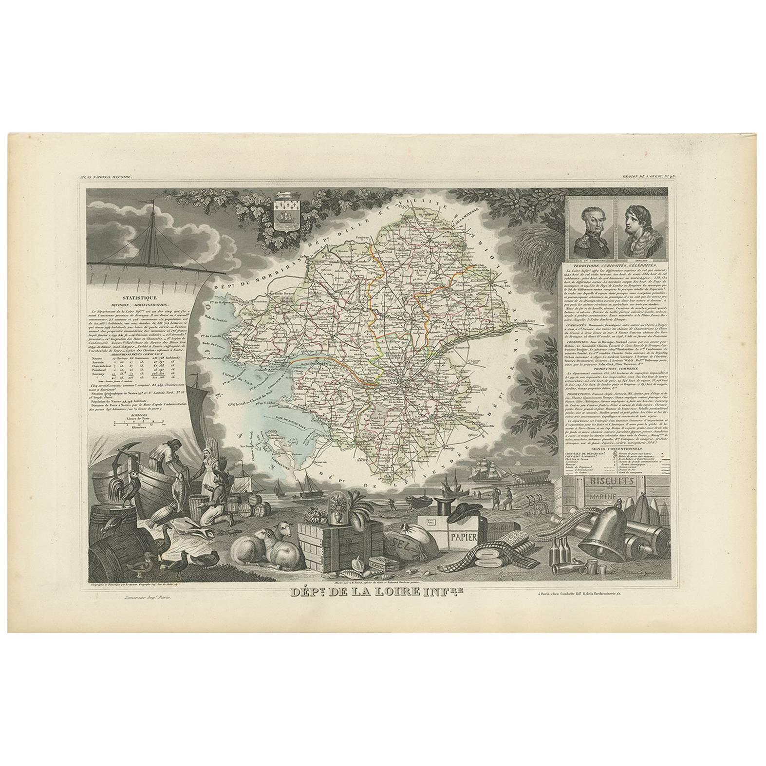
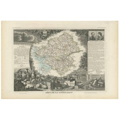
Mapa antiguo de la Loire Inferieure 'France' por V. Levasseur, 1854
Mapa antiguo titulado "Dépt. de la Loire Inferieure". Mapa del departamento francés de Loire Inferieure, Francia (actualmente conocido como Loire-Atlantique.) Esta zona de Francia fo...
Categoría
Antiguo, Mediados del siglo XIX, Mapas
Materiales
Papel
160 € Precio de venta
Descuento del 20� %
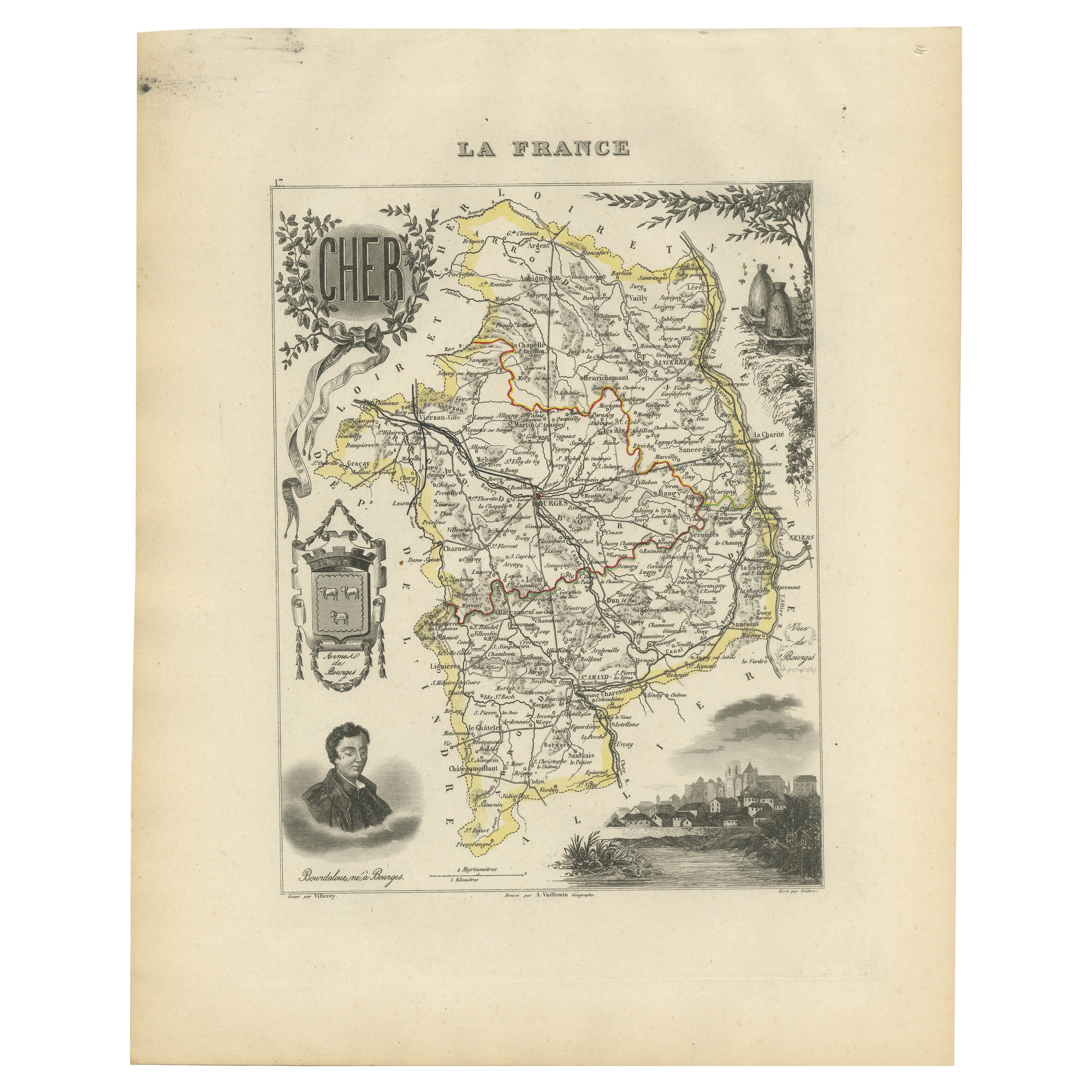
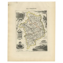
Map of Cher France with Bourges, Sancerre Vineyards and Engraved Vignettes, 1850
Map of Charente-Inférieure France with La Rochelle and Coastal Vineyards, 19th c
Description:
This decorative 19th-century map of the former department of Charente-Inférieure, now k...
Categoría
Antiguo, Mediados del siglo XIX, Francés, Mapas
Materiales
Papel
Map of Charente France with Cognac Region and Château de La Rochefoucauld, 1850
Map of Charente France with Cognac Region and Château de La Rochefoucauld, 19th c
Description:
This richly illustrated 19th-century map of the Charente department in southwestern Fr...
Categoría
Antiguo, Mediados del siglo XIX, Francés, Mapas
Materiales
Papel

También te puede gustar
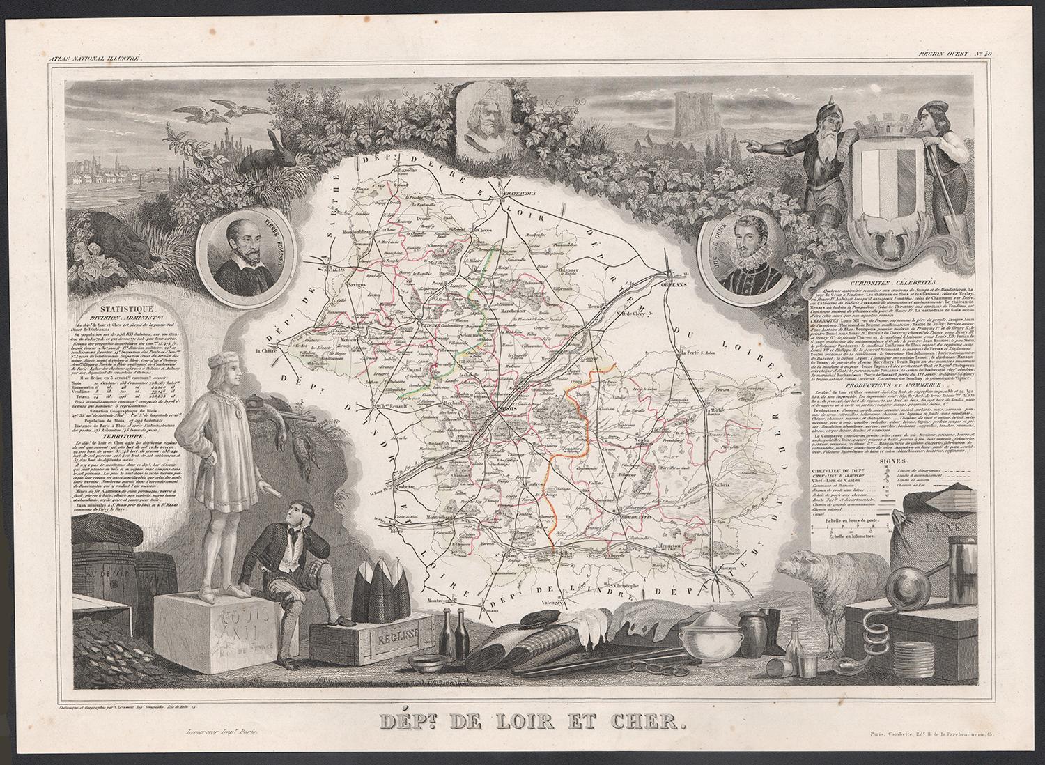
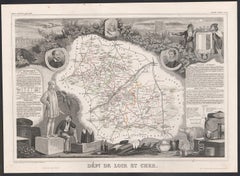
Loir y Cher, Francia. Mapa antiguo de un departamento francés, 1856
Por Victor Levasseur
Dept. de Loir y Cher", grabado en acero con contorno original coloreado a mano, 1856, del Atlas National Illustre de Levasseur.
Esta zona es conocida sobre todo por la producción d...
Categoría
siglo XIX, Naturalista, Impresiones de paisajes
Materiales
Grabado
Saona y Loira, Francia. Mapa antiguo de un departamento francés, 1856
Por Victor Levasseur
Dept. de Saone et Loire", grabado en acero con contorno original coloreado a mano, 1856, del Atlas National Illustre de Levasseur.
El departamento francés de Saone et Loire está en...
Categoría
siglo XIX, Naturalista, Impresiones de paisajes
Materiales
Grabado

Indre y Loira, Francia. Mapa antiguo de un departamento francés, 1856
Por Victor Levasseur
"Dept. d'Indre et Loire", grabado en acero con contorno original coloreado a mano., 1856, del "Atlas National Illustre" de Levasseur.
Esta zona es conocida por su producción de Che...
Categoría
siglo XIX, Naturalista, Impresiones de paisajes
Materiales
Grabado

Aube, Francia. Mapa antiguo de un departamento francés, 1856
Por Victor Levasseur
Dept. de L'Aube", grabado en acero con contorno original coloreado a mano, 1856, del "Atlas National Illustre" de Levasseur.
Esta zona de Francia es conocida por su producción de C...
Categoría
siglo XIX, Naturalista, Impresiones de paisajes
Materiales
Grabado

L'Isere, Francia. Mapa antiguo del departamento francés, 1856
Por Victor Levasseur
Dept. de L'Isere", grabado en acero con contorno original coloreado a mano, 1856, del "Atlas National Illustre" de Levasseur.
Esta zona es conocida por su producción de Bleu du Ver...
Categoría
siglo XIX, Naturalista, Impresiones de paisajes
Materiales
Grabado

Aude, Francia. Mapa antiguo de un departamento francés, 1856
Por Victor Levasseur
"Dept. de L' Aude", grabado en acero con contorno original coloreado a mano., 1856, del "Atlas National Illustre" de Levasseur.
Esta zona de Francia es famosa por su gran variedad ...
Categoría
siglo XIX, Naturalista, Impresiones de paisajes
Materiales
Grabado
